Dukesfield, Dipton and the Devil
Today we're off to walk from Slaley, a string of a village high above Corbridge. Head west on the A69, turn off at the A68, turn right for Riding Mill and once through there turn left for Slaley.
The walk is covered by OS OL 43 Hadrian's Wall.
There is no car park in Slaley, we left our cars on the road by the church.
Parking outside St. Mary's Church Slaley. The church is 19th century.
Having booted up I realised that I had left my camera at home. Two weeks ago I left my flask. Is this the beginning? But after walking 100 yards one of the team of five realised he had left his rucksack so I didn't feel too bad. I used my phone for a few pictures today. Some say you don't need a camera anymore but it's my preference to snap away on it.
Next to the community shop, which has restricted hours, don't expect to buy a tin of beans at 5pm, is the entrance to a footpath leading in a northerly direction and going gently down hill. Having crossed a couple of fields we came to a small wood with a marker, if you follow this route ignore the marker and continue in the fields.
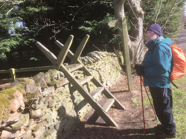
We passed Woodfoot farm and reached a road, turned left and after a hundred yards or so spotted the ladder stile on the right,
Watch out for this stile, and clamber over.
Once over we followed a woodland path on the edge of Dipton Wood until we reached a road (mile 2). We walked the road for a short distance before coming to this fine entrance, so we entered.
Walk this way.
At the end of the track is a farm, on the right of the farm is the entrance to a lovely long woodland walk above, along and near to the Devil's Water.
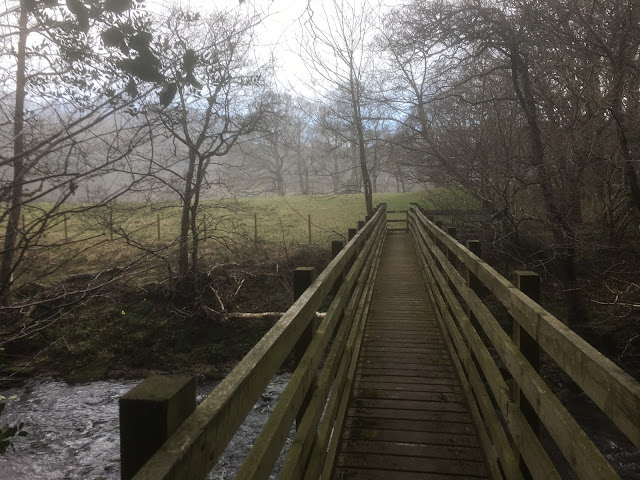
We crossed the stream by a footbridge to the path on the west side, walked a path through a field which would have inspired Wordsworth to compose a poem about daffodils until we reached Peth Foot.
A slight error, we walked on but not far, before it was pointed out we should have used the footbridge to go to the east side.
At about 4.5 miles into the walk we came to the arches of Dukefield and decided it was a fine spot for a Herbie. (Titans, an ALDI special, ginger biscuits and almond slices.)
A smelting centre for mainly lead ore dug from the surrounding hills.It operated from about 1666 to 1835. Only the arches remain, we sat on the edges of the water wheel pit for lunch, the wheel having gone years ago. The lead ingots were taken to Newcastle for shipping. The water wheel was to power bellows to heat the fire for smelting.
Lunch over we continued following the river to Mire House Farm. From the farm we took the soggy, boggy path through woodland to Steel Hall (mile 6) and from there turned through ninety degrees to head north east to Dukesfield Farm. Once round the farm we followed tracks across fields, then farm track then road, going past the interestingly named Palm Strothers, until we reached Slaley, changed and went home, it was only 3pm.
Contains OS data, copyright. Crown copyright and database right 2025.
The walk is 8.5 miles, field and woodland. A few short climbs but easy going.
The start


No comments:
Post a Comment