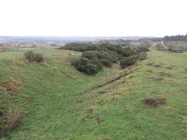
A Tale of a Temple a Fort and a Wall.
(Northumberland) December 9th
MUD WARNING
It's getting to be a bleak midwinter, but without snow in our corner of the Kingdom, which is still in Tier 3, shops can open but not pubs unless they serve a substantial meal. A scotch egg could be considered substantial, but not a bag of crisps. You can only meet in your own bubble so again we gadgies are meeting at an agreed point. Seven walkers, six cars, instead of the old way of sharing, which helped to save the planet. The adventurous seven: John H., John L., Dave, Margaret, Brian, Harry and me.
The walk starts and finishes in Newbrough; A69 west and just beyond Hexham, when the dual carriageway ends, turn right for Warden. Cross the river and head for Fourstones, the next village after Warden and on to Newborough. Park near the Town Hall.
The walk is covered by OS OL 43 Hadrian's Wall.
Nikoplas Pevsner describes Newbrough as a pleasant little place. Unusually, for a village it has a Town Hall, built in 1876 and of course it has a church, St. Peter's, also 19th century. The village is built partly on the site of a Roman fort, one of several on the Stanegate which was a Roman road built in AD 71, years before the wall.
We parked in front of the Town Hall on the main street.
Not an award winning car park but a nice little Town Hall in Newbrough.The walk;
From the Town Hall we walked west along the main street and crossed the Newbrough Burn. Almost immediately after we turned left down a footpath and walked through the muddy Crow Wood and the equally muddy and strangely named Sewage Wood, passing a weir on the burn.
Dave the archaeologist and dog lover was delighted with this stone The Newbrough Burn.
Beyond the weir we followed the steps down to the bank and under the railway bridge. From there the footpath clings close to the South Tyne. The path is one of the Tyne Trails marked out by "Daft as a Brush", a cancer charity. They have produced a book of riverside walks.
At Fourstones we crossed the railway again, admiring the set of warning lights and telephone that had been installed for pedestrians. As the light was green we crossed, passed the Railway Hotel which looks permanently closed and not just in lockdown and up to the village street.
Turning right we walked along the street to the next junction where we turned left and walked uphill . Spotting the fingerpost at what is marked as Fourstones Village on the map we turned right and soon encountered some muddy fields. The path crosses the Stanegate but you wouldn't know. There was a group of people sitting around in 4x4 vehicles, not suspicious but unusual. Following the footpath to a track we turned left close to a large electricity sub station before turning left at Whinny Hill. There were a number of horse boxes parked on the road side so between us we reckoned there must be a hunt in progress.
Turningright at Tilesheds Wood we walked uphill to the next junction and turned left.
Most of the next section of the walk was across muddy fields. It is a law of nature that animals will gather at field gates, churn up the ground and convert it to mud.
Starting going west the path turns north and then north east.
At one point we walked through the yard of a tumbledown farm. A lady came out from a caravan and pointed us in the right direction. She and her partner were renovating the building, slowly.
She has a big job on renovating this house!
After walking north east for a while we turned through a right angle and headed north west towards the Military Road. (B6318), crossed it and joined the Hadrian's Wall long distance footpath, heading west.
A stretch of ruined wall And a turret The ditch on the north side of the wall.The wall provided good seating so we stopped for a Herbie; Almond slices, Club Biscuits, Ginger biscuits, Mince pies, Savoury flapjack and chocolate cake from Mrs A.
Lunch over we continued west along the Wall Path.
This chunk of rock is at "Limestone Corner". It is in the ditch on the north side of the wall. The marks are where the builders attempted to cut the rock up and possibly decided it was too hard. It isn't Limestone either, it's dolerite.
As we approached the Roman fort at Brocolitia we followed the official path across the road and walked towards the fort. Some of the team went to see the Mithraum.
The Mithraum at Brocolitia. Mostly a reconstruction, the actual three altars are in the Great North Museum in Newcastle. Mithras was a popular Roman God, particularly among soldiers and he was taken from Persia. His birthday is December 25th.Once some of the team had seen the temple we headed south on a muddy track across fields and moorland until eventually the track became a metalled road and we were back in Newbrough. Pubs are still closed under the lockdown rules so we went home.
Contains OS data copyright. Crown copyright and database right 2020.
The walk is about 10 miles, mostly across fields and mostly easy going.
Not a day for photographs but


No comments:
Post a Comment