Translate

Saturday, 31 October 2020

 The Dragons Den, a tale of four Wittons.

Northumberland, October 30th.

 Mud warning, but only because of recent downpours.

There are seven of us out today for a walk from Hartburn, very small village in Northumberland.  The team, carefully divided to avoid a group of more than six consists of John x 3, Brian, Margaret, Harry and me. The walk has been devised by Harry.

To get to Hartburn head north on the A1, turn off at the junction north of Morpeth for Ashington and Morpeth, turn left and follow signs for Mitford. Drive through Mitford to Hartburn and continue beyond the village for about half a mile to a gravelled area on the right which has room for ten cars and is near the spot marked Dragons Den on the map.

Hartburn has a church with Saxon origins, St. Andrews. Once used by the Knights Templar and apparently Oliver Cromwell kept his money box there for a time. (Hartburn =O.E heoret burne = stag stream)

           St. Andrew's, Hartburn, Saxon with 12/13 C additions.
The map for this walk is OS Explorer 325 Morpeth and Blyth.

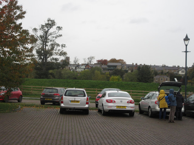
                  Can't compete with last week's car park at Craster for scenic beauty but here it is.
The walk;
Starting from the car park we followed the signpost towards The Garden House. (on a previous walk in February 2018 we visited the grotto near here, designed as a bathing changing room for ladies. Read all about it in Witton, Witton and Witton, February 2018)
Before reaching the house we turned off to the right and crossed the Hart Burn on a footbridge, the track through the wood was very muddy.

                                           Cross here.
The track headed north towards Wittonstone before turning north east and meeting a road. Here we turned right and walked along the tarmac before turning off on the left to walk across fields. We were following the Devil's Causeway which is the course of a Roman road running from Corbridge to Berwick upon Tweed. Like most Roman roads it's straight, but then they did not need planning permission. When we reached Oldpark Wood we turned off the Devil's Causeway and followed an equally straight but much more modern forestry track. We also had the only light shower of the day.

                            Straight but not Roman.

At the edge of the wood (The Trench on the map) we met a road and turned right to walk to the village of Netherwitton. (Witton= O.E widu-tun = settlement by a wood. Nether means lower settlement by a wood.)

Turning left we walked up the road to Bellion Farm, through the yard  and on into the fields which were nicely grassed, but with Lauder grass which is always difficult on the feet. The path went roughly west and through a small plantation. We had to cross the Font Burn which was not too easy as the heroic picture of John shows.   


                                                                                                                                                                  Once out of the wood we spotted a ruined stell, unusually rectangular, and decided it made an excellent Herbie Spot.

                    Socially distanced dining, with shelter from the breeze. Titans, flapjacks, biscuits, ginger biscuits and savoury tart and apple cake from Mrs A.
 Lunch over we headed west on a narrow footpath to Broomfield Fell plantation, entered the wood and walked a narrow path which was strewn with ankle catching brambles. The path turned slowly through 90 degrees and we emerged heading south towards Hilltop. The gateways round Hill Top were muddy, cows tend to congregate in them, churning up the ground.
At Hill Top we turned right across more fields, crossed a road  and walked more fields south to Southwitton. 
From this farm we walked a well puddled  track to the farm at Longwiton Dene. One field later we were on a woodland track above the stream which brought us back to the car park.

                       It was a muddy day, but not many clouds were in the sky.
Once changed from muddy boots some went to the Dyke Neuk pub, some of us went home.

Contains OS data, copyright. Crown copyright and database right 2020.

THE WALK IS JUST OVER 10 MILES FAIRLY FLAT AND NOT ALWAYS SO MUDDY.

The gallery;


Tuesday, 27 October 2020

The Day of the Dolphins. (Northumberland) October 26th. 

  A Monday walk out for Margaret, Brian, Dave and I. Starting and finishing in that familiar coastal village, Craster, familiar walk too but for a change we are going to do it clockwise. Easily followed without a map but the walk is covered by OS Explorer 332 Alnwick and Amble.

The walk, which is mostly flat was chosen in part to allow me to try out my knee brace on a cross country stroll. The brace is designed to assist sufferers from Osteo arthritis.

                                                              Wow


To get to Craster folow the A1 north, turn off for Denwick just beyond Alnwick and follow signs. There is a large car park on the right as you enter the village, in an old quarry, close to the old information centre and toilets. £4 for a whole 24 hours which is not a lot in a car share, not that we would in these difficult days of course.


                  Sunny start to the day but signs of recent rains and promises of more to come.

We walked down to the Shoreline cafe for breakfast. It was quite busy and seating is restricted these days so we chose to eat outside. The seats were a little wet but as we all carry those foldable mats we made use of them.

Having feasted we walked down to the coastal path and headed south. We had not gone far when we spotted a lady excitedly pointing out to sea and telling her children to watch the dolphins. So we joined in, as did most people around us. Not too often seen near here, there were several pods of the creatures frolicking in the water, leaping out  and splashing back.


               The dolphins we saw were too far away to photograph on my compact camera. This is from the internet, thanks to somebody.

Having watched their antics for a while we walked on along the footpath that follows the coast on the cliff tops. Not very high but very scenic. Recent rain had made the path muddy and slippy. It is half term, there were many families out for a walk, happy, enthusiastic toddlers and sullen teenagers resentful of their parents insisting a walk would be fun.


              Along the way (St Oswald's Way, another fairly long walk we keep coming across)

We walked past Black Hole, Cutternose Point and Rumbling Kerns before arriving at the point where the Howick Burn enters the north sea.


This cottage was built as a "bathing hut" for the ladies of Howick Hall. It is now a holiday home for rent.

                       Howick Burn enters the North Sea. On the far side of the stream a fresh water spring comes out of the rocks.
                                                                    Enough said.

At this point we turned north again and took the path marked as a National Cycle Route which becomes a muddy farm track heading to Sea Houses. The farmer was having a chat with his large lokking bull, patting it in a friendly way on the head. It seemed not to mind.

At the farm we turned left and walked up the road to the car park at Howick Hall. The Hall is the home of the Grey family, one made it as Prime Minister and introduced the 1833  ReformAct which extended the vote by about 1%. He is also responsible for Earl Grey tea.

The car park was declared a good Herbie Spot, even though there was a light drizzle. Margaret realised that she had left her mat at the Shoreline Cafe so we had a slight change of plan and decided, after Herbie, to head back to Craster to retrieve it. 

                      Bonus car park; Howick Hall

Our picnic table at Howick Hall. The sun has just come out. We shared Titans, almond slices and savoury buns and apple cake from Mrs A.

Having eaten we walked down a lane and across  fields to Hips Heugh. The field had a border of sun flowers.

                Sunflowers, planted for feathery wildlife
               Richard Of York Gave Battle In Vain.
We crossed a minor road and another field before we were back in Craster. having retrieved the missing mat we walked past the harbour towards Dunstanburgh Castle.
                                 Craster harbour

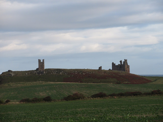
                      The ruined Dunstanburgh castle.
beyond the castle Dave and I walked the edge of the golf course, Margaret and Brian the slightly longer route on the sands, but we all met up again at Dunstan Steads and took the concrete strip through the farmyard towards Dunstan Square.

                           Sand bag bunker and a lime kiln between Dunstan Steads and Dunstan square.
From the square we walked down the field and turned right through a gate and took the path behind the Heughs back to Craster. 
Changed we headed for the Cook and Barker at Newton on the Moor, just off the A1 south of Alnwick.
They had Timothy Taylor's Landlord too, end of a grand day out.


Contains OS data, copyright. Crown Copyright and database right 2020.


The walk is about 10.2 miles. mostly flat and easy going, apart from the mud.

And a few more


Saturday, 24 October 2020

Ladycutters, Lightwater and Lingynook. (Northumberland) Oct 23rd.

  This week's walk is based on Corbridge, pretty little Northumberland town on the north bank of the River Tyne. The town has a long history, there is, nearby the ruins of a Roman fort, Corstopitum. The bridge was built in the 17th century, replacing older structures. In 1771 the Tyne flooded and every bridge over the river was washed away apart from the one at Corbridge.

There are a eight of us out today so to conform with Covid Rules we have split into two groups of four  and kept ourselves well spaced out. Team one; Brian, Margaret, Dave and me. Team two; John x 3 and Harry. We met in the car park on the south side of the river, a large and free one. Prior to meeting some had breakfast in Brockbushes farm shop and  restaurant on the roundabout just before the exit from the A69. It was very busy, happy families were out picking pumpkins for Halloween.

The walk is covered by OS OL 43 Hadrian's Wall and is advisable. 

                              Pumpkin pickers at Brockbushes
              Corbridge free car park with the town across the river.
Once we had all assembled and booted up we headed south along the road towards the Corbridge Station, passing the Dyvels Pub and the Valley restaurant.

                                  Newcastle train at Corbridge.
Not far across the bridge we found the signpost on the right (Tyne trails by Daft as a Brush marker) and followed the footpath uphill across a couple of fields and over Ladycutters Lane to a minor road. Turning right we walked the road to the next junction, turning right again to Temperley Grange. From the Grange we followed a footpath on the edge of a field due south to the next minor road where we turned left towards Dipton House. Just before the house we turned right and followed the footpath through the eastern edge of Dipton Wood, crossing Hunter's Hill and coming out of the wood at Todburn Steel.
                       Muddy track on an autumn day. 

                    The alpaca turned away at the last moment. Probably heard Dave's awful joke "You can call me Al"

We walked across more fields and North Road to arrive at Peel Flatt Farm in Slaley Vale. The village of Slaley, which is one long road of individual houses is visible on the hill. The friendly farmer at Peel Flatt directed us across his fields towards  Black Burn stream and East Woodfoot .

                         Autumn defying tree near Peel Flatt
                                               East Woodfoot
Not far fro East Woodfoot is West Woodfoot! Turning right on a well made track we walked a short distance before settling down on the bank on the roadside for a Herbie.
                        Herdwick sheep, usually found on the Cumbrian Fells.

          Socially distanced dining. Bramley apple pies, chocolate rolls, flapjacks, biscuits and from Mrs A a savoury snack and gorgeous chocolate cake which included a dash of beetroot!
Lunch over we continued up the track to the North Road, turned left and after about 100 yards spotted the footpath sign on the right which took us through a small wood and a couple of fields to a minor road.

                 Fearsome horns but they were placid.
After following the road between Lingynook Plantation and Dipton Wood for a short distance we turned right, passing Lightwater Cottages before turning onto a narrow footpath.
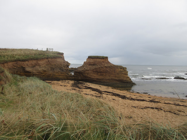
                          Lightwater Cottage.
The footpath, narrow and deep in places, eventually joined a forest track and we walked through woodland to a road, crossed it and followed another stretch of road until we found the signpost on the left saying Corbridge was 2  1/4 miles away. After crossing a couple of fields and walking the edge of  Snokoehill Plantation we came to Ladycutters Lane, turned right, walked the lane for a short distance before turning left into the fields back down to Corbridge Station and the car park.
On the way home we stopped at The Duke of Wellington in Riding Mill for rehydration.

                            Contains OS data, copyright. Crown copyright and database right 2020

THE WALK IS ABOUT 10.2 MILES, SOME MUDDY SECTIONS AND LOTS OF STILES TO CLIMB OVER.