Whisky on Windy Gyle... (Northumberland) July 17th
John Lockey was 70 in May but because of the lockdown, and we gadgies being obedient, we could not celebrate his birthday as we had ten years ago. Today we are doing the same walk as we did for his sixtieth, he provides the whisky. There are eight of us out today, highest number for some time; Me, Dave, Harry, Brian, Margaret and John x3.
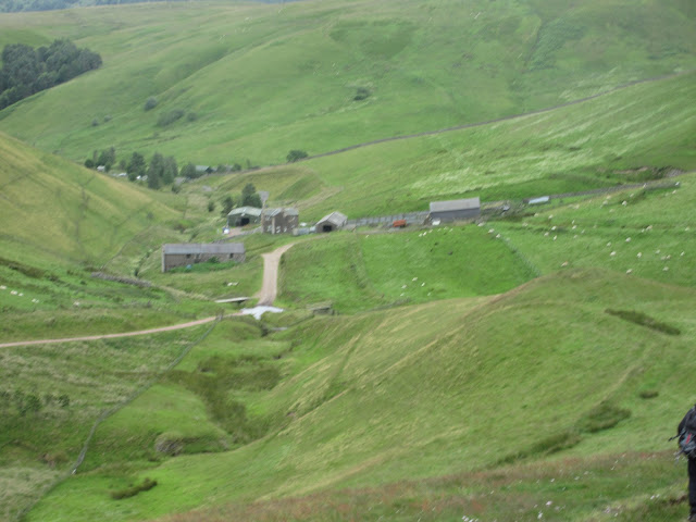
The walk starts at Barrowburn, high up the Coquet Valley. To get to the start take A1 north, A697, turn off for Rothbury and drive through that town to the fork in the road that has a sign post for Alwinton. Go through this village and continue for a few miles of narrow twisting road to the car park at Wedder Leap and leave your vehicle on the left.
The map for this walk is OS OL 16, Cheviot Hills.
A cloudy day with occasional light showers was forecast, correctly.

 Free car park at Barrowburn,( or Wedder Leap)
Once we were all assembled and booted we left the car park, turned left and crossed the footbridge over the infant Coquet. The footpath, which becomes a grassy track, heads north, passing a couple of buildings which were once a school(?) and on over Middle Hill. The walk is best described as undulating but not too hard going several gates to open and close.
 Once a school, now a holiday let
 The grassy track up Middle Hill
After two and a half miles the track meets a farm road and a sign post. Some of the team, the sensible ones, continued on the track going north between the two plantations. The rest chose to head north east towards the farm at Uswayford.
 Easiest to take the track to the Border Ridge
 Maybe a holiday let at Uswayford.
From Uswayford we took the footpath heading north west, making sure we did not cross the bridge in the photo below but heading through long grass to a gateway on the edge of the plantation.
 Do not cross this bridge (He came back)
For those of us who had chosen this route we had an upward route on a narrow footpath with some markers through the woodland which was home to several million flies. Eventually we escaped them coming out onto moorland and joining the footpath leading to the border ridge.
By now we were all together again so we called a Herbie, sat in the heather at the side of the track and had the usual sharing; biscuits, more biscuits, jaffa cakes, Titans, scones with jam as part of John's birthday tea and savoury buns from Mrs A.
Moving on we were soon at the gate on the border:
 John Ha., Brian, Margaret, John L., Harry, John H., Dave.
They are all in Scotland, the photographer is in England.
From this point we walked the border fence to Russell's Cairn. The path is paved with flagstones, probably as well because it is popular and used to be very boggy.
We stayed on the English side to Russell's Cairn where we crossed over and sat in the cairn for a wee dram to celebrate the birthday boy.
 Russell's Cairn. It is thought to be an Iron Age burial site but gets its name from the murder of Lord Francis Russell in 1585. He was a totally innocent Englishman who was talking truce terms with the Scots. The borders were the scene of many a scrap between the two countries up to the 17th century. Who knows what the future holds. The cairn is at 2031 feet or 619 metres if you must.
 Inside the cairn, out of the breeze.
Once the celebrations were over we decided that as the weather was a bit cool and damp we would take the shortest route back down Windy Gyle. The path heads south east for a short distance, then we took the right fork and walked mostly down hill on grass to Rowhope. There are several ways of coming down but this is the shortest. Unfortunately from Rowhope the walk back to the car park is on a tarmac road, initially alongside the Rowhope Burn but then at the confluence, alongside the Coquet.
Once changed we went home, some calling at the Rose and Thistle pub in Alwinton which was reportedly serving Timothy Taylor's Landlord.
Another good walk with some ascent which we felt was needed!
 Contains OS data, copyright. Crown copyright and data base right 2020
An abbreviated Matrix for the walk
steps miles
Dave's NAK1 22479 9.57
"""""""""""""2 22408 9.54
SM 22408 9.54
OUTDOOR GPS 9.75
And a few more;


John Lockey was 70 in May but because of the lockdown, and we gadgies being obedient, we could not celebrate his birthday as we had ten years ago. Today we are doing the same walk as we did for his sixtieth, he provides the whisky. There are eight of us out today, highest number for some time; Me, Dave, Harry, Brian, Margaret and John x3.
The walk starts at Barrowburn, high up the Coquet Valley. To get to the start take A1 north, A697, turn off for Rothbury and drive through that town to the fork in the road that has a sign post for Alwinton. Go through this village and continue for a few miles of narrow twisting road to the car park at Wedder Leap and leave your vehicle on the left.
The map for this walk is OS OL 16, Cheviot Hills.
A cloudy day with occasional light showers was forecast, correctly.


Once we were all assembled and booted we left the car park, turned left and crossed the footbridge over the infant Coquet. The footpath, which becomes a grassy track, heads north, passing a couple of buildings which were once a school(?) and on over Middle Hill. The walk is best described as undulating but not too hard going several gates to open and close.


After two and a half miles the track meets a farm road and a sign post. Some of the team, the sensible ones, continued on the track going north between the two plantations. The rest chose to head north east towards the farm at Uswayford.


From Uswayford we took the footpath heading north west, making sure we did not cross the bridge in the photo below but heading through long grass to a gateway on the edge of the plantation.

For those of us who had chosen this route we had an upward route on a narrow footpath with some markers through the woodland which was home to several million flies. Eventually we escaped them coming out onto moorland and joining the footpath leading to the border ridge.
By now we were all together again so we called a Herbie, sat in the heather at the side of the track and had the usual sharing; biscuits, more biscuits, jaffa cakes, Titans, scones with jam as part of John's birthday tea and savoury buns from Mrs A.
Moving on we were soon at the gate on the border:

They are all in Scotland, the photographer is in England.
From this point we walked the border fence to Russell's Cairn. The path is paved with flagstones, probably as well because it is popular and used to be very boggy.
We stayed on the English side to Russell's Cairn where we crossed over and sat in the cairn for a wee dram to celebrate the birthday boy.


Once the celebrations were over we decided that as the weather was a bit cool and damp we would take the shortest route back down Windy Gyle. The path heads south east for a short distance, then we took the right fork and walked mostly down hill on grass to Rowhope. There are several ways of coming down but this is the shortest. Unfortunately from Rowhope the walk back to the car park is on a tarmac road, initially alongside the Rowhope Burn but then at the confluence, alongside the Coquet.
Once changed we went home, some calling at the Rose and Thistle pub in Alwinton which was reportedly serving Timothy Taylor's Landlord.
Another good walk with some ascent which we felt was needed!

An abbreviated Matrix for the walk
steps miles
Dave's NAK1 22479 9.57
"""""""""""""2 22408 9.54
SM 22408 9.54
OUTDOOR GPS 9.75
And a few more;


No comments:
Post a Comment