"The loveliest spot that man hath found" (Lake District September 1st.
Thus spake William Wordsworth on one of his lonely wanderings, getting away from his sister Dorothy probably.
Four of us out today, Ben, Dave, Harry and me, hoping to enjoy a day in the Lake District. The weatherman said it would be dry and warm, with light clouds so off we set for Borrowdale. From Newcastle A69 west, M6 south, A66 west to just beyond Keswick and follow road signs for Borrowdale, usually described as the wettest place in England.
We parked, originally, in the car park at Seatoller, which is run by the National Trust who charge £7.50 for a day or free to members. Nobody had change and Harry had forgotten his NT members card so we left.
 National Trust car park at Seatoller. Obviously not many members around, or people with change, like us.
We drove down the lane to the farm at Seathwaite where you can park in a field for £2 or on the roadside for free. Needless to say, but I shall, we chose the road side and parked on the muddy verge.
 One of my regular readers has made sarcastic comments about my car park of the week. All I can say is that when my new book, "Country car parks of the North", companion volume to my other best seller "Gate fastenings of old Northumbria" is published, she can forget her share of the fortune it will make.
This walk crosses over two maps;
OS OL 4 English Lakes North West Section and OS OL 6 English Lakes South West Section.
Or photo copy and use Pritt.
From Seathwaite we walked back along the lane towards Seatoller.

 You can scramble up this 20 foot wall or walk round it. I climbed up it. My wife has since said, on seeing the photograph, I should give up such things. Scramble or walk round, you finish up on the top of Glaramara which has a cosy shelter, sadly other walkers had taken it over so we found another sheltered rocky spot for a Herbie.

 Cross shaped shelter near the turn to Ruddy Gill.
 Cross the stream at this point and keep going down

 Stockley Bridge


Thus spake William Wordsworth on one of his lonely wanderings, getting away from his sister Dorothy probably.
Four of us out today, Ben, Dave, Harry and me, hoping to enjoy a day in the Lake District. The weatherman said it would be dry and warm, with light clouds so off we set for Borrowdale. From Newcastle A69 west, M6 south, A66 west to just beyond Keswick and follow road signs for Borrowdale, usually described as the wettest place in England.
We parked, originally, in the car park at Seatoller, which is run by the National Trust who charge £7.50 for a day or free to members. Nobody had change and Harry had forgotten his NT members card so we left.

We drove down the lane to the farm at Seathwaite where you can park in a field for £2 or on the roadside for free. Needless to say, but I shall, we chose the road side and parked on the muddy verge.

This walk crosses over two maps;
OS OL 4 English Lakes North West Section and OS OL 6 English Lakes South West Section.
Or photo copy and use Pritt.
From Seathwaite we walked back along the lane towards Seatoller.
 |
Yurts for glampers at the end of the lane to Seathwaite. My love of yurts goes back to the lovely Mrs Whitehead at junior school about 1953 when she told us all about them.
We turned right at the end of the lane and walked along the road in the direction of Rosthwaite.
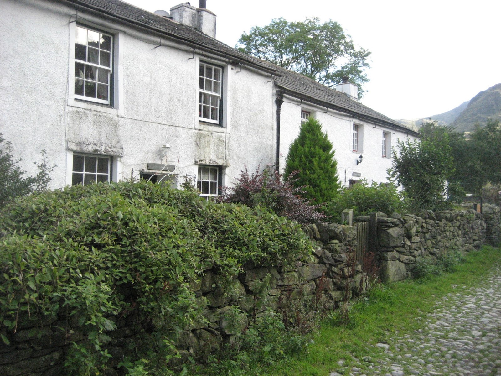
Near a neat row of cottages we turned into the lane that goes to Thorneythwaite Farm and after a few yards spotted the finger post that says Glaramara, 2 miles.
The sign does not tell you that from here the footpath goes uphill to the top of Glaramara. The path is clearly visible all the way as it meanders above Combe Gill, across Thorneythwaite Fell and on to Combe Head.
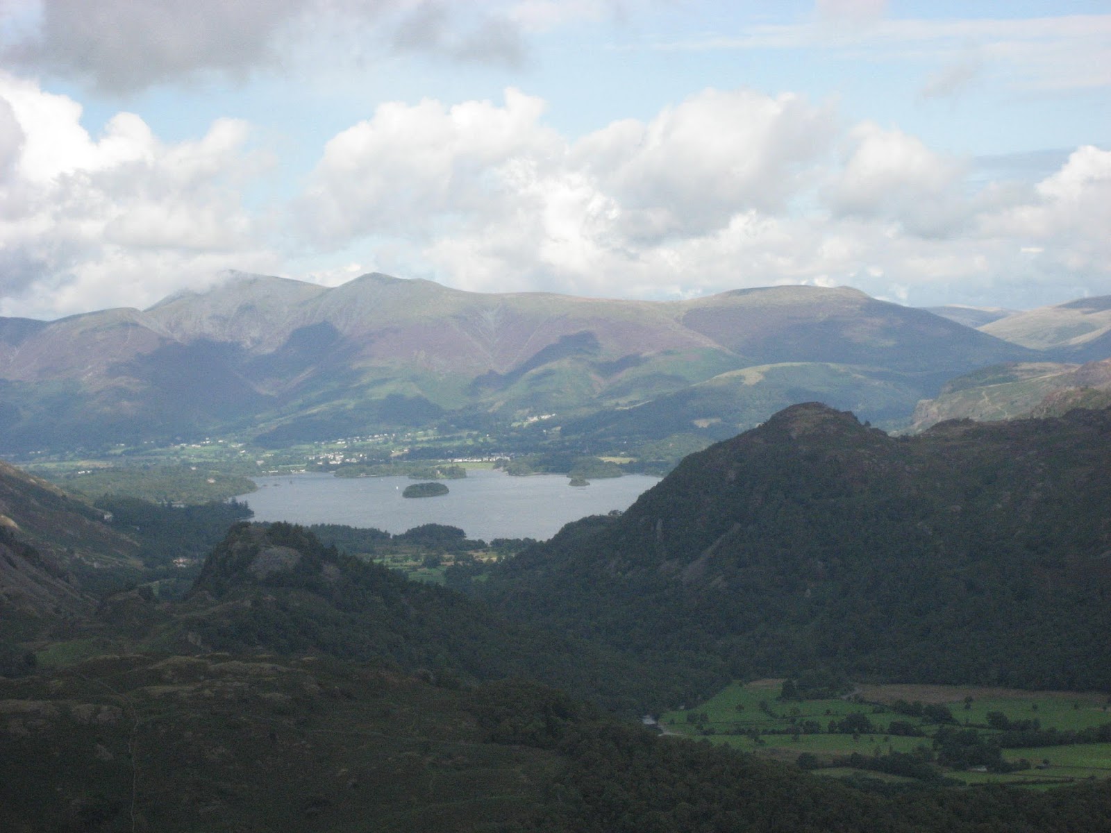
Looking north from the path up Glaramara. Derwent Water and Keswick In places the path is steep, in places the path is boggy but eventually we reached the last obstacle to the top.
 You can scramble up this 20 foot wall or walk round it. I climbed up it. My wife has since said, on seeing the photograph, I should give up such things. Scramble or walk round, you finish up on the top of Glaramara which has a cosy shelter, sadly other walkers had taken it over so we found another sheltered rocky spot for a Herbie.
This is my second ever attempt at a selfie. Completely missed out Dave. We shared Titans, Yorkshire flapjacks and Ben's ginger biscuits
The name Glaramara means "The hill with the mountain hut by a chasm", apparently, in Old Norse.
It is 2569 feet (783 metres in foreign) and is fairly central to the fells. From the summit, on a clear day, you can enjoy a panoramic view of the Lake District. Great Gable, Pillar, Bowfell, Lake Windermere and many more Lakeland spots are visible.
 Harrisons Pike and Pike o' Stickle from Glaramara

Great Gable, Green Gable and Pillar.The name Glaramara means "The hill with the mountain hut by a chasm", apparently, in Old Norse.
It is 2569 feet (783 metres in foreign) and is fairly central to the fells. From the summit, on a clear day, you can enjoy a panoramic view of the Lake District. Great Gable, Pillar, Bowfell, Lake Windermere and many more Lakeland spots are visible.


Lunch and viewing over we continued on our way, south west. Stick to the path, the ground is strewn with a variety of boulders which make the walk a bit tricky if you get off piste. Passing High House Tarn we walked up the rocky trail to Allen Crags (2572 feet or 784 metres).
From here we turned north west and headed for Ruddy Gill, the start of the steep walk down to Seathwaite.


Ruddy Gill, which later becomes Grains Gill.
The path has been greatly improved over the years, much of it now is a stone staircase. I do remember some years ago, walking up Grains Gill that it was so icy we donned crampons.
At Stockley Bridge the path changes sides of the stream and from here on is fairly flat and has a good hard surface all the way back to Seathwaite Farm.

Seathwaite Farm, nothing to do with the sea, it's "the field with reeds"
Changed we headed home, stopping for refreshment at the White Horse Inn, just east of Threlkeld. Very friendly pub, staffed by young Europeans. Three real ales on draught and an interesting menu.
One of the pleasures of walking in the Lake District is the friendliness of fellow walkers, many of whom today looked about our age. It's the grey pound. Most people stop for a chat, usually along the lines of the weather or where have you been today. One couple we passed as they walked up Grains Gill were quite different. She completely ignored our cheery hello, he grunted. They were given a nickname but I would like children to read this.
And finally; today I passed 100,000 hits. Not much in terms of sleb blogs but very pleasing to me and my fellow gadgies.
Matrix MMXVII Z to the nth term
steps miles
NAK 32890 12.97 (ridiculous)
iPhone 27509 10.8
OUTDOOR GPS 8.5 miles
Dave's 3D 27279 11.18
"""USB 23503 10.38
""" NAK 23467 10.37
Ben's GPS 8.7
Pedometers can't cope with changing slopes very well. Steps get shorter, consequently there are more of them, as you plod uphill, or down.

Contains OS data, copyright. Crown Copyright and database right 2017.
Mile markers are approximate and for guidance only.
A few more pictures


No comments:
Post a Comment