Gadgies over troubled waters. (Northumberland) March 3rd.
Kielder water is supposedly the largest man made lake in Europe, surrounded by one of the largest man made forests, 99.99% of which are conifers. The trees provide nesting places for several pairs of Ospreys but our efforts to observe them over the last few years have not provided a single sighting. We will try again later in the year. There is an observation platform, with telescopes and very nice Osprey guides.
Kielder means "violent water", just like the Welsh called-dwfr as you probably failed to notice. Perhaps the north Tyne river, damned to form the lake, was a particularly fast moving stream. Below the dam today it seems quite placid and has even been known to have mandarin ducks on it. We are not walking around the lake (approximately a marathon) but walking from Kielder village north to Deadwater Fell and back along the dismantled railway. Kielder castle, built in 1775 as a shooting lodge for the Duke of Northumberland, has a small museum, a café and a TV screen with a webcam aimed at an osprey nest, when they are present.
To get to Kielder village take the A69 west and the A 68 north at Corbridge and frollow road signs to Bellingham and along the lake shore to the village. It has a pub, a small shop and a library. The Youth Hostel appears to be closed.
The map for the walk is OS Ol 42 Kielder4 Water and Forest.
There are seven dwarves out today, John H., John C., Brian, Harry, Ben, Dave and me. We met at the café but it was closed, opening at 11am, a little late we decided. There is a Yorkshire car park in the village, space for 4 or 5 cars, the car park opposite the castle costs £4.50 for a day. Yorkshire won.
The young lady forecaster on local TV said it would be overcast until about 4pm , with some mist, then it would rain. She was right.
 Today's starting point, Kielder village.
The walk, at last.
From Kielder village, by the Post Office, we walked up to Kielder Castle. Across from the castle is a cycle hire centre (including electric bikes!). There are several mountain bike trails from here, colour coded. Cycling round the lake is popular too, it is approximately a marathon and is fairly flat apart from a few short steep pulls.
 Kielder castle, not a real one with dungeons.
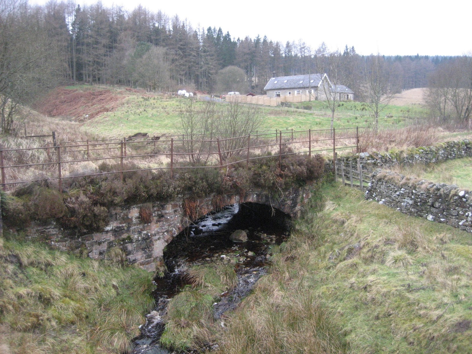
 Cunningham castle. This cottage, belonging to a friend of mine is available for holidays.
We chose the "blue trail" starting in the car park above the cycle centre. A well made cycle track to start with it became a narrow stony path with several hair pin bends. Easy going for walkers.
 A bit of fun for cyclists.
We walked steadily uphill through the wood, now following a red trail. At a T junction we turned left went through a couple of gates with polite notices to close them, and cheerfully ignored the No Entry sign which warned of cyclists descending at high speed and reached a forestry track.


 Much of the walk was through the plantation, like this.
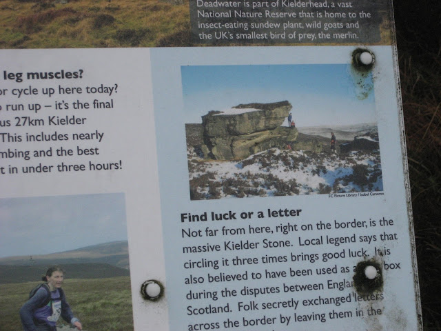
The track climbed steadily uphill to the summit of Deadwater Fell (1873 feet or 571 metres) where we called a Herbie Spot. An information board informed us that to the west we could see the Solway Firth, to the east the sparkling North Sea, to the north Bonnie Scotland and to the south the rolling Cheviots. It was so misty you could see about ten yards.
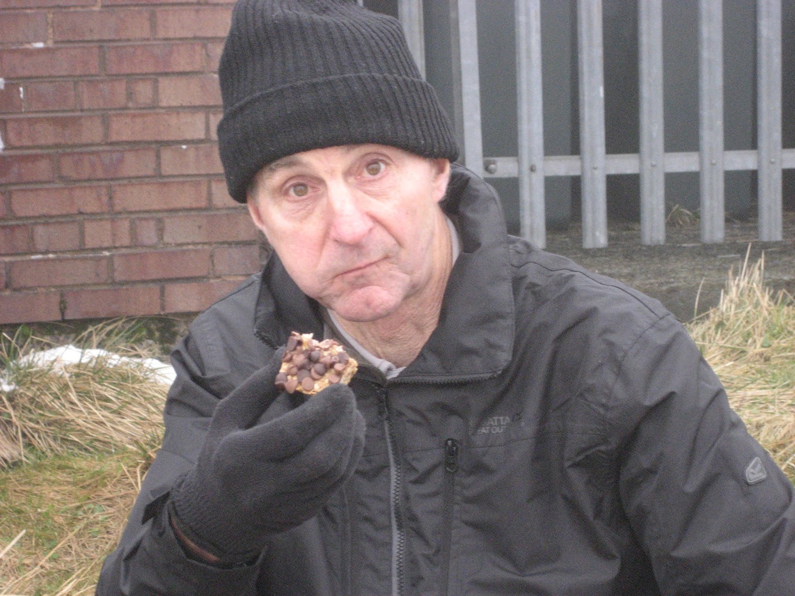
 On the top of Deadwater Fell is an aircraft navigation aid and several buildings. We sat behind one to be out of the wind and shared Mars Bars, ginger biscuits, lemon slices, fruit cake from Mrs A and flapjacks made by me with a lot of help from my kitchen elf.
 Dave enjoys one of my home made flapjacks.
Lunch over we followed the track south until we "closed the loop" at the point where we joined it on the way up. Turning right we took the forest track south west before turning north west (mile 5).
 This is actually a purpose built Herbie Spot on the top of Deadwater Fell but today the wind was blowing straight in.
 Six of the seven dwarves, looking a bit lost
At the bottom of the hill we joined a metalled road, headed north west and walked down the farm path to Deadwater Station.

 This post box is a bit of a giveaway for the station.
Once down at the old station we followed the dismantled railway track all the way back to Kielder Village. The railway track had a good surface and, for good reasons, was fairly flat as it followed the north Tyne river.
 Once it was Deadwater Station.
Changed we headed for the Cheviot Hotel in Bellingham which had four real ales on offer including Jakehead and Tyneside Blonde. The coffee was good too, as was the service from the welcoming staff. Sixties music too!

Contains OS data copyright. Crown copyright and database right 2017
The Matix MMXVII I
steps miles
NAK
25735 10.56
iPhone 24552 11.1
Dave's 3D 23771 10.8
"" USB 23939 11.33
"" NAK 23152 10.96
My Garmin 10.1
Brian 4trex 9.9
Ben's bragometer 9.82
John C 9.9
This is getting out of hand
This week's gallery


Kielder water is supposedly the largest man made lake in Europe, surrounded by one of the largest man made forests, 99.99% of which are conifers. The trees provide nesting places for several pairs of Ospreys but our efforts to observe them over the last few years have not provided a single sighting. We will try again later in the year. There is an observation platform, with telescopes and very nice Osprey guides.
Kielder means "violent water", just like the Welsh called-dwfr as you probably failed to notice. Perhaps the north Tyne river, damned to form the lake, was a particularly fast moving stream. Below the dam today it seems quite placid and has even been known to have mandarin ducks on it. We are not walking around the lake (approximately a marathon) but walking from Kielder village north to Deadwater Fell and back along the dismantled railway. Kielder castle, built in 1775 as a shooting lodge for the Duke of Northumberland, has a small museum, a café and a TV screen with a webcam aimed at an osprey nest, when they are present.
To get to Kielder village take the A69 west and the A 68 north at Corbridge and frollow road signs to Bellingham and along the lake shore to the village. It has a pub, a small shop and a library. The Youth Hostel appears to be closed.
The map for the walk is OS Ol 42 Kielder4 Water and Forest.
There are seven dwarves out today, John H., John C., Brian, Harry, Ben, Dave and me. We met at the café but it was closed, opening at 11am, a little late we decided. There is a Yorkshire car park in the village, space for 4 or 5 cars, the car park opposite the castle costs £4.50 for a day. Yorkshire won.
The young lady forecaster on local TV said it would be overcast until about 4pm , with some mist, then it would rain. She was right.

The walk, at last.
From Kielder village, by the Post Office, we walked up to Kielder Castle. Across from the castle is a cycle hire centre (including electric bikes!). There are several mountain bike trails from here, colour coded. Cycling round the lake is popular too, it is approximately a marathon and is fairly flat apart from a few short steep pulls.


We chose the "blue trail" starting in the car park above the cycle centre. A well made cycle track to start with it became a narrow stony path with several hair pin bends. Easy going for walkers.

We walked steadily uphill through the wood, now following a red trail. At a T junction we turned left went through a couple of gates with polite notices to close them, and cheerfully ignored the No Entry sign which warned of cyclists descending at high speed and reached a forestry track.

Follow the signs


The track climbed steadily uphill to the summit of Deadwater Fell (1873 feet or 571 metres) where we called a Herbie Spot. An information board informed us that to the west we could see the Solway Firth, to the east the sparkling North Sea, to the north Bonnie Scotland and to the south the rolling Cheviots. It was so misty you could see about ten yards.

Lunch over we followed the track south until we "closed the loop" at the point where we joined it on the way up. Turning right we took the forest track south west before turning north west (mile 5).


At the bottom of the hill we joined a metalled road, headed north west and walked down the farm path to Deadwater Station.


Once down at the old station we followed the dismantled railway track all the way back to Kielder Village. The railway track had a good surface and, for good reasons, was fairly flat as it followed the north Tyne river.

Changed we headed for the Cheviot Hotel in Bellingham which had four real ales on offer including Jakehead and Tyneside Blonde. The coffee was good too, as was the service from the welcoming staff. Sixties music too!

Contains OS data copyright. Crown copyright and database right 2017
The Matix MMXVII I
steps miles
NAK
25735 10.56
iPhone 24552 11.1
Dave's 3D 23771 10.8
"" USB 23939 11.33
"" NAK 23152 10.96
My Garmin 10.1
Brian 4trex 9.9
Ben's bragometer 9.82
John C 9.9
This is getting out of hand
This week's gallery


No comments:
Post a Comment