The three mousketeers.(Northumberland)February 5th
Due to an outbreak of holidays, grandchild sitting and training for serious events the team id reduced to three today, Harry, John H. and me. The forecast, according to the Scottish gentleman on local BBC TV has said it will be grey and damp but mild for the time of year. With this in mind we have opted for an old favourite, Carey Burn, which has been blogged on several occasions but as it is my job as blogmeister the walk will be recorded.
The walk starts from the Carey Burn bridge in the Harthope Valley. It is covered on OS OL 16 The Cheviot Hills. To get there from base take the A1 north, turn off on the A697, turn into Wooler and take the first road on the left. (Cheviot Street) After a mile or so take the right fork and continue on the narrow road to the sign post for Langleeford. Go past Skirl Naked, down the hill and park on the grass verge on the right just before the bridge. (GR NT 976250)
 Nice new little car. Snear Hill in the background.
Just before the bridge, on the right hand side a sign post points the way up the Carey Burn. Initially crossing fields the path meanders, a bit like the stream up a rocky valley. (If you are following on a map note that the footpath is not marked by the Ordnance Survey but has become such a popular walk it has been adopted by gadgies of all ages). On occasion we have seen peregrines on the higher cliffs, dippers in the water, herons keeping watch and, in warmer weather, adders. There is a pretty waterfall to see, a short scramble just above it and a wooden hut to admire.
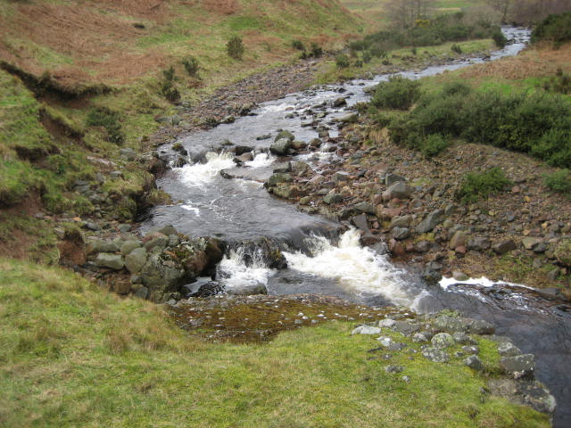
 Carey Burn Force.

Resting place for exhausted grouse shooters.
Not far from the hut as the path approaches open ground before entering a plantation we spotted the following;
 Not a Highland Cow to be seen today, nor game of any kind, never mind black.
The recent storms, Gertrude followed by Henry, had done some damage in the plantation but we soldiered on regardless.
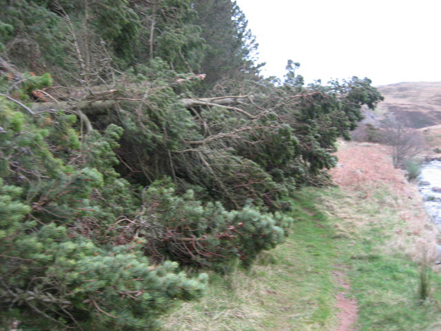 Felled by Gertrude or Henry
Soon we came to the footbridge;
 The footbridge. Nearby two streams, the Commonburn and Broadstruther Burns meet . In Northumberland there are at least two settlements called "Twizell" which means a fork in the river or confluence as they are known to Geography teachers. Harry and I once camped in Austria near a village called Zweizelstein, Zweizel being the German equivalent of Twizell, apparently, and stein meaning a large beer glass.
Across the bridge (marked as "Ford"on the map) the footpath crosses open ground before reaching another footbridge, also marked as Ford, perhaps I need a new map.
 A Twizell
Eventually the footpath meets the farm track which leads to today's Herbie Spot, Broadstruther.
 Looking back down the Carey Burn
 Broadstruther. Once a dilapidated farmhouse, now a cosy shelter for tired grouse shooters.
We sheltered from the increasing wind at the back of the empty building. Slim pickings today as there are only three of us; Hobnob flapjacks and Kendal Mint Cake.
Lunch over we continued on our way from Broadstruther, following a soggy footpath almost due south with Cold Law on our left. The footpath joins a farm track through heather, much of which has been burned off to promote new shoots to promote healthy grouse to entertain the shoots.
 Heather covered Cold Law.
At the fence line we were faced with a choice. Normally we follow the fence straight to the top of Cold Law, but today, knowing the trail up the hill would be a boggy morass we opted to follow the track south east to Hawsen Burn. Besides it was getting cold and was raining slightly, and the wind was getting stronger and we had had enough last week.
If you follow this route watch out for a narrow footpath on the left of the farm track and take it. It leads above Hawsen Burn to emerge on the valley road near the parking area on the Harthope Burn.


 Langlee Farm

 The burn at Carey Burn bridge, north side


The walk starts from the Carey Burn bridge in the Harthope Valley. It is covered on OS OL 16 The Cheviot Hills. To get there from base take the A1 north, turn off on the A697, turn into Wooler and take the first road on the left. (Cheviot Street) After a mile or so take the right fork and continue on the narrow road to the sign post for Langleeford. Go past Skirl Naked, down the hill and park on the grass verge on the right just before the bridge. (GR NT 976250)

Just before the bridge, on the right hand side a sign post points the way up the Carey Burn. Initially crossing fields the path meanders, a bit like the stream up a rocky valley. (If you are following on a map note that the footpath is not marked by the Ordnance Survey but has become such a popular walk it has been adopted by gadgies of all ages). On occasion we have seen peregrines on the higher cliffs, dippers in the water, herons keeping watch and, in warmer weather, adders. There is a pretty waterfall to see, a short scramble just above it and a wooden hut to admire.


Not far from the hut as the path approaches open ground before entering a plantation we spotted the following;

The recent storms, Gertrude followed by Henry, had done some damage in the plantation but we soldiered on regardless.

Soon we came to the footbridge;

Across the bridge (marked as "Ford"on the map) the footpath crosses open ground before reaching another footbridge, also marked as Ford, perhaps I need a new map.

Eventually the footpath meets the farm track which leads to today's Herbie Spot, Broadstruther.


We sheltered from the increasing wind at the back of the empty building. Slim pickings today as there are only three of us; Hobnob flapjacks and Kendal Mint Cake.
Lunch over we continued on our way from Broadstruther, following a soggy footpath almost due south with Cold Law on our left. The footpath joins a farm track through heather, much of which has been burned off to promote new shoots to promote healthy grouse to entertain the shoots.

At the fence line we were faced with a choice. Normally we follow the fence straight to the top of Cold Law, but today, knowing the trail up the hill would be a boggy morass we opted to follow the track south east to Hawsen Burn. Besides it was getting cold and was raining slightly, and the wind was getting stronger and we had had enough last week.
If you follow this route watch out for a narrow footpath on the left of the farm track and take it. It leads above Hawsen Burn to emerge on the valley road near the parking area on the Harthope Burn.

Footpath above Hawsen, Langlee Crags in the background.

A broken stell (sheepfold)by the Hawsen Burn.
Once on the valley road we walked north east back to the car at the Carey Burn Bridge.


Easter Dene


and south side
On our way home we stopped at the Anglers Arms for a change. They had Timothy Taylor's Landlord on offer, and coffee for the driver.
The Matrix MMXVI E
steps miles
NAK 19003 8.09
LIDL3D 11745 5.31 (from Broadstruther)
Etrex 7

Contains OS Data Copyright. Crown copyright and databaseright 2016
No comments:
Post a Comment