Play Misty for me..........................April....24th
The north of England has been bathed in sunshine all week, the temperature in the low 20s, the breeze light, the garden swing inviting and comfortable. So what better than a trip to the Lakes for a gadgie day out. The young lady who gave the Friday forecast on local TV promised sunshine until the afternoon so six of us set off to walk up Skiddaw in the north lakes. It is, at 3053 feet the fourth highest mountain in England. For geologists Skiddaw and its neighbour Blencathra are quite different from the rest of the lake district hills, being composed of mudstone, siltstone and greywacke sandstone. I looked it up.
Six of us out today; John H, John C, Dave, Ben, Harry and me. To get to the start at Highside from base take the A69, M6 south, A66 west and just beyond Keswick take the road signed Carlisle. Take the minor road to the right after a few miles and pull in onto the limited parking area on the right.It is at NY235309, and here it is. Use OS OL4 The English Lakes, North Western area. If you have an older edition the start and finish of the walk is not on the map but on later versions it's on the other side, how very sensible.
 The walk starts just beyond the cars, there is a signpost, says Melbeck I think.
In spite of the promises of sunshine the day had already turned misty, it was not possible to see the tops.
We followed the path across a few fields in a south east direction, taking great care with gates as there was a good number of sheep around with their lambs. The grassy path follows what was possibly once a miners track, it is quite deep and curves over a small hill before becoming a farm track. At the first junction we took the right path which slowly but painfully climbs up to and over Ullock Pike.
 A misty Ullock Pike. Normally good for views over Bassenthwaite, but not today.
 Not much chance of spotting the Bassenthwaite Ospreys today.
It is a long pull up Ullock Pike but once past the summit there is some respite along Longside Edge as the path levels and even descends.

Alfred Wainwright, the Lakeland sage waxes almost lyrically about the mountain but I think the summit is pretty dull, stretching for some distance north and south.
 Lunch time on Skiddaw. The shelter kept the cold wind off and we dined on sandwiches, Belgian chocolate caramel shortbread, flapjacks and Czech Chocolate. ( I brought back a good supply) Sadly Ben had been too busy to bake ginger biscuits and Mrs A was away on holiday with Brian.
 Summit cairn and trig point
We headed north and came off Broad End. (Confusingly the south of the hill also has a Broad End.)
The track, which is not on my map, turns west and the descent is as steep as the ascent, hard on the knees as you get a bit older but gadgies are tough. On one occasion on this hill I slipped on the wet grass and broke a bone in my hand so take care. The route has been called Broken Hand since, sounds like a minor Native American, but not as good as Head Smashed in Buffalo Jump.(Look it up)
Once back in the valley the path rejoins the route taken at the start and soon we were back at the cars.
This is a relatively short walk, 6.1 miles but it is quite a tough one. We called in at the Horse and Farrier in Threlkeld for refreshment. They sell mainly Jennings Beers and their coffee was excellent.
 The juniors take another break
 Gorse in bloom, it usually is
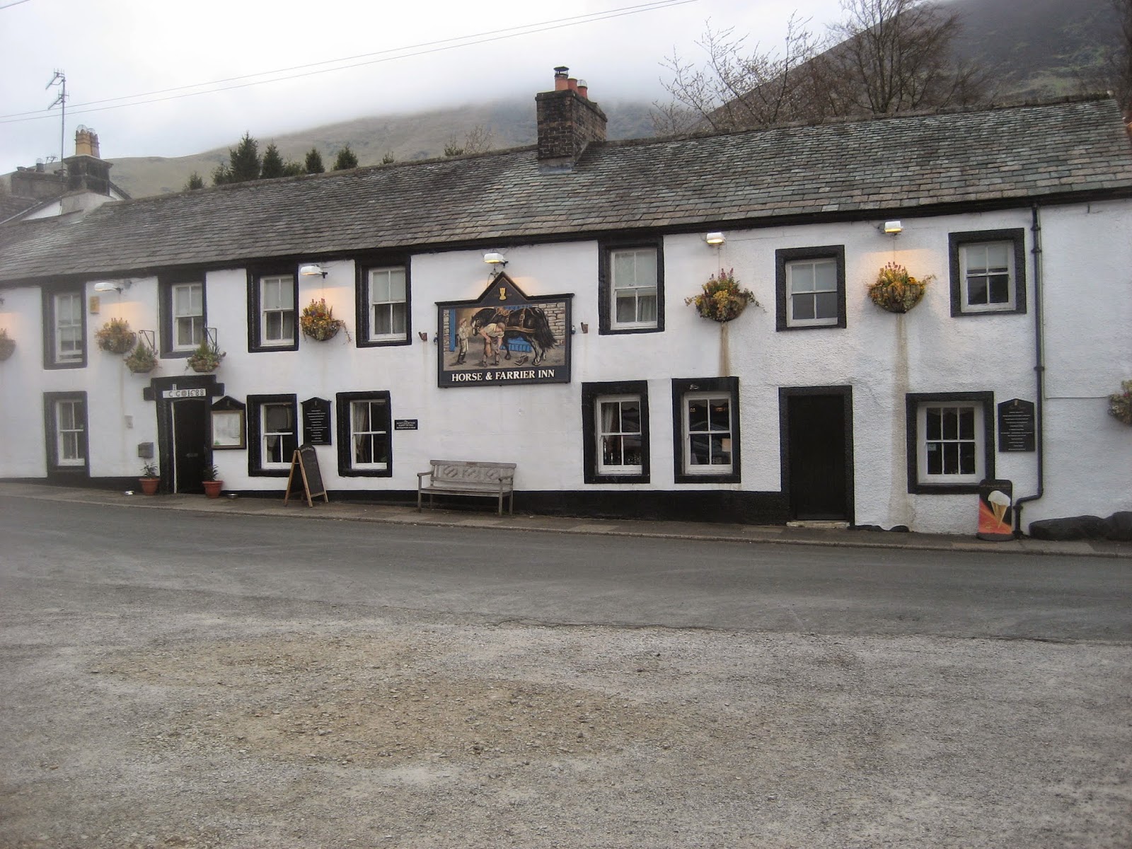 The Horse and Farrier, Threlkeld. Good beer, good food
THE MATRIX MMXV K
steps miles
Hi gear 17127 7.75
LIDL3D 21629 8.6
Dave's LIDL3D 16970 6.58
Dave's LIDLUSB 16857 6.91
OUTDOOR GPS 6.1

 Starting out
 On the way to Ullock Pike
 In the mist on Ullock Pike
 Lunch at the summit
 The summit trig point
 The steep slope down
 Looking back at Skiddaw
The north of England has been bathed in sunshine all week, the temperature in the low 20s, the breeze light, the garden swing inviting and comfortable. So what better than a trip to the Lakes for a gadgie day out. The young lady who gave the Friday forecast on local TV promised sunshine until the afternoon so six of us set off to walk up Skiddaw in the north lakes. It is, at 3053 feet the fourth highest mountain in England. For geologists Skiddaw and its neighbour Blencathra are quite different from the rest of the lake district hills, being composed of mudstone, siltstone and greywacke sandstone. I looked it up.
Six of us out today; John H, John C, Dave, Ben, Harry and me. To get to the start at Highside from base take the A69, M6 south, A66 west and just beyond Keswick take the road signed Carlisle. Take the minor road to the right after a few miles and pull in onto the limited parking area on the right.It is at NY235309, and here it is. Use OS OL4 The English Lakes, North Western area. If you have an older edition the start and finish of the walk is not on the map but on later versions it's on the other side, how very sensible.
In spite of the promises of sunshine the day had already turned misty, it was not possible to see the tops.
We followed the path across a few fields in a south east direction, taking great care with gates as there was a good number of sheep around with their lambs. The grassy path follows what was possibly once a miners track, it is quite deep and curves over a small hill before becoming a farm track. At the first junction we took the right path which slowly but painfully climbs up to and over Ullock Pike.
It is a long pull up Ullock Pike but once past the summit there is some respite along Longside Edge as the path levels and even descends.
Coming out of the mist
At the next junction take the left fork for the ascent to the Skiddaw Plateau. The footpath crosses loose scree and looks something like the moon, rocky and pretty dead. It is also quite steep, particularly towards the end and it is quite a relief to arrive on the long plateau that is Skiddaw. Turning left we reached the shelter at the summit, which also boasts a trig point and on other days spectacular views in all directions.Alfred Wainwright, the Lakeland sage waxes almost lyrically about the mountain but I think the summit is pretty dull, stretching for some distance north and south.
We headed north and came off Broad End. (Confusingly the south of the hill also has a Broad End.)
The track, which is not on my map, turns west and the descent is as steep as the ascent, hard on the knees as you get a bit older but gadgies are tough. On one occasion on this hill I slipped on the wet grass and broke a bone in my hand so take care. The route has been called Broken Hand since, sounds like a minor Native American, but not as good as Head Smashed in Buffalo Jump.(Look it up)
Once back in the valley the path rejoins the route taken at the start and soon we were back at the cars.
This is a relatively short walk, 6.1 miles but it is quite a tough one. We called in at the Horse and Farrier in Threlkeld for refreshment. They sell mainly Jennings Beers and their coffee was excellent.
THE MATRIX MMXV K
steps miles
Hi gear 17127 7.75
LIDL3D 21629 8.6
Dave's LIDL3D 16970 6.58
Dave's LIDLUSB 16857 6.91
OUTDOOR GPS 6.1
I have added some photographs taken by Harry, they are good as usual.
No comments:
Post a Comment