Five go battling the duergars of Simonside.......July 5th
For several reasons today's walk is to be fairly local and not too strenuous. There are five of us out; Harry, Ben, Dave, John and me. The forecast is promising, warm and rain free so we are walking from Fontburn Reservoir. This reservoir is west of Morpeth, to get there take the A1 go almost through Morpeth but turn left for Mitford and on to Scots Gap. Turn north at Scots Gap and watch out for signs for Fontburn Reservoir. Watch out for Roughlees Farm which boasts rare breeds of animals and watch for the sign advertising the Goats on the Roof Café. Cross the dam and park up. It is a popular fishing spot, beware of Geordie Anglers.
A map is advisable and the one to use is OS Explorer OL42, Kielder Water and Forest and the car park is at GR046939.
A word of warning: you may find life easier following the two black dotted lines on the attached map rather than religiously following the gadgie blue route with arrows.
 One of the North's prettier car parks, reservoir in the background.
The walk;
We left the car park and walked east past the dam and with the water treatment plant on our right, with another fine railway viaduct in the background.
 Treatment plants and an abandoned viaduct, must have been a great railway line. Shame on you Beeching.
On the left a marker led us down a path, actually on the old line. It would have been sensible to remain on the railway track past the old station buildings and continued to the track going to Blueburn Farm. (see map).
But we didn't, we turned off the railway and
meandered west, north west, north east, west, north east and finally north until we came to the track leading to Blueburn Farm and turned left.
At the farm there is a path that leads almost due north, crosses Spylaw Burn, continues north, crosses Forest Burn and comes to a junction. Turn left and at the next junction take the left fork which brings you to Spylaw.
 Spylaw Burn
But of course we didn't
we wandered rather aimlessly but generally north west, crossing Spylaw Burn and Forest Burn until ending up at Spylaw.
If you are interested in ancient settlements and cup and ring markings take St. Oswald's Way in a north east direction at Spylaw and visit Lordenshaw. A well preserved fort is there for the visitor, and some of the mysterious cup and ring markings.
We didn't, and Dave the archaeologist was a bit annoyed . We took the right fork at Spylaw and headed north west up a track that became a path that brought us to the well paved track that crosses the Simonside Hills. Like the ones on the Cheviot it is made from redundant mill flagstones and although purists are not keen it makes for easy walking in wet weather.
 The crags on Simonside.
We settled on the crags at the highest point on Simonside and declared a Herbie Spot. Unfortunately I forgot the chocolate but Ben had gingers and Dave had flapjacks so we dined well.
Simonside comes from Sigemund's (ge)set, a seat or settlement. It is thought to have been a sacred mountain and is still the home of the Simonside Dwarfs, Brownmen, Bogles and Duergars.
Their leader is Roarie, they are ugly dwarves wearing lambskin coats, moleskin trousers and shoes and a hat made from moss and heather. The Greeks had their sirens, the Rhine has its Lorelei but Simonside has its Duergars. They entice travellers into the boggier parts of the hills, particularly in the dark, leading them with torches. The word duergar comes, possibly from the Old Norse word for dwarf, (dvergor), or from Anglo-Scottish dialect for dwarf.
Catch them in a good mood and they will take you down to Tomlinsons Café and Bunkhouse in Rothbury for a five flitch bacon sandwich. Catch them on a bad day they could well make a bacon sandwich out of you.
 Lunchtime on Simonside, John in the hat watches for duergars.

Crags on Simonside. Can you see the duergar?
Lunch and duergar baiting over we descended from the summit of Simonside by way of a well constructed stone stairway and path. At the foot of the hill are several forest tracks but we took a footpath heading south across open moorland with plantation on our right, this particular one having been recently felled. The path leads past Selby's Cove, strange name for an inland feature.
 Selby's Cove.
Having crossed more open moorland the path entered a plantation and soon we were on a forest track, heading almost due south, which eventually joins St. Oswald's Trail again. Watch out for the markers as the track eventually becomes footpath leading to the farm at Fallowlees.

Wouldn't be a blog without a stile.
 Friendly Fallowlees Filly
 Fallowlees
At Fallowlees it is possible to take the footpath in front of the house that leads almost due east to Newbiggin Farm and back to Fontburn, but for the prettiest part of the walk we took the bridleway just west of the farm and unmarked, that leads across fields and crosses the Fontburn before turning east and joining the Greenleighton Walk, a National Trust walk, along the south side of the reservoir, along the nature trail laid out inside the boundary fence and back across the dam to the car park.
Along the way it passes a large stone which has several cup markings but no rings, could be a apprentice training school.

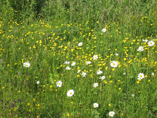 Flowers by the car park.
On the long journey home we stopped at the Dyke Neuk pub near Morpeth for refreshment. I tried the Dyke Neuk beer, very tasty too, made for the pub by a local micro-brewery. Five barrels.
The Matrix MMMVI
steps miles
Asdaped 25596 11.8
LIDL3D 27562 12.4 all is forgiven
Dave's LIDL3D 26373 12.13
LIDLUSB 25458 12.85
OUTDOORS GPS 11.8
Ben's Bragometer 11.7
Bird of the blog.
A quiet day for birds all things considered. Bird of the blog is the Skylark, singing its heart out.
 Skylark
This is a good walk if you want variety: hills, fields, moors, plantation and woodland. But wsatch out for those duergars, they can bite.
Next week the gadgies are off on their holiday to Fort William so wait for report.

For several reasons today's walk is to be fairly local and not too strenuous. There are five of us out; Harry, Ben, Dave, John and me. The forecast is promising, warm and rain free so we are walking from Fontburn Reservoir. This reservoir is west of Morpeth, to get there take the A1 go almost through Morpeth but turn left for Mitford and on to Scots Gap. Turn north at Scots Gap and watch out for signs for Fontburn Reservoir. Watch out for Roughlees Farm which boasts rare breeds of animals and watch for the sign advertising the Goats on the Roof Café. Cross the dam and park up. It is a popular fishing spot, beware of Geordie Anglers.
A map is advisable and the one to use is OS Explorer OL42, Kielder Water and Forest and the car park is at GR046939.
A word of warning: you may find life easier following the two black dotted lines on the attached map rather than religiously following the gadgie blue route with arrows.

The walk;
We left the car park and walked east past the dam and with the water treatment plant on our right, with another fine railway viaduct in the background.

On the left a marker led us down a path, actually on the old line. It would have been sensible to remain on the railway track past the old station buildings and continued to the track going to Blueburn Farm. (see map).
But we didn't, we turned off the railway and
meandered west, north west, north east, west, north east and finally north until we came to the track leading to Blueburn Farm and turned left.
At the farm there is a path that leads almost due north, crosses Spylaw Burn, continues north, crosses Forest Burn and comes to a junction. Turn left and at the next junction take the left fork which brings you to Spylaw.

But of course we didn't
If you are interested in ancient settlements and cup and ring markings take St. Oswald's Way in a north east direction at Spylaw and visit Lordenshaw. A well preserved fort is there for the visitor, and some of the mysterious cup and ring markings.
We didn't, and Dave the archaeologist was a bit annoyed . We took the right fork at Spylaw and headed north west up a track that became a path that brought us to the well paved track that crosses the Simonside Hills. Like the ones on the Cheviot it is made from redundant mill flagstones and although purists are not keen it makes for easy walking in wet weather.

We settled on the crags at the highest point on Simonside and declared a Herbie Spot. Unfortunately I forgot the chocolate but Ben had gingers and Dave had flapjacks so we dined well.
Simonside comes from Sigemund's (ge)set, a seat or settlement. It is thought to have been a sacred mountain and is still the home of the Simonside Dwarfs, Brownmen, Bogles and Duergars.
Their leader is Roarie, they are ugly dwarves wearing lambskin coats, moleskin trousers and shoes and a hat made from moss and heather. The Greeks had their sirens, the Rhine has its Lorelei but Simonside has its Duergars. They entice travellers into the boggier parts of the hills, particularly in the dark, leading them with torches. The word duergar comes, possibly from the Old Norse word for dwarf, (dvergor), or from Anglo-Scottish dialect for dwarf.
Catch them in a good mood and they will take you down to Tomlinsons Café and Bunkhouse in Rothbury for a five flitch bacon sandwich. Catch them on a bad day they could well make a bacon sandwich out of you.


Crags on Simonside. Can you see the duergar?
Lunch and duergar baiting over we descended from the summit of Simonside by way of a well constructed stone stairway and path. At the foot of the hill are several forest tracks but we took a footpath heading south across open moorland with plantation on our right, this particular one having been recently felled. The path leads past Selby's Cove, strange name for an inland feature.

Having crossed more open moorland the path entered a plantation and soon we were on a forest track, heading almost due south, which eventually joins St. Oswald's Trail again. Watch out for the markers as the track eventually becomes footpath leading to the farm at Fallowlees.

Wouldn't be a blog without a stile.


Along the way it passes a large stone which has several cup markings but no rings, could be a apprentice training school.

A poor picture of cup markings

On the long journey home we stopped at the Dyke Neuk pub near Morpeth for refreshment. I tried the Dyke Neuk beer, very tasty too, made for the pub by a local micro-brewery. Five barrels.
The Matrix MMMVI
steps miles
Asdaped 25596 11.8
LIDL3D 27562 12.4 all is forgiven
Dave's LIDL3D 26373 12.13
LIDLUSB 25458 12.85
OUTDOORS GPS 11.8
Ben's Bragometer 11.7
Bird of the blog.
A quiet day for birds all things considered. Bird of the blog is the Skylark, singing its heart out.

This is a good walk if you want variety: hills, fields, moors, plantation and woodland. But wsatch out for those duergars, they can bite.
Next week the gadgies are off on their holiday to Fort William so wait for report.

No comments:
Post a Comment