Translate

Saturday, 15 July 2023

Three go to Beadnell

 Three go to Beadnell July 14th (Northumberland)

Hit by holidays and birthdays again a trio of gadgies is having a coastal walk from High Newton to Beadnell and back. Head north preferably on the Northumberland Coastal Route and follow signs.

The walk is covered by OS Explorer 340 Holy Island and Bamburgh although it is not essential. Worth looking  at for the names of places though.

As you enter the village of High Newton there is a car park on the right. One of the last free car parks in Northumberland, probably in the country.

         This week's carpark in High Newton by the Sea-------free!

                          High Newton by the Sea and a wheelie bin.

Leaving the car park we walked to the village green and followed the finger post's direction down a narrow lane with waist high nettles, crossed a field and came to the road that goes to the village's twin, Low Newton by the Sea.

Before reaching this tiny square of cottages and the Ship Inn ( a favourite with articles on where to eat in the quality papers) we went through a gate on the left and walked the grassy track to Newton Point (mile 1)

                   Looking back across Embleton Bay. Dunstanburgh Castle, my favourite ruin. (Also popular with weekend supplements)
Turning west we walked round the delightfully named Football Hole, descended to the beach for a time before climbing back onto the dunes near Snook Point. Back to the beach (mile 2) we headed on until we almost reached Long Nanny.
At this point there is a roped off section to protect the birds that nest on the beach. We went back to the dunes, (mile 3) and made a slight detour to the bird hide, manned by wardens to protect the Arctic Terns.
                             Beadnell Bay, miles of golden sand


             The warden told us that the terns had arrived, mated, hatched, fed and were departing. As the Byrds said "There is a season, tern tern tern"
Back on the path we crossed Long Nanny on the footbridge and headed back to the beach.
                    Long Nanny footbridge

Just one of the many jellyfish stranded on the sand.
Approaching Beadnell we watched several wind surfers or people paddling boards and flying kites before we settled down on the benches by the Lime Kilns for a Herbie. (mile 5)
                               Beadnell Harbour


The kilns. They were used to convert limestone into fertiliser.
We retraced our steps for a short distance on the beach before walking up a slipway to the car park, turned left and went through the caravan site. This section of the walk is on the Northumberland Coast Path/ England Coast Path/ St Oswald's Way and we followed it, recrossing the Long Nanny footbridge and finally taking the road at Link House farm and returning to High Newton.

Contains OS data, copyright. Crown copyright and database right 2023

The walk is an easy 8 miles, good family trip. (Ice cream in Beadnell)


Saturday, 8 July 2023

BOLAM

 A stroll from St. Andrew's, Bolam

July 7th

Holidays and domestic arrangements have reduced numbers again. Five of us are going for a well worn walk from the  church of St Andrew in the tiny village of Bolam.

Head north on the A1, turn off for Morpeth and turn left at the golf course.  Turn right at Walton and pull into the area infront of the church at Bolam.

The walk is covered by OS Explorer 325 Morpeth and Blyth.


Today's car park infront of St. Andrew's. This gem of a church has Saxon origins and Norman additions. And yes it's the one pierced by a WW2 bomb that failed to go off. (Tiny window between the cars)  The pilot returned 60 years later and apologised.

We walked through the churchyard and found the heavily overgrown path at the back. The grass and nettles were waist high, the cunning brambles were at tripping level. The gate to the fields was blocked but we clambered over a low barbed wire fence and continued in long grass before getting into the sheep mown fields. Heading north we passed Angerton Steads, crossed the dismantled railway which is difficult to detect (mile 1) and headed for Low Angerton.

                                Great sign

We turned west and walked along the farm road, crossing the invisible dismantled railway again, ignored the first finger post and having found the tatty second one turned right into the fields.

Watch out for this finger post and follow it.

The footpath took us across fields to Bickerton where a small flock of turkeys were running around.


                                    Warm turkeys. Plenty of time yet..........................

Turning north we walked through the farmyard at Highlaws, crossed the also invisible Devil's Causeway, a Roman road, and on to a footbridge over the River Wansbeck. (mile 3)

                            River Wansbeck near Highlaws.
Once safely across we headed west across fields, followed by a herd of bullocks in the first field and battling through a field of oats in the second.


  harry battles the oats. The footpath has been left through the field for walkers. Two years ago it was a field of oil seed, higher and tougher.
We eventually made it to the farm at Middleton Mill, walked the farm track to the road, turned left, crossed the Wansbeck, followed the post on the right and headed for the animal shelter for a Herbie (near mile 5)
Lunchtime in the three sided shelter. Skinny whips, malt loaf, sweet and savoury from Mrs A.
Having rested, it was a hot day, we walked on to Middleton South farm and took the footpaths around the edges of fields, ignoring the Standing Stone until we came to a gateless stone wall. It does however have a proper stone stile. Once over we followed the path to a gate, turned right, and for a change went through the Salters Nick, a relic from the ancient tracks, and continued east to Bolam West Houses.

                        Salters Nick.
Turning right on the road at Bolam West Houses we came to Bolam Lake Country Park, followed a footpath round the edge and made a stop at the visitor centre for an ice cream. It was a hot day.
                       Bolam Lake
Having cooled we walked the last mile to the church and cars. Instead of going to the pub we headed for the Blacksmiths Cafe at Belsay. Are we getting older?

Contains OS data, copyright. Crown copyright and database right 2023
The walk is about 10 easy miles.


Monday, 3 July 2023

The Greens go to Druridge Bay

The Greens go to Druridge Bay

Northumberland July 2nd

Several gadgies are away on holiday, others have domestic duties so a walk has been postponed.

To make up for it I'm joining the Greens of Gosforth for a coast and country stroll which starts at Druridge Bay.

Head north on the A189 Which becomes the A1068, go past the sign for Druridge Bay and turn right after about a mile, heading for the coast. Turn right at the coast and there is a car park, enjoy it.

A two map job:

OS Explorer 332 Alnwick and Amble

OS Explorer 335 Morpeth and Blyth

And a map is advisable, some well hidden footpaths on the walk.

              Car park with a glimpse of the sea too.

  Once all eleven of us had assembled and booted up we set off south walking on the beach as the tide was out. The sand was quite firm, soft sand is not too easy on the feet and legs.


 Just another beautiful Northumberland beach. 


                     No hotels, no rows of sun loungers, just sand.
After about a mile we left the beach and went into the Druridge Bay Country Park which has lakes, visitor centre and toilets. And lots of families out for the day, some in canoes too.

                                         Druridge Bay Country Park.
We walked round the edge of Ladyburn Lake. At a narrow point a set of stepping stones provided a short cut but some of us took the path round and over the small burn.

                          Good for you mum.
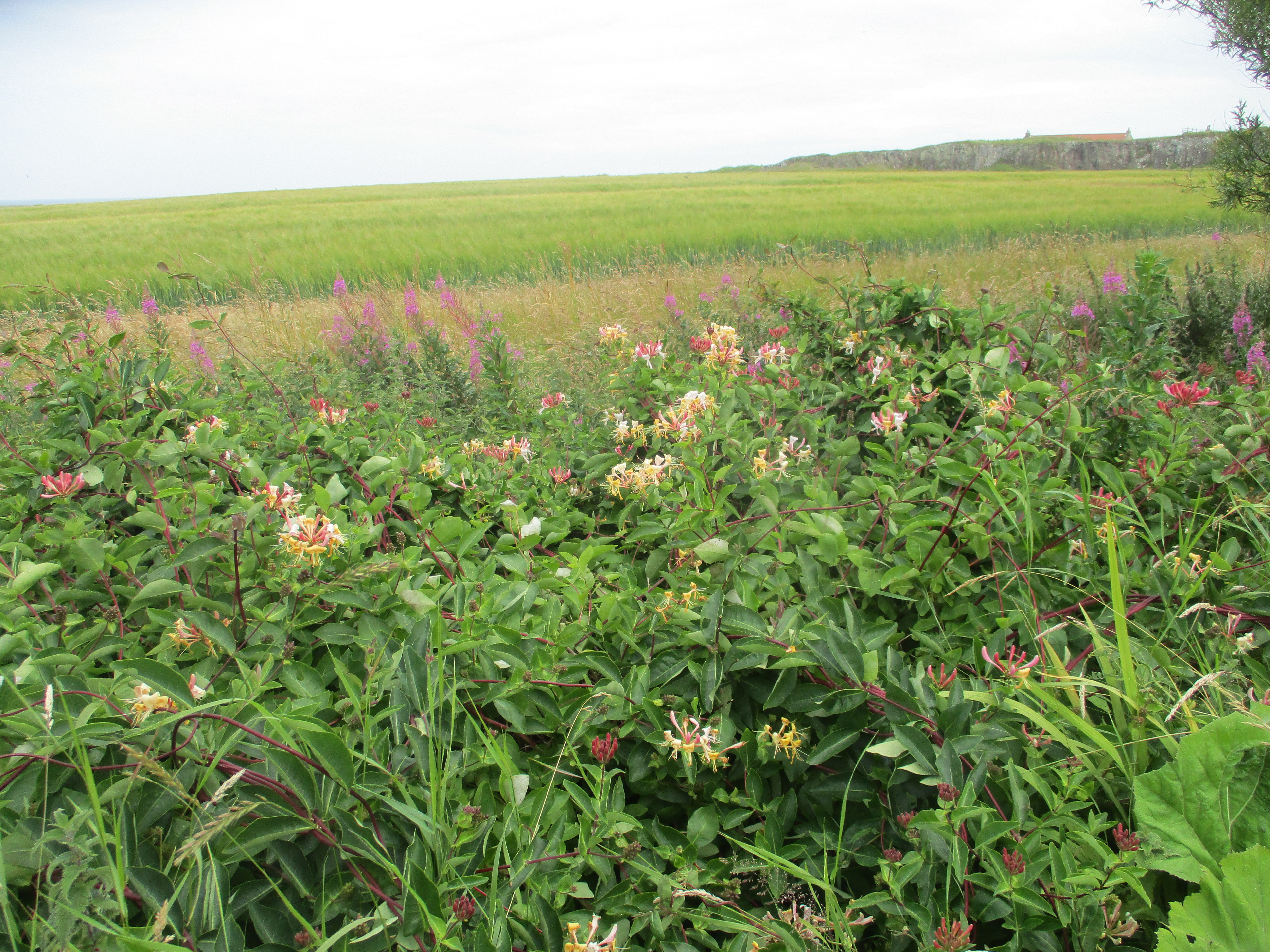
We followed the footpath, turning left (mile 2) and made use of the subway under the A1068. From here we walked the edges of several fields, some with wheat and some with rye. The footpath was covered with long grass which has a nasty habit of undoing bootlaces and tripping walkers up.
At the village of Togston the footpath went past allotments before reaching the main street.

Little green park in little Togston.
The footpath went off the main street, narrow and shaded by trees, brambles reached out for innocent walkers too. Eventually we reached a footpath cross roads (mile 5). The crossroads are on the St. Oswald's Way, he is always cropping up, but we turned right and followed a green lane all the way to Amble. Warkworth Castle was nearby. In Amble we walked down the street to a park near the harbour where we stopped for lunch. 
             A large sundial in Amble. Because we live in the north it's a few minutes out.
Lunch over we headed for the quayside. A busy Sunday market was taking place.
                                              Amble harbour, Northumberland's friendliest port.

We followed the path away from the harbour, walked through another park and joined the Northumberland Coast Path/England Coast Path through the dunes.
                            The Amble Puffin
There is a good view of Coquet Island from the dunes.


Coquet Island. Ancient monastic cell, ruined. The first keeper of the lighthouse was Grace Darling's brother.
At Low Hauxley the dunes path becomes a track. It passes an entrance to Hauxley Nature Reserve, well worth a visit but not today.
                                      Bird house outside Hauxley Nature Reserve.
And about a mile further on we were back at the cars.  Some went to the Widdrington Inn for refreshment, some went to feed cats.

             Contains OS data, copyright. Crown copyright and database right 2023
This enjoyable easy walk is about 10.5 miles. No hills!