Translate

Saturday, 14 June 2014


On the Square at Solomon's Temple....June 13th
  The weatherman said the driest area in the north today would be the North Yorks Moors so we headed for Osmotherley on the edge of the moors just beyond Teeside. Easy to find from Newcastle, through the Tyne Tunnel and head south on the A19 until you spot the road to Osmotherley, the road is called Clack Lane. Osmotherley is a clearing belonging to Asmund if you are a Viking or Osmund if you are a Saxon. A pretty village with pubs, coffee shops, fish and chips and plenty of accommodation for walkers on the Cleveland Way or the Lyke Wake Walk. The village Church, St Peter's, has some Saxon foundations and Norman nave and tower. The whole of the walk is covered by OL26 North Yorks Moors, Western Area. It is a double sided map, most of the walk is on South Side 2 but a short part is on the North Side 1. Much better to photo copy and laminate, if you can stand the snorts from some people.
We parked on the side of the road in the village and made for the Coffee Shop which served a good looking bacon sandwich for those who indulged and the tea was fine, The coffee shop also sells boots, handy if you have forgotten yours (this has happened). Black coffee and a pair of Brashers please, size 10.


Car park and village street. Head up the street towards the village store.

The walk;
  We started by walking north up the village street, sensibly called North End and after a few hundred yards found Ruebury Lane on the left. This is on the Cleveland Way, a long distance footpath easily recognised by the markers which have a white acorn on a black background. Having crossed a couple of fields we diverted from the track to visit  the chapel named "Our Lady of Mount Grace". Founded in 1397 or thereabouts it fell into disrepair after the reformation, although, as with other areas in the north of England, catholicism continued in secret until the 17th century when it came out, so to speak. The chapel was rebuilt in 1961 but retains a few ancient foundations.
                                       Chapel of Our Lady of Mount Grace.
Back on the Cleveland Way we walked along the east side of Arnecliffe Wood , across Scarth Wood Moor before descending and leaving the acorned path. We followed a minor road, there is a rough path on the side. There are a few picnic spots here and a small car park but there is a much larger one close to Cod Beck Reservoir. Before reaching the reservoir there is a set of stepping stones, last week's practise came in  handy.

                      Stepping stones, no longer a problem.
About half way down the reservoir we declared a Herbie Spot near a fine bench dedicated to Albert Etherington. Today's treats were: Mrs A's coconut and lime cake, fruit cake left over from my birthday, Bakewell Tart from Mr Kipling and Ben's ginger biscuits. ( I have set the weight on my pedometer at 200 pounds, but this allows for clothing and a very heavy rucsac.
The lime flavour reminded me that at University my daughter had earned some money giving English conversation lessons to some Japanese students. One day she asked them if they knew what rhyme was and the answer came back "Yes, like lemon but green".
She asked me to send her a copy of Paul Simon;s "Fifty ways to leave your lover" to illustrate rhyme:
"Make a new plan Stan, slip out the back Jack, Let yourself go, Mo" etc.
This allowed the punmeister to explain that the Japanese had ruined the British car industry by finding "Fifty ways to lose your Rover" Good one.

                                            Albert's bench, unusual design.

        Cod Beck Reservoir, nothing to do with fish it comes from OE " Coed", meaning  woody.
                                                                              
Lunch over we continued down the side of the reservoir, glimpsed a small deer in the wood and families of Mallards on the water plus a distant flock of Greylags. Taking a path through the wood we came to a deer fence, turned left and followed it uphill  before emerging into fields. At Rocky Plain we took the footpath  marked around a farm and then walked up the straight farm track to the road and turned right onto a road that passes Solomon's Temple, a neolithic ruin marked by two standing stones, which we missed.
This road is an old drovers road and soon we came to "Chequers", (not that one) now a farm once a pub specifically for the refreshment of cattlemen on their way south.
                                                  The old sign at the Chequers
                                                   The Chequers, once an inn, now a farm
Just beyond Chequers we came across a pair of gateposts very close together and a considerable amount of collapsed stone wall. Was this an overnight holding area for cattle or sheep?
Continuing on the road we soon came to Square Corner and turned right to walk down Oak Dale. The path was paved with old mill yard flags and the valley was well wooded with deciduous trees, presumably that's where the name comes from. We passed a reservoir which had been drained for some work and eventually came to a road. Crossing the road and taking a farm track towards Whitehouse Farm we  stopped to admire the gentle hill before us when  an elderly gent in a Land Rover asked if we needed help. As if gadgies need help! We had a pleasant chat, he said the farmhouse was 17th century and yes, the views were wonderful, on a clear day you could almost see Harrogate.
Near Whithouse Farm.

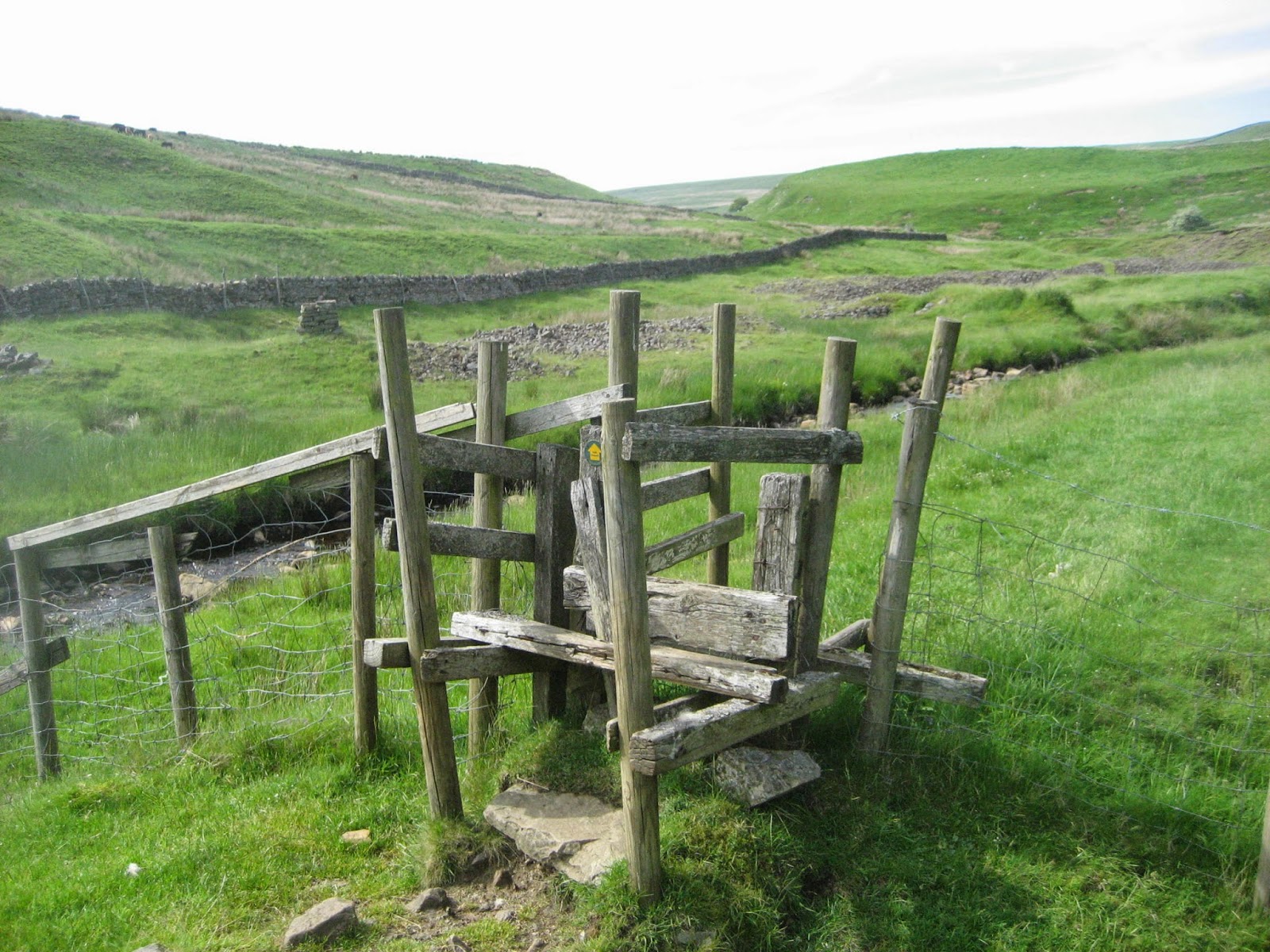
The footpath crossed a stream, climbed steeply and became a very narrow lane with some stone stiles:

                                                    Approaching Osmotherly, with stile.
The path became an alley and we were on the village street, next to the car. Above the alley a sign told us the Osmotherly Methodist Chapel was here. John Wesley preached here in 1761, as he did all over the north.
                                                            Chapel and acorn!
Changed we walked to the Queen Catherine pub in the village square. So called after Catherine of Aragon (Henry VIII's first wife in case you forgot) who used to pop in for a pint on her way to Edinburgh, apparently going to watch Hibs.
The pub offered Lancaster Bomber, Wainwright, Magic Sponge and Black Sheep and crisps.

Matrix MMXIVS
                                                                         steps                         miles
LIDL3D                                                           19404                       9.11
ASDAPED                                                       19487                       9.15
Dave;s LIDL3D                                               18518                        8.7
LIDLUSB                                                         18173                        9.17
My GPS                                                                                              8.7
Brian                                                                                                   8.47
Ben                                                                                                      8.7

Total Gadgie distance 257 miles

Pretty consistent results

We saw red legged partridge, lapwings, sand martins, swallows, warblers, a heron and the bird of the blog:

                                                        Whitethroat


                       Contains OS Data, copyright and data base right 2014

Saturday, 7 June 2014

A Wonderful Walk on the Weardale Way.
June 6th.
   The jovial jock who makes the local weather forecast promised us a fine day for June 6th so five of us (Brian, Ben, Dave, John and me) set out on a walk in Upper Weardale, starting at the village of Westgate. To get there from base take the A69 west to Corbridge (almost), turn south on the A68 and turn right eventually on the B6278 through Edmondbyers to Stanhope. Turn right when you get to Stanhope high street and follow the A689 through Eastgate before arriving in Westgate.
  We did stop long enough in Stanhope to raid the leaflet department of the top class information centre and for a cup of tea in the cafe next door. Brian's bacon sandwich scored well although the bun was English, too soft.

                                              The courtyard behind the information
                                               centre and cafe at Stanhope
                           .......   artwork too
Breakfast and leaflet buying over we headed west through Eastgate to Westgate and parked on the side of the road. The two villages are named as such as they were the east and west boundaries of the Bishop of Durham's hunting park in medieval times. Well you can't be at prayer all the time.
A map is useful for this walk and the recommended one is OL31, North Pennines. Most of the walk is on one side or the other. The roadside  car park is at NY905380 and here is a picture of it and its near neighbours.
                                            Room for a dozen cars, and free
They allow Dave to give us his old quip "You can call me Al" An explanation of this is available for £2 and a SAE.
The walk, at last.
Heading back into Westgate we found the Weardale Way sign post that took us down to the river. Crossing the Wear by the road bridge we found the footpath which follows the south bank of the river  to St. John's Chapel where you have the choice of crossing by footbridge or stepping stones. The last time we were here I chickened out of the stones as the water was high but on this occasion I was applauded across.

 Difficult to imagine that this sun dappled river becomes the industrial stream at Sunderland


                     Stepping stones or bridge? Real men use the stones

From here the path is on the north side of the river and crosses fields until it arrives at Ireshopeburn. Another interesting village, it claims the oldest Methodist that is still in use (since 1760). John Wesley preached here several times and most of the villages seem to have chapels, as indeed does much of the north. Nearby is the Newhouse, 17th century home of the local mine owner. It was the company offices too and behind is an early 19th century reading room built for the men who worked the seams for lead.
                                             Info at Ireshopeburn
                                             The Newhouse 17th Century
                               Recycled Garden gate
                                             Very young foal and most of mum.
A few fields later the path crosses to the south side of the Wear at West Blackdene and passes through Wearhead, another pretty village, watch out for the path markers, some of them double as signs for the Mineral Mine Walk in this area too.Several fields later we reached the village of Cowshill, crossed the river to the north side, walked uphill past the Cowshill Hotel and spotted a couple of benches which had "Herbie Spot" written all over them.
Today's treats were, in order of excellence, Mrs A's home made chocolate cake, tying with Ben's homemade ginger biscuits (there's diplomacy for you), Mr Kipling's carrot cake, chocolate flapjacks and chocolate. (13 st 5 lb or 187 pounds US)
                                            Ben is our expert gate opener. This is
                                                 a proper country gate fastener


                                  Weardale Head village
Lunch over we headed up a minor road the B6295, definitely not the A689 which goes back to Stanhope. After a few hundred yards the signpost pointed us uphill past the farm at Queensbury and out onto rough moorland. Looking back we could see the waste heaps left from old lead mining in the area looking like mini drumlins.
                                           Mr. Froggy going a courting.

                           The remains of old mining operations high in Weardale.
 I think we missed the path as we climbed the hill (see dotted line on map) but eventually at a point where several walls met we turned just south of east and continued on our way over Rase Head. The field walls came close together and we walked on what could have possibly been an old drove road once. At the triangular shaped plantation we hit the road, continued on tarmac past Middlehope Lodge, turned right at the first junction we came to and then turned right again on a path which led us down to Middlehope Burn.
                                            If it weren't for the stone walls it could 
                                    be the cover of  a "Country Greatest Hits " album
                                          Now that's what I call a stile. Awesome.
   Nearly in Westgate again we came across the remains of the Slit Mine, an industrial archaeologist's paradise. Mining for lead ended here in 1878 after several hundred years of work.
The area is worth a visit on its own. For pages of information without raiding Stanhope Information Centre look onwww.explorenorthpennines.org.uk

                              Two of the information boards at the site
                                      Remains of the water wheel pit
Remains of the "Bouseteems" where miners left their haul in their teams "stable" allowing their efforts to be measured and their pay determined.
Ben observed that had it been the site of an ancient castle a greater effort would have been made to preserve it. True.
Brian observed that we would not have enthused about the site had we come across a dirty working area poisoning such a beautiful area. True
Continuing down the wooded Middlehope Burn we returned to Westgate on a beautiful path alongside the stream. Curious to name it Dave picked a flower just before...................

                                         The ASBO or a jail term awaits.


                               The Middlehope Burn, below the old mine workings.
Back at the car we changed and headed home, stopping in the village of Edmondbyers at the Punch Bowl for liquid refreshment. A five barrel pub it had on offer Lord Collingwood Ale, Allendale North Pennine and another one.All good beers, reportedly.
It was agood day for birds, Dippers, Lapwings, Golden Plover, Chaffinches, Curlews, and many more, but the bird of the blog goes to the tiny wren which appeared in a small flock near the river.
                                         The collective term for wrens is a farthing
Good for flowers too, Heartsease, purple orchid, vetches and many more.
The Matrix MMXIVS
                                                              steps                        miles
LIDL3D                                                  25650                       12.06
ASDAPED                                               24307                       11.42
Dave's 3D                                                 24605                       11.56
Dave's USB                                               24496                       12.12
OUTDOORGPS                                                                         11.22
My GPS                                                                                     11.4
Brian's                                                                                        11.2
Ben's Bragometer                                                                         11.4
Total Gadgie distance249 miles
This walk, we all agreed was one of the best of the year, partly because of the weather but also because there were so many things to see, scenery, birds, flowers, archaeological sites. It did not go unnoticed that it was the 70th anniversary of D Day, annd I for one know who to thank for the comfortable life I've led for the last seventy years.

Wednesday, 4 June 2014

A variation on a theme.... Carey Burn  June 3rd.

  There are four of us out today, Dave, John, Harry and me on a Tuesday, for a gadgie extra and the plan is to do the ever popular Carey Burn walk to Broadstruther and back via Cold Law, a short day out as I am off to the pub.
The walk starts at the Carey Burn Bridge in the Harthope Valley. To get there from Newcastle head north on the A1, turn onto the A697 north of Morpeth and drive to Wooler. Go into the town, take the first left (Cheviot Street) after a mile take the right fork and continue to the minor road signposted Langleeford. Drive past Skirl Naked, down the hill and park on the wide grass verge just before the bridge. But be warned, there are cattle loose on the road.
The walk is covered by OL16 and the parking area is at NT976249, approximately.
The path up the Carey Burn is not marked on the map but there is now a signpost on the north side of the stream pointing you in the right direction.
                                               A regular feature, the car park (free)
The path up the Carey Burn is easy to follow, across fields, alongside the stream, close by a waterfall and alongside a wood. Stop to admire the waterfall, watch out on a sunny day for adders and also watch out for herons, dippers, buzzards and possibly a peregrine.
                                                    Don't go near the waterfall.
                                          There is a wooden hut, used by men with guns in season
                                          and swallows. There were young in the nest today.
Eventually the path reaches a footbridge. The stream going to the right is the Common Burn and eventually leads to Commonburn House.
                               Looking down Carey Burn from the footbridge which is marked as 
                            ford on my edition of the OS map.                                                                                                                   The path we followed  moves away from the Broadstruther Burn and takes you to  you to Broadstruther, once a farm, now a lodge awaiting August 12th. It always makes a Herbie Spot.


Broadstruther Lodge. Although locked up there are plenty of 
stones to sit on for a Herbie Spot.
Not having Ben or Brian with us today, and me feeling a bit mean, lunchtime treats were restricted to a Mr Kipling slice and a club orange biscuit. Nothing wrong with the occasional lapse.
 If you want a short walk back to the Carey Burn Bridge the farm track heading east is the quickest route but, being gadgies we headed roughly south for a short distance on a track before spotting the marker for a footpath leading across boggy ground before joining another track that brought us to a gate. At this point we turned left and headed north east beside the fence line that goes almost to the top of Cold Law. Easy to start with there is a bit of a sting at the very end but soon we found the summit trig point.


                              By the gate before turning to walk up Cold Law there is
                              this boundary marker, pretty ancient by the look.
    From the top of Cold Law which is 1483 feet high (452m to Europeans) there are spectacular views of the Cheviot Hills
                                             Hedgehope
                                                     Cheviots

  There are several routes off the top of Cold Law. We opted for the route just east of south past the cairn. It should have brought us down Cockshaw Syke to the valley bottom but as usual we wandered off the footpath and finished up heading for Hawsen Burn and the road back along the
Harhope . On the way down we passed a number of shooting butts, quite sophisticated ones too.
The walk along the valley bottom is about two miles on metalled road, but it is a very pleasant walk, well wooded, well birded and very easy going.


                                     Protection from marauding grouse is on offer in
                                                this trench
                                       A stell, or sheepfold at the foot of Hawsen Burn


                                         The Harthope Burn at Carey Bridge.

For a change we headed straight home at the end of the walk, no bacon today, no beer. Are we getting old?

Birds Sand martins, dipper, heron, chaffinches, grouse, pheasant, wheatear, sand piper, oyster catcher, swallows, but the bird of the blog, spotted by Dave is the Ring Ouzel.

MATRIX MMXIVS

                                                           steps                                 miles
   LIDL3D
                                                          23015                                 10.35
Dave's 3D                                           18147                                 9.25
Dave's USB                                        17822                                  9.0

GPS                                                                                               8.2

Total Gadgie distance 238

    Contains OS Data copyright. Crown Copyright database right 2014