Walking off piste, twice...........May31st.
On the evening of May 30th several gadgies had a curryolic evening. This entails meeting in the Alum House pub near the ferry landing in South Shields, downing a couple of pints at least and then walking to the Asha Restaurant on Ocean Road for a curry and more beer. Because of this we had planned a relatively gentle walk for Friday the 31st but the morning dawned brighter and warmer than most in this miserable English springtime that we had a sudden change of plan and headed for the Lake District to walk up Scafell Pike by way of the Corridor Route. As a reminder, Scafell Pike is the highest bump in England at a mere 3210 feet or 978 m to foreigners apart from Americans.
Because we made a late start we did not stop for breakfast but drove straight to Seathwaite, the usual starting point . From Newcastle take the A69, the M1, the A66 west at Penrith and follow the signs for Borrowdale at Keswick. Turn left just before Seatoller and drive past the yurts to the farm at Seathwaite. There is parking on the roadside, (free) and a toilet in the farmyard.

The car park at Seathwaite. The earlier you arrive the nearer the farm and shorter the walk.
Most of the walk is covered by Outdoor Leisure 6 The English Lakes South Western Area but the start is on OL4 The English Lakes North Western Area. This is an Ordnance Survey ploy to make you buy more maps. The farm is at NY238126, or very close to it.
There are five gadgies on the team today, pm., vm., rm., mm., and bm.. and as we changed into our boots and lengthened our walking poles we saw a Greater Spotted Woodpecker, it was not hammering a tree, just sitting.
From the car we walked through the farmyard and along the path that leads to Stockley Bridge. Having crossed the bridge we carried straight on up the hillside which is quite steep and then alongside Styhead Gill.

Not exactly an aluminium ladder across a crevasse but a wooden bridge crossing Styhead Gill. The intrepid explorer is Harry the routemeister and photographer par excellence.
The path led us just beyond Styhead Tarn and at the stretcher box we called a Herbie Spot, after all there had been no bacon butties or toast and honey. However Harry chose to plod on alone to the summit which allowed Brian to eat two pieces of Mrs. A;s delicious chocolate covered biscuits along with sandwiches and ALDI chocolate. ( I had meant to bring pies as an act of rebellion but my wife maintained they had been in the fridge since last Sunday and may well be off. Try harder next week.)

It is exactly what it says on the box, I looked inside once.
Herbie has slept in it.
 Styhead Tarn
Lunch over we set off to join the Corridor Route, the usual way to climb Scafell Pike from here.
A young couple from Chorley asked us for directions to the top, in return I asked why the Mormons had chosen Chorley for their tabernacle. They had no idea so if you read this and know the reason, let me know please.
It was at this point that Dave and I were first off piste. Brian and John had taken the correct and higher Corridor Route but for some reason Dave followed a lower path and not paying much attention to the other two, I followed.
The path we followed crossed an unnamed gill and kept to the north of Criscliffe Knotts and turned south east at Middleboot Knots to go up the side of a branch of Piers Gill before it rejoined the Corridor Route. There is no advantage to the route Dave and I took, there is a steep climb back up to the Corridor although you do miss out on the scramble down rocks.
Back on the main path we met several parties coming down, one told us that the clouds had come in over the tops, killing off the view. We past a path leading off to the left and after another few hundred yards decided we had made a mistake and turned back, taking the path we had noticed earlier. We were wrong, the path we took led to the gap between Scafell Pike and Broad Crag but we stuck to it and at one point decided to scramble up the scree slope on the right that would lead us to the summit.
 The last snow in England II
It was steep and slippy, almost as someone said a game of Snakes and Ladders but after much effort we arrived at a spot some fifty yards from the summit trig point which was occasionally visible through a break in the clouds. I declared this route an Arthur Robinson trail.* Sitting with their backs to the shelter and enjoying the scene which was limited to about fifty yards, were the other three and several other groups of people, among them half a dozen students, two of whom were American or Canadian, I can't tell the difference until I see their money.
Canadian dollars are proper, they have the Queen on.
Following a tradition going back to the first time I had a mobile phone and was on this peak I called my mother to tell her where I was. She lives in Morecambe and on a good day you can see the bay and the power stations at Heysham as well as the Isle of Man.


Having enjoyed a rest after the struggle up the scree we all set off in a north east direction to the gap between Scafell Pike and Broad Crag. Occasionally the cloud broke offering views of the surrounding hills but the brightness of the morning was gone.
 Crinkle Crags
 Bowfell
The path took us almost to Great End before turning off to the right and heading for Esk Hause. Here we turned north east before turning north west some few hundred yards further on and headed for the stepping stones beneath Great End that took us into Ruddy Gill. At the top of the gill a small group of young men were resting on the grass. As we passed I heard one say,
"Those men were on the top with us, we left before them and they have passed us."
Another cried "You guys are amazing!" That's Tough Geordie gadgies for you!
 Ruddy, misty Gill
 Misty Ruddy Gill

Magnificent but misty, overlooking Seathwaite.
The footpath is quite steep but has been well built as a "stairway" because of the erosive effect of a million feet. Eventually the path crosses the stream at a footbridge and continues down to Stockley Bridge. At the bridge, following another tradition we stopped for a final drink and rest before walking back to Seathwaite.

A slightly tilted Stockley Bridge.
Because the Horse and Farrier at Threlkeld is always busy serving food in its popular restaurant there is little room for drinkers so we went to the Sally across the road which offered Theakstons Black Bull, Cumberland and Wainwright Ales, and seats. A good pub, although there has been no discussion I will award it five barrels.
Bird of the blog:
All we saw, apart from lbjs were ravens and the greater spotted woodpecker, so here he/she is.
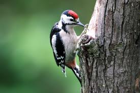
Greater Spotted Woodpecker.
Matrix MMMI
Because I had had trouble with the LIDL3D Dave wore it as a trial Here are the results.
steps miles
My LIDL 3D 27992 12.8
Dave's LIDL3D 27807 12.7 It's the way he wears them
Higear 20610 9.74
OUTDOOR GPS 9.4
Brian's GPS 10.4
Measured 9
The high mileage for the two LIDL3Ds is probably due to the high number of steps climbing the scree slopes.

* We once took a colleague of the North Tyneside Gadgie contingent along Striding Edge. Towards the end of the ridge a member of the Bullingdon Club asked if he was alright.
He replied that he was but that he would not be walking with these jolly fellows again. Or words to that effect. Since then a route not to be followed is an Arthur Robinson after him.
See Glossary for more details.
On the evening of May 30th several gadgies had a curryolic evening. This entails meeting in the Alum House pub near the ferry landing in South Shields, downing a couple of pints at least and then walking to the Asha Restaurant on Ocean Road for a curry and more beer. Because of this we had planned a relatively gentle walk for Friday the 31st but the morning dawned brighter and warmer than most in this miserable English springtime that we had a sudden change of plan and headed for the Lake District to walk up Scafell Pike by way of the Corridor Route. As a reminder, Scafell Pike is the highest bump in England at a mere 3210 feet or 978 m to foreigners apart from Americans.
Because we made a late start we did not stop for breakfast but drove straight to Seathwaite, the usual starting point . From Newcastle take the A69, the M1, the A66 west at Penrith and follow the signs for Borrowdale at Keswick. Turn left just before Seatoller and drive past the yurts to the farm at Seathwaite. There is parking on the roadside, (free) and a toilet in the farmyard.

Most of the walk is covered by Outdoor Leisure 6 The English Lakes South Western Area but the start is on OL4 The English Lakes North Western Area. This is an Ordnance Survey ploy to make you buy more maps. The farm is at NY238126, or very close to it.
There are five gadgies on the team today, pm., vm., rm., mm., and bm.. and as we changed into our boots and lengthened our walking poles we saw a Greater Spotted Woodpecker, it was not hammering a tree, just sitting.
From the car we walked through the farmyard and along the path that leads to Stockley Bridge. Having crossed the bridge we carried straight on up the hillside which is quite steep and then alongside Styhead Gill.

The path led us just beyond Styhead Tarn and at the stretcher box we called a Herbie Spot, after all there had been no bacon butties or toast and honey. However Harry chose to plod on alone to the summit which allowed Brian to eat two pieces of Mrs. A;s delicious chocolate covered biscuits along with sandwiches and ALDI chocolate. ( I had meant to bring pies as an act of rebellion but my wife maintained they had been in the fridge since last Sunday and may well be off. Try harder next week.)

Herbie has slept in it.

Lunch over we set off to join the Corridor Route, the usual way to climb Scafell Pike from here.
A young couple from Chorley asked us for directions to the top, in return I asked why the Mormons had chosen Chorley for their tabernacle. They had no idea so if you read this and know the reason, let me know please.
It was at this point that Dave and I were first off piste. Brian and John had taken the correct and higher Corridor Route but for some reason Dave followed a lower path and not paying much attention to the other two, I followed.
The path we followed crossed an unnamed gill and kept to the north of Criscliffe Knotts and turned south east at Middleboot Knots to go up the side of a branch of Piers Gill before it rejoined the Corridor Route. There is no advantage to the route Dave and I took, there is a steep climb back up to the Corridor although you do miss out on the scramble down rocks.
Back on the main path we met several parties coming down, one told us that the clouds had come in over the tops, killing off the view. We past a path leading off to the left and after another few hundred yards decided we had made a mistake and turned back, taking the path we had noticed earlier. We were wrong, the path we took led to the gap between Scafell Pike and Broad Crag but we stuck to it and at one point decided to scramble up the scree slope on the right that would lead us to the summit.

It was steep and slippy, almost as someone said a game of Snakes and Ladders but after much effort we arrived at a spot some fifty yards from the summit trig point which was occasionally visible through a break in the clouds. I declared this route an Arthur Robinson trail.* Sitting with their backs to the shelter and enjoying the scene which was limited to about fifty yards, were the other three and several other groups of people, among them half a dozen students, two of whom were American or Canadian, I can't tell the difference until I see their money.
Canadian dollars are proper, they have the Queen on.
Following a tradition going back to the first time I had a mobile phone and was on this peak I called my mother to tell her where I was. She lives in Morecambe and on a good day you can see the bay and the power stations at Heysham as well as the Isle of Man.
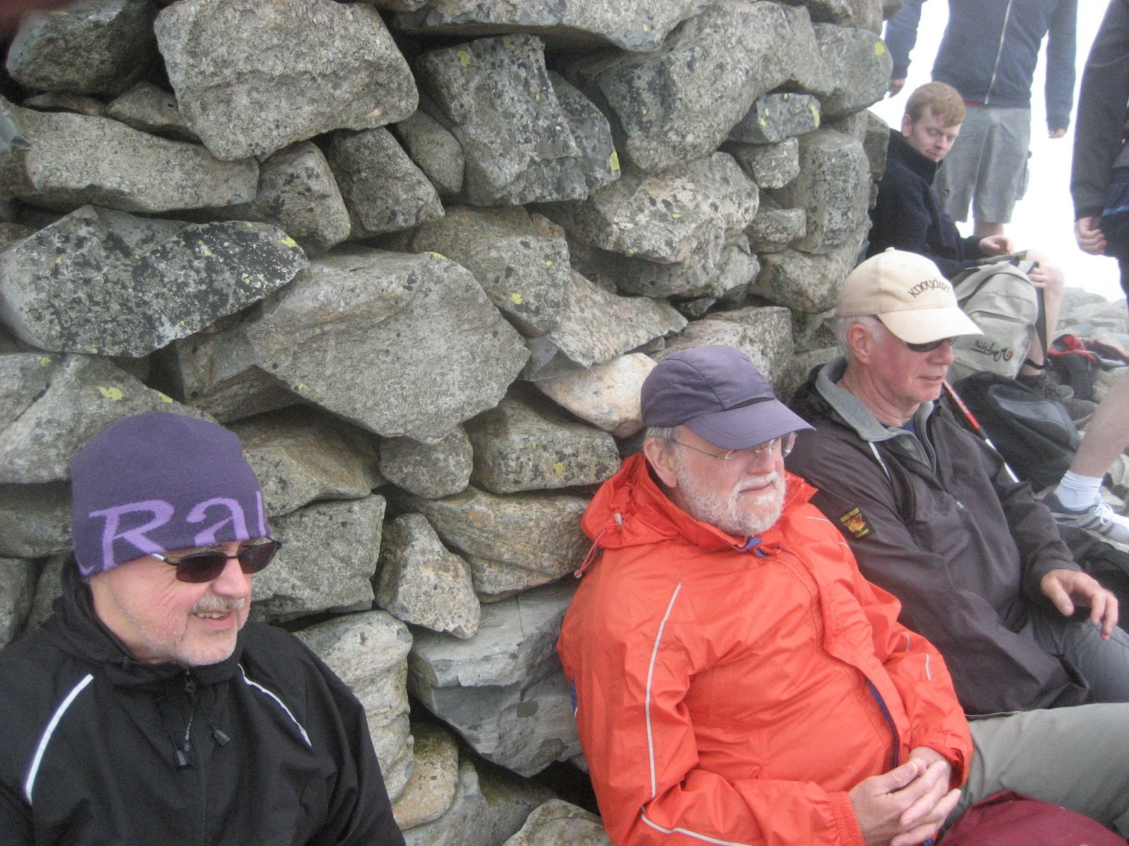
Like a Boy Scout, a Gadgie is always cheerful.

Scafell Pike summit shelter and other walkers.


The path took us almost to Great End before turning off to the right and heading for Esk Hause. Here we turned north east before turning north west some few hundred yards further on and headed for the stepping stones beneath Great End that took us into Ruddy Gill. At the top of the gill a small group of young men were resting on the grass. As we passed I heard one say,
"Those men were on the top with us, we left before them and they have passed us."
Another cried "You guys are amazing!" That's Tough Geordie gadgies for you!


The footpath is quite steep but has been well built as a "stairway" because of the erosive effect of a million feet. Eventually the path crosses the stream at a footbridge and continues down to Stockley Bridge. At the bridge, following another tradition we stopped for a final drink and rest before walking back to Seathwaite.
Bird of the blog:
All we saw, apart from lbjs were ravens and the greater spotted woodpecker, so here he/she is.
Matrix MMMI
Because I had had trouble with the LIDL3D Dave wore it as a trial Here are the results.
steps miles
My LIDL 3D 27992 12.8
Dave's LIDL3D 27807 12.7 It's the way he wears them
Higear 20610 9.74
OUTDOOR GPS 9.4
Brian's GPS 10.4
Measured 9
The high mileage for the two LIDL3Ds is probably due to the high number of steps climbing the scree slopes.

* We once took a colleague of the North Tyneside Gadgie contingent along Striding Edge. Towards the end of the ridge a member of the Bullingdon Club asked if he was alright.
He replied that he was but that he would not be walking with these jolly fellows again. Or words to that effect. Since then a route not to be followed is an Arthur Robinson after him.
See Glossary for more details.


