Translate

Saturday, 14 January 2017

AGM time again............January 13/14th.
It's been a hard years walking so it's time to hold the Annual General Meeting and as usual it is in the Anglers Arms at Weldon Bridge, good beer, fine food, roaring fire. Before the meeting we need a walk and for this year we have chosen a walk based on Lesbury, a village between Alnmouth and Alnwick on the River Aln. (Lesbury: O.E laece-burg meaning Physicians manor, the physician being a leech!!!)
There are eight of us out, John x3, Brian, Ray, Harry, Dave and me, although only four are attending the board meeting. John x3, Ray, Brian, Harry, Dave and me.
To get to Lesbury take the A1 north and turn off towards the coast at Alnwick. But we took the coastal route to breakfast in Warkworth,(Werces settlement) pretty village with another Percy Castle. Bertrams serves strong coffee and does a classic bacon sandwich.
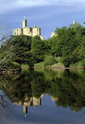

                                      Warkworth and its castle. Bertrams café is in the top left corner
Bertram's café centre


The walk is covered by OS Explorer332 Alnwick and Amble.
We parked near the church in Lesbury, St.Mary's, 14th century origins but mostly Victorian.

                St. Mary's Lesbury and a hint of car park.
A footpath near the church leads down to the path alongside the River Aln and crosses Alnmouth Golf Course to the beach near Foxton Hall.
                                    River Aln

                           Alnmouth Golf Course, like Philadelphia it was closed.
We walked north along the beach as the tide was out but climbed off the sand at Seaton House and followed the footpath (St. Oswald's Way and Northumberland Coastal Path) past Boulmer until we reached Iron Scars where we called a Herbie Spot, tucked in on the beach, backs against rocks.
               Iron Scars are of great interest to Geographers and Geologists. The various layers are clearly visible but in the middle of the picture, just covered by the tide today, is a fresh water spring


               The sea was quite rough, northerly wind and high tide. One wave came high up the beach and wet my boots in spite of me pretending I was King Canute
                    It was a cold day, we are all well wrapped up. Today's goodies included Ginger biscuits from Ringtons as Ben was not here, flapjacks, chocolate brownies, Snicker bars and cheese scones from Mrs. A
Lunch over we turned away from the sea and walked through the woods leading to Howick Hall. During the summer months entrance to the woodlands is from the car park near the hall and there is a fee. In winter the revolving gates are left unlocked. There are many paths in the woods, follow the main one north east, past the pond and with luck you will come out on the road neasr the hall, as we did.
                                   The turnstiles; one at each end.

                                      Swan Lake
If you made it to the exit there is a bridge on the right. Cross the road and take the footpath past Howick Hall.
              Howick Hall built for the grey family in 1782. Earl Grey liked tea and was responsible for the great reform act, allowing seventeen more people to vote in General Elections, but not women.
Follow the concrete path south west to Howick Grange. The track gets a little difficult here, there not being too many markers. We followed the road for a short distance before turning south across fields to Longhoughton, turned east then north a short distance along the road before taking the footpath across a field to a short tunnel under the railway.and headed for the reservoir at Longhoughton Quarry, which we carefully avoided as the sign claimed the water was deep. Once round it we walked the road towards Longhoughton before heading west of south on a farm track to Ratcheugh Farm which seemed to specialise in potatoes. Close by is a Point To Point Race Course

                                       One of the jumps
                   Marked on the map as Observatory
.                       Several fields later, and a conversation with a very friendly horse, we crossed the railway again and walked along the road back to Lesbury.
              John and Dave have a new friend!
Changed we headed to the beloved Anglers Arms for the AGM.
But first, walk data;

Matrix MMXVII B
                                                                                steps                            miles
NAK                                                                      27744                            11.38
Dave's 3D                                                              25124                            11.56
  ""       USB                                                          24514                             11.60
   ""      NAK                                                         24128                             11.42
IPhone                                                                   26507                             11.5
OUTDOOR GPS                                                                                          11.44
 Brian's GPS                                                                                                 11.55
  " Viewranger                                                                                              11.6
John C                                                                                                           12.2
Pretty conclusive.


          Contains OS data, copyright. Crown copyright and database right 2017
========================================================================
THE AGM

                                    The Anglers Arms, Weldon Bridge.
The bar had three real ales on offer, Adnams, Youngs Gold and Black Sheep. The Adnams was particularly tasty but after a couple, or coffee for drivers, the committee members were left in the pub for the meeting and the other chaps left for home.

The Agenda for January 13th 2017

                                   1. Apologies, there were none.
                                   2 Drink some more.
                                   3. After showering and changing, eating.
                                   4 A little more drinking and deep philosophical discussion
                                   5 Meeting closed about 11pm, committee went to their beds.
Having been defeated by the sheer size of the large cod and chips last year I opted for the small portion, which was still very filling, washed down with red Cabernet Sauvignon. Knowledgeable people say you should have white wine with fish. I think it's the only meal you can drink tea with.
January 14th  A walk covered by OS Explorer 332 Alnwick and Amble
In spite of the amounts of drink we all managed a full English breakfast and headed for Rothbury, parking in the large free car park down Bridge Street.
                    An almost deserted car park in Rothbury.
Crossing the footbridge and turning right we started the walk along the footpath alongside the River Coquet until we reached the back entrance to Cragside Estate. It says no entry but that's for cars, pedestrians are permitted to walk through the grounds. Entrance to the house, run by the National Trust, is well worth the fee. The house was built for Lord Armstrong, Tyneside industrialist. The first house in England, if not the world, to be lit by hydro electricity, the whole system designed by his Lordship.

This machine, the Netherton Turbine, was designed for farm work

                            Cragside House.
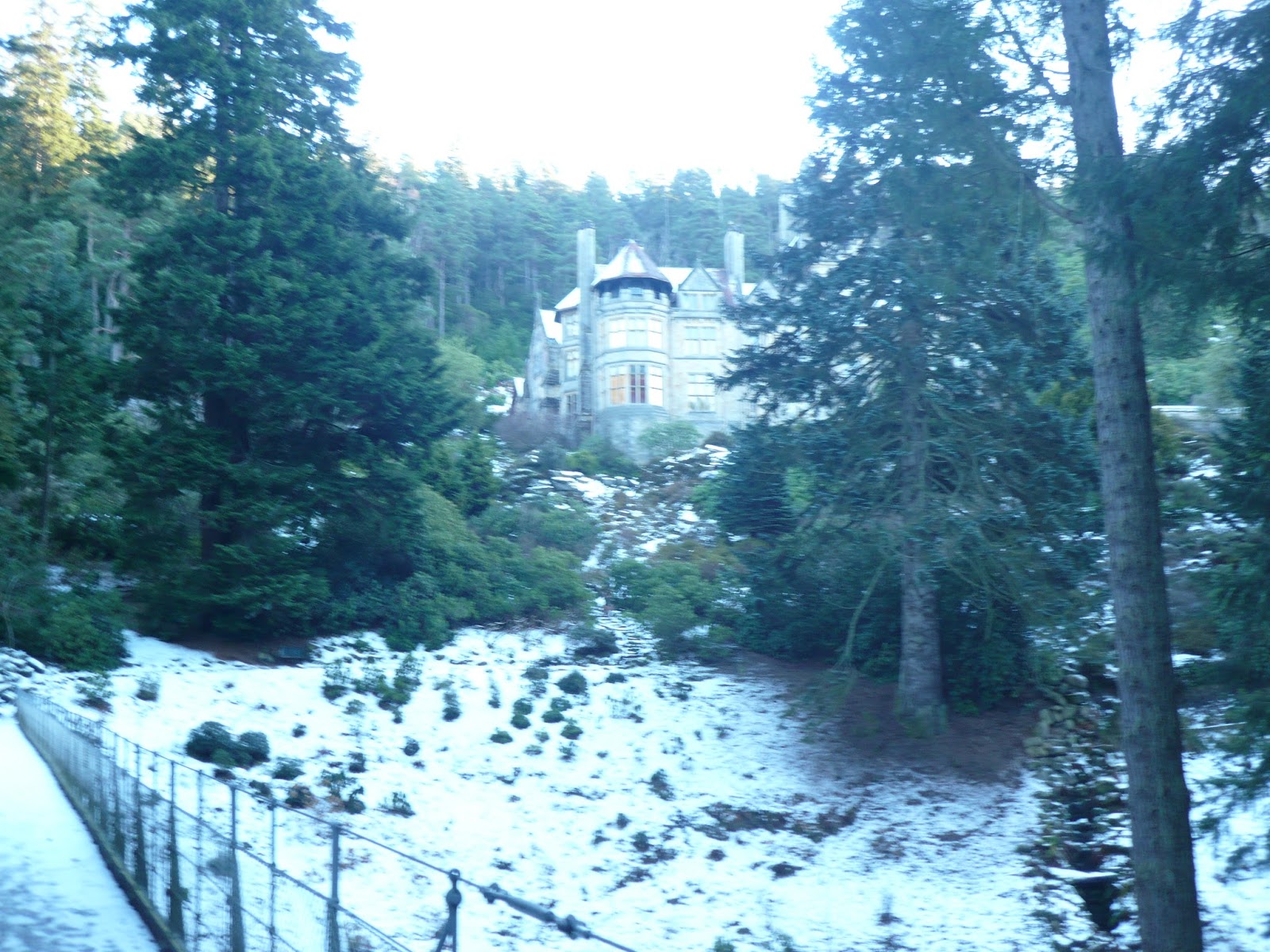
We walked through the park but reaching the road near the entrance,crossing it and heading for the Terraces, the carriage drives for the house. We passed Primrose cottage  and headed north before turning west, stopping to admire the view. The Cheviots were covered with snow, there was not a cloud in the sky, a beautiful day.

Cheviots and Primrose Cottage. There isn't much snow but it's the first this year.
Heading south we followed the path downhill towards Thropton. The footpath eventually becomes the wonderfully named Physic Lane. At the bottom we turned right, past the Cross Keys Pub.


                                The track that becomes Physic Lane
                                              Unusual sheep
                              Thropton
We crossed the stream by the footbridge alongside the road bridge and crossed the road immediately then followed the footpath alongside the stream to the river Coquet. We crossed the river by the footbridge and followed the footpath south of the Coquet. Eventually the path reached another footbridge and we then walked a well made path back into Rothbury.

                                              River Coquet
                                                  Simonside hills
 Changed we headed for Tomlinson's café and bunkhouse for tea and scones before heading home after another successful AGM. A whole year to wait for the next.
            Contains OS data copyright. Crown copyright and data base right.2017

The Matrix MMXVII    C  Much reduced, no Dave.
                                                                              steps                                 miles


NAK                                                                     21285                              8.73
iPhone                                                                   21837                              9.4
OUTDOOR GPS                                                                                          9.03
Brian                                                                                                             9.17


Saturday, 7 January 2017

And the first blog for 2017......Happy New Year.
Walking the coast from North Shields to Blyth
 In 1955 I was at school in Morecambe, Lancashire. The local football team, then a non league club, played Blyth Spartans in the first round proper of the FA Cup. Non of us knew where Blyth was but the name was intriguing. Blyth won after a replay and were forgotten by us. In 1975 I finished up working in Blyth and stayed for the next 27 years during which time the Spartans had several good cup runs. What has this to do with a gadgie walk?                                                                           Nothing really except we are starting off the year in true gadgie style  using bus passes and walking from North Shields to Blyth along the coast and finishing in the Wallaw, a cinema converted into a Wetherspoons pub.
No need for a map but the walk is coverd on sheet 78 of the good old One inch to the Mile series, now renamed 1:50000, Newcastle upon Tyne. Two maps needed using the 1:25000 series;                OS Explorer 316 Newcastle upon Tyne
         OS Explorer 325 Morpeth and Blyth
We met at North Shields Metro station and had tea or whatever at a nearby café. Mugs of tea, great place. There are 7.5 of us, John x 3, Harry, Dave, Brian and me. The 0.5 joined us later.
Leaving the café we walked down the main shopping street towards the river, turned left, turned right and found ourselves outside the Magnesia Bank, a fine pub.
                No car park this week, a metro station instead
                 Good pub, my retirement party was held here.
 Originally the offices of the Stag shipping line, then a pub, called the Stag, now offices again, I think
                      A reminder of the past glories of Tyneside.
The road here is high above the river, great views in all directions, west towards the old shipyards, east towards the mouth of the Tyne and south across the river.
                          Looking west, the boat on the left is the Shields Ferry
              A floating box. Probably a car transport taking Nissan motors to Europe and bringing back VWs
The statue of  Stan Laurel who lived in North Shields when not  living in Bishop Auckland or Ulverston
At the end of the road is another pub of blessed memory, the Wooden Doll, and next to it are some steep stairs which lead down to the quayside.
  The tall tower is the "low light", old navigation building. On the right is the fish quay
                  The stairs down to the quay are on the right of the picture

The building in the background of this awful picture is on Clifford's Fort. built initially in 1672 to protect against the Dutch, improved in the early 19th century to guard against the French.
From the fort there is a promenade alongside the river to Tynemouth, always a pleasant stroll. Towards the end look up at the statue of Lord Admiral Collingwood, number two at Trafalagar and number one when Nelson was shot.
                                  Admiral Lord Collingwood. He lived at Hethpool for a while and his widow planted oak trees.
The road leads up and past Tynemouth Priory and Castle to the promenade.
                     Tynemouth Priory, possibly dating back to Bede's time, dissolved in 1539

 Tynemouth Castle and Gatehouse. There is evidence of Iron Age settlements. Roman occupation and Edward III was very impressed with the castle and priory.
From the promenade we dropped down to walk along the Long Sands, always popular with dog walkers, walkers and surfers too.
                           Tynemouth Long Sands.
At the end of the beach we climbed back to the road at Cullercoats which has a pretty harbour and a Marine Biology Study Centre.

                                        Cullercoats  (Culfre-cots meaning dove cots)
From Cullercoats we continued north along the promenade to Whitley Bay, went down on the beach for a while before climbing back to the promenade to take shelter from the rain and to indulge in the first Herbie Spot of the year. Offerings included tarts with pickle and cheese from Mrs A., mince pies, almond slices, biscuits and chocolate bars. Some do not join in, claiming to be on a diet.
We moved on in the rain towards St. Mary's lighthouse which is on Bait Island. Here we were met by John L. who joined us for part of the walk.
              The Spanish City at Whitley Bay, it is being refurbished. Whitley Bay was once a  popular holiday resort but, like Morecambe, suffered with the invention of package holidays.


                           St. Mary's Lighthouse and café. Inaccessible at high tide.
Leaving the lighthouse we walked round Collywell Bay on the path above the cliffs and along the road to Seaton Sluice.
             Collywell Bay, still known as Collywobble Bay in our house.
Seaton Sluice harbour was built to export coal and glassware by the Delavals of the nearby hall. The sluice was built as a device to scour out the harbour, the cut was blasted out to form a wet dock to facilitate loading.
                Seaton Sluice harbour. The sluice was to the left of the picture

                      The cut, obviously no longer used. Kings Arms pub on the left
John L. left us at the sluice and we continued our way along the footpath/cycleway through the dunes to Blyth. The track is known as the Eva Black trail
               Memorial to three Blyth cyclists who were tragically killed on the road near this spot.
Soon we were in Blyth. Once famous as the chief exporter of coal in England it lost its pits and shipbuilding facilities some years ago. After a period of decline things are looking up for the town, offshore support and wind turbines give life back to the area. Last year the tall ships were here for a long weekend.
      In wartime Blyth was a submarine port. There remains the battery, mostly hidden behind this bank. It opens to the public at times and there is a lot to see.

We headed for The Wallaw, formerly a cinema and now a Wetherspoons pub. The usual selection of real ales was available, between us we sank several pints of Abbott or Plover.
                            End of the trail
A good walk to start the new year, easy going, mostly flat, the actual distance is disputed. Last year it was 12 miles but this year only Dave seems to have walked so far.

The Matrix MMXVII    A

                                                                  steps                              miles
NAK                                                     25322                                10.39
Dave's 3D                                            24951                                 12.22
  ""    USB                                            24265                                 12.25
  ""   NAK                                            24254                                  12.24
iPhone                                                  26424                                    9.3
measured with the little wheel using 1:50000 map                         11
  John Ha.'s measuring                                                                     11.3
 I shall claim 11.5
             Contain OS data Copyright. Crown copyright and database right 2017


                            Delaval Hall,, designed by Van Brugh