The Gadgie AGM..... February 7th
Following the success of last year's AGM we have decided to hold a second, again at the Anglers Arms, Weldon Bridge.
There will, of course, be a walk before the meeting and because of the damp weather that has persisted in the North East of England this week we have chosen to walk to Old Rooklands from Alwinton, a walk we have not done since January 7th, 2012.
There is a full gadgie turn out, Ben, Brian, Dave, Harry, John, Ray and me. To get to the start of the walk from base camp take the A1 north, turn onto the A697 at Morpeth and follow the road signs for Rothbury. There is still a diversion in operation as the road which suffered a land slip last year has still not been repaired. Go through Rothbury and Thropton before turning right at the sign for Alwinton. There is a Northumberland National Park car park, but being pensioners we left cars on the green as we entered the village, it's free. The walk is covered on OL16 The Cheviot Hills and the village of Alwinton is at NT920063. If you do use the National Park car park keep your eye open in the toilet, Dave once found a £5 note there and looks every time we visit, just in case. Naturally we stopped for breakfast at Tomlinsons Cafe and Bunkhouse on Bridge Street in the pretty little town of Rothbury. Some of us , those worried about their weight, had tea, others enjoyed a five flitch bacon butty.
The walk:
 Alwinton's Pensioners Car park
 Alwinton main street. The building on the left is
the Rose and Thistle pub. Nice too. Harry is
taking photographs.
Near the car park is a footbridge across the Hoseden Burn .( Stream, brook, beck, what a rich language English is.) Cross the burn, taking care at this time of the year not to tread on the February Fair Maids (snowdrops) and turn left. The footpath almost immediately joins Clennell Street, an ancient drove road dating back to the times when Scots and English traded animals across the border. The street climbs uphill, on the left, Castle Hills is an Iron Age settlement with earthen ramparts, worth a visit but not today. About a mile from the start a footpath on the right of the track took us across muddy fields and downhill to a point where the river Alwin emerges from the plantation.
 Wait for me lads, please
 There is probably a hill fort on this bump too.
We turned sharp right on the forest track running alongside the River Alwin, crossed a bridge and found the footpath south of Rookland Hill that follows a narrow burn going roughly east. (If you follow this walk make sure you enter the second valley or you finish up at Puncherton, not Old Rooklands). The track here is little more than a sheep trail but eventually the few trees around Old Rooklands are visible on the horizon and then the ruined farmhouse itself. Sitting in the shelter offered by an end wall we declared a Herbie Spot.
 Looking down on the River Alwin in beautiful Northumberland
 Old Rooklands, ruined farmhouse
 Gadgie lunch time at Old Rooklands
AS usual our lunch turned into a feast. Adding to the sandwiches we had flapjacks, Ben's ginger biscuits and individual Bramley Apple Pies
 The trees of Old Rooklands.
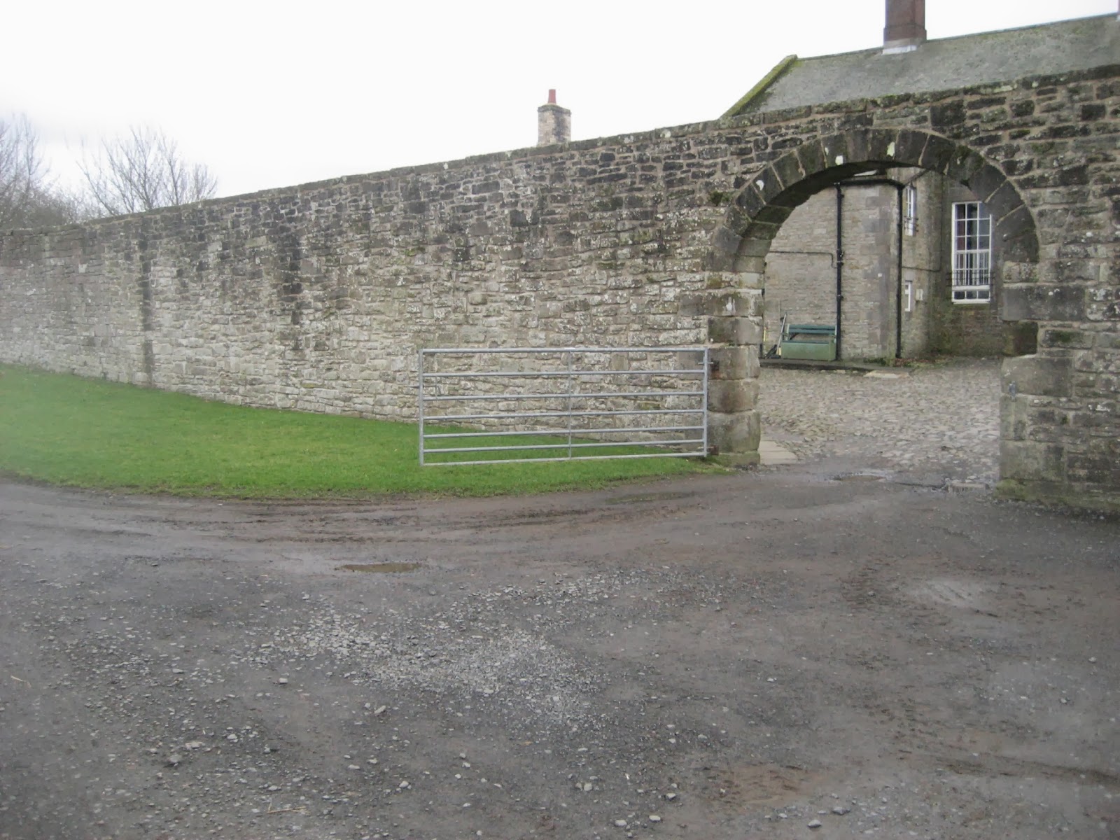
Leaving the ruins we continued east before turning right onto a track that took us downhill through fields heavily populated with heavily pregnant sheep until we met a minor road and turned right and then left at a junction. After a few hundred yards a signpost on the right pointed us across a field until we met another minor road. Shortly after passing the farm at Newton a signpost on the left directed us south across several fields to the farm at Well House. We followed the road to the farm at the Peels. There we took the muddy track marked Border County Ride on the map which goes past Park House and eventually on the road into Alwinton.
 The Border County Ride track. Very muddy
Just before reaching the road there is the ruin of a limekiln, used in the 19th century for the production of lime to be used as a fertiliser. There are many in northern England, this one, last used in 1867 is a fine example. Layers of coal and limestone went in at the top, lime came out at the bottom.

 Impressive stonework in the interior of the kiln

 And instructions too.
Back at Alwinton we decided that, even for us it was too early to go to the pub so we headed for Rothbury and enjoyed a very civilised afternoon tea of tea scones, pronounced with a short letter o.
After tea we headed for one of our favourite pubs, which was also to be home of the Gadgies Annual General Meeting.
But first the Matrix
Matrix MMXIVD
steps miles
Higear 19019 8.995
LIDL3D 20072 9.03
Daves LIDL3D 19417 8.93
LIDLUSB 19127 9.06
Brian's GPS 8.8
Ben's bragometer 8.7
OUTDOORGPS 8.73
Is that consistency?
Gadgie distance 52.4
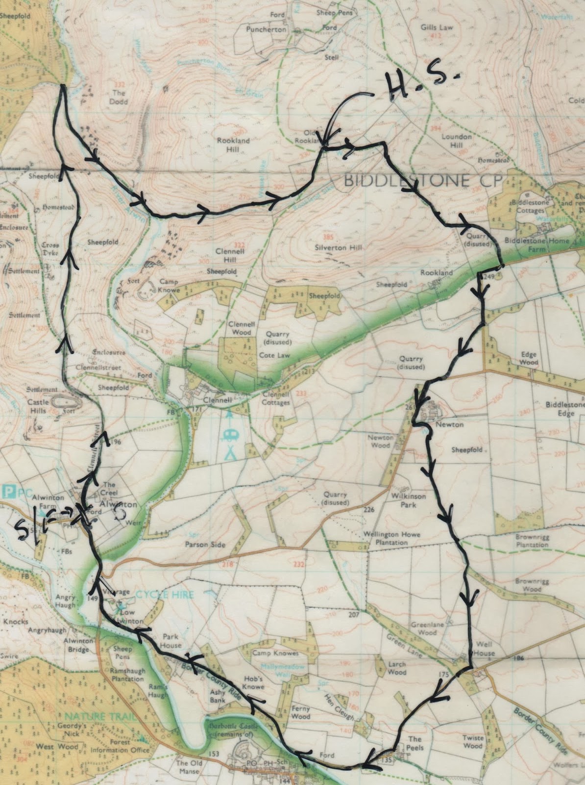
Crown copyright and data base rights, 2014. OS
THE AGM
The meeting was held for the second year in the Anglers Arms at Weldon Bridge.
 Anglers Arms, Weldon Bridge.
AGENDA
1. Drink
2. Eat
3. Drink again
4. More Drink
There were seven members present for the first part of the meeting but the non executives left quite early, leaving four of us to carry on with the meeting. After a couple of pints of Timothy Taylor's Landlord we retired to our rooms to shower and change for dinner. The menu was up to the usual high standard and the excellent food was helped down with some more beer. At one point the attentive young waitress suggested we had wine. Ray was appointed oenophile and he chose a rather fine red which went down very well. It was suggested we end the meeting with a wee dram which actually became several and the meeting ended successfully at 11.45pm when we retired to our rooms for a well deserved sleep. I suspect that during the evening we consumed our weekly ration of units of alcohol, gadgies binge drinking! The nanny state would be shocked, we would be offered counselling and told we were headed on the downward slope. But we all enjoyed it.
Next morning we met at 9 am for breakfast. I confess I could not face the traditional full English, neither could Ray but John and Brian, like real men, tucked into plateful of bacon, egg, sausage and beans. Alpen and toast for me. Wimp.
The Anglers Arms, being a fishermens pub is decorated with many a stuffed specimen.
John said he didn't like them, he thought their glassy eyes were watching him.
"What's your name?"
"Don't tell him Pike!" quipped Brian on form as ever. (A joke for most older English people. An explanation is on offer. SAE and £5 to me)
A SURE CURE FOR A HANGOVER.
We packed and left the hotel about 10am and headed for Simonside, the long hill overlooking Rothbury. There are several car parks near the plantations that cover the lower slopes of this poular walking area. The one we chose is at NZ 035977 on OS OL 42 Kielder Water and Forest.
There are several walks round Simonside, all clearly marked. The one we chose is marked with white arrows on a red background.
 Yes it is.
 Easy to follow signs.
 A good bit of the walk is on trails like this,
Heading west from the start we followed the trail through the woods for a mile before turning roughly south west and slowly climbing on muddy paths. Near Bob Pyle's Studdie the path turns left and climbs steeply on a well made stone path to the cairns at the top of Simonside. An information board at the start of this rocky staircase reminds walkers to beware of the Duergars, the mythical wicked dwarfs that inhabit this once sacred hill. They have a habit of kidnapping walkers and holding them for ransom. (See Five go battling the duergers July 5th 2013)
 These rocks could well be a home for duergers.
On the ridge the path has been laid with flagstones from long dead Lancashire cotton mills which makes the walking easier as it passes several cairns. The views north to the Cheviot hills are well worth the effort it takes to climb up.
 A cairn on Simonside
 Well flagged path on Simonside.
The path heads roughly east. At Dove Crag you may continue to the Beacon and down to a car park near Lordenshaws which has an ancient fort, settlements and several of the mysterious cup and ring markings whose purpose has never been explained.
But we chose to turn north on a muddy footpath which joined another forest trail heading west to Joe's wood. This wood was planted in memory of Joe Rosenburg. He ran a small jewellers in Newcastle and, as the plaque says, was Chairman of the Northern Ramblers,the organisation that helped open areas of England to walkers.

Turning north east we walked down a muddy track through the trees and back to the car park.
It was only 12.30pm so we headed, again for Tomlinsons Cafe and Bunkhouse in Rothbury for, in my case, a late breakfast, English of course. Third visit of the weekend, Brian suggested we should get loyalty cards and save for a free coffee.
Matrix MMXIVE
steps miles
Higear 9987 4.2
LIDL3D 10060 4,53
OUTDOORGPS 4.2
Gadgie distance 56.6
 Sorry about the colour, low on ink.
Following the success of last year's AGM we have decided to hold a second, again at the Anglers Arms, Weldon Bridge.
There will, of course, be a walk before the meeting and because of the damp weather that has persisted in the North East of England this week we have chosen to walk to Old Rooklands from Alwinton, a walk we have not done since January 7th, 2012.
There is a full gadgie turn out, Ben, Brian, Dave, Harry, John, Ray and me. To get to the start of the walk from base camp take the A1 north, turn onto the A697 at Morpeth and follow the road signs for Rothbury. There is still a diversion in operation as the road which suffered a land slip last year has still not been repaired. Go through Rothbury and Thropton before turning right at the sign for Alwinton. There is a Northumberland National Park car park, but being pensioners we left cars on the green as we entered the village, it's free. The walk is covered on OL16 The Cheviot Hills and the village of Alwinton is at NT920063. If you do use the National Park car park keep your eye open in the toilet, Dave once found a £5 note there and looks every time we visit, just in case. Naturally we stopped for breakfast at Tomlinsons Cafe and Bunkhouse on Bridge Street in the pretty little town of Rothbury. Some of us , those worried about their weight, had tea, others enjoyed a five flitch bacon butty.
The walk:
the Rose and Thistle pub. Nice too. Harry is
taking photographs.
Near the car park is a footbridge across the Hoseden Burn .( Stream, brook, beck, what a rich language English is.) Cross the burn, taking care at this time of the year not to tread on the February Fair Maids (snowdrops) and turn left. The footpath almost immediately joins Clennell Street, an ancient drove road dating back to the times when Scots and English traded animals across the border. The street climbs uphill, on the left, Castle Hills is an Iron Age settlement with earthen ramparts, worth a visit but not today. About a mile from the start a footpath on the right of the track took us across muddy fields and downhill to a point where the river Alwin emerges from the plantation.
We turned sharp right on the forest track running alongside the River Alwin, crossed a bridge and found the footpath south of Rookland Hill that follows a narrow burn going roughly east. (If you follow this walk make sure you enter the second valley or you finish up at Puncherton, not Old Rooklands). The track here is little more than a sheep trail but eventually the few trees around Old Rooklands are visible on the horizon and then the ruined farmhouse itself. Sitting in the shelter offered by an end wall we declared a Herbie Spot.
AS usual our lunch turned into a feast. Adding to the sandwiches we had flapjacks, Ben's ginger biscuits and individual Bramley Apple Pies
Leaving the ruins we continued east before turning right onto a track that took us downhill through fields heavily populated with heavily pregnant sheep until we met a minor road and turned right and then left at a junction. After a few hundred yards a signpost on the right pointed us across a field until we met another minor road. Shortly after passing the farm at Newton a signpost on the left directed us south across several fields to the farm at Well House. We followed the road to the farm at the Peels. There we took the muddy track marked Border County Ride on the map which goes past Park House and eventually on the road into Alwinton.
Just before reaching the road there is the ruin of a limekiln, used in the 19th century for the production of lime to be used as a fertiliser. There are many in northern England, this one, last used in 1867 is a fine example. Layers of coal and limestone went in at the top, lime came out at the bottom.
Back at Alwinton we decided that, even for us it was too early to go to the pub so we headed for Rothbury and enjoyed a very civilised afternoon tea of tea scones, pronounced with a short letter o.
After tea we headed for one of our favourite pubs, which was also to be home of the Gadgies Annual General Meeting.
But first the Matrix
Matrix MMXIVD
steps miles
Higear 19019 8.995
LIDL3D 20072 9.03
Daves LIDL3D 19417 8.93
LIDLUSB 19127 9.06
Brian's GPS 8.8
Ben's bragometer 8.7
OUTDOORGPS 8.73
Is that consistency?
Gadgie distance 52.4
Crown copyright and data base rights, 2014. OS
THE AGM
The meeting was held for the second year in the Anglers Arms at Weldon Bridge.
AGENDA
1. Drink
2. Eat
3. Drink again
4. More Drink
There were seven members present for the first part of the meeting but the non executives left quite early, leaving four of us to carry on with the meeting. After a couple of pints of Timothy Taylor's Landlord we retired to our rooms to shower and change for dinner. The menu was up to the usual high standard and the excellent food was helped down with some more beer. At one point the attentive young waitress suggested we had wine. Ray was appointed oenophile and he chose a rather fine red which went down very well. It was suggested we end the meeting with a wee dram which actually became several and the meeting ended successfully at 11.45pm when we retired to our rooms for a well deserved sleep. I suspect that during the evening we consumed our weekly ration of units of alcohol, gadgies binge drinking! The nanny state would be shocked, we would be offered counselling and told we were headed on the downward slope. But we all enjoyed it.
Next morning we met at 9 am for breakfast. I confess I could not face the traditional full English, neither could Ray but John and Brian, like real men, tucked into plateful of bacon, egg, sausage and beans. Alpen and toast for me. Wimp.
The Anglers Arms, being a fishermens pub is decorated with many a stuffed specimen.
John said he didn't like them, he thought their glassy eyes were watching him.
"What's your name?"
"Don't tell him Pike!" quipped Brian on form as ever. (A joke for most older English people. An explanation is on offer. SAE and £5 to me)
A SURE CURE FOR A HANGOVER.
We packed and left the hotel about 10am and headed for Simonside, the long hill overlooking Rothbury. There are several car parks near the plantations that cover the lower slopes of this poular walking area. The one we chose is at NZ 035977 on OS OL 42 Kielder Water and Forest.
There are several walks round Simonside, all clearly marked. The one we chose is marked with white arrows on a red background.
Heading west from the start we followed the trail through the woods for a mile before turning roughly south west and slowly climbing on muddy paths. Near Bob Pyle's Studdie the path turns left and climbs steeply on a well made stone path to the cairns at the top of Simonside. An information board at the start of this rocky staircase reminds walkers to beware of the Duergars, the mythical wicked dwarfs that inhabit this once sacred hill. They have a habit of kidnapping walkers and holding them for ransom. (See Five go battling the duergers July 5th 2013)
On the ridge the path has been laid with flagstones from long dead Lancashire cotton mills which makes the walking easier as it passes several cairns. The views north to the Cheviot hills are well worth the effort it takes to climb up.
The path heads roughly east. At Dove Crag you may continue to the Beacon and down to a car park near Lordenshaws which has an ancient fort, settlements and several of the mysterious cup and ring markings whose purpose has never been explained.
But we chose to turn north on a muddy footpath which joined another forest trail heading west to Joe's wood. This wood was planted in memory of Joe Rosenburg. He ran a small jewellers in Newcastle and, as the plaque says, was Chairman of the Northern Ramblers,the organisation that helped open areas of England to walkers.
Turning north east we walked down a muddy track through the trees and back to the car park.
It was only 12.30pm so we headed, again for Tomlinsons Cafe and Bunkhouse in Rothbury for, in my case, a late breakfast, English of course. Third visit of the weekend, Brian suggested we should get loyalty cards and save for a free coffee.
Matrix MMXIVE
steps miles
Higear 9987 4.2
LIDL3D 10060 4,53
OUTDOORGPS 4.2
Gadgie distance 56.6