Translate

Saturday, 21 December 2024

The Green's Christmas Walk

 The Green's Christmas walk. December 15th.

The Greens are a friendly group of walkers that some of us gadgies have attached ourselves to. Walks every other Sunday, similar to gadgie walks and they usually end in a pub.

The Christmas walk is an annual event, usually a walk round the town of  Morpeth and a feast in the Tap and Spile. A map is not necessary but should you wish to follow the walk closely use OS Explorer 325 Morpeth and Blyth.

We met, about twenty of us, in the car park between the bus station, Home Bargains and the shopping centre. It is free but requires a time of arrival card.

Having assembled and appointed a leader and back marker, just like being at school, off we went.

Down the hill of the main street, across the road, past Wetherspoons (old cinema) and over the river Wansbeck.

Once over the river (and checked) we turned left and followed the river bank for a while before crossing again to the north side.

Leaving the riverside we crossed a road and entered Bluebell Wood which is well worth visiting in spring for the carpet of, amazingly, bluebells, but British not Spanish.


                                  Spot the difference.

             Walking through Bluebell Woods
Once ou of the wood we walked round the perimeter of the hospital, down a road passing King Edward VI School, (known as KEVI) and almost into town.
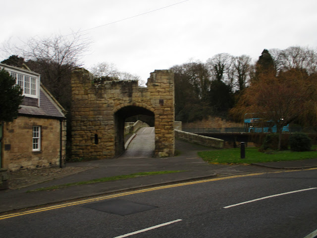
Turning right down the nicely named Beggars Lane we crossed a stream, turned left, crossed the river and followed footpaths through open land to the next bit of wooded land. A series of steep steps took us to the remains of Morpeth Castle. All that is left is the gatehouse and some bits of wall remain from the 14th century stronghold. The gatehouse is run by the Landmark Trust who restored it. My wife and I had lunch there in summer with friends who had taken it for a short holiday. Magnificent view from the roof of Morrisons supermarket, and the rest of the town.
         Walls are vertical, I was not.
Having admired the gatehouse we walked to the next roundabout, crossed the road, passed the station and at a safe crossing went over the railway.

East coast main line from London to Edinburgh and beyond.
The last part of the walk was down a lane which eventually morphed into a road. Passing the back of Morrisons Supermarket we were soon back at the cars. 
As requested we changed our boots for something lighter like  trainers and headed for the Tap and Spile pub nearby.
The pub had provided a fine buffet, far above the standards of the gadgie Herbie Spot. Not only was there ham, salmon, chips, sausages, sausage rolls, olives, crisps, bread and a cheese board to delight but vegetarians, vegans and gluten free were all provided for. And they had Timothy Taylor's Landlord on draught. Happiness is a Green walk.
Contains OS data copyright. Crown copyright and database right 2024.
The walk is about 5.5 miles, easy going.
Apart from the wonky castle and one of the group photographs, credit goes to Andrew. Thanks.


The last gadgie walk of 2024

 The last gadgie walk of 2024. December 20th.

For the last walk of the year, and on almost the shortest day of the year, we are off for a beach and dune walk from Warkworth to the river Aln, opposite the village of Alnmouth. A popular walk, always a pleasure and a good stroll to end the year. Unfortunately, for various reasons, there are only three of us out.

There is parking by the River Coquet in Warkworth, down the main street, turn left at the square full of cars, pass the church and leave your car next to the river. Free.

A map is not essential but the walk is covered by OS Explorer 332 Alnwick and Amble.


                   Parking by the Coquet.

Booted and wrapped against the cold we set off past the village church of St Lawrence and headed for Bernard's cafe for breakfast.

              St Lawrence Church, Warkworth. Almost perfect Norman church

              Warkworth Castle at the top of the street. dates back to 1139

Having eaten we headed off across the new road bridge and turned right up to the car parks near the beach. There is a fairly new footpath in the field next to the road, away from the traffic.

When we reached the dunes we turned right  and walked along the inlet towards the Amble harbour north pier.


                                  Amble harbour.

Turning north we walked on the beach, not surprisingly very quiet today, few dog walkers braving the cold.

Approaching Birling Carrs I took the footpath up to the dunes and followed the path through the caravan site while the others stayed on the beach. Meeting up again we walked the soft sand to the mouth of the River Aln and settled down on a sandy bank opposite the town for a Herbie. ( Stollen, ginger biscuits  iced with Christmas decorations by Jesmond cake company and sweet and savoury from Mrs A.)

                 Uprooted by ereosion
                       Alnmouth from the Herbie Spot

Lunch over we resumed the walk. On previous occasions we have climbed the small hill to the cross that marks the site of the original village church, washed away in the great storm of 1806 and then continued to the Victorian "lying in chapel" but today we took a short cut behind the hill and and joined the St Oswald's Way/ English Coast Path/Northumberland Coast Path.

             Site of the original village church.
We followed the path going through the caravan site, cutting down to a track near the beach and avoiding the path that goes across the golf course but eventually wanders round the edge of it. Reaching the path down from the village we turned right and returned to the cars using the old bridge over the Coquet.


                    The old bridge, 14th century.
On the way home we visited the Ridley Arms in Stannington to sample the Wylam Gold. Highly recommended too.

                   Contains OS data, copyright. Crown copyright and database right 2024
The walk is about 9 easy going miles. 

That's the last gadgie walk of the year. Next episode on January 3rd, the annual opener from Blyth to North Shields.
Happy Christmas and a great New Year.
                          The gate on old Warkworth bridge


                    The Alnmout guano shed, abandoned after the 1806 storm
                    Alnmouth Bay

                                      WW2 defences


Saturday, 14 December 2024

Wylam, Prudhoe and Stanley Burn

 Wylam, Prudhoe and Stanley Burn. December 13th

Sounds like a firm of solicitors.

Wylam village is west of Newcastle, on the north side of the Tyne. Head west on the A69, turn off at the sign post for Wylam and head down towards the free car park close to the bridge.

There are seven of us, breakfast in the Coffee Tree near the church.

              Parking at Wylam. Plenty of space and free!!!


                        The slightly out of focus Tyne at Wylam

Leaving the car park we took the narrow path under the bridge and walked on the river bank, joining a firm track and reaching Hagg Bridge which once carried a railway line on the north side of the river. Once across it joined the line to Carlisle on the south side. 


                             Hagg Bridge

We stayed on the track to Ovingham Bridge where there is a cafe and car park next to Prudhoe station. As the crossing gates were closed we used the footbridge, pausing to watch a rather disappointing freight train pass. On the way we passed "The Spetchells". Artificial mounds created from lime slag used in the manufacture of munitions in WW2.

                   Mural at the cafe at Prudhoe station
                           And the train.

The station is next to the river and as any Geography teacher worth the jacket will tell you, railways follow valleys.

Leaving the Station we walked uphill through Prudhoe, passing the Doctor Syntax pub and the ruins of Prudhoe Castle, built in the 12th century for the Umphravilles.

                                              Castle gate

              Dr Syntax was a horse, not a linguist

Still on an upward path we turned right and, opposite St Mathew's Primary school, took to the fields. 

Eventually we reached the top of the grassy hill and headed down to the farm at Durham Riding.

                             Tree House at Durham Ridings

                                     Durham Ridings

Beyond the farm we turned left and walked a muddy lane to Humble Farm. The neatly arranged stones at the entrance provided a good Herbie Spot. (scones, cherry Bakewells, cookies and, of course, sweet and savoury from Mrs A.)

Full we walked along the road for a short distance before entering fields on the right.

The almost invisible footpath took us to the hard to find entrance to Stanley Burn.

For a mile we followed the narrow track, up and down, crossing footbridges until we reached Stanley Bridge and a road.

We followed the road, passing Prudhoe golf course and then turned left to go round the waste disposal site. Just beyond that we turned right at a finger post, followed a woodland walk until we reached Hagg Bridge. From there it was a short walk back to the cars.

Some went to the Fox and Hounds which has TTL.


Contains OS data, copyright. Crown copyright and database right 2024

The walk is about 9.5 miles, easy going with a couple of steady climbs


                             A proper doctor!
                        The Spetchells

 
                                  You can call me Al.
                                     Stanley Burn


Saturday, 7 December 2024

Felton and Morwick. Muddy but goody

 Felton and Morwick. December 6th.

Muddy but goody!

Felton is a village some miles, but not too many, north of Newcastle, just off the A1. It has a Running Fox cafe for breakfast bacon. Felton is Old English for "field farm".

The walk is covered by two maps:OS Explorer 325 Morpeth and Blyth and 332 Alnwick and Amble.

Hopefully it's dry, but it is cold so the man on the TV says, and we won't  get the latest  storm until Saturday.

We had breakfast at the Running Fox, one of the finest bacon sandwiches available in the North East. It is advisable to book at this very popular bakery/cafe.

No car park, we left our vehicles on the street.


                    Parking and a nice old bridge which is next to a modern concrete one.
We crossed the modern bridge and turned left. There are two paths, one next to the river and a higher one which is part of St. Oswald's Way. We went with the saint, initially staying close to the river  but leaving the bank after about 1.5 miles and plodged along a muddy track, crossed a road and continued to plodge through or close to pools of water and yards of mud and going under the East Coast railway line.

              River Coquet, full after recent rain.
We walked through the mud of Rake Lane until we reached a road, turned left and after a few hundred yards turned into the Morwick Dairy and  ice cream shop, which was open. 
                     Morwick ice cream shop.
There were several picnic tables in the yard so we called a Herbie: Cherry Bakewells, cookies, cake and sweet and savoury from Mrs A.
Lunch consumed we headed off through the farmyard and across fields and woodland until we reached the railway line again. The footpath crosses the railway line, take care.
                 An exercise in perspective.
Once across the line the footpath took us over fields and into a wood which had a sign proclaiming "Sid's Wood". It also had feeding barrels for pheasants. 
Reaching a road we turned right and crossed the Coquet.

The ruins of Brainshaugh Priory chapel, close to Guyzance which is possibly named for the Guines family who came over with William.
Turning left we followed a rough track, passing the memorial to the Guyzance tragedy.
                     The Guyzance Tragedy.
The path crossed fields but at about 8.5 miles goes off to the left and descends to the river bank. The entrance to the path is not marked but is fairly easy to spot.
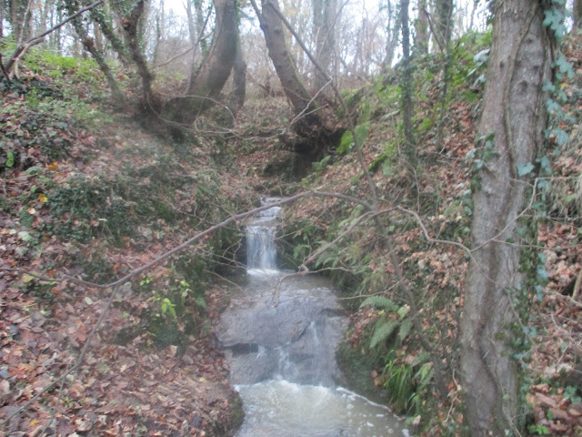
                 A mini waterfall adding to the Coquet.
Leaving the riverside walk we crossed a field and joined the road back to Felton.
On the way home we called in at the Ridley Arms, Stannington, which had Wylam Gold on offer. A good session beer.

Contains OS data, copyright. Crown copyright and database right 2024
At nearly 10  miles of muddy but easy going tracks this is a good walk, fields, woodland and riverside, plus the opportunity to have an ice cream.