The Dales Diary Volume 2. June 2024
This year's long distance walk is a repeat of 2018's Dales Way adventure from Ilkley in Yorkshire to Bowness on Windermere in Cumbria.
There are seven of us from Tyneside plus two from Cumbria who are joining us, using their caravette.
Team 2024: Brian, Margaret, Dave, Ian, John L. Janice and me, plus Paul and Maureen. The accommodation, taxi and baggage transport have been arranged by Shepherds Walks, a company based in Rothbury, Northumberland.
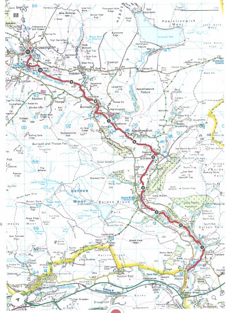
There are several guide books available for the walk and a plastic coated waterproof map of the route too, saves carrying a couple of OS maps.
Day 1, getting there. June 5th.
Two cars for seven people, taking us to Craiglands Hotel on Cowpasture Lane, Ilkley. A former spa, now a comfortable hotel. Not surprisingly once we were settled in we went off for dinner, Italian, and the local Wetherspoons.
Craiglands and its car park. We left the cars there for the trip
DAY 2, the shortest walk on the longest day. June 6th.
The Dales Way starts at a stone bench near a bridge over the River Wharfe. we were joined by a friend of John's who had come all the way from Leeds to make a team of ten.
I'm off to Bowness, 81 miles away.The way is well marked for most of the walk, occasional lapses and occasionally it is shared with the Pennine Way and a Pennine Journey, but for our first day we followed the footpath close to the river.
The first place we came to, Low Mill, is a village whose houses are mainly constructed from the wreckage of a mill. Pretty it is, too.
Low MillNext stop, Addingham, ancestral home on my father's side. We searched the churchyard and found a few Emmotts. I recalled that my grandad's birth certificate also had this spelling.
One of the tribeThe village church, St Peter, dates back about 1000 years. The current building is only 16th century but there are Norman parts to it. In the 9th century the Bishop of York hid in the Saxon church because the Vikings were sacking his city. Don't blame him. The church has a blue clock face, one of several such like in the area.
St Peter's, Addingham
A little further on we stopped at a caravan park at High Mill for tea or coffee in a recently opened cafe. (mile 3)
Not far beyond the cafe we stopped at Farfield to look at the old Quaker Meeting House.
Refreshed, and we hadn't walked far. we pushed on, following the riverside path to Bolton Bridge and then into the estate of Bolton Abbey.
Strictly speaking a Priory, the Abbey was founded in 1154 by Augustinians. Building work was still going on at the time of the reformation when, as a monastery, it was dissolved. The Priory itself remains as a church and is well worth a visit.
However, the grounds of the ruined abbey contain many many graves, and amongst them is this one:
Fred Trueman, fast bowler for Yorkshire and England. My childhood hero.The Abbey was the end of the first day's walk, a short one to get us in the mood. Some decided to have a circular stroll back to Ilkley, some decided to take the pre-booked taxi . We rang to say we were ready to be picked up but the company denied all knowledge of our booking. A call to Shepherds Walks sorted that out and back to Craiglands we went.
That evening we ate in a Turkish restaurant. Ilkley is very cosmopolitan.
Miles are approximate. GPS had a bad day.
My milage 6.6 for the day Running total 6.6 miles
(Note. Should you think I've made a mistake and thought today was Summer Solstice, June 6th is the 80th anniversary of the D Day landings on the Normandy beaches. The phrase "the Longest Day" is attributed to German General Erwin Rommel and not John Wayne, one of the stars of the film with that title.
Day 3 We're going to Grassington. June 7th.
After an energising breakfast we took the pre-booked taxi to Bolton Abbey, yesterday's end point. to continue on the Dales Way. Joined today by another of John's friends,Paul, and he brought his friendly dog. A full side today.
There are stepping stones and a bridge to cross the Wharfe, I had been challenged to go for the stones, fortunately two had been washed away in recent heavy rains so, like the other eight, I used the bridge.
Bridge or stones, but see the gap in the middle.On this section of the path the people of Bolton Abbey Estate have constructed a Welly Walk for children. Lots of things to climb over or into or swing on by the path. Felt a bit tempted.
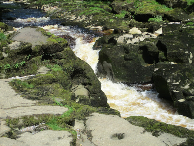
After two miles we came to the famous Strid where the river narrows into a fast flowing and deep channel. Not particularly wide but failure to make the jump is hazardous and people are advised not to try. The water is about 30 feet deep and fast flowing, We admired it and moved on.
The Strid.
Moving on through woodland and open field, crossing the river to the north side beyond Strid Wood , passing close to Appletreewick we eventually reached Burnsall. (mile 8)
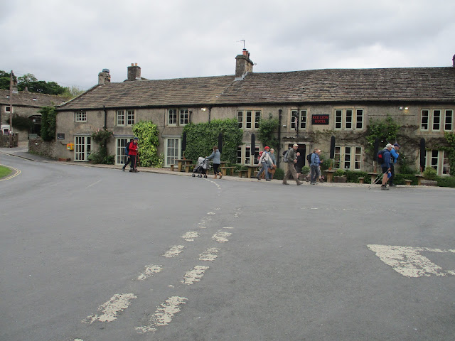
We crossed the river here, crenelated bridge The Red Lion at Burnsall, we've stayed here on previous walks but today we had an icecream at the cafe opposite. Rested we finished the last three miles of the day walking to Grassington. Here the party was divided, three of us staying in the Foresters Arms, the pub with the interesting carpet, four staying in the Grassington Lodge. But we all ate and drank in the Foresters, a very busy pub with a large party in one room, playing music, singing and telling tall tales.
The Foresters Arms, Grassington
My milage 11.2 miles Running total 17.8 miles
Day 4 On to Hubberholme June 8th.
Leaving the Foresters or Grassington Lodge we went up the village street and were soon out in the country, crossing open fields high above the river. The first climbing of the walk but not too strenuous, fortunately. The highpoint is Coniston Pie, a rocky limestone outcrop.
You would expect a Lime Kiln in this area Coniston Pie, weather sculpted limestone outcrop The locals.
As a reward for the climb to the pie the way goes steadily downhill to the village of Kettlewell. (mile 7) Popular tourist spot and a circle of benches made an ideal Herbie. (No sharing on long walks apart from the occasional banana.
Kettlewell. Seemed to be a lot of holiday cottages.Herbie over we crossed the river and walked on flat fields with plenty of fellow strollers until we reached Hubberholme. Pronounced Hubberum by the locals, it is a village with a few houses, a church and a pub, The George, where we stayed for the night. A minor problem, the luggage for those who had stayed in The Grassington Lodge had not arrived. After a few phone calls the missing bags were found and delivered but too late for the owners to change.
The George at Hubberholme. Run by Ed, an ex mechanical engineer from Teeside it's worth a visit for his wit and wisdom. His verbal skirmish with John L was worthy of many a TV show. His persuasive means of getting you to buy another pint is unfailing and the food he serves is great.
My milage, 12.84 miles Running total 30.64 miles One of the many field barns............... ...................
and one of the many bridges. Day 5. Leaving for the station. June 9th
Leaving The George and hoping to return we went past the church in Hubberholme. St Michael's has several interesting points. One of only two rood lofts in the country, it escaped an edict of Elizabeth I that such trappings should go, and a plaque for JB Priestly, author of An Inspector Calls and other works.
St Michael's, Hubberholme, mainly 12th century.
Back on the riverside we walked the Wharfe before starting to climb Oughtershaw Moss, leaving the Wharfe behind. Good tracks and some steep sections of path that weren't we eventually reached Cam House, the high point of the day after 8 miles.
Snow plough I think it's Pen Y Ghent The famous Ribblehead Viaduct.On the long downhill road we had a good view of Pen y Ghent and then the Ribblehead viaduct on the Carlisle to Settle line.
Leaving the Dales Way we walked along the road for about a mile to the Station Hotel, close to the railway line and our rest for the night.


My miles 12.66 Running total 43.3 miles
Day 6. Past halfway and on to Dent. June 10th
Leaving the Station Hotel we walked back along the road for about a mile before rejoining the Dales Way, which now shares a track with the Ribble Way. Heading north we contoured on the east side of Blea Moo until we reached another viaduct on the Carlisle to Settle scenic railway.
The viaduct near Dent Head Farm. We even saw a train crossing it. The road down into Dent Dale took us to Cowgill, after seven miles a good place to Herbie. The pub here is the Sportsman's. we stayed there on a previous walk.
For dinner in the Station Hotel Margaret and Janice had ordered the Sunday roast. It came with so much beef and sliced so thick neither of them could finish it. Margaret saved one slice for next day's Herbie. I had a cheese sandwich.
That sandwich is worth a second view.Lunch or feast over we walked on. passing a group of Duke of Edinburgh Award teenagers, full of energy.
Eventually we left the road and followed some very muddy footpaths alongside the River Dee until we arrived in the village of Dent.
Six of us had rooms in The Dent Stores, a shop and very welcoming BnB. Alas poor Janice, alone in the George and Dragon where we all had dinner.
St Andrew's Church, Dent, 12th century origins, rebuilt 1417 and again in 1787. Grade 1 listed building Dent Stores and BnB. Small but welcoming. My milage 11.61 Running total 54.91 miles
Day 7. Short walk to school. June11th
Leaving Dent behind we started off by road before taking the footpath alongside the River Dee and sharing the way with A Pennine Journey, not to be confused with The Pennine Way. Crossing the river at Brackensgill we crossed fields to Millthrop .
The Beatrix Potter garden at Millthrop. Poor picture but I spotted Peter Rabbit, Jemima Puddleduck and several other characters.
Soon we were in Sedbergh, home of the renowned school. We walked past a rugby pitch, a sports hall, a cricket pitch, the school and another cricket pitch.So good I think Lancashire or Yorkshire played there some years ago. The school is co-educational, the students we saw were all smartly dressed in uniform. It seemed the staff were too! As it was a short day we amused ourselves with exploring the town before settling in the Dalesman for the evening.
The Dalesman in Sedbergh. Very well appointed but for dinner we were booked in to the Red Lion where we were entertained by a folk group. They played Blaydon Races for us and we sang.My milage, 6.65 mile Running total 61.65 miles
Day 8, This really is our longest day. June 12th
Leaving the town and school behind we headed southwest to Brigflatts, another Quaker Meeting House before the Dales Way turns north at Hebblethwaite. Some road work, some footpath work and another viaduct but this time on a dismantled railway.
Bridge on dismantled railway near Crook of Lune, not to be confused with Crook of Lune near Lancaster..

ok
To our right the Howgills, an area we have rarely walked.
The Howgills.AtBeckfoot we took a path parallel to the M6, the most beautiful motorway in England, before crossing it and several fields later crossing the main East Coast Railway line too.
The paths were mostly easy to follow and much to my relief we eventually reached Burnside where we were picked up by taxi outside the Jolly Anglers pub and taken to Kendal.
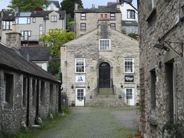
We stayed in The Shakespeare on the high street. Lovely pub and restaurant. The rooms were nmed for characters from A Midsummer Night's Dream. Dave and I shared Oberon!
I did wonder why there would be a Shakespeare Hotel in Kendal. Now I know.GPS Problems again. I probably forgot to switch it on after a Herbie. My milage 16.33 Running total 77.98 miles
Day 9. Getting very near the end. June 13th.
Back to the Jolly Anglers at Burnside for the final stretch. Good paths all the way to Stavely where we stopped for morning coffee, adding a few extra yards by going off the Dales Way.
St Margaret's Tower Stavely.After the break we continued on our way, mostly across fields. And for the first time it rained, heavily.
Approaching Bowness I noticed the team ahead of me (they usually are, I'm nearly always at the back) waiting under a tree. I thought they were taking a bit of shelter but no, they insisted, in spite of my protestations, that I lead them to the end as it was my choice of walk for reaching 80!
And I did lead them to:
The stone seat marks the end of the Dales Way.Back row: Margaret, John L, Paul, Maureen, Dave.
Front row: Brian, Janice, me, Ian.
(Fortunately a passing couple offered to take the photo as soon as they saw us)
For our last night we stayed in The Ro Hotel in Windermere. Another old spa converted to a large and comfortable hotel. Not the greatest place for real ale drinkers but nobody fancied walking downhill in the rain to a pub, and struggling back up again.
The Ro Hotel
My milage 10.28 Final score 88.26 miles
ALL MAPS Contain OS data, copyright. Crown copyright and data base right 2024.
Day 10, Going Home. June 14th
We were taken by pre-booked minibus to Ilkley and then we drove home.
And a few photos









.JPG)


