Translate

Saturday, 24 February 2024

FOUR GO TO RIDING MILL

 Four go to Riding Mill. February 23rd.

Mud warning

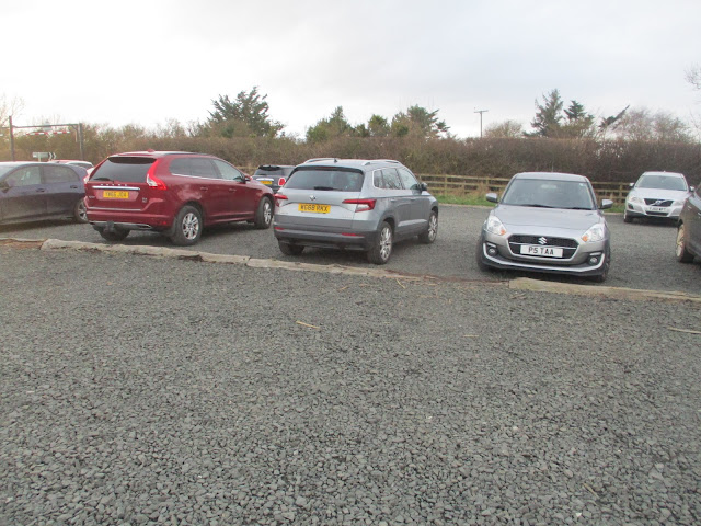
Brian, Margaret, John C and I are off for a walk from Riding Mill. a village in the Tyne Valley, easily reached by following the A69 west to the Corbridge roundabout and following signs. There is limited parking next to the railway station, free.

Riding Mill does not have a lot to offer, a station on the Newcastle Carlisle line, a pub, no shop as far as I know, the original mill is now a private residence. Mainly a commuter village for Tyneside.

Two maps cover the walk: OS Explorer 316 Newcastle upon Tyne & OS Explorer 307 Consett. Could be useful.

Breakfast at Brockbushes which is being expanded, opening new premises later this year. It will be much bigger. And it does a great bacon sandwich.


                Not the most inspiring of car parks, but free.

Once booted and coated, (it was cold) we crossed the railway line, using the footbridge of course, and followed a footpath close to some old cottages, crossed the village road, walked up East View lane, over the railway again  and off into open land. 

After crossing a field we crossed the A68, a busy road, and followed a footpath through a small wood.


Excluding roads, this is probably the least muddy part of the walk.

Just outside the wood we passed this solid looking building. WW2 bunker?

 Once out of the wood (mile 1)  we crossed more fields  and a minor road. After a short stretch of dry road walking we reached Broomley (mile 2) and took the track to Old Ridley. (mile 3) A road heading roughly south west took us through the hamlet of Hindley, a collection of large houses, until we came to a crossroads. Going straight across we walked uphill on a muddy farm track, passing Wheelbirks which looked inviting.

                                           Wheelbirks ice cream and food.
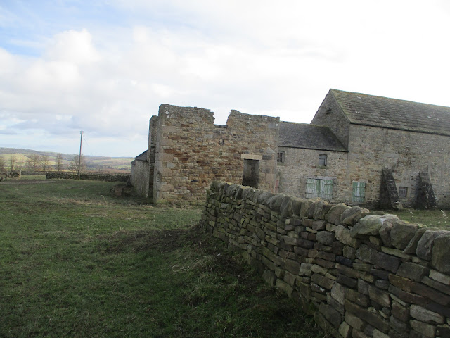
At the top of the hill we came to the A68 and had to walk a short distance on the side of it, carefully watching the traffic. Turning right we came to  the farm at Lower Fotherley (mile 5) which seems to have the ruins of an old Peel Tower.

Could it be the ruins of a Peel Tower?
Across a field from the farm we settled down on some stones at the edge of a wood for today's Herbie, a quiet affair, apple pies, sweet and savoury from Mrs A. (mile 6).
Lunch over we walked the muddy woodland path, crossed a field and reached Healey, a small village with a small church.

Top: a nice bit of topiary. Bottom: St John's church, a Victorian chapel of ease.
After  walking through the village we turned left and at Burnt House took the muddy footpath through Broomleyfell plantation. Emerging on a minor road we turned left and on the corner spotted the finger post pointing back to Riding Mill. Across a couple of soggy field , adding more weight to boots already caked with mud and finally a road back into Riding Mill.
On the way home we called at the Fox and Hounds in Wylam which serves TTL and zero alcohol Guinness.

           Contains OS data, copyright. Crown copyright and database right 2024.
The walk is just over 9 miles, some climbs but generally easy going apart from the mud.


Saturday, 17 February 2024

On the coast again.

 On the coast again. February 16th

(And the bus) (And a castle)

Four of us (Brian, Margaret,  Harry, me) out on a walk we have done several times but why not. Start by driving to High Newton by the Sea which has a fine, free facility for cars and taking the bus to Bamburgh. The bus, number 418, leaves High Newton at 10.48.


High Newton: A1 to Alnwick, turn off for Denwick and watch out for signposts. However we took the Northumberland Coast route and had breakfast in Bernard's cafe in Warkworth.

Held up on the drive from Warkworth to Bamburgh by a couple of slow moving cars driven by elderly people we " caught the bus in seconds flat" as Paul wrote. The bus takes about half an hour to reach Bamburgh. We got off next to the cricket ground just below the castle.

It is possible to follow the walk without a map but just in case it is covered by:

OS Explorer 340 Holy Island and OS Explorer 332 Alnwick and Amble

Car park for the day at High Newton. Not the start of the walk, we "ran" for the bus from here.

Once off the bus in Bamburgh we walked round the cricket pitch and took the footpath at the north end of the castle down onto the beach.

Bamburgh Castle. The site has been in use since the stone age. Fortifications built by Britons, Romans, Saxons and Normans.The castle has been used in several films, including a version of MacBeth when a clever bit of computer work put a large range of snowy mountains in the background.

Once on the beach we headed south. The sandy beach was busy with family groups, walking, playing (even a cricket match) and walking dogs. The Greenhill rocks were on the slippy side and tricky side so we climbed up to the road, crossed a stream and took to St Aidan's dunes  until  we were close to Seahouses. Back on the road we walked through the little holiday town, famous for fish and chips and trips out to  the Farne Islands.. Passing the back of the Olde Ship we headed for benches overlooking the harbour and settled down for a Herbie. (mile 4)

                A Herbie view of the harbour (apple pies, savoury and almond slice from Mrs A)

                         Looking back at Bamburgh Castle.

Lunch over  we walked carefully round the golf course to the road, crossed a stream  and headed back to the beach. After some more sand walking we climbed up to the road and strode on through Beadnell to the harbour. (mile 7)

                            The Lime Kilns of Beadnell
                                 Dunstanburgh Castle from Beadnell Harbour

                        A very quiet Beadnell Harbour

Back on the beach for a stretch of Beadnell Bay but the stream known as Long Nanny was a bit on the deep side so we headed for the footbridge.


                    Long Nanny footbridge and Long Nanny stream.

From the bridge we followed the England Coastal Path (Now called the King Charles Path) to Newton Links House where we encountered the only mud of the day. We left the path at Mile 10, turned right and headed on an unmarked trail to a stile, crossed a field and were back in High Newton.

Ridley Arms on the way home.Blonde Star or Black Sheep.

Contains OS data, copyright. Crown copyright and data base right 2024

The walk is 10.5 miles, easy going.


Saturday, 3 February 2024

WYLAM, WHITTLE AND HORSLEY

 Wylam, Whittle and Horsley Woods. February 2nd

Four of us, Brian, Margaret , Harry and I are off for a walk from Wylam, along the Tyne for a while then up Whittle Dene. After more rain its probably going to be muddy.

To get to Wylam from Newcadtle head west on the A69 and turn south at the sign post. Through the village towards the station and make use of the free car park just before the bridge over the river.

The walk is covered by OS Explorer 316 Newcastle upon Tyne.

Craftily we left the car close to the Fox and Hounds but I'll  pretend we started the walk from the car park, it's not far away.

Breakfast at the Coffee Tree, a gaggle of giggling maidens were also in, lycra clad, frightening.

Conveniently parked off road near the Fox and Hounds in Wylam.

  From the car park:

The old railway line by the car park has been a cycle/walking/riding track for years. Heading roughly west on the track we soon reached Hagg Bridge and crossed the Tyne.


River Tyne and Hagg Bank Bridge. Originally a railway bridge, the line joined the present track on the south side of the river.

The track on the bank of the river is firm, there is a short diversion nearer the river but after 2.5 miles we reached the Visitor Centre near the bridge to Ovingham.


                      Mural at the Visitor Centr.

We crossed the river using the footbridge next to the narrow, one way road bridge into Ovingham. Turning left just before the church we walked down the road and by an old bridge spotted the sign post for Ovington. We crossed a couple of fields before reaching the village, arriving close to the Social Club.


              Ovington Social Club

We took the track on the left of the club for a few hundred yards before turning left on another farm track then crossed a field or two to the gate into Whittle Dene.

A steep path took us down to the stream and an equally steep path took us to the other side. A large rock infront of a low cliff made a sheltered Herbie Spot. (Apple pies and sweet and savoury from Mrs A).


                   Whittle Dene. We spotted a deer that promptly vanished on our approach.

A few yards south back down the track from the Herbie spot a gate took us into fields and on to Whittle Farm. Following the farm road we reached the bridge across the A69. (mile 6)

One of many clumps of February Fair Maids on the farm road.
Once over the dual carriageway  we turned right and walked along what looks like the old road used before the A69 was built to a few bungalows, turned right, under the A69, turned left and headed for Horsley.
Just beyond the very last house in the village, on the right, is a sign post for Wylam. A narrow footpath next to the stables took us to a couple of fields. Crossing one to a rickety stile we decided not to take the usual route back to Wylam but headed for Horsley Woods. The first part was a firm woodland path but later we wandered along a muddy trail until we reached the road by the old  Victorian pumping station.
                         Victorian pumping station.
Approaching Wylam on the road we went down a set of stone steps, crossed a field, went up a set of wooden steps and were back at the Wylam end of Hagg Bank Bridge and soon we reached the car, changed and went to the Fox and Hounds. Tim Taylor's on offer.

Contains OS data, copyright. Crown copyright and database-right 2024
The walk is 10.5 mile. (17 km approx.) A couple of climbs but easy going.


                 The Spetchells, man made piles of industrial waste. Interesting fauna and flors though