Clockwise from Belford August 18th
Turn out hit again by holidays and family commitments three of us are repeating the well worn route to St Cuthbert's Cave.
Head north on A1, turn off for Belford. Halfway through the village turn left on the Wooler road. Almost immediately there is parking on the right in front of the village hall.
The walk is covered by OS Explorer 340 Holy Island and Bamburgh
On the way we stopped at Carnaby cafe and shop on the A1. Bacon sandwiches and tea.
Not a winner but a free carpark in Belford. (having camera problems)
The walk starts on the left of the building in the photograph. We walked down the lane for a short distance before going through a gate on the left and walking alongside a stream. We passed West Hall, a crenelated Victorian farmhouse built on the site of an old fortified building. Look carefully, there is evidence of a moat.
West HallThe footpath crosses fields, crosses a couple of stiles, climbs a small hill to a radio mast and then goes down to Swinhoe Farm.
All is safely gathered in, ere the winter storms begin. Belford is in an agricultural area, Swinhoe Farm seems to have produced a good crop this year.
There is a cross roads of tracks at he farm, we took the one heading south west and walked alongside fields, passing Detchant Coalhouses and Dick's Old Walls before reaching woodland. The track passes Cockenheugh, a rocky outcrop. At the only junction in this area take the right fork which eventually leads to St Cuthbert's Cave.
St Cuthbert's Cave, a natural cave. Legend has it that the monks of old, on their journey carrying the saint's remains, paused here to avoid Viking raiders. It's a popular picnic spot.We looked but didn't visit the cave, having seen it a number of times. Beyond the cave, at mile 4, we turned right and climbed the short steep hill to narrow footpath on the ridge of Greensheen Hill.
Trig point on Greensheen Hill( 205m or 673 feet)
The heather is in full bloom at this time of year making for a colourful walk. we met and passed a small group of people on a guided walk. They didn't seem too keen on exchanging the usual pleasantries, perhaps they were southerners.
Just beyond Holburn Moss(mile 5) the track turns, passes Raven's Crag and enters woodland.
Holburn Moss
The track turns east the south east before emerging from the fly ridden wood. Just beyond the wood is a fishing/birdwatching site called Graymare. It would have made a good Herbie Spot but was marked as private so, being good gadgies we sat on the grassy bank at the side of the track for lunch. (Apple pies, cake and cheese scones from Mrs A)
And it started to rain, not heavily but enough to force us into waterproofs and we continued on our way.
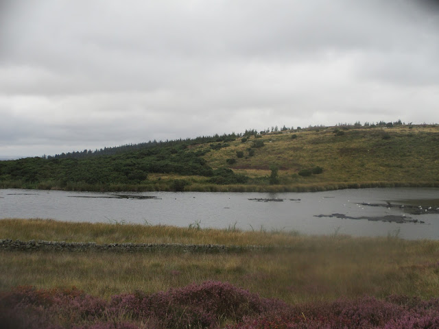
As we approached Swinhoe Lake a flock of young mallards waddled on the track before turning into the lake.
A little further on we were met by a farm vehicle (and driver) herding more ducks along the track. The driver explained he was herding them back to the lake, they had been feasting in his grain store.
Duckherding back to the lake.
Soon we were at Swinhoe farm again. This time we took the track to the left. After a short distance we took the right fork and a little further on, at a finger post, took the footpath through woodland (mile 9) to Craggy Hall, passing a lime kiln on the way.
A Lime Kiln!
Soon we were back at the car park in Belford. Changed we headed for the Widdrington Inn, a bit out of the way but it did have Timothy Taylor's Landlord.
Contains OS data, copyright. Crown copyright and database right 2023
The walk is just over 10 miles. easy going with a couple of very short climbs.


