Translate

Friday, 24 February 2017


The day after Doris  (Northumberland) Feb 24th

Doris Day made some fun films with Rock Hudson; Pillow Talk, Send me no flowers, Lover come back, usually about sophisticated New Yorkers with large cars. She sang The Deadwood Stage too.
But our Doris, the latest storm, hit much of the northern half of Britain on February 23rd, blowing down trees, disrupting rail, road and air services and causing one tragic death.
As the storm deposited rain and snow on the hills we decided to abort our proposed walk from Kielder and stay on the relatively low Rothbury Terraces where the paths and tracks are firm.
There are eight of us; John x3, Dave, Ray, Brian,Ben and me and we are meeting in Tomlinsons café and bunkhouse, Bridge Street, Rothbury for breakfast. There is a Yorkshire car park just across the river. 
For Rothbury take A1 north, A697 at Morpeth and turn left at Weldon Bridge following the Rothbury sign post.
The map to use is OS Explorer 332 Alnwick and Amble. 
Breakfast over, tea/coffee/bacon and various combinations served in this café that is always worth visiting we headed back to the car park, booted up and set off.
          The now familiar Rothbury car park
               And the familiar Tomlinsons café. Well worth a visit if you are in Rothbury
Crossing to the north side of the River Coquet by way of the footbridge we turned east and walked along the riverside path. Doris had brought a great deal of rain, the river was full.
                                            Thrum Mill
                             River Coquet near the mill.
Just beyond Thrum Mill the footpath meets a road, we crossed it and entered the Cragside Estate through the gate which says No Entry. This refers to vehicles.
Cragside House and estate was developed in the 19th century by Lord William Armstrong, arms and ship builder. For the Russo- Japanese war of 1905 he supplied both sides with ships and armaments, that's business. There are miles of footpaths in this National Trust property, most well signposted and we followed the paths to the big house.

Cragside Hall, designed by Norman Shaw and eleven years in the building. The extensive grounds were planted with seven million trees and acres of rhododendrons. Lord Armstrong designed a hydro-electric system to light the hall and power various items.
Once beyond the house we followed the sign posts uphill through rocky paths until we came to Nellie's Moss which were, I think, the reservoirs used to power the hydro-electric machinery.
                                      Nellie's Moss lake.
Having admired Nellie's Moss we continued on the metalled road north then west until we came to the entrance to the park, where we called a Herbie Spot.
It is very close to John Hall's birthday so we celebrated with buns with candles, buns without candles, ginger biscuits from Ben, chocolate biscuits and home made flapjacks from Mrs E.
                              Gadgie birthday party, I don't remember it being sunny.
Party over we crossed the road and almost immediately entered a plantation, following the road to Primrose Cottage.
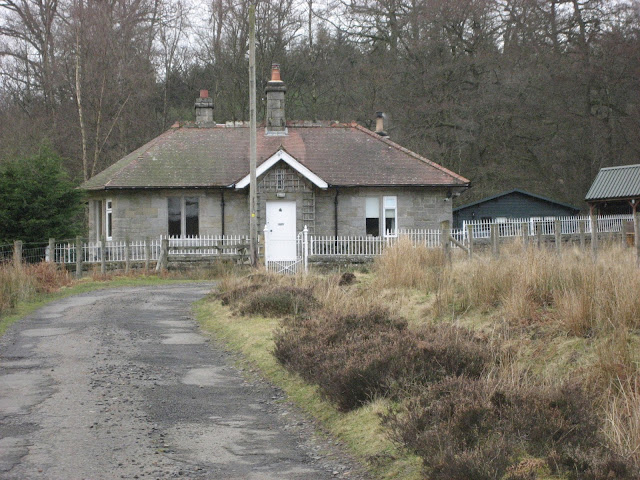
                                       Primrose Cottage.
We turned right at the cottage, through a gate and along a good track initially heading north before turning west then south again near South Cartington.
             We followed the track south at the above forestry commission sign. After about a mile we spotted the footpath marker on the right hand side of the track. The marker post has been pushed over, look out for it if you go this way. No longer on a track we took the muddy footpath uphill to the trig point at the 249 marker on the map.
              There's something about a trig point, redundant now thanks to satellites.

                      This is an outdoor art installation
We continued through the heather until we hit the track that took us east past the radio mast and standing stone to the plantation at Addycombe. There is a point here which looks directly down on to Rothbury, worth pausing and enjoying the view.


                  Rothbury and the Simonside Hills.
We took a well hidden and precipitous footpath down through the woods to Hillside Road, lined with bungalows, and followed the signs back into the town.
Changed we headed for the Anglers Arms. It being nearly John's birthday he followed the old gadgie tradition of buying a whole round, we could choose from Adnams, Bombardier or Black Sheep.
Another good day out, especially considering the amount of water Doris had left behind. The Cragside stretch was particularly good, I had never been to Nellie's Moss before.

MATRIX MMXVII  H
                                                                          steps                                miles
NAKOSITE was left at home, accidently
Dave's 3D                                                        21218                              9.77
  "" USB                                                          20617                              9.76
  "" NAK                                                         20328                              9.62
OUTDOOR GPS                                                                                    9.6
Brian's View Ranger                                                                               9.5  ?
John C                                                                                                     9.7?
Contains OS data. Copyright. Crown copyright and database right 2017


.

Tuesday, 14 February 2017

Xoдитb  с Россиянами 
  I have a few Russian friends who live in the north east. Occasionally we have a walk out, Russians and English. On Sunday February 12th we decided to walk round Hulne Park, part of the Duke of Northumberland's estate in Alnwick. It's a beautiful area, woodland, farmland, rivers, ruins and it's just past his grace's castle. You can park on the side of the road approaching the park, but you must park parallel and not at an angle like Americans, or the man in the cottage gets upset. AND YOU MUST NOT TAKE YOUR CAR OR DOG INSIDE.
Find the website and there is a map of the park with walks marked on it, or use OS Explorer 332, Alnwick and Amble. On the official park map there are three colour coded walks, yellow, blue and red, we chose the blue, approximately 6.5 miles.
There were nine of us, some qualifying as gadgies or gadgettes but only me from the regular team.

                    The entrance to Hulne Park. Drive through Alnwick, turn left at the castle gate and then left after the Duchess School.
Initially the three walks coincide and we strode out in the cold heading north east on the road. Near the track to the Park Farm we noticed the Red route was temporarily closed.
                    A fine example of a hemel, semi open barn.
After a couple of miles there is a track on the left that leads up to the Brizlee Tower, a folly built by one of the Dukes in 1781. I believe it was once possible to climb to the top, but no longer, H and S at least. We opted to give it a miss and continue on the blue walk west then north before turning east at the East Brizlee bridge and walking along Palmstrother Drive.
Soon we were at the foot of the hill on which sits Hulne Abbey, used in Robin Hood, Prince of  Thieves as  maid Marion's home. We climbed the low hill to the abbey but unfortunately disaster struck and one of our number became quite ill. But fortunately we had a doctor with us who took control of the situation, advised lying down, a little drink and some sugar. The doctor then volunteered to run to the entrance, get a car and drive round to pick up the sickly individual. On the way out of the park the car was stopped and although a good reason was given for disobeying the no car rule was given the guy on the gate was very rude.

                                            Hulne Abbey. There is a cottage inside, lights and TV on but no response to our request for help with the sickly one.

Now we were seven. We walked on past Lady's Well and alongside the River Aln.
On the opposite bank are the remains of Alnwick Abbey. Very big into abbeys in the north.
Eventually we wound our way back through woods with some impressive trees until we were back at the gate.
Unlike the gadgie walks, the Russian walks end with a meal in a pub, we drove to, guess where, the Anglers Arms at Weldon Bridge. The large fish and chips were superb.
Unfortunately one of the team suffered a heavy nose bleed. The doctor had gone. With ice cubes from the water jug and lots of help from the staff at the pub we managed to stop it.
This really is a terrific walk at any time of the year, easy and interesting. Suitable for a family walk.
I suspect the man in The Times has covered it, if not he should.


                   Two distant bviews of Brizlee Tower

Contains OS Data Copyright. Crown copyright and database right 2017

Friday, 10 February 2017

It's the biggest blooming village in the world  February 10th   (Northumberland)
As Our Gracie never sang. After last week's wander on the Wansbeck we are headed to the same area, starting a walk from Ashington, heading for the coast, going through Newbiggin and back some way along the Wansbeck.
There are seven of us, John H., John C., Dave, Harry, Ben, Ray and me. Some of us are travelling by bus from Newcastle and some by car, but we are all meeting up in what was once described as the biggest village in the world.
Haymarket bus station, Newcastle upon Tyne, M and S behind it and the round and round car park in the background


Ashington once had several coal mines,all gone. It does retain its links with the past at Woodhorn Museum, built round an old pit yard and with several of the old mine buildings still in place. Asa museum of northern life in the coal fields it is well worth a visit, not only for its displays on mining but also for its art galleries. It's free too, but there is a charge for the car park.
Ashington is famous for producing footballers: Jackie Milburn whose statue is outside the Leisure Centre and Jack and Bobby Charlton, brothers who played for England the only time we won the World Cup. (1966) Steve Harmison, England fast bowler was also born in the village.
As with last week's walk this one could easily be done without a map but if required OS Explorer 325 Morpeth and Blyth covers every step.
We got off the bus in Ashington and walked towards the Leisure Centre to admire the statue.
Wor Jackie. Jackie Milburn played for Newcastle United. I was not a big fan of his because Newcastle beat Blackpool in 1951 and Blackpool were my team although I was only seven.
We walked down the street and crossed the road at a gate which opened first onto the railway line and then the path into the Queen Elizabeth Park. We walked round the lake and past the Woodhorn Museum before turning right, crossing the road and taking the footpath past the Eucalyptus plantation.
The narrow gauge train takes visitors round the lake. The spiky construction on the museum in the background represents a coal cutting machine.
The Eucalyptus trees were grown for a local firm who used the oil extracted from the leaves. We did not see any Koala Bears, too cold probably.
At the end of the path, at Woodhorn we walked past the old mill and along the road to the power station.
The old and the new. People like ancient windmills but many are not so fond of the turbines, one of which is in the background.
 We followed the road into the power station but at a yellow finger post followed the footpath across Newbiggin Golf Course.
 Follow this finger post, unless on business you can not go into the power station.
Ellington Power Station was built to supply the Alcan smelter. The smelter shut down a few years ago and the power is now fed into the national grid.
The coast is very rocky, the path stays close to the edge but it is easy walking round the greens and fairways, just watch out for flying golf balls.
                             World War two relic. The coast was defended because there was some fear of invasion in this area, many of the beaches having a gentle slope towards the land.
Nearing Newbiggin we had to leave the path, it was too near the eroded cliff edge. We walked through a caravan site, re-emerged on the path and came round the back of St Bartholomew's church.
                                                   St Bartholomew's
 The children of Newbiggin buried a time capsule beneath this stone, to be opened in 2100.


This plaque is on the side of the Centre and Museum. Non of us had seen it before or new about the corn exporting. Learn something every day.
As last week we stopped and had a Herbie Spot outside the museum. Today's feast included ginger biscuits, flapjacks, almond tarts and chocolate. This will help replace the weight I have lost through the gadgettes insistence on salad all week.
                           Dave and John, looking cold
                                Ebb and Flo
Lunch over we walked the promenade round the curve of the bay and took the path along the cliff tops. The tide was in and instead of walking along the beach we followed the footpath through the caravan site at Sandy Bay and turned right to take the footpath alongside the river Wansbeck.
                         Looking back at Newbiggin

                Man, dog and the estuary of the Wansbeck
The footpath goes under the Northumberland Spine road, aka the A189. Shortly before the railway bridge there is a signpost pointing up a dene into a new housing estate. From here we walked the road back to the bus station. As we needed refreshment we went to the Wetherspoon's pub, the Rohan Kanhai. Rohan was a West Indian cricketer in the days when the West Indies were a powerful team. He played as professional for Ashington when not in the national side. The pub had Doom Bar, Abbott, Ruddles and several other beers,
We caught a bus back to Newcastle and decided we should visit the Three Bulls in the Haymarket. The pub had Lancaster Bomber and Black Sheep. A good day out.

The Matrix MMXVII F
                                                         steps                         miles
NAK                                                26043                      10.68
Dave's 3D                                       22079                       10.37
  ""    USB                                      21398                        10.46
  ""  NAK                                       21250                        10.39
Garmin                                                                             10,25
John C                                                                               10.4

Some agreement there I think.
Contains OS data copyright. Crown copyright and database right 2017