All around the Blooming Heather...August 30th
Late August and the heather is in bloom on the hills, acres of purple colour the familiar Cheviots and six of us are off to walk in the Bowmont Valley on the Scottish side of the hills. The team consists of Brian, Dave, Harry John and, making a welcome return, Ben, plus me so we have two cars.
To get to this beautiful valley from Newcastle take the A1 north, A697 at Morpeth and just beyond Wooler take the B6351, driving through Kirk Newington, (English) Kirk Yetholm and Town Yetholm, small Scottish towns, no passport needed yet., but the referendum approaches. Watch out for the signpost pointing to Belford on the left and follow the road to the hamlet. There is some parking on a grass verge on the left just beyond the phone box.
A map is very useful, OS OL 16 The Cheviot Hills covers the walk and the car parking area is at
GR NT 815207.
Of course we stopped on the way in Wooler for bacon or scones and tea at the excellent Terrace Café. Brian and I did think the bacon was a little too salty for our taste and knocked off a half flitch, so only four and a half this week. Very nice place though, well worth a visit, friendly staff.
The walk:
Yet another in my series of car parks, and a free one too.
We followed the metalled road that is clearly visible in the picture, heading roughly in a south east direction. Eventually the metalled road became a gravelled track near Cairoust Farm. WE have noticed that many farms these days look like scrap yards with piles of junked machinery left uncleared but this farm was immaculate and won the rare accolade of Tidy Farm of the Walk, a pleasure to walk by!
From here the track, still gravelled, followed the Cairoust Burn and climbed steadily past two artificial looking ponds, a pretty little house that looked as if it could be a holiday let, and a wood that contained a small flock of turkeys.
Waiting for Christmas, only 16 weeks to go.
Peaceful place for a holiday in the hills.
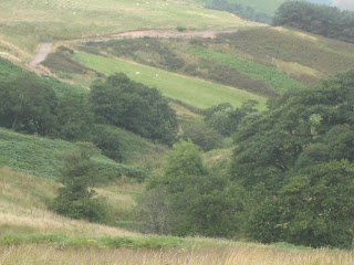
Cheviot view.
We continued on the track which we suspect was built for forestry work or to give access to the grouse moors, still heading south east until the road came to an end at a turning circle. A footpath leaving the circle in a south westerly direction took us across moorland to a wire fence and a grassy track. Harry, Ben, John and I turned left at this point and walked south east until we came to a sign post that informed us that Hownam, a target on the walk, was in the opposite direction, so we turned round. However Dave and Brian had crossed the fence and headed towards the Border Fence that marks the English Scottish boundary. We saw them once on the horizon, but never again.
The four of us headed west and were soon walking downhill in the Heatherhope Burn, with a view of the Heatherhope Reservoir which once supplied the small valley towns with water but is now disused, except by a family of swans.
Heatherhope Reservoir, home to a cob, pen and
three cygnets, plus some fish.
Any lassie would be only too happy to
go around the bloomin' heather that
is in full bloom this time of year, hiding
the grouse from the hunter, and the buzzard.
A new use for an old sheep fold.
Bee hives near the reservoir, not Manuka but good
old Scottish heather honey for your porage.
Approaching the dam we disturbed a small herd of goats. There are several herds of feral goats in the Cheviots, usually brown and white but the majority of this herd were black.
Two of the Billy Goats gruff have crossed the bridge
and await the fate of either the big bad troll or their older
brother. Will he be eaten for supper?
A light drizzle began to fall and we stopped at the deserted building beyond the dam hoping it would offer us shelter but there was no way in so we held a Herbie Spot outside, sandwiches and ginger biscuits from Ben, plus ALDI chocolate.
This area was home to literally thousands of pheasants, grouse and partridges which flew backwards and forwards across the stream and in and out of the heather. I have never seen so many together, whether it was haven from the shooters, a breeding ground for next year or just a handy meeting place I do not know. ( The OED has given its blessing to the more modern use of the word literally, but I am using it correctly, the place was crawling with them.)
The Hearherhope swans. Numbers are down this
year apparently, but here is a grand little family.
Late lunch over we continued on our way down the road in the direction of Hownam. We passed this military looking, but abandoned vehicle. It had a left hand drive and seemed French for some reason. Thinking it could be a target for incoming Tomahawk missiles we soon left and walked on to the village of Hownam.
Qu'est que c'est? C'est un auto francais.
Hownam is a pretty little Scottish village with a row of houses, a few more buildings behind and a church. First mentioned in 1165 the name is believed to come from Hunas, the name of the Iron Age tribe who lived here and built the many hill forts and settlements whose embankments can still be seen in the area, the largest being on Hownam Law, worth seeing but a stiff climb.
Hownam Village...
.... and church, which does not seem to have a
saint. An old church, restored in 1752 and 1840.
Having admired the village street we turned east up a road by what looked like the old village school. The road passed a house and became a grassy track that led us over low hills back to Belford. On the way we passed the ruins of Seefew house, so called because not many people see it, according to the locals. It was in a field of turnips, presumably winter fodder for the areas large number of sheep.
Seefew house.
Back at Belford we considered our options and chose to head for the Anglers Arms at Weldon Bridge, that home for the tired and thirsty. We left a note on the windscreen of Brian's car hinting broadly where we were.
We arrived at our favourite hostelry about 6.30 pm. On offer were Timothy Taylor's Golden Best, which wasn't, Directors and Spitfire, "The Bottle of Britain", but on draught. Very nice too.
Naturally we discussed the fate of the other two and considered going back to Belford to see if the car was still there. Not a good idea, we might pass them on the way. They are big boys with a map, experience, proper clothes and food. Give them until 8.15 pm and then think again. They arrived in the pub at 8.10 having walked further than us and, much to Dave's delight come across one of the many hill forts in the area, and some ridge and furrow fields. All's well that ends well, as somebody once said.
The Matrix MMMCVII
steps miles
ASDA Ped 24728 11.62
LIDL 3D 26999 12.16
OUTDOORS GPS 11.8
Dave and Brian claimed 16 miles and who am I to doubt them.
Bird of the blog
We saw buzzards, ravens, pigeons, grouse, lbjs and partridges but the award goes to the pheasant.
 Appendix, this could be a new feature
Dave and Brian walked due south until they hit the border fence and then turned west, continuing along the border to the mountain refuge hut where they stopped for lunch. The then retraced steps to a point east of Lamb Hill and headed north to the reservoir. At the reservoir they took a compass bearing and headed back to Belford.
Distances were:
steps miles
LIDL3D 35680 16.41
LIDLUSB 34174 16.17
Brians GPS 16
Late August and the heather is in bloom on the hills, acres of purple colour the familiar Cheviots and six of us are off to walk in the Bowmont Valley on the Scottish side of the hills. The team consists of Brian, Dave, Harry John and, making a welcome return, Ben, plus me so we have two cars.
To get to this beautiful valley from Newcastle take the A1 north, A697 at Morpeth and just beyond Wooler take the B6351, driving through Kirk Newington, (English) Kirk Yetholm and Town Yetholm, small Scottish towns, no passport needed yet., but the referendum approaches. Watch out for the signpost pointing to Belford on the left and follow the road to the hamlet. There is some parking on a grass verge on the left just beyond the phone box.
A map is very useful, OS OL 16 The Cheviot Hills covers the walk and the car parking area is at
GR NT 815207.
Of course we stopped on the way in Wooler for bacon or scones and tea at the excellent Terrace Café. Brian and I did think the bacon was a little too salty for our taste and knocked off a half flitch, so only four and a half this week. Very nice place though, well worth a visit, friendly staff.
The walk:
Yet another in my series of car parks, and a free one too.
We followed the metalled road that is clearly visible in the picture, heading roughly in a south east direction. Eventually the metalled road became a gravelled track near Cairoust Farm. WE have noticed that many farms these days look like scrap yards with piles of junked machinery left uncleared but this farm was immaculate and won the rare accolade of Tidy Farm of the Walk, a pleasure to walk by!
From here the track, still gravelled, followed the Cairoust Burn and climbed steadily past two artificial looking ponds, a pretty little house that looked as if it could be a holiday let, and a wood that contained a small flock of turkeys.
Waiting for Christmas, only 16 weeks to go.
Peaceful place for a holiday in the hills.
Cheviot view.
We continued on the track which we suspect was built for forestry work or to give access to the grouse moors, still heading south east until the road came to an end at a turning circle. A footpath leaving the circle in a south westerly direction took us across moorland to a wire fence and a grassy track. Harry, Ben, John and I turned left at this point and walked south east until we came to a sign post that informed us that Hownam, a target on the walk, was in the opposite direction, so we turned round. However Dave and Brian had crossed the fence and headed towards the Border Fence that marks the English Scottish boundary. We saw them once on the horizon, but never again.
The four of us headed west and were soon walking downhill in the Heatherhope Burn, with a view of the Heatherhope Reservoir which once supplied the small valley towns with water but is now disused, except by a family of swans.
Heatherhope Reservoir, home to a cob, pen and
three cygnets, plus some fish.
Any lassie would be only too happy to
go around the bloomin' heather that
is in full bloom this time of year, hiding
the grouse from the hunter, and the buzzard.
A new use for an old sheep fold.
Bee hives near the reservoir, not Manuka but good
old Scottish heather honey for your porage.
Approaching the dam we disturbed a small herd of goats. There are several herds of feral goats in the Cheviots, usually brown and white but the majority of this herd were black.
Two of the Billy Goats gruff have crossed the bridge
and await the fate of either the big bad troll or their older
brother. Will he be eaten for supper?
A light drizzle began to fall and we stopped at the deserted building beyond the dam hoping it would offer us shelter but there was no way in so we held a Herbie Spot outside, sandwiches and ginger biscuits from Ben, plus ALDI chocolate.
This area was home to literally thousands of pheasants, grouse and partridges which flew backwards and forwards across the stream and in and out of the heather. I have never seen so many together, whether it was haven from the shooters, a breeding ground for next year or just a handy meeting place I do not know. ( The OED has given its blessing to the more modern use of the word literally, but I am using it correctly, the place was crawling with them.)
The Hearherhope swans. Numbers are down this
year apparently, but here is a grand little family.
Late lunch over we continued on our way down the road in the direction of Hownam. We passed this military looking, but abandoned vehicle. It had a left hand drive and seemed French for some reason. Thinking it could be a target for incoming Tomahawk missiles we soon left and walked on to the village of Hownam.
Qu'est que c'est? C'est un auto francais.
Hownam is a pretty little Scottish village with a row of houses, a few more buildings behind and a church. First mentioned in 1165 the name is believed to come from Hunas, the name of the Iron Age tribe who lived here and built the many hill forts and settlements whose embankments can still be seen in the area, the largest being on Hownam Law, worth seeing but a stiff climb.
Hownam Village...
.... and church, which does not seem to have a
saint. An old church, restored in 1752 and 1840.
Having admired the village street we turned east up a road by what looked like the old village school. The road passed a house and became a grassy track that led us over low hills back to Belford. On the way we passed the ruins of Seefew house, so called because not many people see it, according to the locals. It was in a field of turnips, presumably winter fodder for the areas large number of sheep.
Seefew house.
Back at Belford we considered our options and chose to head for the Anglers Arms at Weldon Bridge, that home for the tired and thirsty. We left a note on the windscreen of Brian's car hinting broadly where we were.
We arrived at our favourite hostelry about 6.30 pm. On offer were Timothy Taylor's Golden Best, which wasn't, Directors and Spitfire, "The Bottle of Britain", but on draught. Very nice too.
Naturally we discussed the fate of the other two and considered going back to Belford to see if the car was still there. Not a good idea, we might pass them on the way. They are big boys with a map, experience, proper clothes and food. Give them until 8.15 pm and then think again. They arrived in the pub at 8.10 having walked further than us and, much to Dave's delight come across one of the many hill forts in the area, and some ridge and furrow fields. All's well that ends well, as somebody once said.
The Matrix MMMCVII
steps miles
ASDA Ped 24728 11.62
LIDL 3D 26999 12.16
OUTDOORS GPS 11.8
Dave and Brian claimed 16 miles and who am I to doubt them.
Bird of the blog
We saw buzzards, ravens, pigeons, grouse, lbjs and partridges but the award goes to the pheasant.

Dave and Brian walked due south until they hit the border fence and then turned west, continuing along the border to the mountain refuge hut where they stopped for lunch. The then retraced steps to a point east of Lamb Hill and headed north to the reservoir. At the reservoir they took a compass bearing and headed back to Belford.
Distances were:
steps miles
LIDL3D 35680 16.41
LIDLUSB 34174 16.17
Brians GPS 16


