It may be an Osprey, I don't know.(Northumberland) July5th
Another mid week walk for Dave and I, in search of the Elusive Ospreys of Kielder Water.
A linear walk, requiring two cars or a bus. We have opted for the bus so it's a proper gadgie walk with passes!
The plan, which worked this time, is to drive to Kielder village, catch the 9am bus back to the dam and walk the foot/cycle path back to Kielder. A map is not essential, the path is easy to follow but it is covered by OS OL 42 Kielder Water and Forest. To get to Kielder take the A69 west, the A68 north near Corbridge and watch out for brown signs directing drivers through Bellingham to Kielder, largest man made lake in Europe, in largest man made forest in Europe in one of the largest counties in England.
If you use the bus plan carefully, it only runs two days a week, one of which is a Tuesday and the other, I think is Friday.
Before we start:
A lady wrote a comment on the last blog, Danby and Riggs, explaining why farmers cut the perimeter of hayfields. It was to encourage tufted grass that in turn encouraged a whole range of beasties. Unfortunately I deleted the comment. My wife thinks it's a good job I am not Prime Minister because I am forever pressing computer buttons and would probably send off a missile by accident. So Anne, if you read this could you rewrite your comment please?
My sister, who lives at the north end of Edmonton, Alberta, writes to tell me that farmers there do a similar thing but it is because the perimeters are often sown with a different seed and which is harvested first. It is easier to cut the perimeter too, the tractor goes round corners in a big arc and when there is a cut perimeter he can go up and down!
The driver dropped us at the end of the dam, we set pedometers and set off north along the south shore on the well built Lakeside path.
 Starting point, makes a change from a car park.......................
The path on the lakeside at this time of the year is awash with flowers. I'm not a great one for species but along the way we saw orchids, ragged robin, horse tails, ox-eye daisies bugloss, yellow flowers, wild thyme and more.
The first point of interest along the south shore is Tower Knowe visitor centre. Gift shop and café and information on the dam. The ladies in the shop are knowledgeable when it comes to Ospreys.
 Orchids
 Clover and daisies
 Ragged Robin
We walked on, watching the lake hopefully. At Bull Crag Peninsula it is possible to cut a few miles off the walk by cutting through the marked track but gadgies go for break and we walked all the way round.
 At times the path leaves the shore and wanders through woodland and crosses feeder streams
 A very large RAF plane passed low overhead, but I just missed it.
Like the north shore this side of the water has its art:


Shortly before Leaplish we came across Freya's hut and called a Herbie Stop. The hut is sheathe3d in copper and looks across the lake to Robin's hut. The Romeo and Juliet of Kielder eventually got together.
Only two of us out but we shared pork pies and Racer bars from ALDI.
 Freya's view of the lake
 Freya's hut from the lake side...........
 ............................................and the land side
Leaplish is another visitor centre. Plenty of things for children to do, a café and also an observation point for Osprey watchers. We saw neither Ospreys or watchers. I am beginning to think the birds are a myth. Further on the path crosses Lewisburn on this beautifully designed bridge, built by the Prime Minister!


At Mathew's Linn the path goes inland around a large still pool. A group of children were being taught kayak skills on the quiet water.
 Distant kayakers
Not far beyond Mathew's Linn we past the road going down to the Kielder Column near the Bakethin weir but on this occasion gave it a miss and walked on to the bird hide nearby. Not much doing on the water, a dabchick, tufted duck with chicks, cormorants and mallards, no sign of an osprey.
In an attempt to encourage future osprey visitors a platform has been erected in front of the hide, currently occupied by a noisy crow but maybe in the future.....
 View from the hide at Bakethin
 Platform for the future, it is vertical really
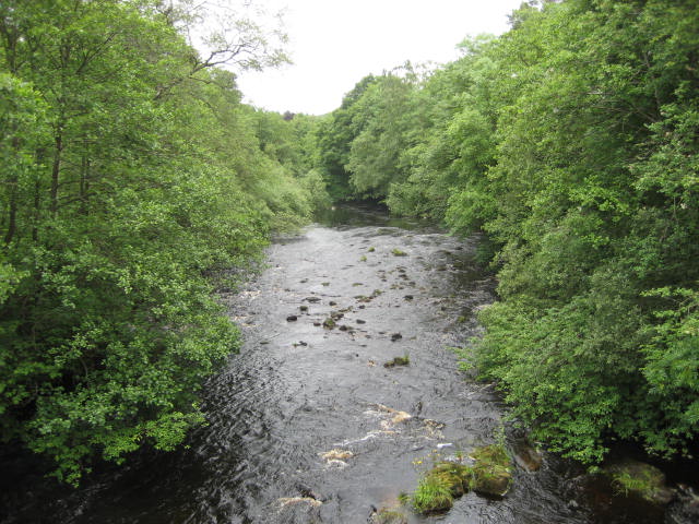
 The North Tyne at Butteryhaugh Bridge.
We were soon back at Butteryhaugh where we had left the car in front of the school and what appears to be a closed Youth Hostel.
We saw a variety of small birds, the most numerous being Siskins but failed again to spot the ospreys. Regardless of that it is a good walk, easy going and very scenic. Back again next year!
 At last a car park!

 Contains OS data Copyright. Crown copyright and database right 2016
The lower map would not scan very well, no idea why. I blame the laminate.
The Matrix MMXVI Q
steps miles
Dave's 3D 30005 14.72
" USB 29805 15.05
"NAK 29667 14.98
Etrex 4hr 44min walking 1hr 28min talking 14.74
My pedometer was ridiculous


Another mid week walk for Dave and I, in search of the Elusive Ospreys of Kielder Water.
A linear walk, requiring two cars or a bus. We have opted for the bus so it's a proper gadgie walk with passes!
The plan, which worked this time, is to drive to Kielder village, catch the 9am bus back to the dam and walk the foot/cycle path back to Kielder. A map is not essential, the path is easy to follow but it is covered by OS OL 42 Kielder Water and Forest. To get to Kielder take the A69 west, the A68 north near Corbridge and watch out for brown signs directing drivers through Bellingham to Kielder, largest man made lake in Europe, in largest man made forest in Europe in one of the largest counties in England.
If you use the bus plan carefully, it only runs two days a week, one of which is a Tuesday and the other, I think is Friday.
Before we start:
A lady wrote a comment on the last blog, Danby and Riggs, explaining why farmers cut the perimeter of hayfields. It was to encourage tufted grass that in turn encouraged a whole range of beasties. Unfortunately I deleted the comment. My wife thinks it's a good job I am not Prime Minister because I am forever pressing computer buttons and would probably send off a missile by accident. So Anne, if you read this could you rewrite your comment please?
My sister, who lives at the north end of Edmonton, Alberta, writes to tell me that farmers there do a similar thing but it is because the perimeters are often sown with a different seed and which is harvested first. It is easier to cut the perimeter too, the tractor goes round corners in a big arc and when there is a cut perimeter he can go up and down!
The driver dropped us at the end of the dam, we set pedometers and set off north along the south shore on the well built Lakeside path.

The path on the lakeside at this time of the year is awash with flowers. I'm not a great one for species but along the way we saw orchids, ragged robin, horse tails, ox-eye daisies bugloss, yellow flowers, wild thyme and more.
The first point of interest along the south shore is Tower Knowe visitor centre. Gift shop and café and information on the dam. The ladies in the shop are knowledgeable when it comes to Ospreys.


We walked on, watching the lake hopefully. At Bull Crag Peninsula it is possible to cut a few miles off the walk by cutting through the marked track but gadgies go for break and we walked all the way round.


Like the north shore this side of the water has its art:


Shortly before Leaplish we came across Freya's hut and called a Herbie Stop. The hut is sheathe3d in copper and looks across the lake to Robin's hut. The Romeo and Juliet of Kielder eventually got together.
Only two of us out but we shared pork pies and Racer bars from ALDI.


Leaplish is another visitor centre. Plenty of things for children to do, a café and also an observation point for Osprey watchers. We saw neither Ospreys or watchers. I am beginning to think the birds are a myth. Further on the path crosses Lewisburn on this beautifully designed bridge, built by the Prime Minister!


At Mathew's Linn the path goes inland around a large still pool. A group of children were being taught kayak skills on the quiet water.

Not far beyond Mathew's Linn we past the road going down to the Kielder Column near the Bakethin weir but on this occasion gave it a miss and walked on to the bird hide nearby. Not much doing on the water, a dabchick, tufted duck with chicks, cormorants and mallards, no sign of an osprey.
In an attempt to encourage future osprey visitors a platform has been erected in front of the hide, currently occupied by a noisy crow but maybe in the future.....


We were soon back at Butteryhaugh where we had left the car in front of the school and what appears to be a closed Youth Hostel.
We saw a variety of small birds, the most numerous being Siskins but failed again to spot the ospreys. Regardless of that it is a good walk, easy going and very scenic. Back again next year!


The lower map would not scan very well, no idea why. I blame the laminate.
The Matrix MMXVI Q
steps miles
Dave's 3D 30005 14.72
" USB 29805 15.05
"NAK 29667 14.98
Etrex 4hr 44min walking 1hr 28min talking 14.74
My pedometer was ridiculous


No comments:
Post a Comment