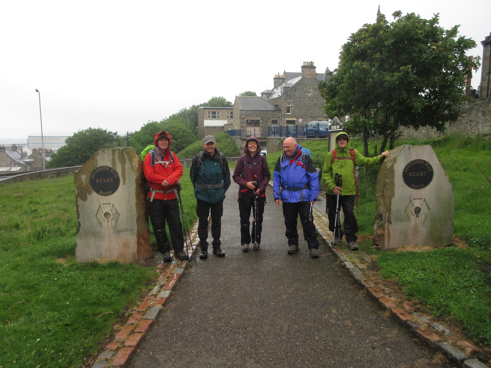
The longest day..,(Northumberland) June 21st
After the Speyside Way walk four of us are having a stroll out based on Craster, familiar fishing village in Northumberland. A1 to Alnwick, turn right and follow signs. OS Explorers 332 Alnwick and Amble and 340 Holy Island cover the walk.
Four fine fellows out today; Brian, John H., Dave and me, all having recovered from the Speyside Way.
We parked in the large car park on the right at the entrance to the village. £4 for a day.
 Classic car park in an old quarry at Craster. Worth every penny for the day and guaranteed to please my growing army of car park fans.
As usual we are calling in at the Shoreline café in Craster for breakfast: bacon sandwich, sausage sandwich, tea or coffee.

 We breakfasted on the decking outside the Shoreline café and were joined by this sparrow and his mates.
The Walk.
Breakfast over we left the café and turned to head south down the coast from Craster. (Normally we head north but the rebel element remains in all of us.) The path is well marked on the ground and on the map, it is part of the Northumberland Coast Path. Fairly flat with a few little ups and downs and always close to the coast.
 The bathing cottage, built for the ladies of Howick Hall, now a holiday let.
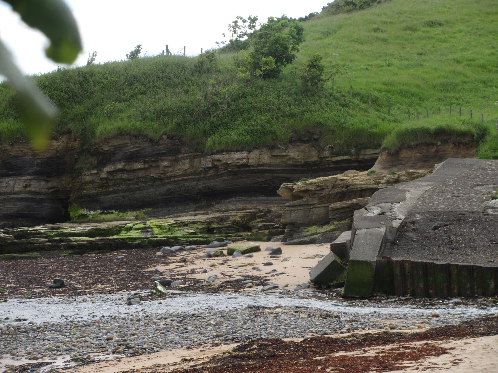
 Guano factory on the footpath south from Craster.
If you have the map enjoy the interesting names given to features along the way; Hole o' the Dike, Black Hole, Cullernose Point and Swine Dee. We followed the path to Iron Scars where the Howick Burn enters the North Sea and there is a freshwater spring on the rocks.
 Iron Scars. The spring is in the centre of the picture, on the flattish section of rock.
Here we turned through almost 180 degrees and followed the footpath to Sea Houses Farm where we turned west and walked along the road to Howick Hall, home of the Grey family of tea fame.
Although we had only walked four miles we decided the picnic tables kindly provided in the car park would make a jolly Herbie Spot.
 Our dining table at Howick Hall car park. We shared cheese muffins from Mrs A. Titans, flapjacks and out of date chocolate biscuit bars which didn't harm us.
From Howick Hall we followed the footpath across fields, one had a fine crop of thistles, behind Hips Heugh to Craster South Farm. From here we walked the road to Dunstan, through the village, past the Tower and Proctor's Stead to a footpath heading across fields to Embleton
 Follow this finger post.
Beyond Mosscrop Plantation, close to a caravan site, we reached Shirewater Low Mill and took the footpath through the woods to Low Mill Farm and Dunstanburgh Castle Golf Club. The footpath goes round the edge of the course, naturally, and passes the bird hide at Newton Pool Nature Reserve.
There were several people in the hide, equipped with some fancy looking cameras and spotting scopes. Renowned for once shouting "Ooh look, a kingfisher in a hide" I behaved myself. Not that there was much action on the pond.
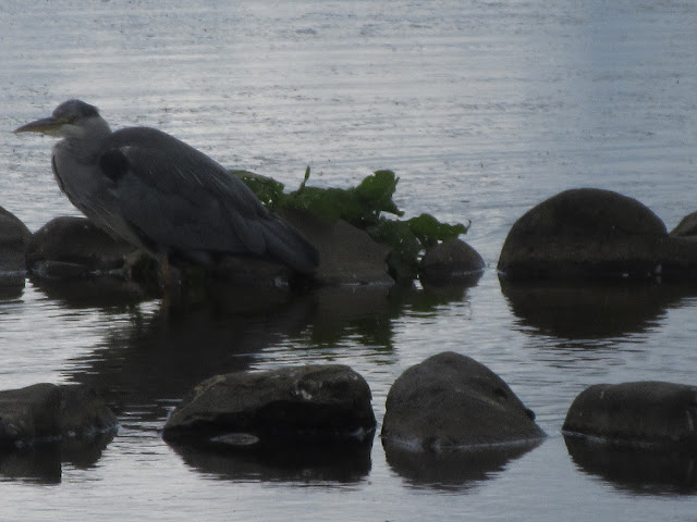 A heron is considered the sign of a good gadgie walk. This one is on Newton Pond.
Leaving the hide we walked the short distance to the square of cottages that make up Low Newton by the Sea.
 Low Newton by the sea. Mostly holiday lets now rather than fishermen's cottages, and the famous Ship Inn, good food and beer but not today.
Back in the beach, rather than joining the Northumberland Coast Path, we headed south across the sands of Embleton Bay, fairly busy with families building castles or walking their dogs.
Again the names are fascinating; Fish Carr, Scadpallet, Jenny Bells Carr and Graymare Rock.
Rumble Churn is the small bay beneath the ruins of Dunstanburgh Castle.
 Dunstanburgh from a distance
 Can't resist the famous anticline near the castle
 The Lilburn Tower at Dunstanburgh
A couple of miles across the fields from Dunstanburgh Castle on the Coast Path and we were back in Craster. (Cushat Stiel, Nova Scotia, Oxberrylaw Holes and Liverpool Hole on the way)

 Craster, famous for kippers.
Changed we headed home, calling at the Cook and Barker at Newton on the Moor for a little light refreshment.
 Secret Kingdom, Lindisfarne and Black Sheep on tap.
 Contains OS data, copyright. Crown copyright and data base right 2019.
MATRIX MMXIX 6b
steps miles
NAK (New one!) 34994 14.35 (generous)
Dave's NAK1 27879 13.2
""" """""2 27580 13.18
""""""SM 27700 13.11
Garmin 4h 36 min walk 55 min talk 13.44
OUTDOOR GPS 13.2
A few more pictures


After the Speyside Way walk four of us are having a stroll out based on Craster, familiar fishing village in Northumberland. A1 to Alnwick, turn right and follow signs. OS Explorers 332 Alnwick and Amble and 340 Holy Island cover the walk.
Four fine fellows out today; Brian, John H., Dave and me, all having recovered from the Speyside Way.
We parked in the large car park on the right at the entrance to the village. £4 for a day.

As usual we are calling in at the Shoreline café in Craster for breakfast: bacon sandwich, sausage sandwich, tea or coffee.


The Walk.
Breakfast over we left the café and turned to head south down the coast from Craster. (Normally we head north but the rebel element remains in all of us.) The path is well marked on the ground and on the map, it is part of the Northumberland Coast Path. Fairly flat with a few little ups and downs and always close to the coast.


If you have the map enjoy the interesting names given to features along the way; Hole o' the Dike, Black Hole, Cullernose Point and Swine Dee. We followed the path to Iron Scars where the Howick Burn enters the North Sea and there is a freshwater spring on the rocks.
Here we turned through almost 180 degrees and followed the footpath to Sea Houses Farm where we turned west and walked along the road to Howick Hall, home of the Grey family of tea fame.
Although we had only walked four miles we decided the picnic tables kindly provided in the car park would make a jolly Herbie Spot.

From Howick Hall we followed the footpath across fields, one had a fine crop of thistles, behind Hips Heugh to Craster South Farm. From here we walked the road to Dunstan, through the village, past the Tower and Proctor's Stead to a footpath heading across fields to Embleton

Beyond Mosscrop Plantation, close to a caravan site, we reached Shirewater Low Mill and took the footpath through the woods to Low Mill Farm and Dunstanburgh Castle Golf Club. The footpath goes round the edge of the course, naturally, and passes the bird hide at Newton Pool Nature Reserve.
There were several people in the hide, equipped with some fancy looking cameras and spotting scopes. Renowned for once shouting "Ooh look, a kingfisher in a hide" I behaved myself. Not that there was much action on the pond.

Leaving the hide we walked the short distance to the square of cottages that make up Low Newton by the Sea.

Back in the beach, rather than joining the Northumberland Coast Path, we headed south across the sands of Embleton Bay, fairly busy with families building castles or walking their dogs.
Again the names are fascinating; Fish Carr, Scadpallet, Jenny Bells Carr and Graymare Rock.
Rumble Churn is the small bay beneath the ruins of Dunstanburgh Castle.


A couple of miles across the fields from Dunstanburgh Castle on the Coast Path and we were back in Craster. (Cushat Stiel, Nova Scotia, Oxberrylaw Holes and Liverpool Hole on the way)


Changed we headed home, calling at the Cook and Barker at Newton on the Moor for a little light refreshment.


MATRIX MMXIX 6b
steps miles
NAK (New one!) 34994 14.35 (generous)
Dave's NAK1 27879 13.2
""" """""2 27580 13.18
""""""SM 27700 13.11
Garmin 4h 36 min walk 55 min talk 13.44
OUTDOOR GPS 13.2
A few more pictures