Translate

Saturday 29 April 2023

OMG! THEY MADE ME LEADER

 OMG! THEY MADE ME LEADER. APRIL 28TH

I've been walking with some members of the team for about forty years but have always been a cheerful follower rather than leader. But, because I suggested today's walk and sent  everybody a map as pdf or gpx they have decided I must lead. Panic.

The walk starts from Wylam in the Tyne Valley. Wylam  is the birthplace of George Stephenson inventor of railways and part of the family of lighthouse builders. William Hedley, another railway pioneer came from the area and of course there were coal mines here. 

The walk is covered by OS Explorer 316 Newcastle upon Tyne. Not essential but useful.

Easy to reach, head west on the A69, turn left at the signpost, head downhill, at the second junction in the village turn left for the station. Just before the bridge across the Tyne there is a carpark -free.

Wylam car park. The track on the left used to be a railway line. Now it is a walkers/cyclists/horse-riders path.
Once ready, on a day that turned out to be warmer than promised, I led the team of five westward along the track. Walking under the road bridge we soon reached Hagg Bank Bridge which once carried trains but the line joined the tracks on the south of the river soon after.

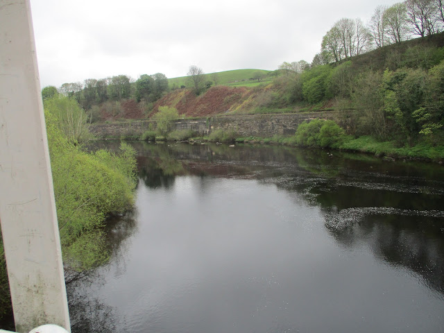
             Hagg Bank Bridge and a view of the Tyne from it. The local heroes  cross the bridge using the arches, apparently.
Once over the bridge we simply followed the footpath. At a fork in the path we took the right tine and followed the trail close to the river, hidden from the Newcastle to Carlisle railway and the Prudhoe paper works.
After 2.75 mile or thereabouts we came to the Tyne Country Park, just beyond the Ovingham Bridge and stopped for coffee.

                      Murals at the country park.
Break over I led the team over the bridge, turned left before the church, turned right after the church and spotted a stone stile in a wall, and a finger post suggesting this was the way to Whittle Dene.
And so it was. Whittle Dene climbs quite gently. The paths were quite muddy today but not as bad as some we have encountered recently. There are several holiday hideaways in the Dene and evidence of past industrial activity.


Whittle Dene, woodland and ruined buildings and very pleasant too with primroses and the first bluebells.

At the top of the dene we came to the A69, fortunately there is a bridge. Once over we went through a gate on the right, promptly turned left and walked across fields to a footbridge crossing the Whittle Burn. Once over we continued edging fields to Welton Hall, farmhouse with a Peel Tower.


Welton Peel tower incorporated into farm buildings.

The farm track took us past a reservoir to the B6318, usually called the Military Road. This section is built on top of Hadrian's Wall! 18th century vandalism.

Across the road (mile 7), we joined the Hadrian Wall trail, a footpath close to another reservoir and protected from the road by a hedge. At the corner of the reservoir there are several picnic tables and a bird hide, so we called a Herbie.


Lunchtime near the hide: Skinny whips, cookies, sweet and savoury from Mrs. A

Continuing our walk along the path we met two men who were walking the length of the wall in three days, it's about 74 miles.

At Harlow Hill the path is on the side of the road (mile 8). Just before the entrance to Albermarle Barracks we crossed the road and followed the farm track south to Northside Farm and on across fields to the A69. There is not a bridge here and the dual carriageway is busy, take care. (If you go west for a short distance there is a minor road going beneath the A69)

Once across we followed the footpath to the village of Horsley.

One of the many horses of Horsley.
We walked the length of the viallage. Just after the last house on the right a partial hidden fingerpost ponts the way across the fields to Wylam.

             Watch out for this fingerpost.
The path officially crosses several fields, some with a blooming crop of rape seed. We walked the edge of the fields with crops.

Graded excellent by Ofstile, some on the walk are inadequate.
Eventually we came to the road into Wylam. At the first junction we took the "No through Road Sign" , walked through a housing estate and reached the car park.
To rehydrate we went to the Fox and Hounds, nice pub, Timothy Taylor's on draught. Heineken non alcoholic beer too.

Contains OS data copyright. Crown copyright and database right 2023
The walk is just under 12 miles, some easy climbs. AND IT WAS VERY WELL LED

Spetchells, a man made mound from industrial slag but interesting for flora


Saturday 22 April 2023

SHIPLEY

 SHIPLEY? (Northumberland) April 21st

There is a town between Leeds and Bradford in the good old West Riding of Yorkshire called Shipley.

The nearest name to it in Northumberland is Shilbottle, the starting point for today's  walk. Easy to find, head north on the A1 and turn right at the signpost. The name comes from Old English Scipleanigas-botl, meaning "The Shipley people's buildings. " Shipley apparently means sheep pasture. There are places near Alnwick called Shipley, and thousands of them in Australia.                                                                   The walk is covered by OS Explorer 332 Alnwick and Amble. 

Because of holidays and family commitments there are four of us out today on a cool, breezy, cloudy Friday.

Entering the village we passed the Running Fox, an excellent cafe. At five pm it closes and one half of it becomes the Farrier Inn.

We parked on the side of the road near the church. There is small car park nearer the church, opposite the health spa, but it was full.

                  Free parking. Follow the road to the church.

We walked down the road, passing the secret health spa, a peel tower and the church and turned left.

                          The old vicarage with its peel tower
St James'church. Mid 19th century on the site of a demolished 12 century church.

Beyond the church we turned right and followed a road to Townfoot, a farm with several new build houses on the site. From here we walked the edge of the field to Longdyk, making navigational error which led to a lengthy discussion but all was resolved. Crossing a field to a road, crossing that and several fields and a stretch of road to Spy Law.


                        We had a sign.

From Spy Law the route crossed fields and followed tracks in a direction a few degrees east of south to High Buston. Once through the farm and its many outbuildings we were back crossing fields. Some of the fields were already sprouting crops, some were recently ploughed and harrowed. The footpath crosses fields, if not seeded we crossed them. But some farmers leave paths between the crops.


We don't feel guilty crossing fields when a path has been left.

From this part of the walk we could not only see the North Sea, the coastal village of Alnmouth, and Coquet Island but we could here the noise of the waves hitting the beach.


                  Alnmouth on a grey day.

We hit the road between Buston Barns and Low Buston Hall. Four large stones, placed in a gap in the hedge to stop people driving vehicles into the field made good if cold seats for a Herbie. Slim pickings again, Skinny Whips and mini malt loaf.

Lunch consumed we headed south, entertained by a couple of horses who hoped we had apples. They were disappointed.

Had Dave been with us we would probably gone to see the remains of the Medieval village. Fortunately he was away.

Moving on wehit a road at mile 5, followed it for a short time before spotting a finger post that pointed the way across fields to the farm at Southside, another large Northumberland set up. Seral sections of farm track later we arrived at a road, turned right and walked uphill past Harty Law. On the corner we found the finger post for Shilbottle and walked several more fields back to the village.It was 4pm. th Farriers Inn opened at 5. The coffee in the Running Fox was excellent.


Contains OS data, copyright. Crown copyright and data base right 2023.

The walk is just over 9 miles and is the first mud free walk of the year.


Saturday 15 April 2023

Five go off to Wylam and Newburn and Throckley and Heddon and Close House

 Five go off on a walk by the Tyne. April 14th

A quintet of gadgies, Brian, Ian, John H., John C and me, are out for a walk from Wylam in the Tyne Valley. Not far from Newcastle to get to Wylam head west on the A69 and turn off south at the road sign.

Drive through the village towards the station and just before the river there is a car park on the left.

The map to use is OS Explorer 316, but it's not essential.


                        Wylam car park --------------------Free!

Leaving the car park we turned left and headed towards the river. Over the Tyne we turned into the Wylam station car park and at the far end joined the Keelmans* Way.


                    The Tyne from Wylam Bridge.

The footpath runs along the river bank. It has recently reopened after closure because of a land slip. The path is close to the Newcastle Carlisle Railway line and goes round the edge of Ryton Golf Course. One section is fenced off, for years the area smoked and smelled of sulphur, supposedly from underground mine workings but today not a hint of smoke. After two and a half miles the path is close to Ryton Willows, nature reserve. There are several rowing club headquarters buildings here on both sides of the river and there were several boats out, some with two rowers, some four and at least one with an eight, plus a mini landing craft with coaches shouting orders.


                         The Tyne boatmen.

After three miles and a bit we came to Newburn Bridge, a single track, light controlled crossing, and we crossed.


                                 Newburn Bridge. (Newburn was the site of one of the early Civil War battles in 1640. The Scots won.)

Once across the river we also crossed the main village street and climbed the steps to the War Memorial. From there we followed a footpath over a small hill, past Newburn Primary School and joined a track through some well defended allotments. The track gave way to paths through Walbottle Dene and we continued gently uphill through the woods which had a healthy looking crop of wild garlic. A walker told us there were deer in the woods but we saw none.


Walbottle Dene, compares well with Jesmond Dene.

As we almost reached the A69 we crossed a footbridge and headed up a staircase of sorts to a picnic bench at the edge of Throckley. (mile 5) Of course it made a Herbie Spot.  We shared Whips, mini malt loaves and savoury and sweet cake that Mrs A had kindly sent.

Lunch over we headed through the estate to the main village road which was probably the main Newcastle to Carlisle road before the A69 was built. Crossing a roundabout we took a footpath between an off licence and a betting shop. The path was generously littered with broken glass and discarded drinks cans. We kept on downhill  past The Leazes (mile 6) until we reached the Tyne Riverside Park.

Heading west on a track that became a narrow but flat footpath we eventually came to Station Road. Turning right we walked, slowly in some cases, uphill to Heddon on the Wall.

                        Station Road, the hill seemed to go on for ever.

The path through Heddon is tricky, turning second left we threaded through an estate until we came to Heddon Banks Farm. From here we followed the road to Close House.

Close House is a grand golf course with a modern looking club house and restaurant. We decided the restaurant would not be too keen on five pairs of muddy boots.


                Close House art work and restaurant.

We followed a well marked path through the woods near the restaurant, walked the edge of the golf course and emerged on the Hadrian's Wall Path close to Stephenson's cottage and walked back to the cars,

                      Hobbit home in Close House
              There were six deer in the field

Stephenson's cottage. ( George Stephenson was a railway pioneer. In their spare time the family built lighthouses)


Contains OS data, copyright. Crown copyright and database right 2023

The walk is just over 10 miles, easy going apart from that hill.

*Keelmen rowed boats full of coal out to ships in the river.