From Anna's promontory to Vuderintuna (Northumberland) March 31st.
The forecast suggests a cold breeze off the North Sea, drizzle and showers so five of us have chosen a well worn gadgie track from Amble, a small port on the Northumbrian coast to Widdrington, a small village near the Northumberland coast.
A welcome back to Brian and Margaret who have been holidaying for several weeks, joining John C., John H. and me today.
This is a linear walk along the England Coast Path so requires a bit of planning with cars or a bus trip, which was our choice.
The walk can easily be done without a map but should you insist you need:
OS Explorer 332 Alnwick and Amble and OS Explorer 325 Morpeth and Blyth.
Initially we drove to Widdrington, first recorded in 1160 as Vinderintuna Old English for the settlement of Wuduhere's people, booted up and caught the bus to Amble. The bus goes between Newcastle and Alnwick each half hour, but check times if you decide to use it. And all being old we have bus passes.
Parked in Widdrington. (Yes we closed the doors) Holy Trinity. Widdrington. 13th century origins.We got off the bus on Amble main street, the shelter had some great art work.

,
makes a change from Liam was here.
Amble is first recorded in 1206, the name comes from Anna's Promontory apparently.
(Short form of Annabelle)
Coquet Island, a nature reserve. The first keeper of the lighthouse was Grace Darling's brother.
We walked down the street towards the cemetery, where there is parking should you decide to use cars. From here we joined the England Coast Path, passing Wellhaugh Point just before mile 1 and continuing on the track through the dunes to Low Hauxley.
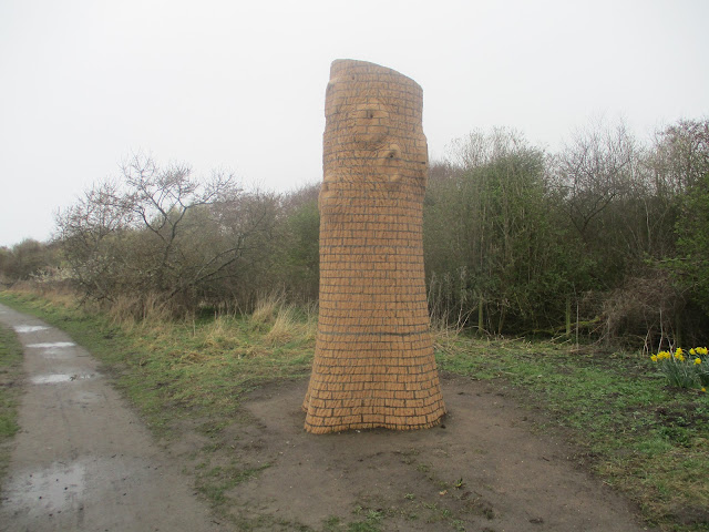
Shortly after this small settlement we turned right into the nature reserve at Low Hauxley for a cup of coffee in the visitor centre. Well worth avisit for the wild life, particularly the birds and also for some unusual art work.
Art at Hauxley: a bird nesting tower A host of golden daffodils, it was cloudy day, not so much as a lonely one Art work: a murmuration.
Coffee downed we returned to the Coast Path and walked the road rather than going down onto the beach and trudging across soft sand. This section is also the Northumberland Coast Path.
Shortly after mile 5 we took the footpath into the Druridge Bay Country Park, found a suitable bench overlooking the water and settled down to a Herbie.
View over the water from the Herbie spot: mini malt loaf, whip bars and sweet and savoury from Mrs A.Back on the track after lunch we continued along the edge of Druridge Bay until we spotted the finger post at mile 7 which sent us in the direction of Widdrington. The path passes several ponds, with several hides and we saw shovellers, potchards, geese, swans tufted ducks and teals.
There are several ponds in the area, we decided some could be a result of open cast mining but we are not sure.
The footpath took us west across wet fields to the ruin at Low Chibburn.
From 1313 to 1540 Low Chibburn was a preceptory of the Knights Templars. Closed in 1540 after the dissolution it later became a Dower House for the widow of the Widdrington estate. In 1691 an unpleasant Frenchman landed in a sulk and razed it, having failed in his raid on Tynemouth. During WW2 it was an observation post.Beyond the ruin a firm track took us back to the cars. A short distance away we visited the Widdrington Arms which served Timothy Taylor's Landlord from Keighley. A fine Yorkshire Ale, so fine I needed another.
Contains OS data, copyright. Crown copyright and database right 2023
The walk is about 8.5 easy going miles


No comments:
Post a Comment