Lady Anne, the Landlord and the Wharfedale Blonde. August 2021, Yorkshire and Cumbria.
This year's long walk is a large section of the Lady Anne Way which wanders the dales from Skipton to Penrith. Four of us, Brian, Margaret, Dave and I are walking approximately two thirds of the walk, finishing in Kirkby Stephen which used to be in Westmoreland but for almost fifty years has been in Cumbria.
As usual we have used Mickledore to organise accommodation and transfers when needed and as usual Mickledore have come up with the goods.
Lady Anne Clifford was born in Skipton Castle in 1590. Eventually inheriting a series of castles she set out to restore them and some churches. Generous towards her tenants, she built alms houses in some places.
The walk is covered by three OS maps;
OS OL 2 Yorkshire Dales, South and West
OS OL30 Yorkshire Dales North and Central
OS OL 19 Howgill Fells and Eden Valley
Please note this is not a guide just a report on our walk. There is a guide book available written by Sheila Gordon and titled Lady Anne's Way. Published by Skyware Ltd. ISBN 978-1-911321-02-06
It is also possible to download GPS maps from walkingenglishman.
Getting to the start;
Brian took the four of us plus four bags and four rucksacks to the start of the walk in Skipton.
On the way we stopped in Silsden, the small Yorkshire town where my elder sister and I were born. Yes, in the house.
Number 2, Cragg View, Silsden. No electricity, toilet in the yard, tin bath brought in from the yard. We moved when I was nearly five to a posh place with electricity and a bathroom.We lunched in a small park and moved on to Skipton, checking in to a pub/hotel called the Woolly Sheep. The owners very kindly said we could leave the car in their yard all week so it seemed only fair that we eat and drink with them, especially as the pub had a full range of Timothy Taylor's fine ales.
Great Inn, great beer. Shame to leave.
Day 1
Fully fed we walked up the high street to the church, turned left, crossed a bridge and found the start of the walk, opposite the:
The walk starts opposite the pie shop
From the start the trail goes directly north, crossing fields and the Skipton Golf Course to a road where we turned east down Brankenly Lane, under a railway bridge and on to the village of Embsay where there was a nice little coffee shop.
Morning break over we moved on down the village road, found a trail sign, cut across a couple of fields to Eastby. After a short distance on a road we joined Bark lane, a track and headed East across fields to the wonderfully named Calm Slate which seemed to be the centre of the local ice cream industry.
Ice cream van convention.Onwards to Halton East, looking for a marker, not always easy to find on the Lady Anne Way but having found it we headed north across fields and rough moorland to a road. Turning right we walked downhill, left at the junction and soon reached Barden Tower.
Barden Tower, one of Lady Anne's homes. On our walk it was being used for a wedding venue and we were politely asked to leave as it was a private party.
A little further on past the tower we turned right and crossed the River Wharfe at Barden Bridge. From here we followed the riverside path across fields to Burnsall, the stop for the night.
The Manor House at Burnsall, part of the Red Lion hotel where we ate and drank. Amongst others, the Red Lion kept Wharfedale Blonde, a fine ale in my opinion.
Contains OS data, copyright. Crown copyright and database right 2021
Day's distance 12.01 miles Running total 12.01 miles (19.3 km)
Day 2
Leaving Burnsall after the full English breakfast we crossed the river and headed north east across fields to South View where the path turned north west and after more fields we were in Hebden.
Almost two miles later we were in Grassington, pretty village devoted to tourism so naturally we stopped for coffee and a little people watching.
Looking back at Grassington.
We re-joined the LAW at the north end of the village. For the next seven miles the path crosses fields and moorland but eventually we arrived in the village of Kettlewell, too late for another coffee but after a brief rest we headed off for Starbotton. Dave and Margaret followed the official route on the east side of the river, Brian and I walked the Dales Way on the west. We all arrived about the same time at the and some enjoyed a pint of Wharfedale Blonde before checking in at the Fox and Hounds for the night. It was also the eatery for the night.
Fox and Hounds, Starbotton, cosy friendly pub/hotel.
Contains OS data, copyright. Crown copyright and data base right 2021
Distance for the day 14.12 miles Running total 26.13 miles (42.05 km)
Day 3
We left the comfort of the Fox and Hounds after a substantial breakfast of bacon, egg, sausage, beans, hash browns, mushrooms and tomatoes. I declined the Black Pudding.
Crossing the river we followed the Dales Way path close to the water until we reached Dubb's Lane, crossed over the Wharfe again and reached the village of Buckden.
Views of Wharfedale.
From Buckden we made the first climb of the walk, hauling ourselves uphill through Rakes Wood to Buckden Rake and the start of the almost eight mile walk across fairly flat moorland.
Addleborough, aka Table Mountain. Visible everywhere near Askrigg
Looking down on Seemer Water.Eventually the path started to go down from the open and rather boring moorland to the village of Worton. Here we crossed the River Ure and crossed fields into Askrigg. From Askrigg we had a pre-booked taxi to Hawes, our next stop. Having some time to wait we went to the King's Arms which sold King's Blonde.
The taxi took us to the White Hart hotel in the centre of Hawes where we stayed and ate. Great pub/hotel with an interesting local character.
Contains OS data, copyright. Crown copyright and database right 2021
White Hart Inn, Hawes. Ynnuf kcolc.
Distance for the day13.45 miles Running total 39.58 miles (63.7km)
Day 4.
After the usual breakfast we were taken back by taxi to Askrigg. As on day 3 we had cut out the last section of the LAW we walked back across fields to Worton and then to Nappa Hall, a small ruin. From Nappa we returned to Askrigg although we managed to get split up and I finished in a very fine but private garden. Back, eventually in Askrigg we had coffee before setting off again.
From Askrigg the path heads west across farm land until it reaches Sedbusk, small village but some shelter from the rain which had started. After a break we continued through a succession of spring stiles which are sometimes so narrow it's a squeeze through. Having reache Simonstone House, a fine looking hotel we headed down hill to Hardraw and the Green Dragon, once visited on the Tributaries Walk (qv).
Simonstone House hotel It has fine views too Green Dragon at Hardraw. Timothy Taylor's Landlord on draught. Just what was needed after a hard day's walk.
From Hardraw it was a short walk across the fields back to Hawes and dinner in the White Hart. On the way we watched two young ladies and one collie round up a flock of sheep and drive them on. Two girls and a dog, good idea for a TV programme.
Contains OS data, copyright. Crown copyright and database right 2021
Day's distance 10.15 miles Running total 49.73 miles (80 km)
Day 5
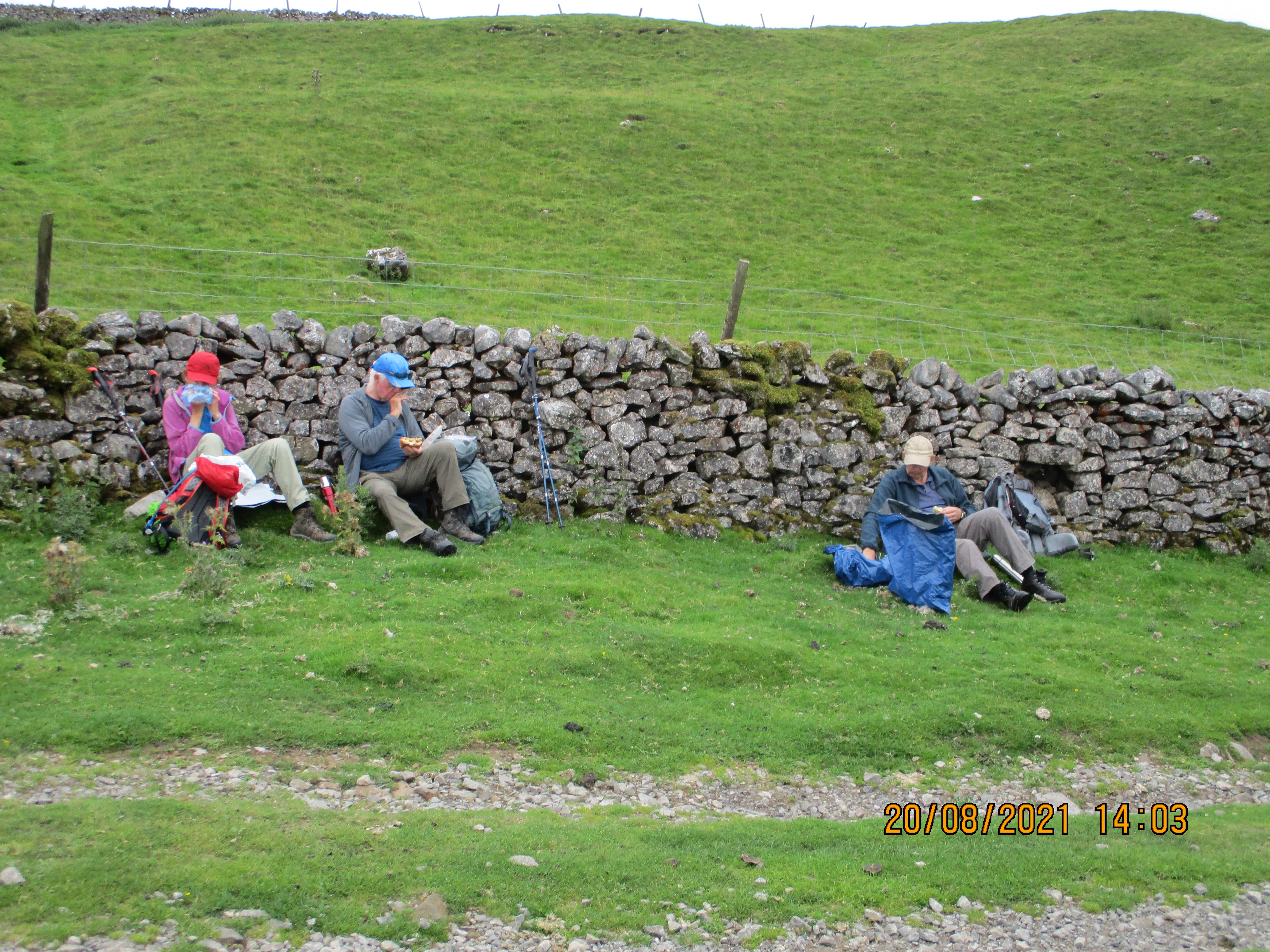
After another substantial English style breakfast we set off again from Hawes, walking through the village to find the LAW path which initially heads west across fields then north to the hamlet of Appersett. From here we followed the River Ure to Collier Holme Farm where we started a long steep climb up Cotter End. Fortunately there was a bench at the top for a well earned rest. Once on the move again we had an easy walk contouring along the Highway which is possibly an ancient drove road. We crossed Hell Gill Bridge which was rather disappointing , continued on Old Road to The Thrang where we crossed the valley road and crossed fields to Outghill.
The taxi took us to Redmayne House in Kirkby Stephen where we were welcomed by Liz and Rob. An offer of tea and cake was very welcome and Liz kindly offered to have our wet clothes dried.
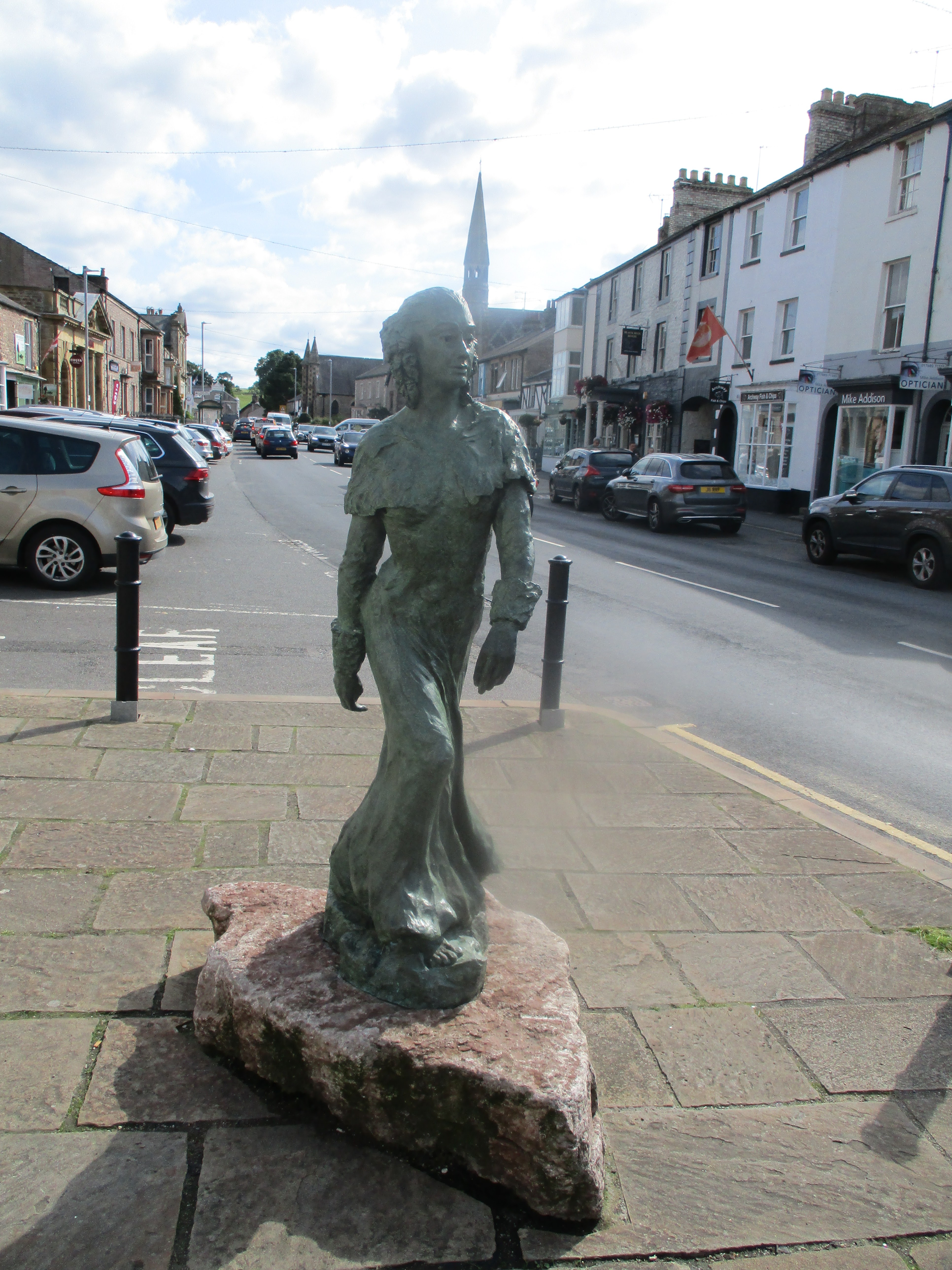
Art on the hillAt Outhgill we had a short wait for our pre arranged taxi. We waited under a Yew Tree in the grounds of St Mary of Mallerstang, a church restored by Lady Anne in 1663
St Mary of Mallerstrang, Outhgill Staue of Lady Anne Clifford in Kirkby Stephen Redmayne House, parts of which date from 1648
In the evening we took a taxi to the Black Bull in Nateby. A very busy pub, obviously popular on a Sunday but they supplied us with a welcome dinner and Bombardier ale.
Black Bull at NatebyContains OS data, copyright. Crown copyright and database right 2021
Day's distance 11.76 miles Running total 61.49 miles (98.9km)
Day 6.
Breakfast over were taken by taxi back to Outhgill on the last day of our walk. Going back through the churchyard we crossed the river and headed north to Pendragon Castle, another ruin.


From the ruin we followed footpaths over fields and down narrow lanes. Some of the lanes were so narrow and the nettles were so high we could have done with a achete or two. The route bypassed Nateby, following the River Eden, crossed a dismantled railway and entered Kirkby Stephen by Frank's Bridge, the start of a popular local walk. After tea in the town we headed back to Redmayne House to freshen up before a final meal on the walk back at the Black Bull in Nateby.
Contains OS data, copyright. Crown copyright and database right 2021.
Day's distance 6.2 miles Final total 67.69 miles (109km)
Going Home
Next day, after a large breakfast, we were taken by taxi to Kirkby Stephen station from where we caught a train to Skipton. Once of the train, and watching it disappear, one member of the party admitted to having left a rucksack on board. The railway company were very helpful. Unable to contact the train directly the rucksack loser was permitted to travel on the next train to Leeds where the item was still on our train, which fortunately had not started its return. The sack was retrieved, the owner returned to Skipton and we set off home. Those of us who remained in Skipton wandered the town and viewed this fine statue.
Fiery Fred, great Yorkshire and England bowler. My childhood hero.
And a few views on the way.