A walk in the woods...............Dec 11th(Northumberland)
Today's walk is a repeat of another popular stroll round Thrunton Woods in Northumberland. Five gadgies; Brian, Dave, Ben, Harry and me set off for the start. As we approached the plantation it began to rain heavily so an executive decision was taken and we headed for Craster on the coast.
If you start from Newcastle and don't go off to Thrunton follow the A1 north and just beyond Alnwick turn off for Denwick and follow signs to the fishing village of Craster. There is a car park as you enter the village, with an information centre and toilets, which become increasingly important as you get older. The car park costs £2 for the day, a bargain.
Info, toilets, car park.
The rain had not caught up with us but it was cold. Booted and hatted and coated we set off to the Shoreline Cafe in the village. Some had tea, one had coffee and one indulged in a bacon sandwich.
Inside the Shoreline. Notice the poster with its north east dialect words and phrases and with gadgie incorrectly spelt. Translations are available for a fee.
The walk; the map to use is OS Explorer 332 Alnwick and Amble.
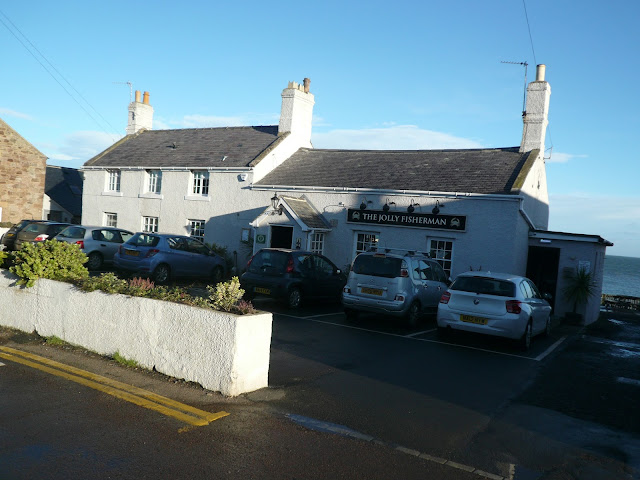
From the cafe we headed past the Jolly Fisherman pub to the harbour.
Popular with tourists for its crab lunches and sandwiches. Gets a mention in the "where to eat in the frozen north" columns of the quality papers.
Craster harbour. Once busy exporting stone for roads, now for pleasure and fishing.
We walked past the cottages that face the harbour and headed across the fields to Dunstanburgh Castle.
Two views of this once massive castle, home of the Gaunts and resting place for Queen Margaret of Scotland before she sailed off to Denmark.
We walked past the castle, which is always worth a view even if it is a ruin. Not far north of the castle is the famous anticline, mentioned in many a blog and probably photographed by many a geology student.
An anticline, arch shaped folded rocks!!!!
And close by is a WW2 pill box.
The path skirts the edge of the golf course. It was a very windy day, the players were struggling to control their balls.
But there is a fine view of Embleton Bay to be enjoyed.
The grand sweep of sandy Embleton Bay
We turned left along a footpath to Dunstansteads and turned left again along a fairly straight concrete track. It is supposed to another relic of WW2 when the area was used by the army. And at some point along the track we came across a rather dilapidated corrugated barn filled with bales of straw. It made a comfortable Herbie Spot. After yesterday's meagre rations we were back to normal. Mince pies, Yorkshire flapjacks, Ben's ginger biscuits and gorgeous chocolate cake from Mrs A. Ans all enjoyed with a view of Dunstanburgh Castle.
Planning the next move. Or looking for a needle.
Lunch over we continued on the concrete strip, past an old lime kiln and an unusual WW2 pill box.
Lime Kiln
It is constructed of concrete "sand bags"
At the end of the track we came to Dunstan Square, walked through it and continued across fields before turning south west for \the hamlet of Dunstan. The path through Dunstan takes a bit of finding; near a stone bus shelter is a cottage, Anchor Cottage. The narrow path is in front of it, it narrows further but eventually emerges on a short piece of road near Craster Tower.
Craster Tower, mentioned as long ago as 1415, remodelled in the 19th century and now a holiday place.
An arch near the Craster Tower
Just beyond the tower we turned left and walked a short way along the road before turning up the lane at Craster South Farm and heading south across fields below Hips Heugh, across another field and up a muddy lane to the back end of Howick Hall, home of the Grey family, famous for tea and the Great Reform Act of 1833.
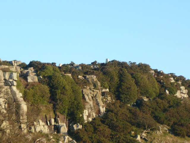
Hips Heugh, with trig point
We turned left down the road, left again to the hamlet of Howick, left on the road and then joined the Northumberland Coastal Path back to the car park in Craster.
Changed we headed for the Greys pub in Embleton which had several beers on offer including a delightful Blonde from Creedence Brewery in Amble, Alnwick ales and Tyne 9. We were entertained by a young woman who had had a long day in the pub and a restaurant. A works' do of course.
The Matrix MMXV ZZZ
steps miles
LIDL3D 20295 9.17
NAK 22350 9.52
Dave's USB 18065 8.55
" Nak 18508 8.6
etrex 8.4
Brian's GPS 8.52
Contain OS data Copyright. Crown copyright and data base right 2015
A couple of extra photographs of the castle, taken by Harry on his new camera, sharper and brighter than mine I think.
Today's walk is a repeat of another popular stroll round Thrunton Woods in Northumberland. Five gadgies; Brian, Dave, Ben, Harry and me set off for the start. As we approached the plantation it began to rain heavily so an executive decision was taken and we headed for Craster on the coast.
If you start from Newcastle and don't go off to Thrunton follow the A1 north and just beyond Alnwick turn off for Denwick and follow signs to the fishing village of Craster. There is a car park as you enter the village, with an information centre and toilets, which become increasingly important as you get older. The car park costs £2 for the day, a bargain.
Info, toilets, car park.
The rain had not caught up with us but it was cold. Booted and hatted and coated we set off to the Shoreline Cafe in the village. Some had tea, one had coffee and one indulged in a bacon sandwich.
Inside the Shoreline. Notice the poster with its north east dialect words and phrases and with gadgie incorrectly spelt. Translations are available for a fee.
The walk; the map to use is OS Explorer 332 Alnwick and Amble.
From the cafe we headed past the Jolly Fisherman pub to the harbour.
Popular with tourists for its crab lunches and sandwiches. Gets a mention in the "where to eat in the frozen north" columns of the quality papers.
Craster harbour. Once busy exporting stone for roads, now for pleasure and fishing.
We walked past the cottages that face the harbour and headed across the fields to Dunstanburgh Castle.
Two views of this once massive castle, home of the Gaunts and resting place for Queen Margaret of Scotland before she sailed off to Denmark.
We walked past the castle, which is always worth a view even if it is a ruin. Not far north of the castle is the famous anticline, mentioned in many a blog and probably photographed by many a geology student.
An anticline, arch shaped folded rocks!!!!
And close by is a WW2 pill box.
The path skirts the edge of the golf course. It was a very windy day, the players were struggling to control their balls.
But there is a fine view of Embleton Bay to be enjoyed.
The grand sweep of sandy Embleton Bay
Planning the next move. Or looking for a needle.
Lunch over we continued on the concrete strip, past an old lime kiln and an unusual WW2 pill box.
Lime Kiln
It is constructed of concrete "sand bags"
At the end of the track we came to Dunstan Square, walked through it and continued across fields before turning south west for \the hamlet of Dunstan. The path through Dunstan takes a bit of finding; near a stone bus shelter is a cottage, Anchor Cottage. The narrow path is in front of it, it narrows further but eventually emerges on a short piece of road near Craster Tower.
Craster Tower, mentioned as long ago as 1415, remodelled in the 19th century and now a holiday place.
An arch near the Craster Tower
Just beyond the tower we turned left and walked a short way along the road before turning up the lane at Craster South Farm and heading south across fields below Hips Heugh, across another field and up a muddy lane to the back end of Howick Hall, home of the Grey family, famous for tea and the Great Reform Act of 1833.
Hips Heugh, with trig point
We turned left down the road, left again to the hamlet of Howick, left on the road and then joined the Northumberland Coastal Path back to the car park in Craster.
Changed we headed for the Greys pub in Embleton which had several beers on offer including a delightful Blonde from Creedence Brewery in Amble, Alnwick ales and Tyne 9. We were entertained by a young woman who had had a long day in the pub and a restaurant. A works' do of course.
The Matrix MMXV ZZZ
steps miles
LIDL3D 20295 9.17
NAK 22350 9.52
Dave's USB 18065 8.55
" Nak 18508 8.6
etrex 8.4
Brian's GPS 8.52
Contain OS data Copyright. Crown copyright and data base right 2015
A couple of extra photographs of the castle, taken by Harry on his new camera, sharper and brighter than mine I think.


No comments:
Post a Comment