From the Tyne to the Wall. June 27th
Back in Northumberland after the Cotswolds Way today's walk starts and finishes in Corbridge. The small town on the banks of the Tyne has a Roman fort. Corstopitum, a bridge that withstood the great flood of 1771 and a book shop. It also has a free carpark on the south side of the river.
Well that was the plan and I had already written the title but the weatherman told us to expect rain all day near Corbridge so we made a quick change and walked from Earsdon.
Earsdon is a village east of Newcastle and slightly north of Whitley Bay. Close by is a garden centre where we met for breakfast. And close by the garden centre is a parking place on the roadside.
The Earsden Garden Centre, good for breakfast and plants, is on a narrow road parallel to the main link between Earsden and Holywell. At the north end is enough room for several cars to park.
Parking near Earsden Garden Centre.
Once booted, and lightly dressed on a warm morning we set off, walking the road back towards Holywell. Once across the road bridge we took the footpath back across the burn and into the dene on the south bank. The footpath through the woods wanders along, occasionally climbing up stairs then down again, passing a footbridge until we reached the road into Hartley.
Holywell Dene and an old railway bridge.At Hartley we crossed the road and took the path to the coast, passing the Delaval Arms and the Blue Stone.
The Blue Stone outside the Delaval Arms. It once marked the centre of Hartley Village. (Now gone) Weighing between 400 and 440 pounds (200 kg if you must) it was lifted in 1776 by Willy Carr, the strong man of Blyth. Also lifted more recently but unlikely to be stolen.
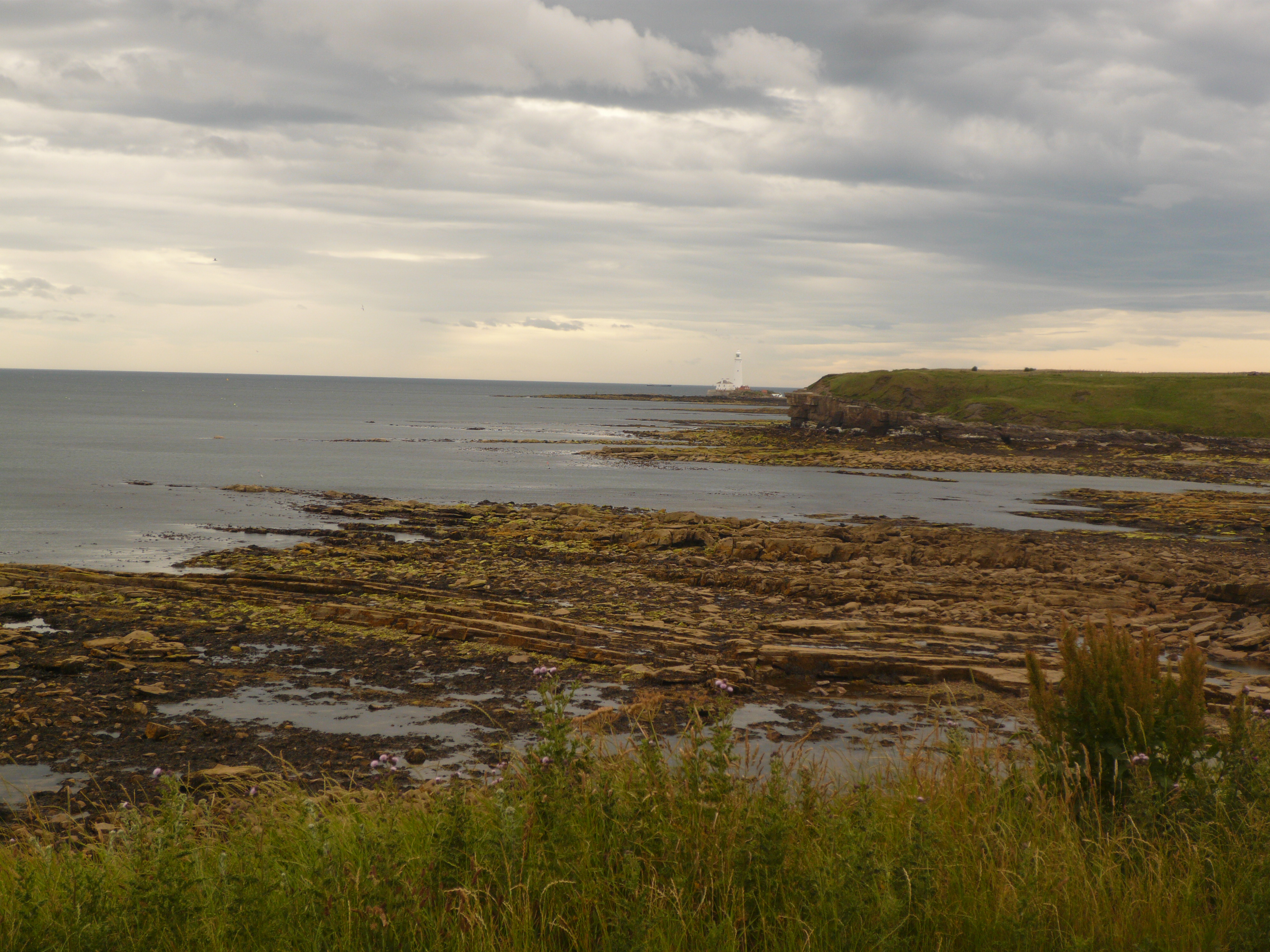
We followed the footpath on the cliff tops round Collywell Bay (Known as Collywobble Bay in our house), passing Charley's Garden, a lump of rock in the bay, before settling down on benches behind the Kings Arms for a Herbie. (Cherry Bakewell's, ginger biscuits, flapjacks and sweet and savoury from Mrs A.)
Charley's Garden and the lunch-spot view. St Mary's lighthouse just visible.
After a rest and and lunch we carried on round to the harbour at Seaton Sluice.
Seaton Sluice Harbour, once a busy port for coal and glass. The sluice, built toflush out the harbour is gone.The mermaid at Seaton Sluice
The cut, carved out to make a dock. We took the footpath down to the harbour, crossed the dene on the footbridge and went under the road bridge to re-enter the dene on the north bank. We climbed the steps out of the dene near the famous Starlight Castle, built as a bet by one of the Delaval family in 1750 and now a ruin. We missed it.
Once out of the dene we followed what looks like, and probably is, an old wagon way, heading south west in a straight line, crossing the Tyne and Wear heritage Way and coming to a halt at the hide at Holywell Pond Nature Reserve.
Herons, geese, swans, gulls, grebes but not a Kingfisher to be seen. Leaving the hide we continued to Holywell Village, past the Fat Ox and then turned left to find a gate back into the dene. After a stretch of woodland we left the dene and headed south on a track on the edge of the fields. Beyond Holywell Grange Farm we turned left. edging more fields, before we were back at the cars. Unusually we went to the garden centre for tea and cake before going home.
At one point on the walk we passed the house of a fellow gadgie who was away. Cheekily we rang his doorbell, it was one of those with a camera. We offered greetings but were surprised when the fellow gadgie replied. He was in a pub by the Tower of London! Amazing.
Contains OS data, copyright. Crown copyright and database-right 2025


No comments:
Post a Comment