It's been a long time since we've walked the Carey Burn. Northumberland. June 2nd
The Carey Burn, a stream that joins the Harthope is one of my favourite Cheviot walks.
A narrow valley leading to Broadstruther, it always seems remote. There is the chance to see a peregrine heading out from its rocky home, there are adders to avoid, but they usually avoid humans.
The walk, as usual, starts at Carey Burn bridge. Take A1 north, A697 to Wooler, in the town take the first left (Cheviot St) after a couple of miles follow sign for Harthope on the right and after a couple more turn right for Harthope. Up the hill, pass the interestingly named Skirl Naked, downhill and park on the grass on the right just before Carey Burn bridge. Who needs GPS?
The walk is covered by OS OL 16, Cheviot Hills. Breakfast in Wooler first at the Terrace Cafe.
This week's scenic car park by the Carey Burn Bridge. There is a warning that livestock may be on the road. A passing herd of cattle once sprayed a car!
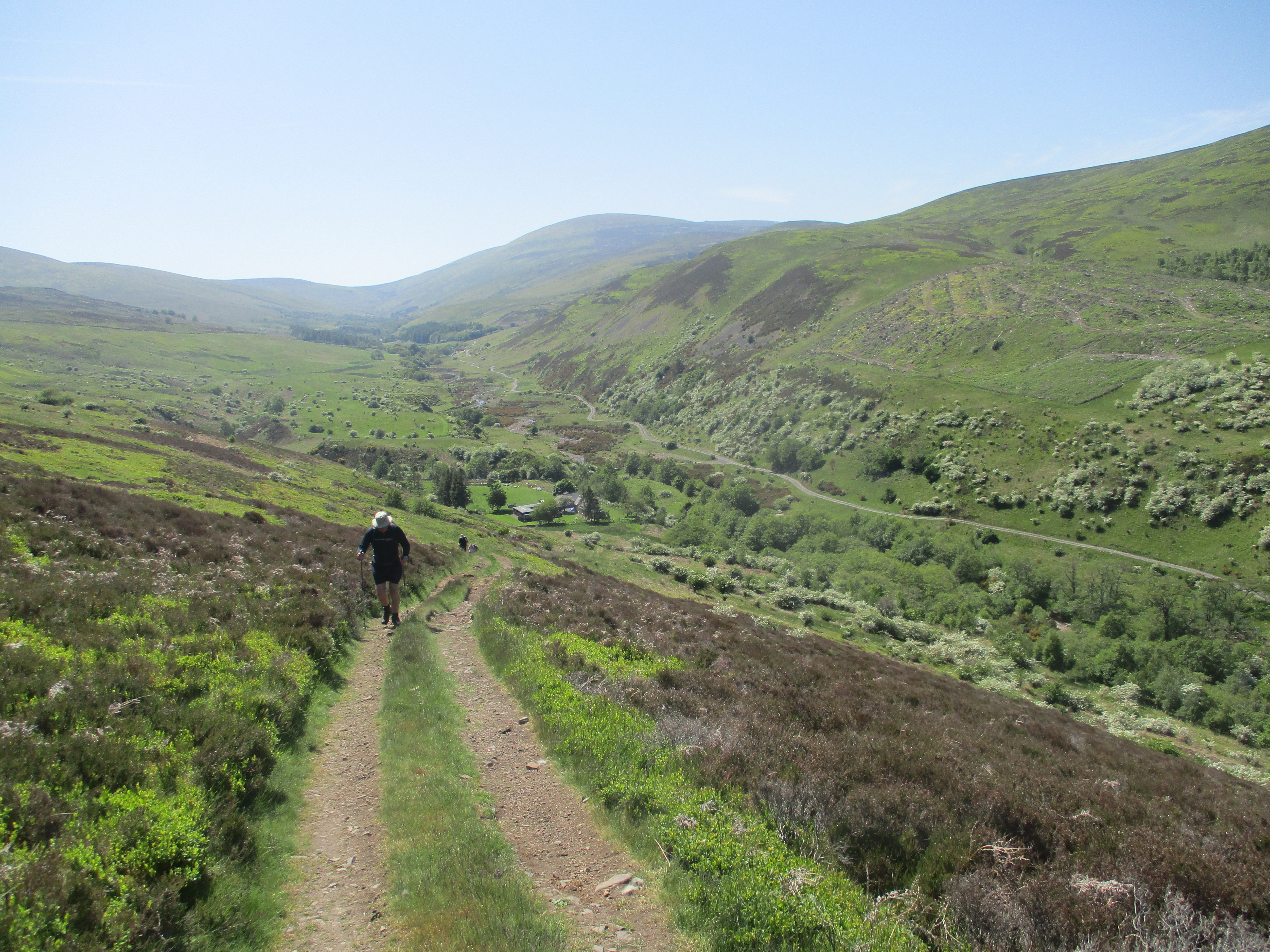
Just beyond the car park and before the bridge, a finger post points the way up the Carey Burn. The footpath stays close to the stream, at times a grassy track, at times a scree and at times a short rocky scramble. Unusually I was leading the column of seven and spotted a plump adder on the path ahead but it slithered swiftly away before anybody else saw it.
Carey Burn waterfall, it has been very dry recently. And a general view of the valley.
Eventually the trail enters woodland and reaches a footbridge across the stream.
Footbridge across Carey Burn
Looking down the stream from the bridge.Over the troll free bridge the grassy track is easy going and reaches a second crossing at the Broadstruther Burn. From here a good farm tracks climbs gently and turns to Broadstruther.
Broadstruther. Once farmhouse, then a ruined farmhouse and now a refreshment centre for shooting parties after August 12.
A hundred yards from the building there is a marker on the left that points the way to a footpath which crosses the moorland in a southerly direction until it meets a farm track that brings walkers to a gate. Ramblers can turn left and walk up Cold Law or, as we did, continue on the track down Hawsen Burn. At one point down the hill a marker (mile 4) on the left indicates a footpath that takes walkers to the Harthope Valley. Once we had reached the valley floor we sat on the bank by the side of the road for a Herbie: blackcurrant and apple pies, cookies, savoury tart and cake from Mrs A.(mile 5)
Lunch over we walked along the road towards the farm at Langlee. here the day's outing took us across the stream, round the side of the farm and then up the long incline to Brands Hill. And it seems long and steep too.
Looking down the Harthope Valley from the track at Langlee.
Once at the top we headed east across fields. There are several iron age settlements in the area including the site of Middleton Old Town. Having past a couple of deserted tumbled down houses (but not iron age) we followed the track to a marker on the left hand side. This took us down to a footbridge and then a footpath that followed the Coldgate Water as Harthope Burn has become. Eventually, several fields and a stretch of woodland later we came to another footbridge and we were on the far side of Carey Burn Bridge itself and near the cars.
On the way home we stopped for a needed rehydration (it had been a warm day) at the Ridley Arms in Stannington. Blacksheep and a couple of blondes. (beers that is, not ladies)
Contains OS data, copyright. Crown copyright and database right 2023
This walk is 9 miles with one steep climb but worth it for the scenery.


No comments:
Post a Comment