Simonburn II (Northumberland) February 10th
MUD WARNING
After last week's aborted effort to walk from Simonburn because of traffic problems we are going again. That is: me, Brian, Margaret, Harry, Ian and Joh H.
Simonburn is in the North Tyne valley: west on A69, turn north beyond Hexham through Acomb to Cholerford, take B6320 heading for Wark and watch out for sign on the left.
OS OL 43 Hadrian's Wall covers the walk.
We had bacon sandwiches at Brockbushes Farm Shop and cafe on the Corbridge roundabout. Always good.
Brockbushes for tractors and breakfast
Close to the church in Simonburn there is a car parking area for about a dozen vehicles, free too but sadly no benches for sitting on to boot up.
Car park. St Mungo's church behind, 13th century but built on the site of an earlier place of worship.
Once ready we left the car park, walked past the east end of the church and took the path up Castle Lane, steep but short climb to start the day.
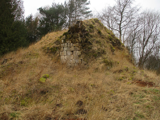
We passed the ruins of Simonburn castle, and ruins they were.
Simonburn castle ruins, it dates from early 15th century
At the stream we turned left and walked along Castle Dene , leaving it at a marker for the farm at Fenwick Field, first of several farms today. Heading south across muddy fields we came to Greenhaugh, turned right on a good road, chatted briefly to some dog walkers as we crossed Slaterfield Fell.
We turned right, then left and began the long haul over the muddy Simonburn common to Great Lonbrough.. (Dotted line on the map is our route, continuous line planned walk)
Just beyond Barley Hill, still on open muddy moorland we made use of a dilapidated sheepfold for a Herbie.
Post Herbie, M and B prepare for the second half. (Cherry almond tarts, cookies, sweet and savoury from Mrs A)
After the break we trudged in the drizzle on a north east direction passing beneath Ravensheugh Crags.
Ravensheugh Crags. Heugh comes from Old English hoh or heel and is a rocky place where stone can be easily quarried. Not to be confused with haugh mentioned last week.
Beyond Ravensheugh we reached a road, crossed it almost immediately and continued on our muddy way to Shielahaugh and high Moralee. Once round the farm we walked more muddy fields to Bleaklaw and on to Conshield.
Turning south we headed for Allgood Farm, crossed the Red Burn and walked south east back to Simonburn
Once changed we headed for the Wellington at Riding Mill for Blacksheep, Ipa, alocohol free or coffee.
Contains OS data, copyright. Crown copyright and database right 2023.
The walk is about 10.5 miles, easy going but muddy in winter.


No comments:
Post a Comment