A Brandy on Windy Gyle
Northumberland. May 6th
Ii is John's birthday again. Following a tradition going back twelve years his birthday is to be celebrated with a trek to Windy Gyle and downing a brandy at Russell's Cairn on the border between England and Scotland.
To get to the start of the walk go north on A1, A697, turn off at Weldon Bridge, go through Rothbury, turn off for Alwinton, go through the village and continue to a car park on the left at Barrowburn.
The map to use is OS OL16 The Cheviot Hills.
There are seven in today's team: Brian, Margaret, Ian, John L. Dave, myself and Julie, a member of the Green's Walking club who has opted to join us.
This week's car park at Barrowburn, also marked as Wedderleap in honour of the rustler who stole an ewe and tried to leap across the River Coquet with it but failed.
Leaving the car park, as the rain started, we crossed the river using the footbridge that presumably wasn't there when the rustler pinched the sheep, crossed a field and headed north passing the old village school which is now a holiday let.
Footbridge over Coquet and old village school.
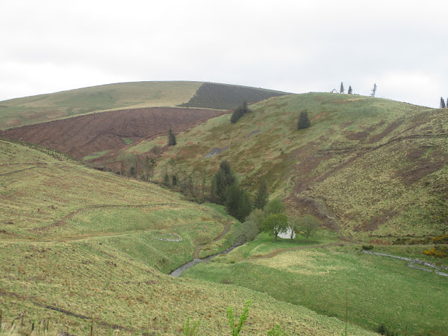
The path, quite well marked, heads north, contouring Kyloe Shin, crossing Middle Hill and another, unnamed bump until it reaches a cross track, which is like a cross road but for tracks. (2.5 miles) Heading north east takes the walker to Uswayford and a walk through a plantation until it joins the more direct route followed by us today. This route goes alongside Hazely Law and Hazely Slack climbing steadily until it reaches open moorland and a gate on the border between England and Scotland. (mile 4)
Brian, Ian, Margaret, John, Dave and Julie. They are in Scotland, the photographer is in England.
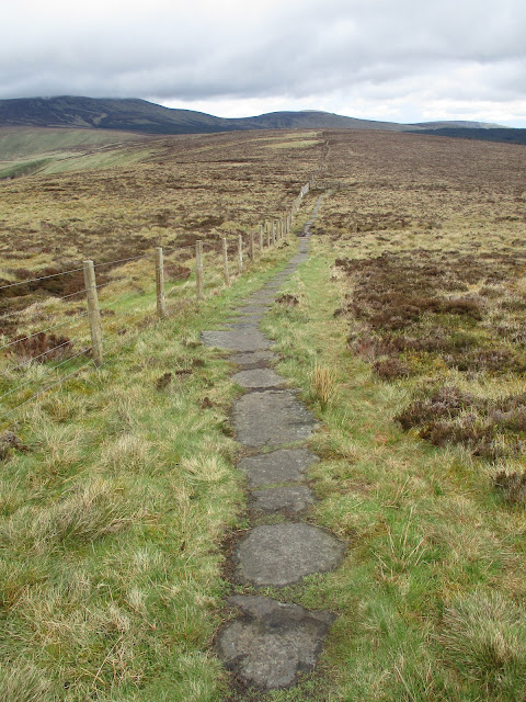
On the English side of the border fence is a footpath made from good old Yorkshire Mill flagstones. Probably as well, otherwise it would be rather boggy, although there has not been much rain recently. Until today that is, dark clouds scudding in from the west, dampening the soles but not the spirits.
This section of the walk is on the Pennine Way, the longest long distance footpath in England and Scotland.
True Yorkshire GritDave, a professional archaeologist says this is the real Russell's Cairn. It is on the Scottish side of the border and is in memory of Lord Russell, an English aristocrat who was slain on the spot by the Scots as he tried to make peace negotiations in July 1585
Some few hundred yards further on and also on the Scottish side is the large burial cairn marked as Russell's Cairn on the OS map. It is the burial site of an iron age chieftain, possibly and there is enough room in its circular walls for seven of us to have a Herbie.(mile 5)
Herbie time at Russell's Cairn, possibly. Ian is mostly hidden by John. I'm incognitoIt was John's birthday. To celebrate he very kindly brought along a bottle of brandy, enough paper cups and some birthday cake. Happy birthday John. This is the third time we have celebrated his birthday in this spot. A tradition in the making.We also shared apple pies, savoury tarts, apple cake and chocolate cake. Strangely I lost two pound in weight on this walk. (1kg approx)
A dreek view of Bonnie Scotland, land of oats and whiskey.
Lunch over we continued to follow the Pennine Way and the border fence, passing the delightfully named Split the Deil, (no idea what it means), crossed the Foul Step which is a bit steep and the small stones act like ball bearings until we came to Plea Knowe.(6.5 miles)
From here we headed south on good moorland tracks with several gates and stiles to negotiate. Fortunately all gates were easy to open, stiles are getting difficult for older gadgies. The track climbs several smaller bumps and of course has to come down from them. The views are well worth pausing for, even on a damp May day.
More storm Arwen devastation. Gonna be some great bonfires this November!
This track is called the Street and crosses Black Braes, Swineside Law and Hindside Knowe until it finally comes down to the valley bottom and the Rowhope Burn. On one hillside we spotted some of the famous feral Cheviot goats, Too distant to photograph and too smelly to approach but....
Billy goat Gruff, on a bluff.
There is a small car park (mile 10) where the track hits the valley road. From there we walked back to the car park. Changed we headed for the Rose and Thistle in Alwinton. Great pub, had only one beer on today, Northumberland Gold from Hadrian Brewery. So good we had several, apart from the noble drivers of course.
Rose and Thistle, food, drink and maybe accommodation.


No comments:
Post a Comment