On the road again. Mostly St. Oswald's (Northumberland) January 14th
Last Friday the boys started the year with the traditional walk from Blyth, along the coast to North Shields. I was unable to join them, being isolated with covid. But today I am unchained having served my 10 days and, along with several of the others, off for a walk based on Felton, a village in Northumberland.
Easy to find, head north on the A1 and turn off at the signpost for Felton. There is parking in the village and also an excellent cafe, the Running Fox. Sadly it was fully booked so some of us went to its sister cafe at Shilbottle.
A team of six: John H., John C., Margaret, Brian, Dave and me. And a perfect day for a winter walk, blue skies, no wind and a temperature of about 6C. Fleeces came off after the first mile!
Maps: OS Explorer 325, Morpeth and Blyth; OS Explorer 332 Alnwick and Amble.
Felton is on the north side of the River Coquet, on the south side sits West Thirston. The two are joined by a 15th century bridge, now used by pedestrians, and a 2oth century concrete span. The parish church, St. Michael has roots in the 12th century, with lots of later additions and extensions. The name Felton comes from Old English "Feld tun", meaning field farm.
There didn't seem to be a car park so we left cars on the street outside the Running Fox cafe.
Parking in Felton, in front of the Running Fox, a cafe well worth visiting, but book first, always busy.And finally the walk:
Walking away from the river, passing the cafe, we went uphill for a short distance before turning off on the right and going down Mouldshaugh Lane, tarmac and easy going.
Should have moved the twig. It says "No grown ups allowed", so we walked on. Soon we reached the farm at Mouldshaugh where Dave and I initially mistook the sound of some farming or DIY implement for a woodpecker.
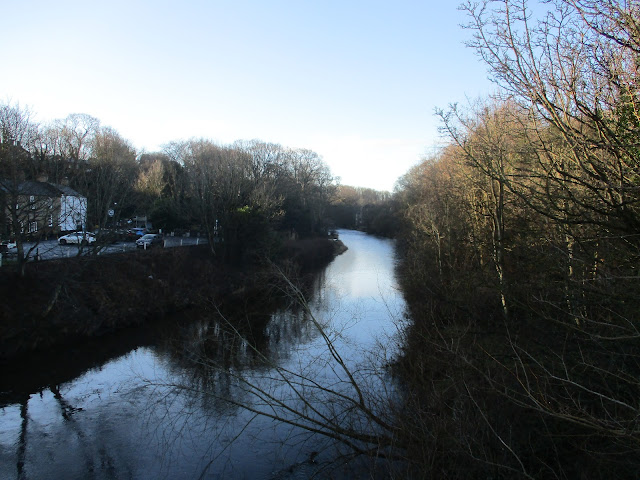
Mouldsclough dovecoteAt the farm (1 mile)we followed the signpost's direction across a field and entered a wood above the River Coquet, a bit on the muddy side but a lovely walk for about a mile before we left the river side (2 miles), crossed fields and re-entered woodland. Staying close to the river we passed some areas of interest to industrial archaeologists; remains of iron works and water mills. Close to a horse shoe shaped weir we came across the memorial to soldiers who had died in a tragic accident in 1945. Young trainees, fully equipped, their boats capsized.
Memorial near the weir. (DLI is the Durham Light Infantry, DWR is the Duke of Wellington's Regiment)
Just beyond the memorial we joined the road going downhill, turned right and crossed the river (3 miles)
On the north bank are the remains of a chapel.
The weir where the accident happened. River Coquet.
We stayed on the road, shortly after passing Acklington Park we took the footpath on the left, across a field to Morwick Banks, another muddy, woodland footpath above the river. Leaving the wood (mile 4) we crossed fields, crossed the main east coast railway line very carefully and headed for Morwick House (5 miles). Morwick house has an ice cream shop/ cafe, unfortunately closed today but we made use of the picnic tables for a Herbie.
A lady came out of the building, said it was fine to eat there but would we please take our rubbish away with us as the bins had been taken indoors for winter. As one we chorused we were all well brought up and of course would not leave a scrap. ( I left my apple core for the birds).
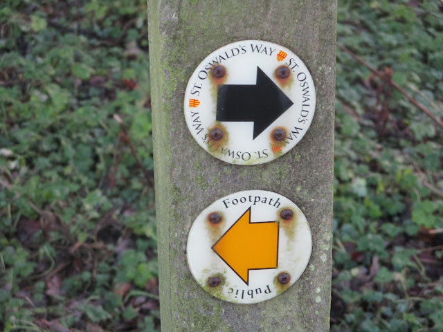
Apple pies, cookies, almond slices, savoury buns and cake from Mrs A Worth calling in for the ice cream when open.We headed south for a short distance before joining St. Oswald's way and turned east along Rake Lane.
Going under the east coast railway line (6+ miles) we followed the green and muddy lane to Low Park and onward to North/ South Park Wood (8 miles) Once through the woods we walked on a road downhill before joining the riverside path again. At this point St. Oswald's Way is in open fields which are though to have been the site of a Viking camp. (9 miles) Eventually we reached West Thirston. The footpath had been damaged by flood or storm Arwen or both and we had to take a diversion before heading down towards the bridge in Felton again. (10 miles)
Having scraped off some of the mud and changed we went to the Northumberland Arms in West Thirston. Lovely pub, friendly staff and Rigg and Furrow or Tyneside Blonde ales were on offer.
Contains OS data, copyright. Crown copyright and database right 2022.
The walk is 10 miles, easy going with only a few gentle slopes.
The old bridge at Felton. it once carried the main Great North Road.


No comments:
Post a Comment