The Schill is a Hill, on the border.
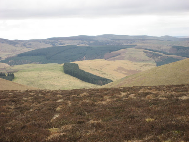
Still in lockdown and still obeying the rules, walk locally and with only one other, so today is another revisit. We have not done this walk since 2015. The high point is on the border between England and Scotland with superb views over the lands once plagued by thieves and rustlers - from both countries.
The walk starts in the village of Kirk Yethom, a couple of miles over the border from England. At the moment the Scots are not too keen on people crossing the border as, under lockdown rules, we are asked not to travel far but to exercise from home. Hopefully in the near future things will return to normal.
To reach the start A1 north, A697 at Morpeth, through Wooler and turn left at Millfield, through Kirknewton and find the village of Kirk Yetholm.
There is a small village green next to the Border Hotel and a few benches too, always useful for booting up or down.
The map to use is OS OL 16, The Cheviot Hill, recommended too.
Full team out today and beautiful sunny weather too.
Car parking in Kirk Yetholm. Sharp eyed readers will notice this photo was not taken in JanuaryThe Border Hotel. It is at the end or the beginning of the Pennine Way, Long distance walk between here and Derbyshire. If you finish here you can claim a half pint of beer as a reward, thanks, it is said, to the generosity of the great Alfred Wainwright.
This lane is the end/beginning of the Pennine way, it passes a building called Penial House which, as you can imagine, caused some merriment in a group of older men.
After about a mile the the Pennine Way offers alternatives. Take the higher route close to the ancient fort on Great Humbleton, or the lower route. We chose the latter, it climbs at a gentler rate as it follows Halter Burn, past a farm of that name and later Burnhead. Sticking close to the burn we came to Old Halterburnhead, having left the fields behind for more open moorland.
Close to the hill with the delightful name of Black Hag (more likely a reference to peat bog, not an ancient crone) the two Pennine Way tracks become one on the last steep stretch up to the Schill.
A distant view of the Schill.
Close to the summit there is a fence, easily climbed and within yards, the rocky top, which makes an excellent Herbie Spot, seating for all as we shared biscuits, cakes and pies while admiring the views.
Final few steps to the top of the SchillOnce we had lunched we retraced our footsteps back down from the Schill, taking again the lower of the two Pennine Way routes. But at the point labelled Piper's Faulds on the OS map we took the footpath on the left that follows the Curr Burn. This footpath follows close to the burn which eventually becomes the Clifton Burn. The footpath goes through Clifton, no more than a few houses nd then reaches the Bowmont Water at Primsidemill.
The geese of Clifton Burn.


No comments:
Post a Comment