Ladycutters, Lightwater and Lingynook. (Northumberland) Oct 23rd.
This week's walk is based on Corbridge, pretty little Northumberland town on the north bank of the River Tyne. The town has a long history, there is, nearby the ruins of a Roman fort, Corstopitum. The bridge was built in the 17th century, replacing older structures. In 1771 the Tyne flooded and every bridge over the river was washed away apart from the one at Corbridge.
There are a eight of us out today so to conform with Covid Rules we have split into two groups of four and kept ourselves well spaced out. Team one; Brian, Margaret, Dave and me. Team two; John x 3 and Harry. We met in the car park on the south side of the river, a large and free one. Prior to meeting some had breakfast in Brockbushes farm shop and restaurant on the roundabout just before the exit from the A69. It was very busy, happy families were out picking pumpkins for Halloween.
The walk is covered by OS OL 43 Hadrian's Wall and is advisable.
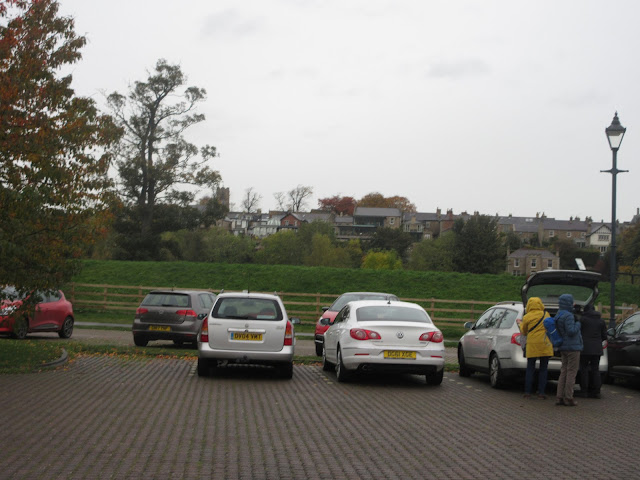
Pumpkin pickers at Brockbushes Corbridge free car park with the town across the river.Once we had all assembled and booted up we headed south along the road towards the Corbridge Station, passing the Dyvels Pub and the Valley restaurant.
Newcastle train at Corbridge.
Not far across the bridge we found the signpost on the right (Tyne trails by Daft as a Brush marker) and followed the footpath uphill across a couple of fields and over Ladycutters Lane to a minor road. Turning right we walked the road to the next junction, turning right again to Temperley Grange. From the Grange we followed a footpath on the edge of a field due south to the next minor road where we turned left towards Dipton House. Just before the house we turned right and followed the footpath through the eastern edge of Dipton Wood, crossing Hunter's Hill and coming out of the wood at Todburn Steel.
Muddy track on an autumn day. The alpaca turned away at the last moment. Probably heard Dave's awful joke "You can call me Al"We walked across more fields and North Road to arrive at Peel Flatt Farm in Slaley Vale. The village of Slaley, which is one long road of individual houses is visible on the hill. The friendly farmer at Peel Flatt directed us across his fields towards Black Burn stream and East Woodfoot .
Autumn defying tree near Peel Flatt East WoodfootNot far fro East Woodfoot is West Woodfoot! Turning right on a well made track we walked a short distance before settling down on the bank on the roadside for a Herbie.
Herdwick sheep, usually found on the Cumbrian Fells. Socially distanced dining. Bramley apple pies, chocolate rolls, flapjacks, biscuits and from Mrs A a savoury snack and gorgeous chocolate cake which included a dash of beetroot!
Lunch over we continued up the track to the North Road, turned left and after about 100 yards spotted the footpath sign on the right which took us through a small wood and a couple of fields to a minor road.
Fearsome horns but they were placid.
After following the road between Lingynook Plantation and Dipton Wood for a short distance we turned right, passing Lightwater Cottages before turning onto a narrow footpath.
Lightwater Cottage.
The footpath, narrow and deep in places, eventually joined a forest track and we walked through woodland to a road, crossed it and followed another stretch of road until we found the signpost on the left saying Corbridge was 2 1/4 miles away. After crossing a couple of fields and walking the edge of Snokoehill Plantation we came to Ladycutters Lane, turned right, walked the lane for a short distance before turning left into the fields back down to Corbridge Station and the car park.
On the way home we stopped at The Duke of Wellington in Riding Mill for rehydration.
Contains OS data, copyright. Crown copyright and database right 2020
THE WALK IS ABOUT 10.2 MILES, SOME MUDDY SECTIONS AND LOTS OF STILES TO CLIMB OVER.


No comments:
Post a Comment