He's hiding in the woods! (Northumberland) Aug 3rd
Most families have their children's expressions that were amusing at the time. This is one of ours but it is relevant to today's walk out because four of us are off to Thrunton Woods to find McCartney's Cave. We have done this walk several times over the year but have never found the cave but armed with a GPS it should be easy. WE four are Brian, Margaret, Dave and me, To get to the start, the car park at Thrunton Wood, head north on the A1, turn off on the A697 and take the narrow road on the left that crosses the Coe Burn. But do stop at the Thrunton Woods Cafe, by the burn, only been open a few weeks, lovely staff, eat inside or, as we did, sit in the sun outside.
The walk is covered by OS Explorer 332 Alnwick and Amble.
 Last week's car park photo was heavily criticised so I took several on this walk. This is the best in my opinion, no open doors, no cars crossing lines. It's pretty too, and free.
The walk:


Most families have their children's expressions that were amusing at the time. This is one of ours but it is relevant to today's walk out because four of us are off to Thrunton Woods to find McCartney's Cave. We have done this walk several times over the year but have never found the cave but armed with a GPS it should be easy. WE four are Brian, Margaret, Dave and me, To get to the start, the car park at Thrunton Wood, head north on the A1, turn off on the A697 and take the narrow road on the left that crosses the Coe Burn. But do stop at the Thrunton Woods Cafe, by the burn, only been open a few weeks, lovely staff, eat inside or, as we did, sit in the sun outside.
The walk is covered by OS Explorer 332 Alnwick and Amble.

The walk:

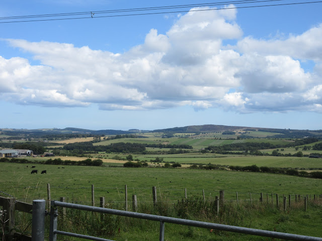
Rather than walk on the road we headed up the first forest track just north of the car park and turned right down a footpath that brought us back to the road. We followed the road to the Forrest Office where we entered the wood on a forest track and walked along it, climbing steadily until we were close to the Iron Age Fort at Castle Hill. Giving it a miss, (been there, seen that) we spotted a gate on the left, walked through it and began the search for the cave.

Go through this gate to find the cave,#.
The cave is at GR NU 060095, approximately but we had to wander the many narrow footpaths, going uphill and down until a final short steep section brought us to the spot.


We took turns to look inside .Quite small, just about possible to stand up but rather cosy.
One crossed off the bucket list we climbed a steep bank, carefully avoiding saplings, until we came to an open space suitable for a Herbie. (Titans, Cherry Bakewell tarts and a piece of cake from Mrs A.)
Lunch over we took the footpath going roughly south west, past a cairn near Hob's Nick and out onto open moorland over Hard Nab.

Cairn near Hard Nab. Great view for the chieftain who may have been buried here.
The footpath is narrow and a million boots have worn it into a channel in places. It descends to the infant Coe Burn and then climbs, still a narrow channel at times to Long Crag.

The long walk up to Long Crag. Two young men were carrying their Mountain Bikes up the path, and they had a dog.

High on the hill sits a lonely Trig Point.
We followed the footpath along the ridge past Coe Crags and then downhill until we reached the footbridge over the Coe Burn.


Once over the burn we turned left and decided to have a mini Herbie using the roots of this tree as a seat.
HS2 over we followed the forest track as it turned northwest then north then north east before bringing us back to the road and the car park.
On the way home we called in at the Shoulder of Mutton in Longhorsely. It had several beers on offer including:

Eeh lad, it's right champion is that.

Contains OS data, copyright. Crown copyright and database right 2020
No Matrix but we agreed the walk was about 10.5 miles
A few pictures though;


No comments:
Post a Comment