The gadgies of Wooler Common are we. (Northumberland, July 10th)
Great news, pubs have reopened, with restrictions, but they have opened. As a result at the end of today's walk we may get a pint, or a coffee.
Today's walk starts from Wooler Common, known to gadgies as "Who let the dogs out" simply because on one occasion we were there an ice cream van played this "tune" instead of the usual chimes.
To get there, A1, A697, turn into Wooler and turn up the road signed "WOOLER COMMON". After a couple of miles there is a car park on the right, and a nature trail.
The walk is on OS OL 16 The Cheviot Hills and a map is advisable.
Good team out today: Dave, Brian, Margaret, John L., John H, Harry and me.
The forecast is for a mainly dry day with some showers.
 Today's car park, surrounded by woodland and free!
We left the car park crossing a stream by means of a footbridge and as soon as we got into the wood took the footpath on the left which climbed up to a gate. Like good boys and girl we made sure it was closed once we were all through.
 Off we go.
All safely through we followed the footpath across a field before turning almost due north to walk a grassy track, passing an upturned trailer on the right, wheels in the air like a dead animal. I'm sure it used to be the right way up.
Some distance down the track we went through a gate on the left and started to climb Humbleton Hill. A steep climb so early in a walk. On the top are the remains of an Iron Age Hill fort and close by is the site of the Battle of Homildon Hill, fought between the English and the Scots in 1402. On this occasion the English won. (Homildon is the old spelling of Humbleton)
 Piles of stones now but once they were protective walls, possibly 9 feet high.
 It's a bivallate fort, two sets of walls.
 Marked on the OS map as a Currick which is a northern word for cairn. The "benches " are fairly new.
 Looking east
Having admired the view, and rested, and talked to a chap taking his five year old grandson for a hill walk we moved on.
The path goes initially just north of west before turning north east and also, thankfully, going downhill.
At one point we came to a farm track heading north but we took the footpath alongside walls around the side of Harehope Hill. At one point a fairly fat adder slithered across the grass but before I could get my camera out it disappeared into the bracken. At a gate in the wall we turned right and walked down to the farm at Gleadscleugh.
 Gleadscleugh
At the farm we took the track heading south west, passing a very square enclosure on one side of the valley.
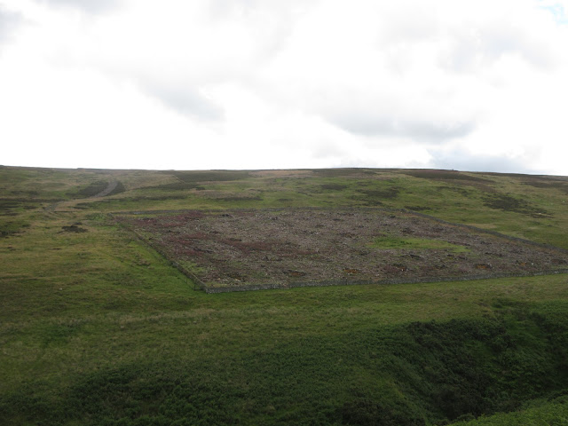
Square and bare.
We finally reached a gate, turned right and walked uphill for a few hundred yards before deciding a grassy bank would make an fine Herbie Spot.


 Hebie Spot and view. We shared Gold bars, Titans, Ringtons brilliant ginger biscuits, biscuits and almond tarts from Mrs A.
Having filled up, and it felt like it after non sharing days in lockdown, we walked a short way to admire Tom Tallon's Crags, although we could only really get a bit of a glimpse of the top of them. We decided it wasn't worth going that extra mile to look at an old tor.
 Tom Tallon's Crag
From here we headed south on a rough track to Commonburn house which had a number of dogs in the kennels. I think they are used for hunting.

 Commonburn House and dogs.
(If you want to shorten the walk follow the tarmac road from the farm, it goes directly to the car park)
From the south side of the house we took the footpath across fields and crossed the Common Burn using the footbridge. At this point it started to rain, heavily so we sheltered in the wood, hoping there would not be a thunderstorm. When the shower stopped we walked the footpath over the moor to Broadstruther, that well known Herbie Spot on previous walks. The footpath is well posted and easy to follow although Harry and I reminisced about the day we crossed it in deep snow, it was hard going.
 6/7ths of the team at Broadstruther
 Broadstruther looking very tidy. Shooting starts on August 12th and this place is used as a shooting lodge, lunch spot and so on.
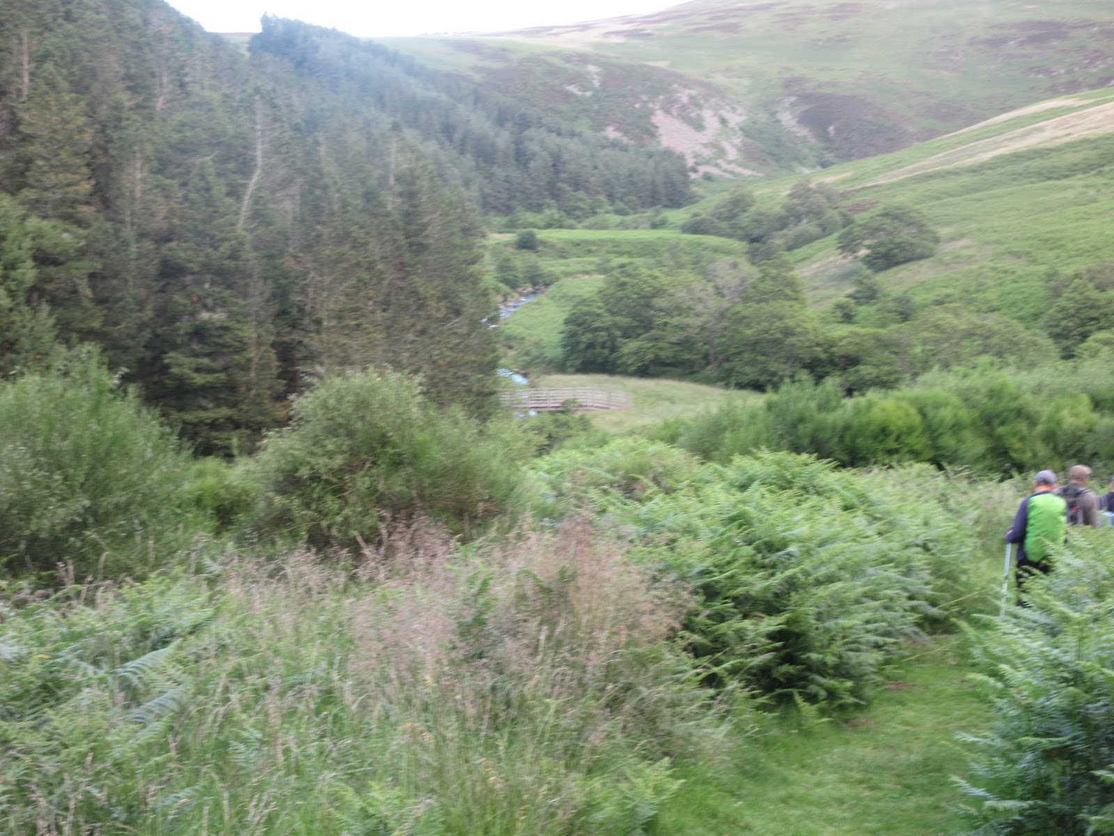
From Broadstruther we followed the farm track down to the Hazelly Burn, crossed the stream and followed the footpath down to the familiar Carey Burn.

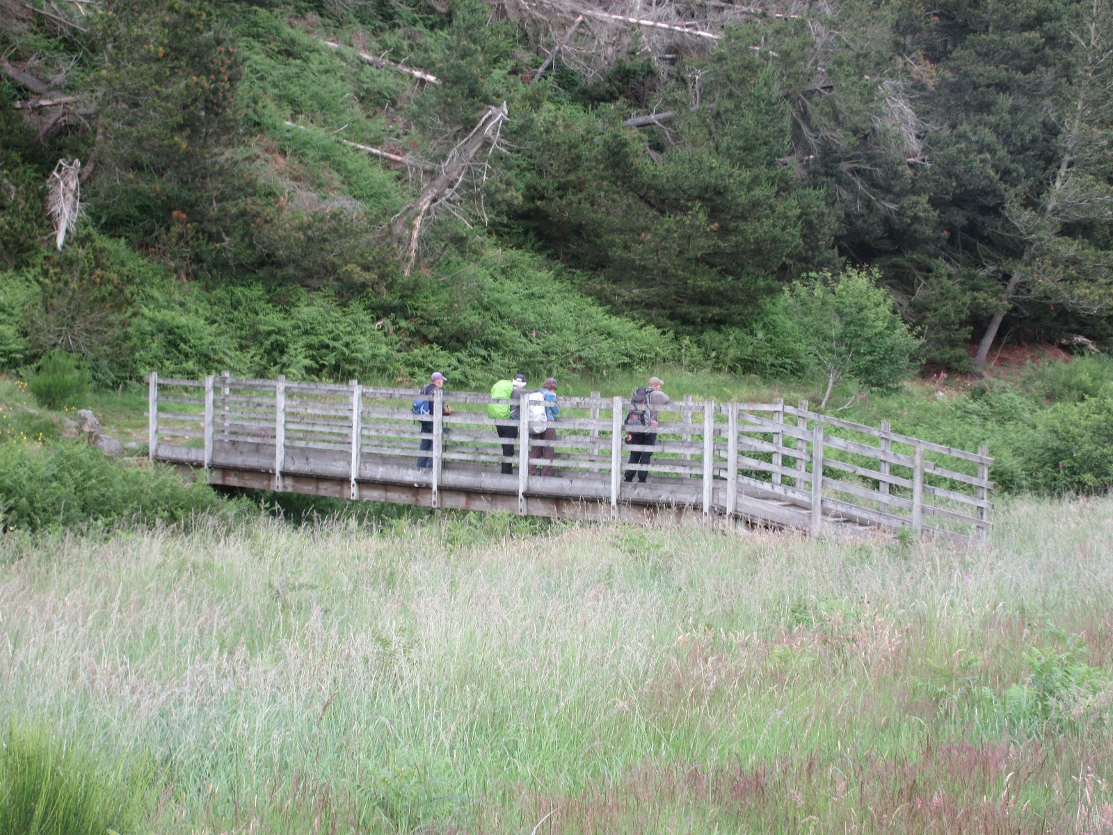
 Walking down to the burn and crossing the bridge.
From the bridge we headed east to the point where the path divides. The right fork goes to the famous Carey Burn bridge. The left, which we took climbs steeply on what is called the Hell Path. It levels out, thankfully, crosses fields to a farm and then the footpath crosses a couple of fields and goes down to the car park.
On the way home we stopped at the Shoulder of Mutton pub in Longhorsely. Restrictions apply, give your name and phone number but getting back to a pub after a walk really made the day. Sadly I was driving!
 Contains OS data, copyright. Crown copyright and database right 2020
And a matrix.
steps miles
NAK 1 29304 11.1
Dave's NAK 1 24424 10.4
""""""""""""2 24455 10.42
SM 24413 10.4
OUTDOOR 10.3
Brian 10.2
And a few more


Great news, pubs have reopened, with restrictions, but they have opened. As a result at the end of today's walk we may get a pint, or a coffee.
Today's walk starts from Wooler Common, known to gadgies as "Who let the dogs out" simply because on one occasion we were there an ice cream van played this "tune" instead of the usual chimes.
To get there, A1, A697, turn into Wooler and turn up the road signed "WOOLER COMMON". After a couple of miles there is a car park on the right, and a nature trail.
The walk is on OS OL 16 The Cheviot Hills and a map is advisable.
Good team out today: Dave, Brian, Margaret, John L., John H, Harry and me.
The forecast is for a mainly dry day with some showers.

We left the car park crossing a stream by means of a footbridge and as soon as we got into the wood took the footpath on the left which climbed up to a gate. Like good boys and girl we made sure it was closed once we were all through.

All safely through we followed the footpath across a field before turning almost due north to walk a grassy track, passing an upturned trailer on the right, wheels in the air like a dead animal. I'm sure it used to be the right way up.
Some distance down the track we went through a gate on the left and started to climb Humbleton Hill. A steep climb so early in a walk. On the top are the remains of an Iron Age Hill fort and close by is the site of the Battle of Homildon Hill, fought between the English and the Scots in 1402. On this occasion the English won. (Homildon is the old spelling of Humbleton)


Having admired the view, and rested, and talked to a chap taking his five year old grandson for a hill walk we moved on.
The path goes initially just north of west before turning north east and also, thankfully, going downhill.
At one point we came to a farm track heading north but we took the footpath alongside walls around the side of Harehope Hill. At one point a fairly fat adder slithered across the grass but before I could get my camera out it disappeared into the bracken. At a gate in the wall we turned right and walked down to the farm at Gleadscleugh.

At the farm we took the track heading south west, passing a very square enclosure on one side of the valley.

Square and bare.
We finally reached a gate, turned right and walked uphill for a few hundred yards before deciding a grassy bank would make an fine Herbie Spot.


Having filled up, and it felt like it after non sharing days in lockdown, we walked a short way to admire Tom Tallon's Crags, although we could only really get a bit of a glimpse of the top of them. We decided it wasn't worth going that extra mile to look at an old tor.

From here we headed south on a rough track to Commonburn house which had a number of dogs in the kennels. I think they are used for hunting.


(If you want to shorten the walk follow the tarmac road from the farm, it goes directly to the car park)
From the south side of the house we took the footpath across fields and crossed the Common Burn using the footbridge. At this point it started to rain, heavily so we sheltered in the wood, hoping there would not be a thunderstorm. When the shower stopped we walked the footpath over the moor to Broadstruther, that well known Herbie Spot on previous walks. The footpath is well posted and easy to follow although Harry and I reminisced about the day we crossed it in deep snow, it was hard going.


From Broadstruther we followed the farm track down to the Hazelly Burn, crossed the stream and followed the footpath down to the familiar Carey Burn.
From the bridge we headed east to the point where the path divides. The right fork goes to the famous Carey Burn bridge. The left, which we took climbs steeply on what is called the Hell Path. It levels out, thankfully, crosses fields to a farm and then the footpath crosses a couple of fields and goes down to the car park.
On the way home we stopped at the Shoulder of Mutton pub in Longhorsely. Restrictions apply, give your name and phone number but getting back to a pub after a walk really made the day. Sadly I was driving!

And a matrix.
steps miles
NAK 1 29304 11.1
Dave's NAK 1 24424 10.4
""""""""""""2 24455 10.42
SM 24413 10.4
OUTDOOR 10.3
Brian 10.2
And a few more


No comments:
Post a Comment