Sixteen K from the old Scot's Gap. (Northumberland) February 9th.
Another muddy walk too
It has been cold this week, with some snow that hung around for a few hours before adding to the mud in the fields, especially the gateways where the animals gather. A good argument for vegetarianism.
Another local walk, not far from Newcastle, based on Scot's Gap.
Scot's Gap is a village west of Morpeth. The direct route is A1 north, go through Morpeth and turn left for Mitford. Head west until you reach the village. There is parking behind the now closed National Trust office at the west end of the village. (we took a longer route and called at the Blacksmiths coffee shop in Belsay for breakfast and to keep out of the rain which had fallen steadily all morning. Almost to the point where we considered going to Alnwick and walking round Barter Books.
 Blacksmiths' coffee shop, and cake, and eggs and refills
Scot's Gap takes it's name from one of the many border skirmishes between England and Scotland that eventually ended with the union of the crowns. Like many villages the settlement had a night fold for animals which was in this case a hollow reached through an avenue or gap. A band of marauding Scots were once defeated here by the noble, and probably totally innocent, Northumbrians. Hence the name.
The village has an auction mart. It had a railway station once too, closed in the Beeching era, and is very close to the junction of two lines, some stretches of which are footpaths. Pevsner does not give Scot's Gap a mention. On the OS map it is named as Scot's Gap but on the OS site it is Scots'Gap. The station was called Scotsgap at one time, confusion reigns.
Not having an Anglican church it is really a hamlet but a few miles away the village of Cambo has Holy Trinity church, originally a 12th C chapel, completely rebuilt in the 19th C.
The map to use is OS OL 42 Kielder Water and Forest, and it is advisable. Much of the walk is on the Wannie Line Walk" and is well posted. Some stretches are on St. Oswald's trail.
 This week's car park. The start of the walk is behind the car with the open hatch.
 There is a restricted but dry booting up area.
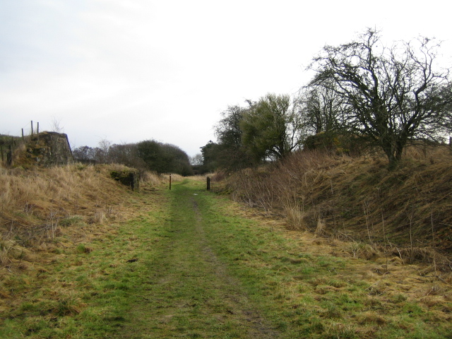
The walk starts at the back of the car park on the disused railway. After a few hundred yards it was decision time as we reached the junction of the two old railways. We chose the right hand track and followed our walk in an anti- clockwise direction, no particular reason.
 Taking the right fork at the junction. Marker on the post at the right.
It was easy walking on the old railway, if a little on the muddy side. After about a mile and a half the walk leaves the old line, goes down a bank to follow the Dell Burn in a westerly direction.
 Down to the Dell and yet another kissing gate.
Once across a field we entered Dell Plantation and walked a muddy footpath above the burn, leaving the woodland at about the second mile of the day. The field edge was lined with beech trees which appeared to be growing from an old boundary wall.
 A line of beeches, later there were some ash trees in the row too.
In one of the fields we crossed we all had a wander to examine the remains of a quarry and some spectacular lime kilns.
 A fine line of lime kilns.
We walked across more fields until we reached Low Fairnley where we declared a Herbie Spot next to a stream, the Fairnley Burn. Down the bank by the water we were out of the cold wind.
 Herbie Time. By now the weather had cleared and we enjoyed a sunny if cold break although personally it was embarrassing and a disaster. My new, fresh from ALDI soup container flatly refused to open and I was left with a dry bun. But we did share Pork Pie, Battenberg, ginger biscuits and cookies so it wasn't all that bad.
 View of the Fairnley Burn as we Herbied.
Soupless lunch over we headed towards Fairnley farm. A slight misreading of the map took us through the farm yard instead of around the buildings. A bonus actually as the friendly farmer, instead of shooting us offered a bundle of bailer twine and a view of his collection of Massey Ferguson tractors.

Massey Ferguson. How tractors have changed since my uncle bought his first little Ferguson!
Beyond the farm we joined St. Oswald for a short distance heading south alongside Catcherside Plantation, a narrow strip of woodland. At Catcherside Cottage we left the saint's walk and crossed several muddy fields until we came to the disused railway. A bit naughty here as the railway line is not a footpath but it provides easy walking as it meanders east. A sigh of relief at one point where we came across Wannie Walk signs again, knowing we were free of having an ASBO slapped on us. The railway path brought us back to the original junction and then into Scot's Gap again.
In spite of the mud, it is February, we agreed this was an excellent walk and decided to go for post ramble refreshment in the Beresford Arms in Whalton village near Ponteland. Like Philadelphia it was closed so we headed for the Diamond Inn in Ponteland. A busy pub, even at five pm on a Friday afternoon, it had several beers on offer, including Bombardier and Robinson's Blonde.
The Matrix MMXVIII F
steps miles
NAK 28256 10.7
IPhone 24282 10.5
Dave's 3D 23011 10.8
"" USB 21992 !0.75
"" NAK 21951 10.73
Sylvia's mother 22709 11.11
OUTDOOR GPS 10.4

Contains OS data, Copyright. Crown copyright and data base right 2018


Another muddy walk too
It has been cold this week, with some snow that hung around for a few hours before adding to the mud in the fields, especially the gateways where the animals gather. A good argument for vegetarianism.
Another local walk, not far from Newcastle, based on Scot's Gap.
Scot's Gap is a village west of Morpeth. The direct route is A1 north, go through Morpeth and turn left for Mitford. Head west until you reach the village. There is parking behind the now closed National Trust office at the west end of the village. (we took a longer route and called at the Blacksmiths coffee shop in Belsay for breakfast and to keep out of the rain which had fallen steadily all morning. Almost to the point where we considered going to Alnwick and walking round Barter Books.

Scot's Gap takes it's name from one of the many border skirmishes between England and Scotland that eventually ended with the union of the crowns. Like many villages the settlement had a night fold for animals which was in this case a hollow reached through an avenue or gap. A band of marauding Scots were once defeated here by the noble, and probably totally innocent, Northumbrians. Hence the name.
The village has an auction mart. It had a railway station once too, closed in the Beeching era, and is very close to the junction of two lines, some stretches of which are footpaths. Pevsner does not give Scot's Gap a mention. On the OS map it is named as Scot's Gap but on the OS site it is Scots'Gap. The station was called Scotsgap at one time, confusion reigns.
Not having an Anglican church it is really a hamlet but a few miles away the village of Cambo has Holy Trinity church, originally a 12th C chapel, completely rebuilt in the 19th C.
The map to use is OS OL 42 Kielder Water and Forest, and it is advisable. Much of the walk is on the Wannie Line Walk" and is well posted. Some stretches are on St. Oswald's trail.


The walk starts at the back of the car park on the disused railway. After a few hundred yards it was decision time as we reached the junction of the two old railways. We chose the right hand track and followed our walk in an anti- clockwise direction, no particular reason.

It was easy walking on the old railway, if a little on the muddy side. After about a mile and a half the walk leaves the old line, goes down a bank to follow the Dell Burn in a westerly direction.

Once across a field we entered Dell Plantation and walked a muddy footpath above the burn, leaving the woodland at about the second mile of the day. The field edge was lined with beech trees which appeared to be growing from an old boundary wall.

In one of the fields we crossed we all had a wander to examine the remains of a quarry and some spectacular lime kilns.

We walked across more fields until we reached Low Fairnley where we declared a Herbie Spot next to a stream, the Fairnley Burn. Down the bank by the water we were out of the cold wind.


Soupless lunch over we headed towards Fairnley farm. A slight misreading of the map took us through the farm yard instead of around the buildings. A bonus actually as the friendly farmer, instead of shooting us offered a bundle of bailer twine and a view of his collection of Massey Ferguson tractors.

Massey Ferguson. How tractors have changed since my uncle bought his first little Ferguson!
Beyond the farm we joined St. Oswald for a short distance heading south alongside Catcherside Plantation, a narrow strip of woodland. At Catcherside Cottage we left the saint's walk and crossed several muddy fields until we came to the disused railway. A bit naughty here as the railway line is not a footpath but it provides easy walking as it meanders east. A sigh of relief at one point where we came across Wannie Walk signs again, knowing we were free of having an ASBO slapped on us. The railway path brought us back to the original junction and then into Scot's Gap again.
In spite of the mud, it is February, we agreed this was an excellent walk and decided to go for post ramble refreshment in the Beresford Arms in Whalton village near Ponteland. Like Philadelphia it was closed so we headed for the Diamond Inn in Ponteland. A busy pub, even at five pm on a Friday afternoon, it had several beers on offer, including Bombardier and Robinson's Blonde.
The Matrix MMXVIII F
steps miles
NAK 28256 10.7
IPhone 24282 10.5
Dave's 3D 23011 10.8
"" USB 21992 !0.75
"" NAK 21951 10.73
Sylvia's mother 22709 11.11
OUTDOOR GPS 10.4

Contains OS data, Copyright. Crown copyright and data base right 2018


No comments:
Post a Comment