On the trail of the Lonesome Kite.. or the Three Mouse(kite)eers. (Tyneside) January 19th.
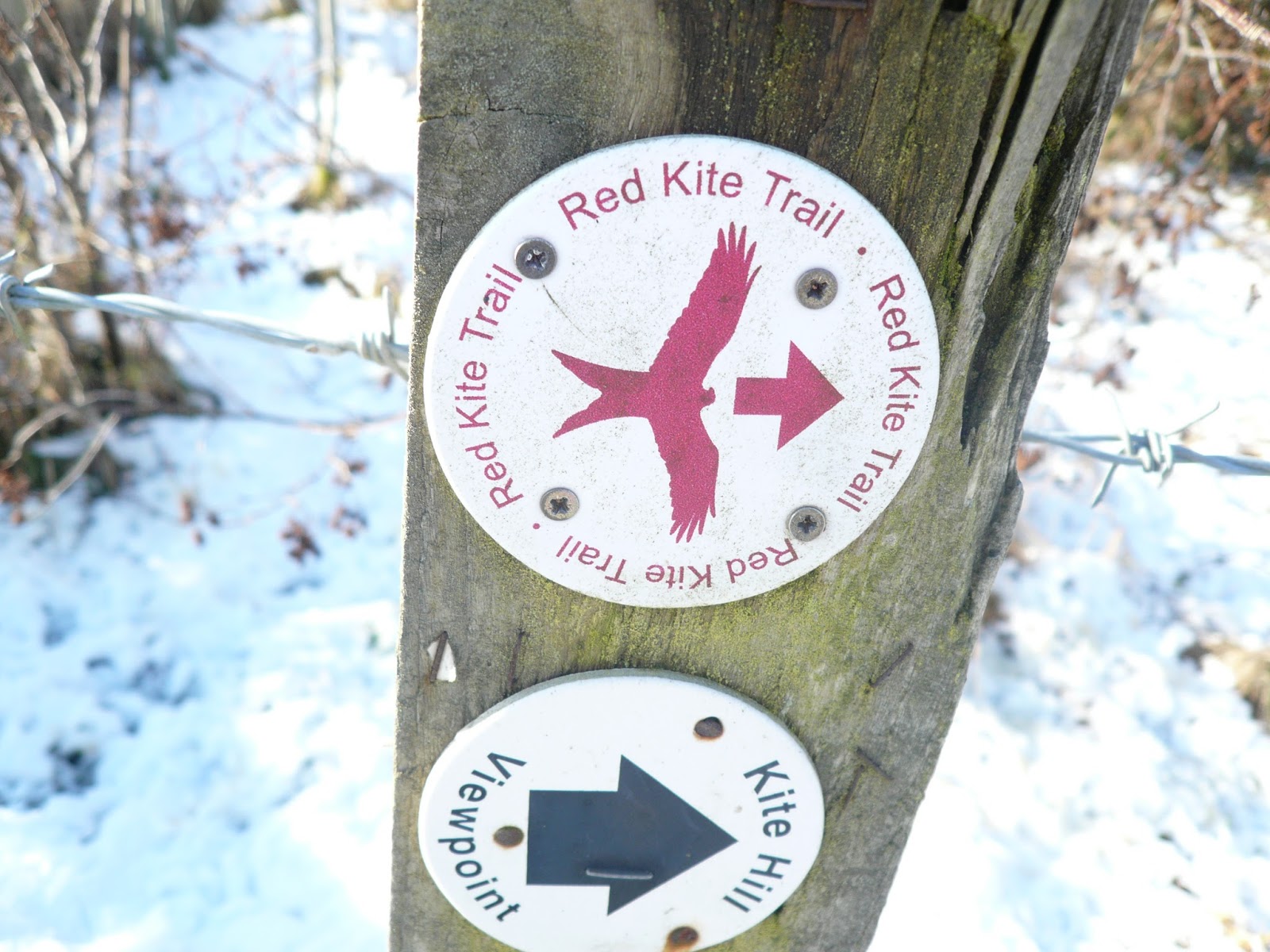
Snow hath fallen, snow on snow. Not a lot but enough to put some of us off driving into the wilds for a walk. Instead we are going by bus as far away as Winlaton and walking part of the Red Kite trail. Kites were once common in Britain, hunted almost to extinction but now on the up again. Introduced to the area south of the Tyne several years ago they are flourishing and expanding their territory.
Three of us, John H., Brian and me agreed to meet on Newcastle's Eldon Square bus station and catch a bus to Winlaton, getting off at the Derwenthaugh and DerwentWalk Country Park and following the Red Kite Trail.
Being a bus journey there is no car park but because two young ladies I know look forward to the weekly photo of assembled automobiles I add a picture of the bus station at Newcastle. It's a good one, covered waiting, large electronic information boards and a nearby Greggs. Usually at this time of day there are other gadgie groups setting off for a mini adventure too.

Eldon Square bus station and a cylindrical car park.
Most of the walk is covered by OS Explorer 307 Consett and Derwent Reservoir, the missing start and finish is on OS Explorer 315 Newcastle upon Tyne. The complete walk is on my ancient OS "One inch to the mile" sheet 78 Newcastle upon Tyne and you can download a leaflet and map by googling Red Kite Trail and following links and things.
On the other hand this trail is marked really well, just follow the;
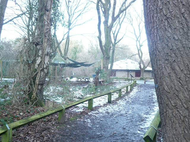
 There is a car park at Winlaton Mill where we started but it is closed at the moment while a café and information centre is being built.
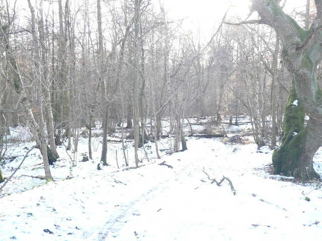
Once off the bus and ready to go we walked a short distance on the road past the Red Kite pub where we turned off to follow the Derwent walk/Red Kite Trail. Initially the walk follows the Derwent River round Goodshields Haugh before joining the dismantled railway which takes walkers, cyclists and horse riders all the way to Consett. Being an old railway line it climbs gently, crossing two viaducts. Lined with leafless trees and covered with icy slush it wasn't the easiest of walks. And at one point the trail joins Burnhopfield Road. Cross the road after a few hundred yards and rejoin the trail, still on the dismantled railway.
At one point there is a viewing area overlooking Rowlands Gill so we stopped to view and sure enough, in the distance we saw three kites the ruins of an old chapel and some houses.

View Point and information board.
From one of the high viaducts on the old line we saw two deer in the field below. Look carefully in the left corner of the photo to see them.
 It's only a compact camera.
Just beyond Priestfield Wood the Derwent Walk goes round the old station house the Red Kite Trail goes off to the right and follows a narrow footpath down to Lintzford which has an old mill and fine stone houses.

Lintzford.
The trail goes left across the road and along a footpath into Chopwell Woods, the first climb of the day.As elsewhere the path through the woods is well posted with Red Kites and the the track has a good surface. At one point, a few yards of the trail is a high post with a carving of a kite on the top. We called a Herbie Spot and sat on the bench round the post overlooking the Derwent Valley.
 Looks a bit Owlish. We saw more kites as we lunched on biscuits, Stollen and Mrs A's lovely fruit slab cake.
Lunch and looking over we continued on our way through the wood, emerging at "Pitmans Ride", followed a road north east before crossing fields to the back end of Rowlands Gill and taking a minor road past the now closed Hookergate School.
More woods, (Spen Banks) before we came to a disused waggon way which we followed for a short distance. If you follow this watch out for the Red Kite marker on the left which takes walkers on a footpath above the muddy waggon way and then north to Ashtree Lane. The Red Kite Trail officially goes from here to Barlow where it turns and and comes south back to the end of Ashtree Lane. We cut this bit out and walked down the lane turning right, passing Thornley Bank dog and cat holiday home, then right down a lane, left to High Thornley. Here we crossed a road and struggled along the edge of a very muddy field which contained no grass but probably a dozen horses. Terrible, something like the trenches.
 Should you keep horses in these conditions?
Beyond High Thornley the path crosses fields to.... Low Thornley. Watch out for the marker, it's the only one not easily spotted. Downhill to Thornley Woodlands Centre, which was closed and then along a boarded footpath back down to the Derwenthaugh Park and the track to The Red Kite pub.
 Thornley Woodlands Centre
 Red Kite pub. John and I had a friendly bet that the pub would sell a "Red Kite" Ale. It didn't so we drank Wainwrights, there was also Deuchars, Boon Doggle and Sloe Storm. Nice selection.
Then we caught buses back to Newcastle and home. This is another good walk, a bit muddy in sections today. Apart from Kites we saw grey squirrels, deer, redwing and a sparrow hawk.
 Red Kite, beautiful, and fond of kittens, some say.
Matrix MMXVIII (C)
Not having Dave not much today but:
steps miles
NAK 28894 11.85
iPhone 24213 10.5
OUTDOOR GPS 10,9
Brian 10.5


Lots of overlap on the maps, couldn't squeeze them onto one
Contains OS data copyright. Crown copyright and database right 2018.


Snow hath fallen, snow on snow. Not a lot but enough to put some of us off driving into the wilds for a walk. Instead we are going by bus as far away as Winlaton and walking part of the Red Kite trail. Kites were once common in Britain, hunted almost to extinction but now on the up again. Introduced to the area south of the Tyne several years ago they are flourishing and expanding their territory.
Three of us, John H., Brian and me agreed to meet on Newcastle's Eldon Square bus station and catch a bus to Winlaton, getting off at the Derwenthaugh and DerwentWalk Country Park and following the Red Kite Trail.
Being a bus journey there is no car park but because two young ladies I know look forward to the weekly photo of assembled automobiles I add a picture of the bus station at Newcastle. It's a good one, covered waiting, large electronic information boards and a nearby Greggs. Usually at this time of day there are other gadgie groups setting off for a mini adventure too.

Most of the walk is covered by OS Explorer 307 Consett and Derwent Reservoir, the missing start and finish is on OS Explorer 315 Newcastle upon Tyne. The complete walk is on my ancient OS "One inch to the mile" sheet 78 Newcastle upon Tyne and you can download a leaflet and map by googling Red Kite Trail and following links and things.
On the other hand this trail is marked really well, just follow the;
Once off the bus and ready to go we walked a short distance on the road past the Red Kite pub where we turned off to follow the Derwent walk/Red Kite Trail. Initially the walk follows the Derwent River round Goodshields Haugh before joining the dismantled railway which takes walkers, cyclists and horse riders all the way to Consett. Being an old railway line it climbs gently, crossing two viaducts. Lined with leafless trees and covered with icy slush it wasn't the easiest of walks. And at one point the trail joins Burnhopfield Road. Cross the road after a few hundred yards and rejoin the trail, still on the dismantled railway.
At one point there is a viewing area overlooking Rowlands Gill so we stopped to view and sure enough, in the distance we saw three kites the ruins of an old chapel and some houses.

View Point and information board.
From one of the high viaducts on the old line we saw two deer in the field below. Look carefully in the left corner of the photo to see them.

Just beyond Priestfield Wood the Derwent Walk goes round the old station house the Red Kite Trail goes off to the right and follows a narrow footpath down to Lintzford which has an old mill and fine stone houses.

Lintzford.
The trail goes left across the road and along a footpath into Chopwell Woods, the first climb of the day.As elsewhere the path through the woods is well posted with Red Kites and the the track has a good surface. At one point, a few yards of the trail is a high post with a carving of a kite on the top. We called a Herbie Spot and sat on the bench round the post overlooking the Derwent Valley.

Lunch and looking over we continued on our way through the wood, emerging at "Pitmans Ride", followed a road north east before crossing fields to the back end of Rowlands Gill and taking a minor road past the now closed Hookergate School.
More woods, (Spen Banks) before we came to a disused waggon way which we followed for a short distance. If you follow this watch out for the Red Kite marker on the left which takes walkers on a footpath above the muddy waggon way and then north to Ashtree Lane. The Red Kite Trail officially goes from here to Barlow where it turns and and comes south back to the end of Ashtree Lane. We cut this bit out and walked down the lane turning right, passing Thornley Bank dog and cat holiday home, then right down a lane, left to High Thornley. Here we crossed a road and struggled along the edge of a very muddy field which contained no grass but probably a dozen horses. Terrible, something like the trenches.

Beyond High Thornley the path crosses fields to.... Low Thornley. Watch out for the marker, it's the only one not easily spotted. Downhill to Thornley Woodlands Centre, which was closed and then along a boarded footpath back down to the Derwenthaugh Park and the track to The Red Kite pub.


Then we caught buses back to Newcastle and home. This is another good walk, a bit muddy in sections today. Apart from Kites we saw grey squirrels, deer, redwing and a sparrow hawk.

Matrix MMXVIII (C)
Not having Dave not much today but:
steps miles
NAK 28894 11.85
iPhone 24213 10.5
OUTDOOR GPS 10,9
Brian 10.5


Lots of overlap on the maps, couldn't squeeze them onto one
Contains OS data copyright. Crown copyright and database right 2018.


No comments:
Post a Comment