Rob Roy Way June 8th to 15th..................
After the success of the West Highland Way Walk last year we have decided to follow the Rob Roy Way in Scotland for one of the trips of 2017.
Rob Roy was the Scottish Equivalent of Robin Hood, born in the 17th century he was a cattle dealer, drover, military man and extortionist, although not all at the same time. He died in 1737 and is buried near Balquidder. Immortalised in words by Sir Walter Scott and on film by Richard Todd and Liam Neeson, films made some forty years apart, and embroidered for the big screen.
There are five of us walking, Brian, his wife Margaret (Mrs A. of gadgie fame), Dave, John H. and me.
The walk is about 80 miles, we have booked transport between B and Bs and have very cleverly left a car at either end, Drymen for the start and Pitlochry for the finish.
The walk is covered by four OS maps, but I think it is better to purchase one of two Rob Roy Way maps, both printed on tough polyethylene paper which makes them waterproof, no need to laminate even. 1; Harvey map, Rob Roy Way and 2 Footprint map, The Rob Roy Way. There are several books on the walk too, we had copies of one called with great imagination "The Rob Roy Way" by Jacquetta Megarry. Spiral bound, very useful.
We spent the first night at The Hawthorns, run by Chris and Jane Cunningham in Drymen. Lovely place, and a good meal in the village pub, The Clannach, one of the oldest Scottish inns. It had been election day and on the morning of Friday June 9th before we set off Jane gave one of the best talks I have ever heard on the problems of Brexit, Scottish independence and Northern Ireland. The talk was aimed at three Americans doing the West Highland Way (See July last year), Jane should be a commentator on TV but she's too nice.

Ready for the off. Dave, Brian, Margaret, John H. and me, looking porky.
DAY 1 Drymen to Aberfoyle
The Americans came with us for the first mile or so before turning off on the WHW, we continued on the metalled road north before turning west. We followed forestry tracks making easy walking as we passed many of the water works and aquaducts that feed Glasgow from Loch Katrine. Some of the points on the map have fascinating names such as Manhole Bridge and Corrie Aquaduct.

Corrie Aquaduct.
We stopped at Clashmore Cottage for a Herbie, sharing chocolate flapjacks from Mrs A. and vegan fruit cake from www.jesmondcakecompany.com. Plus a sandwich bought in the Drymen Spar.
Lunch over we walked more forest track until we reached Aberfoyle our resting place for the night.
Dave and I stayed in the Bield,, run by Alison in the town, John, Brian and Margaret were put up at Corrie Glen, home of Pauline and Steven Alexander. Both places welcoming and comfortable.
We dined in the Forth Inn which looked strange on the outside but the dining room was atmospheric, the walls covered in pictures of Scottish heroes and thinkers such as David Hulme and Bonnie Prince Charlie and Watt, inventor of the giant steam kettle. The bar had five real ales on too!

Fairies grave at Aberfoyle. Place a coin for luck

Downtown Aberfoyle, Forth Inn on the right.
Day's distance 11 miles Running total 11 miles

Drymen is just off the map at the bottom
Contains OS data copyright.Crown copyright and database right 2017.
Day2 Aberfoyle to Strathyre. The Longest Day (And the wettest)
We left Aberfoyle about 10 am in the rain. For the first two miles we walked on good tracks but then we hit the boggy footpath over the Menteith Hills. It had been raining for several days and the going was soft and hard if you see what I mean until we met a track close to Loch Venachar. The official RRW goes through Callander but at the end of the loch we crossed a bridge and followed a footpath to Kilmahog. The footpath was being used by a local running/cycling group and did they look wet, the cyclists all had that well known muddy streak up their backs.

Walking in the rain.
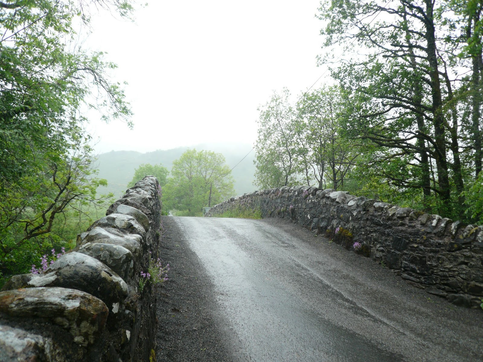
The bridge to a short cut
In Kilmahog we stopped for coffee. I had been using my phone as a GPS but had carefully wrapped it in a plastic bag, put it in my rucksack and covered the sack with a waterproof cover. Waiting for coffee I took it out and put it in my coat pocket, sat down with the drink and took out my phone to check the distance. My pocket was full of water and so was the phone, slowly it died.
Coffee over we continued on our wet way following a good surface towards Loch Lubnaig, pausing to admire the torrent at the Falls of Leny and to have a soggy lunch nearby.

A soggy lunch near Loch Lubnaig. Fruit cake from Mrs A and vegan fruit cake too.
The path along the loch is a good firm one, built on an old railway bed? There are several camping sites and holiday homes too. Soon we reached Strathyre and beds for the night. We were all put up in Airlie House with Colin and Sheriden Adams. The bathroom Dave and I shared was as big as most bedrooms but importantly, the water was hot. Much to our delight the village pub had Timothy Taylor's Landlord on draught, wet on the inside and the outside today.


The Inn, Strathyre, and T T L
Day's distance; 18 miles Running total 29 miles.


Contains OS data, copyright. Crown copyright and database right 2017.
Day 3 Strathyre to Killin
After breakfast (home made marmalade by Colin and he did the toast which considering he had been to watch Scotland draw with England at soccer the previous night was an achievement) we set off for Killin. Wet tracks underfoot but not as much rain as yesterday we progressed well to the hotel/café/cake shop called Mohr 84. On the maps it is marked as the Kingshouse Hotel but it has changed names to avoid confusion with the place at the top of Glencoe. It is on the A84, hence the name. The cakes looked good but we resisted and had tea or coffee.
Crossing the road we walked along a good path through woods towards Lochearnhead but as we approached that small town we climbed up to the footpath/cyclepath that runs along an old railway line high above Glen Ogle. It must have been a beautiful ride, high above the road, crossing several viaducts.


Viaduct above Glen Ogle.
Near Glenoglehead Cottages the footpath crosses the road. Julia's Snax sells burgers and drinks but just beyond her caravan we halted at the picnic spot for sandwiches from Strathyre and fruit cake from the usual sources. For the first time we were bothered by the infamous Scottish midges so we didn't hang around. A short distance on the way from the picnic spot is a memorial to two RAF servicemen who were tragically killed when their Tornado crashed in the nearby hills.
There are two RRW paths down to Killin, we took the left fork and went mostly downhill before joining another long dead railway line into Killin. (Sleepers still piled on the side of the track).
In the village we paused for refreshment at The Falls of Dochart Inn, three excellent real ales on, before heading for the Old Bank, resting place for the next two nights. Run by Jenny Bramall, a London lady and very comfortable too.
Showered and changed we returned to the Falls of Dochart Inn for food and drink. The venison burger was filling, the beer was fine.


Falls of Dochart above, the Old Bank below.
Day's distance 14 miles Running total 43 miles.

Contains OS data. copyright Crown copyright and database right 2017
Never mind it says 12.7 miles, I plotted this out, we know it was really 14.
Day 4 Killin to Ardtalnaig.
After a short walk on road out of Killin we had the first climb of the walk, almost 2000 feet above Loch Tay and giving us mountain views for the first time.

Ptarmigan Ridge above Loch Tay. We walked it two years ago. Sadly I can't remember its Gaelic name, which sounds much more romantic. I should look it up!

Lochan Breaclaich and dam. It provides some hydro=electric power.
For the first time we met Nancy and Dan, a pair of Americans from Seattle, walking the RRW too. Slightly slower than us our paths crossed and recrossed several times over the next three days.
Beyond the lochan there is a large diameter water pipe and where it turns east the trail becomes a boggy footpath over the moors although there are marker posts to help the walker. We lunched at the ruins of an old summer "camp", once used by shepherds bringing their flocks to the higher ground for summer.

Piles of stones that once were shelters.
A good road down from the Ardeonaig Outdoor Centre took us to the hotel of the same name, where we stopped for coffee. The manager was Swedish, the girls helping were from Eastern Europe, like so many others on the way. What happens after Brexit?
From here we walked the road to Ardtalnaig where we were picked up, along with the two Americans, and taken back to the Old Bank at Killin. Food and drink in the Falls of Dochart again
Day's miles 12 miles Running total 55 miles.

Contains OS data, copyright. Crown copyright and database right 2017

We got the feeling everywhere started with A
Day5 Acharn to Aberfeldy A bit of a cheat
Having said goodbye to Killin by taxi we chose to start the day at Acharn which is a few miles down the loch from Ardtalnaig to avoid walking on the road. (And saving a few miles). Our driver was William from Cheshire. In 12 milesw we had his whole life story. He was a genius, fixed railway engines, cleaned toilets, loaded shelves for Morrisons having invented a new system of moving stock, he rescued lost motorists at night and repaied their cars on the roadside. Nobody else got a word in.
From the village we immediately climbed the steep track to the Hermit's Cave and the Falls of Acharn.

Falls of Acharn.
Having admired them we headed on along the Queen's Drive, a lovely walk through fields and woodland. We walked this route a few years ago, it was muddy but the forestry commission have improved the roads considerably.
Waling along one forest track we came across the wild life sight of the week; a pine marten. He/she was trying desperately to get through a fence made from chicken wire. Unsuccessful and angry it showed its teeth and screeched at us, we walked on but managed to get some pictures.
 |
An angry pine marten, and who can blame it.
Our two Americans from Seattle missed the creature but a couple of young Germans tried to approach it but we warned them off, looked like you could get a nasty bite.
Approaching Aberfeldy we had the choice of going downhill to the small town or heading uphill and walking past the falls of Moness and the Birks of Aberfeldy, an area so beautiful and covered with birch trees no less a person than Rabbie Burns was inspired to pen a poem;
The braes ascend like lofty wa's,
The foaming stream deep-roaring fa's
O'erhung wi' fragrant spreading shaws
The Birks of Aberfeldy.
Coming down from the falls there are several hundred steps and at the bottom of the woodland is;
  The Birks of Aberfeldy In Aberfeldy we stayed with Cathy Ross. What a wonderful lady, we called her Aunty Cathy. She watched us walk up the street towards her large bungalow and welcomed us in with tea, short bread and fruit cake. She offered us advice on pubs and restaurants in the town, we chose the Schiehallion bar for some real ale and The Chillies Indian restaurant for dinner. Day's miles 11 Running total 66 miles  |
Contains OS data copyright. Crown copyright and database right 2017
Day 6 Aberfeldy to Pitlochry
 Cathy at home
Leaving Aunty Cathy but promising to wave from the distant white house we could see on the horizon we started the last day. Walking along the road we passed Dewars Distillery before joining a path alongside the river Tay. One of the prettiest parts of the whole walk it took us to Grandtully where we stopped at The Inn for coffee before crossing the river to Strathtay, climbing through woodlands over the Ballechin hill and down through the Clunie Wood to Pitlochry, end of the walk.
 We're almost there
We stayed at Tigh Na Cloich Hotel (House of Stone?), found liquid refreshment at the Old Mill Inn where we found our American friends, now known as Nancy and Dan, and said our farewells. They invited us to come and walk in the north west of the US. Good idea. We went for a celebratory dinner at Victorias, nice place, shame about the beer.
Day's total 10.5 miles Running total 76.5 miles but more like 80.
Day 6 Aberfeldy to Pitlochry

Leaving Aunty Cathy but promising to wave from the distant white house we could see on the horizon we started the last day. Walking along the road we passed Dewars Distillery before joining a path alongside the river Tay. One of the prettiest parts of the whole walk it took us to Grandtully where we stopped at The Inn for coffee before crossing the river to Strathtay, climbing through woodlands over the Ballechin hill and down through the Clunie Wood to Pitlochry, end of the walk.

We stayed at Tigh Na Cloich Hotel (House of Stone?), found liquid refreshment at the Old Mill Inn where we found our American friends, now known as Nancy and Dan, and said our farewells. They invited us to come and walk in the north west of the US. Good idea. We went for a celebratory dinner at Victorias, nice place, shame about the beer.
Day's total 10.5 miles Running total 76.5 miles but more like 80.

Another brilliant walk, really enjoyable in spite of the rain! Good company and good walking, next year the Yorkshire Dales Walk!
A few pictures, more to come, I am having computer problems.


No comments:
Post a Comment