The day after Doris (Northumberland) Feb 24th
Doris Day made some fun films with Rock Hudson; Pillow Talk, Send me no flowers, Lover come back, usually about sophisticated New Yorkers with large cars. She sang The Deadwood Stage too.
But our Doris, the latest storm, hit much of the northern half of Britain on February 23rd, blowing down trees, disrupting rail, road and air services and causing one tragic death.
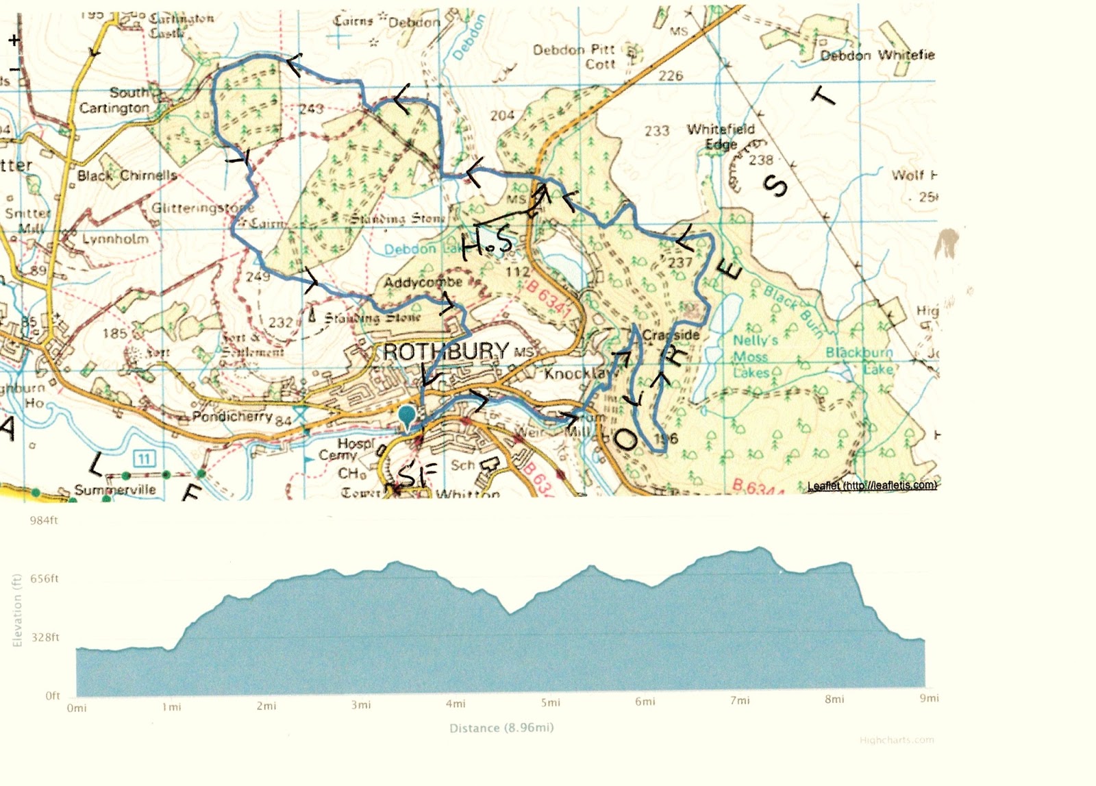
As the storm deposited rain and snow on the hills we decided to abort our proposed walk from Kielder and stay on the relatively low Rothbury Terraces where the paths and tracks are firm.
There are eight of us; John x3, Dave, Ray, Brian,Ben and me and we are meeting in Tomlinsons café and bunkhouse, Bridge Street, Rothbury for breakfast. There is a Yorkshire car park just across the river.
For Rothbury take A1 north, A697 at Morpeth and turn left at Weldon Bridge following the Rothbury sign post.
The map to use is OS Explorer 332 Alnwick and Amble.
Breakfast over, tea/coffee/bacon and various combinations served in this café that is always worth visiting we headed back to the car park, booted up and set off.


Crossing to the north side of the River Coquet by way of the footbridge we turned east and walked along the riverside path. Doris had brought a great deal of rain, the river was full.


Just beyond Thrum Mill the footpath meets a road, we crossed it and entered the Cragside Estate through the gate which says No Entry. This refers to vehicles.
Cragside House and estate was developed in the 19th century by Lord William Armstrong, arms and ship builder. For the Russo- Japanese war of 1905 he supplied both sides with ships and armaments, that's business. There are miles of footpaths in this National Trust property, most well signposted and we followed the paths to the big house.


Once beyond the house we followed the sign posts uphill through rocky paths until we came to Nellie's Moss which were, I think, the reservoirs used to power the hydro-electric machinery.

Having admired Nellie's Moss we continued on the metalled road north then west until we came to the entrance to the park, where we called a Herbie Spot.
It is very close to John Hall's birthday so we celebrated with buns with candles, buns without candles, ginger biscuits from Ben, chocolate biscuits and home made flapjacks from Mrs E.

Party over we crossed the road and almost immediately entered a plantation, following the road to Primrose Cottage.

We turned right at the cottage, through a gate and along a good track initially heading north before turning west then south again near South Cartington.


This is an outdoor art installation
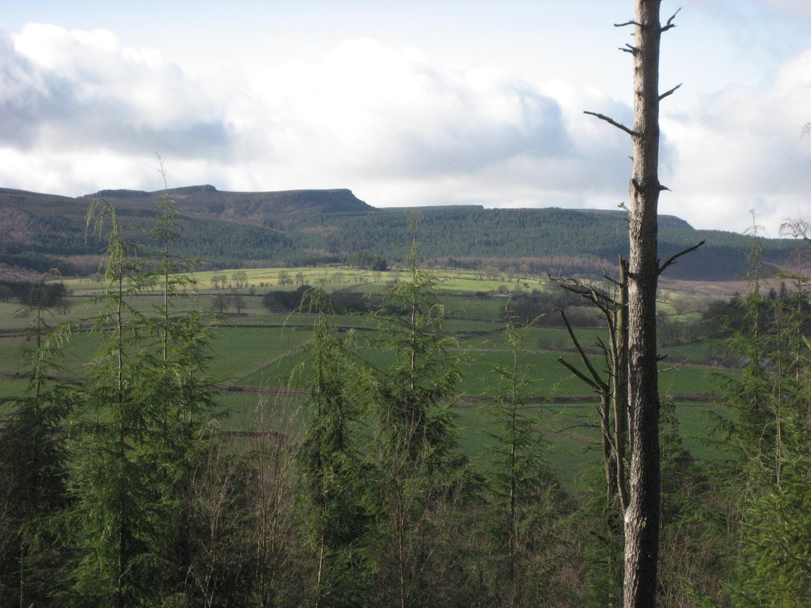
We continued through the heather until we hit the track that took us east past the radio mast and standing stone to the plantation at Addycombe. There is a point here which looks directly down on to Rothbury, worth pausing and enjoying the view.


Rothbury and the Simonside Hills.
We took a well hidden and precipitous footpath down through the woods to Hillside Road, lined with bungalows, and followed the signs back into the town.
Changed we headed for the Anglers Arms. It being nearly John's birthday he followed the old gadgie tradition of buying a whole round, we could choose from Adnams, Bombardier or Black Sheep.
Another good day out, especially considering the amount of water Doris had left behind. The Cragside stretch was particularly good, I had never been to Nellie's Moss before.
MATRIX MMXVII H
steps miles
NAKOSITE was left at home, accidently
Dave's 3D 21218 9.77
"" USB 20617 9.76
"" NAK 20328 9.62
OUTDOOR GPS 9.6
Brian's View Ranger 9.5 ?
John C 9.7?
 |
| Contains OS data. Copyright. Crown copyright and database right 2017 |


.
No comments:
Post a Comment