The hill with the mountain hut near a chasm..(Lake District)............................October 8th
As the days get shorter we are having what is possibly the last visit to the Lake District until next year, it does take two hours to get there.
The jolly jock on local TV assured us it would be a dry day with some sunshine. he was wrong, when we arrived at Seathwaite in Borrowdale the sky was overcast and the drizzle was light. Regardless we decided to do the planned walk up Glaramara from the farm at Seathwaite and finishing in Rosthwaite. A linear walk with a car left at each end . There are five of us, Dave, Ray, John H., Harry and me.
To get to Seathwaite farm from base: A69 west, M6 south, A66 west, go through Keswick and follow signs for Borrowdale, at the bottom, just before Seatoller, turn left down the narrow road to the farm. It is a popular starting point for walking up Great Gable, Scafell and several other bumps. There is a campsite at the farm but sadly the café has closed.
Like all the best walks this one requires two maps; OS OL4, English Lakes North West and OS OL 6, English Lakes South west.
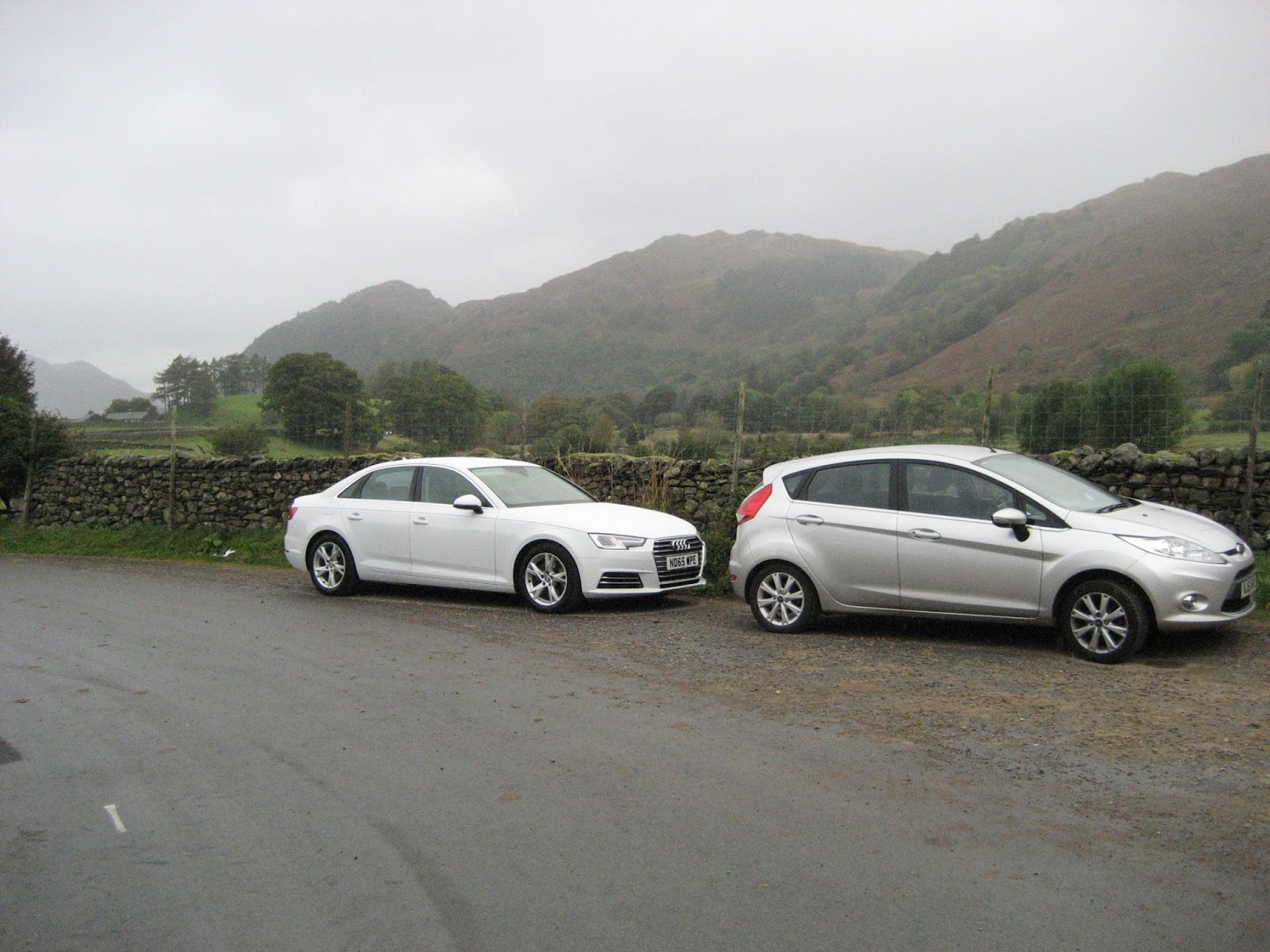
 A line of parked cars at Seathwaite.
The walk, and it is a good one;
We walked south through the farmyard and along the track to Stockley Bridge;
 Stockley Bridge. A decision spot. Once across the bridge walkers head uphill to Styhead Tarn and beyond or turn left as we did and head for Grains Gill.
Having crossed the pretty little bridge, and explained to a young Canadian couple how to get to Scafell we followed the rough track up the east side of Grains Gill which becomes Ruddy Gill at the next bridge, a footbridge. The path gets steeper but has been paved with rough stones, it used to be hard work in winter without them. Under the gloomy Great End the path crosses the stream but almost immediately turns south west towards Allen Crags.
 Lower Ruddy Gill with Great End in the background, path on the left
 And nearer the top of the gill.
Eventually we reached a cross road of paths. To the right is a cross shaped shelter which provides protection from the wind from any direction and there was a cold draught blowing in from the east, so we called a Herbie Spot. (You noticed there was no bacon stop?)
Today's sharings consisted of Fruesli Bars, iced carrot cake and (in Ben's absence) ginger biscuits from Ringtons.
Lunch over we turned north east and walked over Allen Crags, a rocky path but the views are worth the effort.
 Langdale Pikes and distant Windermere
 The rough track along Allen Crags and distant Derwentwater.
From Allen Crags the path follows a route on the ridge to Glaramara.
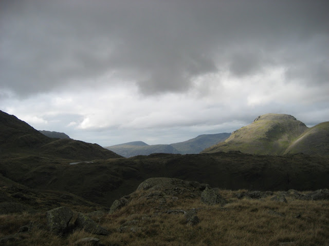
Glaramara, one of those beautiful Lakeland names like Helvellyn and Blencathra. It sounds a bit Celtic but comes from the Old Norse meaning "the hill with the mountain hut near a chasm". It is 2569 feet high(783m to other EU states and the rest of the world.
It is pretty much a central points and has 360 degree panoramic views of the Lake District.
 Bowfell and Esk Pike
 Great Gable on the right.
Coming off Glaramara is a dried up waterfall, a bit of a scramble going down.
Harry and I decided to leave it to the under 70's and we walked round it, joining the rest of the team on the long slope down on the east side of Thorneythwaite Fell to a crossing point of Coombe Gill. From here we followed a rough path to Stonethwaite, walking through a farmyard and coming to the tiny village church, dedicated to St. Andrew.
 St. Andrew's church, Stonethwaite
 Looking up the valley of Stonethwaite Beck.
We had left a second car here so, after a bit of shunting back and forward to Seathwaite we were all ready for the journey home. On the way home we stopped at Carts Bog near Hexham, nice country pub and reataurant, serving Pennine Pale from Allendale and Mordue's Northumbrian Blonde.
Glaramara is a great walk out with some climbing at the start and some rocky paths needing care. After a long dry spell some of the rocks were greasy and slippy.
The Matrix MMXVI ZZZZ
steps miles
NAK 28611 10.69 (generous, but steep walking
Dave's 3D 25082 9.89 """""""""""""""""""
"USB 21808 9.63
" Nak 21323 9.42
OUTDOOR 8
RAY 9
Settle for 8.5 but that looks generous too.


 and finally the other car park
As the days get shorter we are having what is possibly the last visit to the Lake District until next year, it does take two hours to get there.
The jolly jock on local TV assured us it would be a dry day with some sunshine. he was wrong, when we arrived at Seathwaite in Borrowdale the sky was overcast and the drizzle was light. Regardless we decided to do the planned walk up Glaramara from the farm at Seathwaite and finishing in Rosthwaite. A linear walk with a car left at each end . There are five of us, Dave, Ray, John H., Harry and me.
To get to Seathwaite farm from base: A69 west, M6 south, A66 west, go through Keswick and follow signs for Borrowdale, at the bottom, just before Seatoller, turn left down the narrow road to the farm. It is a popular starting point for walking up Great Gable, Scafell and several other bumps. There is a campsite at the farm but sadly the café has closed.
Like all the best walks this one requires two maps; OS OL4, English Lakes North West and OS OL 6, English Lakes South west.

The walk, and it is a good one;
We walked south through the farmyard and along the track to Stockley Bridge;

Having crossed the pretty little bridge, and explained to a young Canadian couple how to get to Scafell we followed the rough track up the east side of Grains Gill which becomes Ruddy Gill at the next bridge, a footbridge. The path gets steeper but has been paved with rough stones, it used to be hard work in winter without them. Under the gloomy Great End the path crosses the stream but almost immediately turns south west towards Allen Crags.


Eventually we reached a cross road of paths. To the right is a cross shaped shelter which provides protection from the wind from any direction and there was a cold draught blowing in from the east, so we called a Herbie Spot. (You noticed there was no bacon stop?)
Today's sharings consisted of Fruesli Bars, iced carrot cake and (in Ben's absence) ginger biscuits from Ringtons.
Lunch over we turned north east and walked over Allen Crags, a rocky path but the views are worth the effort.


From Allen Crags the path follows a route on the ridge to Glaramara.
Glaramara, one of those beautiful Lakeland names like Helvellyn and Blencathra. It sounds a bit Celtic but comes from the Old Norse meaning "the hill with the mountain hut near a chasm". It is 2569 feet high(783m to other EU states and the rest of the world.
It is pretty much a central points and has 360 degree panoramic views of the Lake District.


Coming off Glaramara is a dried up waterfall, a bit of a scramble going down.
Harry and I decided to leave it to the under 70's and we walked round it, joining the rest of the team on the long slope down on the east side of Thorneythwaite Fell to a crossing point of Coombe Gill. From here we followed a rough path to Stonethwaite, walking through a farmyard and coming to the tiny village church, dedicated to St. Andrew.


We had left a second car here so, after a bit of shunting back and forward to Seathwaite we were all ready for the journey home. On the way home we stopped at Carts Bog near Hexham, nice country pub and reataurant, serving Pennine Pale from Allendale and Mordue's Northumbrian Blonde.
Glaramara is a great walk out with some climbing at the start and some rocky paths needing care. After a long dry spell some of the rocks were greasy and slippy.
The Matrix MMXVI ZZZZ
steps miles
NAK 28611 10.69 (generous, but steep walking
Dave's 3D 25082 9.89 """""""""""""""""""
"USB 21808 9.63
" Nak 21323 9.42
OUTDOOR 8
RAY 9
Settle for 8.5 but that looks generous too.


Contains OS data Copyright. Crown copyright and data base right 2016


No comments:
Post a Comment