Where there's a Wear there's a way, even if it's muddy. March 29th.
We had planned an easy local walk for Friday the 28th of March. However as four of us left home base it was raining heavily so we decide to visit the Blacksmith's tea room at Belsay for an extra breakfast. Nice place, lovely staff, disappointing bacon sandwich. It was still raining so we moved on to Rothbury. It was still raining so we decided to lunch in the car park of the Anglers Arms at Weldon Bridge. After a sandwich or two we chose to have a lunchtime pint in the pub as it was still raining. Then we went home.
The reason we had chosen an easy local walk was because we had planned an extra walk on Saturday from Wolsingham to Bishop Auckland. Unless you use cars at either end the simplest way of doing this walk is to catch the Weardale Motor Company X21 from Newcastle to Wolsingham.It only runs on Wednesday and Saturday, It brings shoppers and sight seers from Weardale to marvel at the big city and do some shopping. It leaves Newgate Street to return at 10am. (It comes back in the afternoon for the shoppers in case you worried)
 The Weardale X21 in Newgate Street,
makes a change from a car park.
WARNING; THIS WALK CAN BE VERY MUDDY. Should you choose to follow the Weardale Way on this stretch a map is advisable. OS OL 31 North Pennines and OS Explorer 305 cover the route, and more.
The journey to Wolsingham takes roughly an hour so the five of us, Dave, Harry, Brian, guest Mrs A and I started our walk at 11am.
We walked down a street in the small town towards the railway station and crossed the river. A number of young men were busy donning wet suits preparing to kayak down the stream which was rather high, not surprising after all the rain that fell yesterday. The footpath runs alongside the river and was very muddy, an introduction for the slippery paths ahead. After two miles close to the south bank of the Wear the path, which is marked with little yellow signs, climbs away from the river through Black Bank Plantation.
 Watch out for these signs but be careful, Durham County Council
seem to have run out of them in places and there are other footpaths that sometime share the route: the Mineral Valley Way and the Butterfly Path.
Once out of the plantation the path goes downhill across some fields (where we saw a stoat; How do you tell the difference? A weasel is easily recognised but a stoat is totally different), down through a plantation where it crosses the river by footbridge and the railway.
 River Wear on its way to Durham, Chester le Street
and Sunderland.
The footpath heads for the ancient looking farm at Low Harperley where we made our first mistake, taking the footpath across a couple of fields full of expectant ewes and mums to the A689.

 Mrs A's hand, Brian and Harry enjoy lunch.
Sandwiches, chocolate, green tomato cake.
Recharged and refreshed we continued on our way past Harperley Hall which has some connection with the Durham Constabulary to Wadley where we had a pleasant chat with Lady Diana de Burgh who lived in the lovely 16th century house looking over the valley. Shame it was foggy, not much to see. She told us she had come to Durham many years ago expecting to find a land of pits, shipyards and engineering works. Many people still think the same way.
A second slight error took us downhill from the Lady's residence before turning right and rejoining the Weardale Way across fields all the way to Witton le Wear. Here it is necessary to cross the A68 and walk towards the village before spotting the sign that simply says Public Footpath and leads steeply downhill, crosses the railway and the river before entering Witton Park. In a loop of the river are Witton Castle Lakes, home to several Greylag geese today.


Ancient time piece, the hole is for the gnomon.
 On the north wall is a stone inscribed LEG VI.
Recycled stone from a nearby Roman Camp, home of the Sixth Legion.

Information outside the church.
From Escomb the path follows the river bank, muddy in places before coming to Bishop Auckland Rugby ground. We followed the road past the ground and at Newton Cap turned right up the hill into the town, which is the home of the Bishop of Durham. In the town square we found a Wetherspoons, named the Stanley Jefferson after the man who was christened here, attended school here and changed his name to Stan Laurel............................
 Journey's end as we approach the Stanley Jefferson.
After a supper of fish and chips, washed down with Abbott Ale we caught a bus back to Newcastle from where we made our various ways home. A real gadgie walk as we used bus passes but, although we saw geese, ducks, oyster catchers, chaffinches, goosanders, curlews and a fox and stoat no heron.
MATRIX MMXIVK
steps miles
LIDL3D 18490 8.32 rubbish
ASDA mini 17696 8.31 rubbish
Daves 3D 32022 14.73 How does he do it?
Dave's USB 31158 14.75 ditto
OUTDOORGPS 15
Brian's GPS 15
Gadgie distance 129 miles


 All three contain OS Data, copyright. Crown copyright and database right 2014
We had planned an easy local walk for Friday the 28th of March. However as four of us left home base it was raining heavily so we decide to visit the Blacksmith's tea room at Belsay for an extra breakfast. Nice place, lovely staff, disappointing bacon sandwich. It was still raining so we moved on to Rothbury. It was still raining so we decided to lunch in the car park of the Anglers Arms at Weldon Bridge. After a sandwich or two we chose to have a lunchtime pint in the pub as it was still raining. Then we went home.
The reason we had chosen an easy local walk was because we had planned an extra walk on Saturday from Wolsingham to Bishop Auckland. Unless you use cars at either end the simplest way of doing this walk is to catch the Weardale Motor Company X21 from Newcastle to Wolsingham.It only runs on Wednesday and Saturday, It brings shoppers and sight seers from Weardale to marvel at the big city and do some shopping. It leaves Newgate Street to return at 10am. (It comes back in the afternoon for the shoppers in case you worried)
makes a change from a car park.
WARNING; THIS WALK CAN BE VERY MUDDY. Should you choose to follow the Weardale Way on this stretch a map is advisable. OS OL 31 North Pennines and OS Explorer 305 cover the route, and more.
The journey to Wolsingham takes roughly an hour so the five of us, Dave, Harry, Brian, guest Mrs A and I started our walk at 11am.
We walked down a street in the small town towards the railway station and crossed the river. A number of young men were busy donning wet suits preparing to kayak down the stream which was rather high, not surprising after all the rain that fell yesterday. The footpath runs alongside the river and was very muddy, an introduction for the slippery paths ahead. After two miles close to the south bank of the Wear the path, which is marked with little yellow signs, climbs away from the river through Black Bank Plantation.
seem to have run out of them in places and there are other footpaths that sometime share the route: the Mineral Valley Way and the Butterfly Path.
Once out of the plantation the path goes downhill across some fields (where we saw a stoat; How do you tell the difference? A weasel is easily recognised but a stoat is totally different), down through a plantation where it crosses the river by footbridge and the railway.
and Sunderland.
The footpath heads for the ancient looking farm at Low Harperley where we made our first mistake, taking the footpath across a couple of fields full of expectant ewes and mums to the A689.
Ah!
Realising our mistake we retraced our steps to the farm, spotted the correct marker and headed south east. Having covered roughly five miles we called a Herbie Spot on the track going through a plantation with the original name of New.Sandwiches, chocolate, green tomato cake.
Recharged and refreshed we continued on our way past Harperley Hall which has some connection with the Durham Constabulary to Wadley where we had a pleasant chat with Lady Diana de Burgh who lived in the lovely 16th century house looking over the valley. Shame it was foggy, not much to see. She told us she had come to Durham many years ago expecting to find a land of pits, shipyards and engineering works. Many people still think the same way.
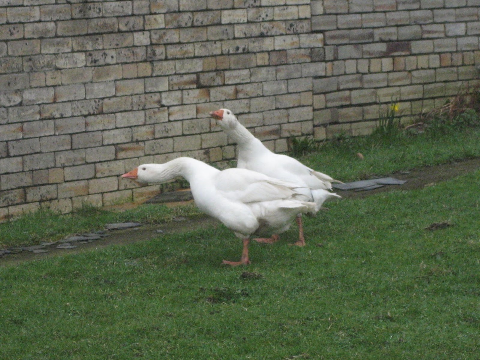
A second slight error took us downhill from the Lady's residence before turning right and rejoining the Weardale Way across fields all the way to Witton le Wear. Here it is necessary to cross the A68 and walk towards the village before spotting the sign that simply says Public Footpath and leads steeply downhill, crosses the railway and the river before entering Witton Park. In a loop of the river are Witton Castle Lakes, home to several Greylag geese today.
Not Greylags but with that wall they
could be defending Rome.
Witton Castle, just visible from the path.
After another muddy stretch we came to Paradise, which was a little disappointing, crossed the railway line again and walked across muddy fields before arriving at Escomb. The village itself has not much to offer but at its centre is the Saxon Church of Escomb, one of the most complete Celtic Saxon Churches in England.
Escomb Saxon Church, built in 670 AD. It has one of the oldest sun dials
in the country, visible to the left and above the central window.
Recycled stone from a nearby Roman Camp, home of the Sixth Legion.
Information outside the church.
From Escomb the path follows the river bank, muddy in places before coming to Bishop Auckland Rugby ground. We followed the road past the ground and at Newton Cap turned right up the hill into the town, which is the home of the Bishop of Durham. In the town square we found a Wetherspoons, named the Stanley Jefferson after the man who was christened here, attended school here and changed his name to Stan Laurel............................
After a supper of fish and chips, washed down with Abbott Ale we caught a bus back to Newcastle from where we made our various ways home. A real gadgie walk as we used bus passes but, although we saw geese, ducks, oyster catchers, chaffinches, goosanders, curlews and a fox and stoat no heron.
MATRIX MMXIVK
steps miles
LIDL3D 18490 8.32 rubbish
ASDA mini 17696 8.31 rubbish
Daves 3D 32022 14.73 How does he do it?
Dave's USB 31158 14.75 ditto
OUTDOORGPS 15
Brian's GPS 15
Gadgie distance 129 miles
No comments:
Post a Comment