Seven Golden Gadgies go walking up the Schil
March 15th
The forecast was for rain in the west again so the proposed trip to the Lake District was postponed again and we decided to stay on the drier east side of the country and walk the Schil from Hethpool.
To get to Hethpool take the A1 north, turn onto the A697 at Morpeth, turn left onto the B6351 at Akeld north of Wooler and watch out for a signpost pointing left for Hethpool. Follow this road for a couple of miles and just past the row of cottages cross the cattle grid and use the car park on the left.
This car park is at the entrance to the College Valley which is private and accessible bycar only with a pass (twelve vehicles a day) obtainable from John Sales in Wooler for a fee of £10. In the lambing season, which is probably now passes are not available.
Of course we stopped in Wooler for breakfast at the Terrace cafe where we were welcomed as old friends. Still worth five flitches +T. (New category, the T means the cafe has a toilet, useful information for Dave in particular.)
There are seven out today, pm, vm, km, mm, rm, hm and bm. A map is advisable, OL16 The Cheviot Hills covers the whole walk and the car park is at NT894280
 Yet another in my growing collection of car park photographs.
Hethpool's main claim to fame is that the hall was at one time occupied by Admiral Lord Collingwood, Nelson's second in command at Trafalgar. He can't have lived there long as he spent most of his adult life at sea. He has a huge memorial statue at Tynemouth. The name Hethpool probably means "heathery pool" but some experts think it could be connected to Hertha, a goddess.
There are several hillforts in the area, one called Great Hetha and one called Little Hetha and there is a hillfort trail for another day.
From the car park we walked back past the row of cottages and the pond outside Hethpool House.
After a short walk along the road we turned left on the track that leads to Elsdonburn Farm, a small, isolated settlement. The path continues round the farm on St. Cuthbert's Way and across fields before entering a small plantation.
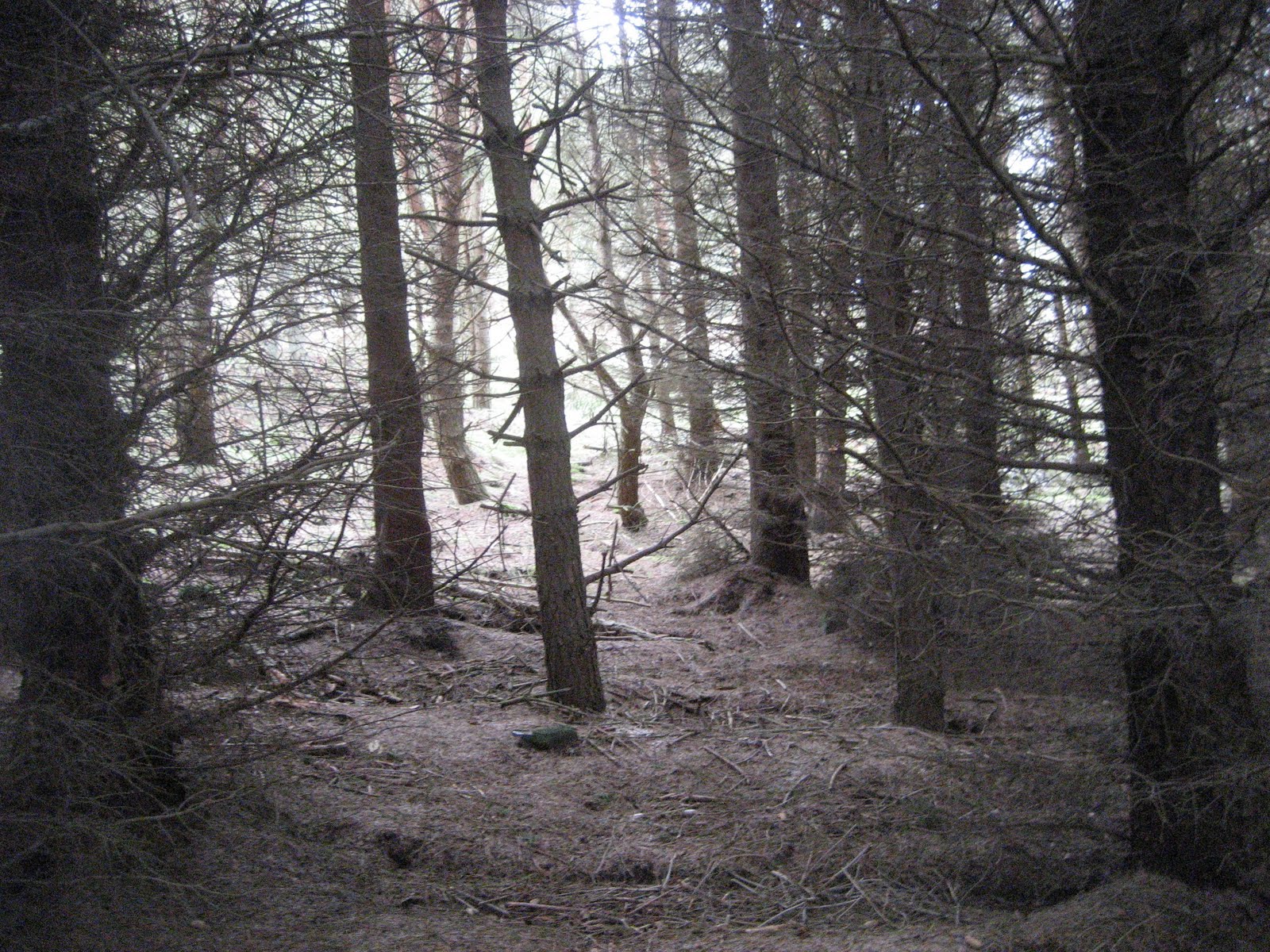
 Rows of conifers, I hate them, give me a good old
English deciduous wood.
The next part of the walk took us over rough moorland. Dave (vm) said he had pulled a muscle in his calf. Brian (pm) said he should get a bottle of calf medicine. He's a one that lad.
This part of the walk took us briefly, across the border into Scotland. We had a good view of the bivallate hill fort on Green Humbleton, a hill east of Kirk Yetholm. We have often walked to the Schil from this town. It is also the northern end of the Pennine Way, the long distance path that starts in Derbyshire. You are entitled to a free glass of beer at the Kirk Yetholm pub when you have finished the walk. You deserve it.

Green Humbleton plus hill fort.
So far we have been heading generally west but at this point the path joins the "upper" Pennine Way* and turns south east then south. There are a number of earth works and cairns along the route as it follows the border fence. Walking alone at the time I was unable to ask archaeologist Dave which bumps were definitely cairns but this could be one.
 Beneath this bump there lie remains
Of a long dead chieftainor some thanes.
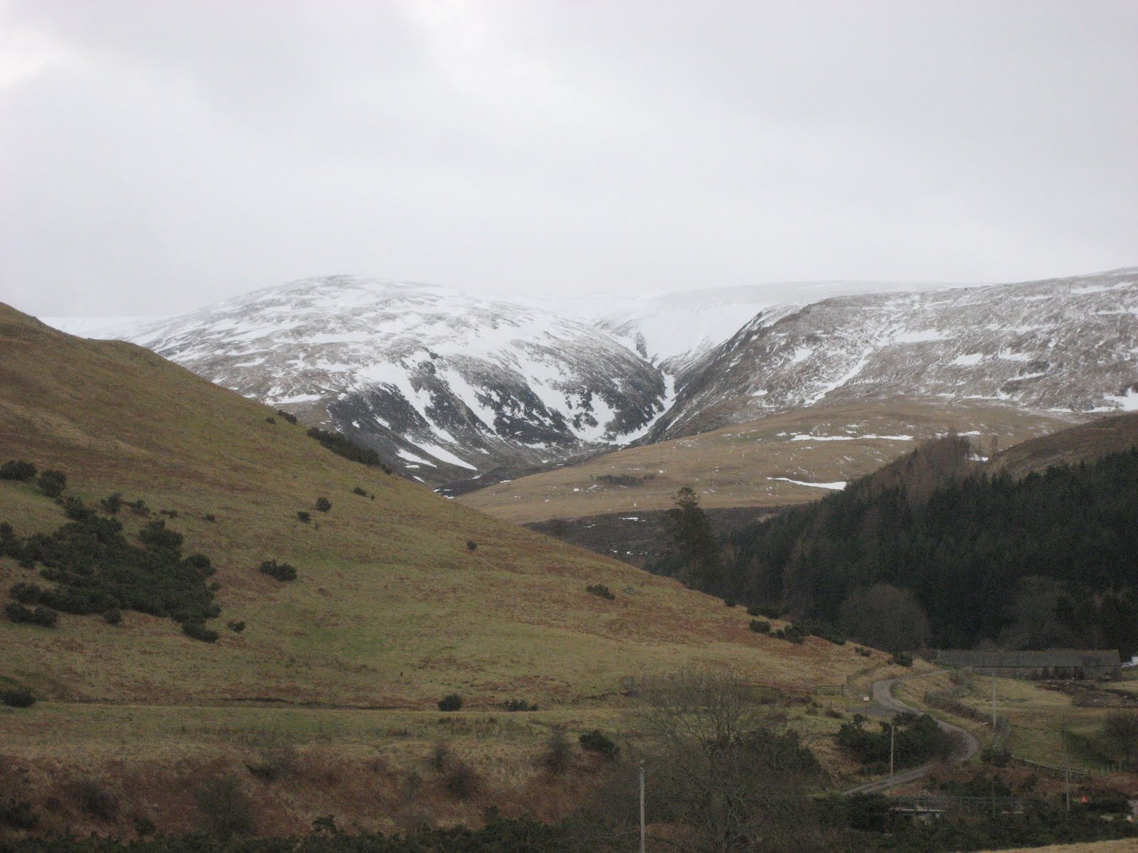
The Pennine Way here is a series of ups and downs, seems like more ups, but the views are worth the effort and it wasn't a particularly clear day. To the east the sea, to the south the Schil and the Cheviot to the west the area round Carter Bar and to the north west the border hills round Jedburgh.
 Looking towards The Schil.
Thye path leaves the border fence for a short while with Black Hag on the left. Fear not, hags in the case means the peaty bogs that abound and are messy enough in dry weather, never mind a day like today following a fall of snow.
A stile brought us back into England and we settled down behind the sheltering wall for a Herbie Stop. Still no pies, Dave is taking this warning about processed meat far too seriously. Thank Ben for the ginger biscuits and Aldi for the chocolate. We chatted gaily, in the old fashioned sense, teased Dave for his inflatable cushion and told stories that are not for a family publication. Meanwhile Harry (rm but also snapmeister) set up his tripod and took another team photograph which will be added when it arrives.
 Meanwhile, the photographer photographed to coin a phrase.
Lunch over we made the final climb, which is steep and rocky to the top of the Schill. Three of us went to play on the rocky summit.
 The rocky top of the Schil
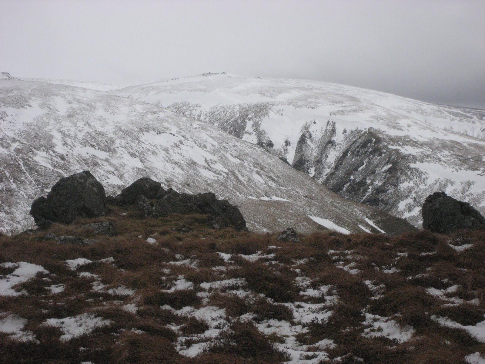
I love this walk because of the views, down the College Valley and over to the Hen Hole on the Cheviot. Quite independently Ben and I thought that in today's conditions and with some snow remaining the Hen Hole looked like one of Wainwright's** sketches.
 The Hen Hole on the Cheviot.
I have tried to find a meaning for Schil but have failed. Harry suggested it could be similar to the Scottish mountain Schiehallion but this means "the fairy hill of the Caledonians" from Gaelic. "The Skelligs" are a group of jagged rocks of the Irish coast and the word comes from the Gaelic Na Scealaga meaning "the splinters". There is a group of jagged rocks on the summit of the Schil.
Harry and I were enjoying playing on the top we didn't notice the other five had left to go downhill. We decided to head due east down the steep side of the hill towards the delightfully named Mounthooly. We eventually saw the others who had continued a short way along the border fence before also heading down. We all met up at the Mounthooly Youth Hostel which must be one of the more isolated hostels. We should stay sometime.
 Harry's hand and Mounthooly.
 From here the path back follows the road in the bottom of the valley. As a rule gadgies do not like walking on metalled roads but this valley is so beautiful nobody minds. Nothing to do with education the name College Valley refers to the marshy "letch" or stream that runs north in the valley bottom.
 A view of The Bizzle on the Cheviot.
The next farm along the road has the interesting name Fleehope!
Beyond this is the memorial to allied airmen killed in crashes in the area during World War II

The war memorial
 Reverse side
 General view
 The Valley Hall near the memorial.
 Side stream entering the valley.


And three general views of the College Valley
Back at the cars and changed we headed home, calling at the Anglers Arms for refreshment, Timothy Taylor's, Jennings Bitter or Directors. Of course it gets three barrels.
Not the best of days for the keen ornithologists among us. Jackdaws, crows and a few small birds, but we spotted three kestrels.
 Kestrel, bird of the day.
Matrix MCMLDIV
Dave, who did a slightly longer walk
steps miles stride (inches)
ASDAPED 27684 12.18 28
LIDLUSB 27252 12.03 28
Me
ASDAPED 20190 10 30 Wrong
Higear 20276 9.59 30 trousers
Brian's GPS said 12.1 and so did the Ben bragometer.
OUTDOORGPS gave 11.2 miles for the route Harry and I took and I measured it as 11.1
Dave has measured his route as 12.1 miles. Pretty good apart from my peds.

 AMBULO ERGO SUM
* At this point the Pennine Way offers two routes for a while,one at a higher level and one down a valley.
** Alfred Wainwright author of guide books on Lakeland walking, illustrated by line drawings.
DD, Ben, John
March 15th
The forecast was for rain in the west again so the proposed trip to the Lake District was postponed again and we decided to stay on the drier east side of the country and walk the Schil from Hethpool.
To get to Hethpool take the A1 north, turn onto the A697 at Morpeth, turn left onto the B6351 at Akeld north of Wooler and watch out for a signpost pointing left for Hethpool. Follow this road for a couple of miles and just past the row of cottages cross the cattle grid and use the car park on the left.
This car park is at the entrance to the College Valley which is private and accessible bycar only with a pass (twelve vehicles a day) obtainable from John Sales in Wooler for a fee of £10. In the lambing season, which is probably now passes are not available.
Of course we stopped in Wooler for breakfast at the Terrace cafe where we were welcomed as old friends. Still worth five flitches +T. (New category, the T means the cafe has a toilet, useful information for Dave in particular.)
There are seven out today, pm, vm, km, mm, rm, hm and bm. A map is advisable, OL16 The Cheviot Hills covers the whole walk and the car park is at NT894280

Hethpool's main claim to fame is that the hall was at one time occupied by Admiral Lord Collingwood, Nelson's second in command at Trafalgar. He can't have lived there long as he spent most of his adult life at sea. He has a huge memorial statue at Tynemouth. The name Hethpool probably means "heathery pool" but some experts think it could be connected to Hertha, a goddess.
There are several hillforts in the area, one called Great Hetha and one called Little Hetha and there is a hillfort trail for another day.
From the car park we walked back past the row of cottages and the pond outside Hethpool House.
After a short walk along the road we turned left on the track that leads to Elsdonburn Farm, a small, isolated settlement. The path continues round the farm on St. Cuthbert's Way and across fields before entering a small plantation.
English deciduous wood.
The next part of the walk took us over rough moorland. Dave (vm) said he had pulled a muscle in his calf. Brian (pm) said he should get a bottle of calf medicine. He's a one that lad.
This part of the walk took us briefly, across the border into Scotland. We had a good view of the bivallate hill fort on Green Humbleton, a hill east of Kirk Yetholm. We have often walked to the Schil from this town. It is also the northern end of the Pennine Way, the long distance path that starts in Derbyshire. You are entitled to a free glass of beer at the Kirk Yetholm pub when you have finished the walk. You deserve it.

Green Humbleton plus hill fort.
So far we have been heading generally west but at this point the path joins the "upper" Pennine Way* and turns south east then south. There are a number of earth works and cairns along the route as it follows the border fence. Walking alone at the time I was unable to ask archaeologist Dave which bumps were definitely cairns but this could be one.

Of a long dead chieftainor some thanes.
The Pennine Way here is a series of ups and downs, seems like more ups, but the views are worth the effort and it wasn't a particularly clear day. To the east the sea, to the south the Schil and the Cheviot to the west the area round Carter Bar and to the north west the border hills round Jedburgh.

Thye path leaves the border fence for a short while with Black Hag on the left. Fear not, hags in the case means the peaty bogs that abound and are messy enough in dry weather, never mind a day like today following a fall of snow.
A stile brought us back into England and we settled down behind the sheltering wall for a Herbie Stop. Still no pies, Dave is taking this warning about processed meat far too seriously. Thank Ben for the ginger biscuits and Aldi for the chocolate. We chatted gaily, in the old fashioned sense, teased Dave for his inflatable cushion and told stories that are not for a family publication. Meanwhile Harry (rm but also snapmeister) set up his tripod and took another team photograph which will be added when it arrives.

Lunch over we made the final climb, which is steep and rocky to the top of the Schill. Three of us went to play on the rocky summit.

I love this walk because of the views, down the College Valley and over to the Hen Hole on the Cheviot. Quite independently Ben and I thought that in today's conditions and with some snow remaining the Hen Hole looked like one of Wainwright's** sketches.
I have tried to find a meaning for Schil but have failed. Harry suggested it could be similar to the Scottish mountain Schiehallion but this means "the fairy hill of the Caledonians" from Gaelic. "The Skelligs" are a group of jagged rocks of the Irish coast and the word comes from the Gaelic Na Scealaga meaning "the splinters". There is a group of jagged rocks on the summit of the Schil.
Harry and I were enjoying playing on the top we didn't notice the other five had left to go downhill. We decided to head due east down the steep side of the hill towards the delightfully named Mounthooly. We eventually saw the others who had continued a short way along the border fence before also heading down. We all met up at the Mounthooly Youth Hostel which must be one of the more isolated hostels. We should stay sometime.


The next farm along the road has the interesting name Fleehope!
Beyond this is the memorial to allied airmen killed in crashes in the area during World War II

The war memorial


And three general views of the College Valley
Back at the cars and changed we headed home, calling at the Anglers Arms for refreshment, Timothy Taylor's, Jennings Bitter or Directors. Of course it gets three barrels.
Not the best of days for the keen ornithologists among us. Jackdaws, crows and a few small birds, but we spotted three kestrels.
Matrix MCMLDIV
Dave, who did a slightly longer walk
steps miles stride (inches)
ASDAPED 27684 12.18 28
LIDLUSB 27252 12.03 28
Me
ASDAPED 20190 10 30 Wrong
Higear 20276 9.59 30 trousers
Brian's GPS said 12.1 and so did the Ben bragometer.
OUTDOORGPS gave 11.2 miles for the route Harry and I took and I measured it as 11.1
Dave has measured his route as 12.1 miles. Pretty good apart from my peds.

* At this point the Pennine Way offers two routes for a while,one at a higher level and one down a valley.
** Alfred Wainwright author of guide books on Lakeland walking, illustrated by line drawings.
DD, Ben, John
No comments:
Post a Comment