Translate

Thursday, 4 January 2024

Blyth spirits

 Blyth Spirits. January 5th

The coastal walk from Blyth to North Shields has been the first walk of the year for some time.

The walk follows footpaths close to the sea and a map is not necessary but if you like to keep up with names of places you need:

OS Explorer Morpeth and Blyth 325 and OS Explorer  Newcastle upon Tyne 316

We met at Cicarellis coffee shop/ cafe/fish and chip shop at South Beach, Blyth.

Great turnout: Brian  Margaret, John  L, John C, Harry,  Paul, Ian,  Ben and me. (Maureen joined us for coffee and then trotted off to take artistic photographs of Blyth.)

As most of us have come by bus or been delivered by loving spouses (spice?) there should not be a car park photo but with the super calendar in mind here's  a snap of the South Beach free parking area.


                    South Beach car park, Blyth, free.

Ready to go we set off, passing the Blyth battery, one of the best preserved East Coast defences, built for WW1 and upgraded for WW2. 

                 One of the Blyth battery guns. Not the original. The battery is open to visitors but check times.

Once beyond the guns we took the Eve Black Way, a cycle/footpath that goes through the dunes to Seaton Sluice. As an alternative, walk on the sandy beach. 

  The harbour at Seaton Sluice. Once a thriving port for exporting coal and glass. The sluice gates are gone but the cut, between the two white buildings, remains. Designed   and built in the 18th century.
We walked past the Waterford Arms and carried on on the road above the cliffs, passing the Tower Gallery.

The Octagon, originally the Harbour Master's office with accommodation below.
We took the footpath on the left, crossing a field and a car park before heading down to St. Mary's Lighthouse.


St. Mary's lighthouse, visitor centre and shop. There is a colony of seals on the rocks. The lighthouse is reached by a short causeway and is cut off by a high tide.
            The nearest one. A lady gave us a short talk on the lives of seals; babies born in autumn, leave mum soon. grow a new coat and eat a lot.

                     The pub closed recently.

Away from the lighthouse we walked a short way on the promenade  before taking the muddy footpath across the links until we reached the next section of prom. A couple of shelters made a good Herbie Spot.
Close to Brian's birthday, we were offered chocolate cake and also exchanged mince pies and ginger biscuits. (Ringtons, very snappy)
The promenade was busy, children on bikes, scooters, having a good day out.
Moving on we passed the famous Whitley Bay Spanish City, refurbished and reopened some years ago.

The Spanish City, built in 1908 for the blossoming seaside resort.
We stayed on the busy promenade to Cullercoats, home of the Dove Marine Laboratory, run by Newcastle University.

                               The Marine Laboratory.
Beyond the laboratory we descended to the Long Sands of Tynemouth, busy with walkers and a football game with coats for goals!
Climbing back up to the road we passed the Tynemouth Priory and castle ruins.
           Tynemouth Priory.Origins in 8th century, destroyed by Danes in the 9th. Castle started in the 11th

                            Tynemouth Castle.
Beyond the ruins we walked down to the promenade, beneath the statue of Lord Collingwood.

                          Collingwood, number two at Trafalgar.
We reached the remains of Clifford's Fort built to defend the river in 1672 and headed for the Low Lights pub. A good selection of beers, a proper pub, famous for pies. The lady behind the bar presented us with a huge bowl of chips! (She said the people in the bar didn't want them. Can't understand why.)
   The memorial to fishermen lost at sea was created by Ray Lonsdale.

                 Contains OS data, copyright. Crown copyright and database right 2024
The walk is 9.5 miles. easy going

I walked from Blyth Bus Station to South Beach part of the way on the quayside:


Saturday, 30 December 2023

Two of us wearing raincoats

 Two of us wearing windproofs and waterproofs. December 29th

MUD WARNING

Reduced in numbers again, it is Christmas, John L and I are braving the elements for a gentle walk from Bolam Lake. The small lake is west of Morpeth, the maps for the walk is OS explorer 325 Morpeth and Blyth and OL OS 42 Kielder Water and Forest.

The UK has been hit by storm Gerrit very recently, heavy rain and strong winds spoiled the post Christmas days, particularly in Scotland. We expect a muddy walk.

We parked by St Andrew's  Church in the tiny village. It's free. No other cars today and it was quite sunny, but cold. To start with!

Lovely little church of St Andrew, Bolam. The tower is Saxon, the nave is Norman, the small window is where a WW2 bomb pierced the wall but failed to explode. Some 60 years later the pilot returned and apologised.


                               Parking by the church

We walked back down the lane turned right and headed downhill for the walkers  entrance to the Visitor Centre and car park at Bolam Lake.

                 The car park at Bolam Lake Visitor centre. First hour free, two hours £2 all day £4. A bargain compared to some in Northumberland.
My daughter has had a calendar made up from the best car park shots of the year, sample below.

It made a great Christmas present, copies not available even in good book shops.

There are several footpaths in the country park, we followed the one round the east and south of the lake.


               Bolam Lake on a cold December day.

Leaving the lake at the next little car park, near Bolam Low House, we went through the White Gate and walked straight across a field to Shortflatt Tower Farm. The footpath here is clearly marked, not through the farm but over a footbridge  before crossing a field to a good farm track. The track curves past Sandyford Farm.


Sandyford Farm, sheep and symmetry.

At mile 3 on the map a footpath heads north across fields to East Shaftoe Hall. The Devil's Causeway, an old Roman Road, crosses the land but its line is difficult to spot, ploughed  over centuries ago.

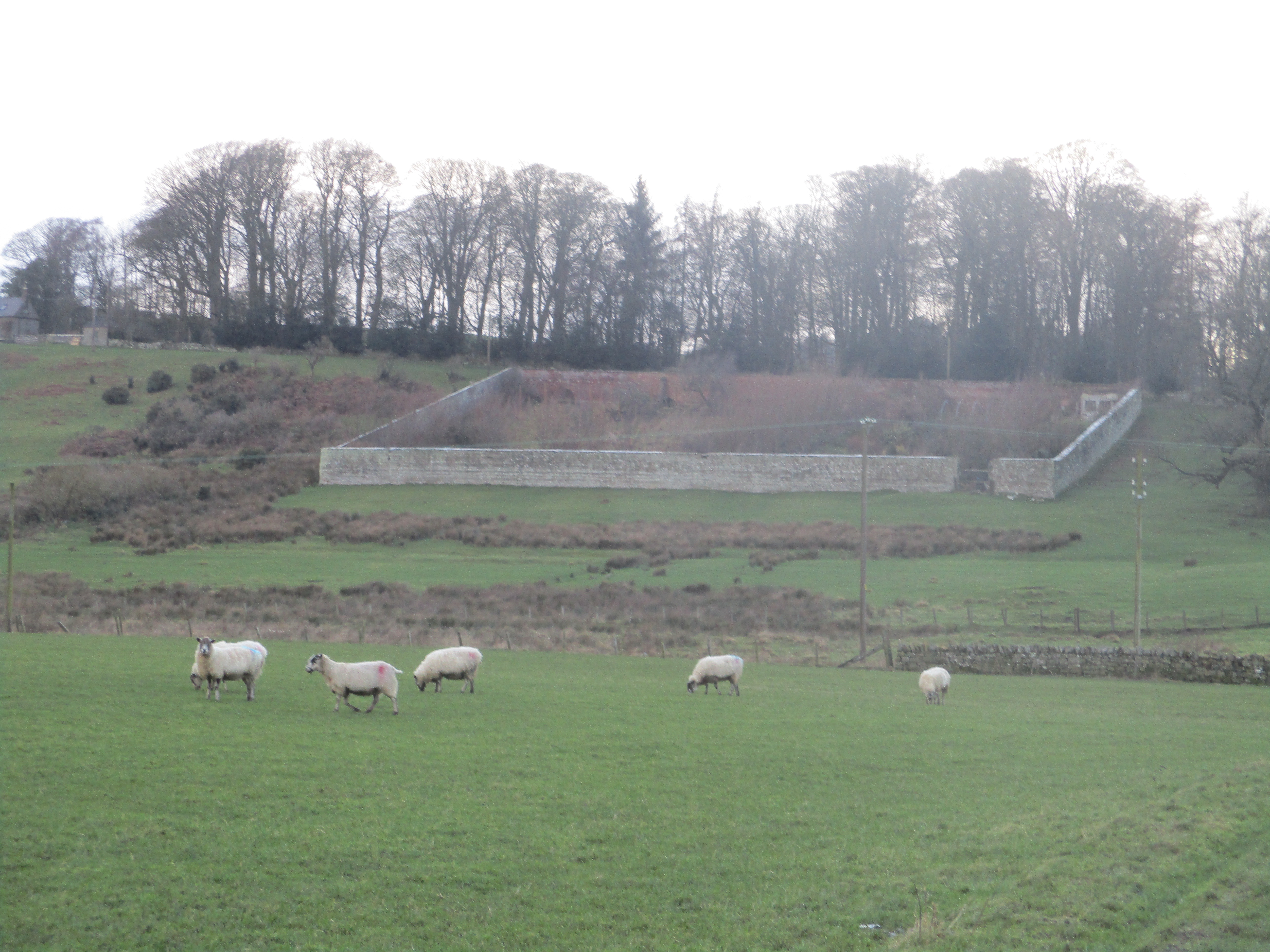
                    The walled garden at East Shaftoe Hall

                 and a gloomy picture of the farm.

At this point it started to rain adding a little misery to the strong wind. We followed the farm track close to the Iron Age fort before turning north to Shaftoe Crags where we took shelter and called a Herbie.

Lunch spot at Shaftoe Crags. Skinny whips and Christmas cake eaten out of the rain but in the cold
Taking on the bad weather, hoods up and fastened, we continued battling the elements before turnin east to walk through Salters' Nick.

The crags were cut through to assist carters on their way. Never spotted them but there are pick marks on the right and the cut is wide enough for a wagon. It would need good springs!

From the Nick we crossed muddy fields, churned up by hooves until we reached the firm farm track and walked in relative comfort to Bolam West Houses. Turning right we walked down the road to the first small car park on the lake and took the footpath to the left following the north side of the water back to the Visitor Centre. We considered a cup of tea but were so wet and muddy we decided to head back to the car and home.


Contains OS data, copyright. Crown copyright and database right 2023.

A good walk, even in poor weather. About 8 fairly flat miles.


Saturday, 16 December 2023

A view from the terraces

 A view from the terraces  December 15th.

MUD WARNING

Stiil looking for firm tracks after the rain and snow six of us are out on a familiar walk from Rothbury. Brian, Margaret, Harry, Ian, John C and I are off to traverse the terraces above the town. Devised as carriage drives by Lord Armstrong they cross moorland and with a couple of forestry tracks make a mostly easy walk, hopefully.

Rothbury is reached by following the A1 north, taking the A697, turning left at Longframlington. In the town turn left down Bridge Street, cross the river, turn right and make use of the large and free car park.

Rothbury is on the edge of maps. The walk is covered by OS OL 42 Kielder Water                                     &  OS Explorer 332 Alnwick and Amble. Advisable.

                       Rothbury riverside car park. Not a winner.

Booted and windproofed we crossed the footbridge and headed to the Newcastle Hotel for breakfast, passing All Saints church on the way.


Al Saints, Saxon origins and Victorian rebuilding, with lots of additions inbetween.

 Once breakfast was finished we set off  up to the town centre, turned left  up Brewery Lane and passed the terrace of flats built by Lord Armstrong for his rtetired estate workers.

Addycombe Terrace flats 19th century

Taking a footpath on the left we crossed a field to a higher road, turned right and after a short distance took the footpath across fields to a forest track. (Mile 1). Turning left we followed the meandering track through Addycombe for a mile Before turning off (Mile 2) and taking a footpath across open land. More like a  muddy trench than a footpath, narrow and stony, crossing a footbridge and eventually reaching a forest track. Turning right this track took us to another, we turned left and at Mile 3 went through a gate on to open moorland.


                 Rothbury from the terraces.

The track took us on an almost semi-circular route until at Mile 4 we reached  Blue Mill

                  They are waiting for the old ones to catch up.
After a half mile of gentle uphill walking we took the footpath on the right, crossed a stone stile and were back on open land on a fair track.
                             A proper stile
On previous occasions we have stopped along this track for a Herbie but it was cold and windy so at Mile 5 we went through the gate and walked downhill to Physic Lane.
                      This way for Physic Lane

                      Thropton from Physic Lane.
Close to the Cross Keys pub we made good use of a bus shelter for a Herbie: Mince pies, lemon cake and savoury bun from Mrs A.
Crossing the stream we walked through the coach park and took the footpath round to a footbridge over the River Coquet.

Crossing the Coquet.
We expected the fields to be a marsh after the recent rains but they were merely damp and we followed the river bank to a footbridge just before mile 8. 
                              One more footbridge.
Once across and having taken the field path and scambled up a short but muddy bank we were on the Rothbury riverside footpath which took us back to the car park.
Rehydration at the Ridley Arms in Stannington. Anarchy Blonde, very drinkable.

                     Contains OS data, copyright. Crown copyright and database right 2023.
The walk is about 9 miles, easy going with a couple of short climbs.