Translate

Saturday, 26 November 2011

Женныъс Лантерн
Jenny's Lantern November 24
   In 1959 the Everly Brothers had a hit with a song called "Poor Jenny" written by Boudleaux and Felice Bryant. Not one of their greatest hits in the UK, it was the tale of a teenage couple going to a party which ended in "a heck of a fight". Poor Jenny got arrested for being a teenage gang leader and was jailed. Her family, not surprisingly, were hot on the trail of her boyfriend. Great stuff, a ballad of teenage angst, no an operetta. I still think their best song is "Always Drive a Cadillac."
 The Jenny of the title of this weeks blog was a far more sensible woman. Legend has it that Jenny stood on top of a hill at night with a lantern, guiding her husband home from his drinking session in an Eglingham tavern. The hill now bears the name "Jenny's Lantern." Sounds like the sort of wife we gadgies need. An alternative explanation for the name of the hill is that "Jenny's Lantern" is a local name for will o' the wisp, the phospheresccent light seen on marshy ground.
  There are seven gadgies out today, (A heptagadge) last week's crew has been joined by Cornish Johhny, friend of Dave, registered gadgie and keen, knowledgable musician. Proper music that is, Jazz, sixties pop and so on. Henceforth to be known as musicmeister.

Today's walk starts in Eglingham, a pretty linear village in Northumberland. From Newcastle take the A1 to Alnwick, go through the town and shortly after the castle take the B6346 to Eglingham. There is some parking on the lane down to the village church which is dedicated to St. Maurice,* patron saint of English dancers.  It was built in the 12th and 13th centuries, like much of this part of the country was sacked by the Scots, and rebuilt in the 17th century. At the right time of year you can buy home made preserves in the church, an honesty box is provided. Down the village street you can also buy farm vegetables from an open stall, honesty box also provided. Sainsbury's, Morrisons etc. please note! Use OS81. The church is at GR106195.
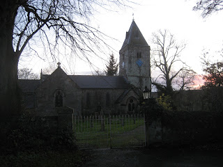
St. Maurice's church Eglingham.


From the church walk past the village inn, The Tankerville Arms, a lovely friendly pub and restaurant, past the farm vegetable stall until you come to a signpost on the righthand side of the road. Go through the gates, carefully closing them behind you of course, and follow the path on the south side of the Eglingham burn through several fields. Keep Kimmer Lough on your right hand side. On our walk the lough was home to a large flock of geese which took off, circled in a magnificent skein and landed back on the water, becoming a flock again.  Dave thought they were Greylags but was not too sure.
Once across the Titlington Burn turn right and follow the path uphill, turning off to the left to climb to the top of the hill called Jenny's Lantern. On the top is the ruin of a building described as an eyecatcher, a type of folly, possibly built round a shepherd's cottage. It makes a good Herbiespot.

 Although we were not welcomed by a lantern waving wife, nor by Harry's mythical Scandinavian Air Stewardesses, Jenny's Lantern made a welcome Herbiespot, especially as a short sharp squall arrived, forcing us to don waterproofs. I think that's my glove on the left. Forget the blue sky, it rained. Of course I brought pies. I am the pieman.


From Jenny's Lantern the walk continues almost due west to an L shaped plantation. Between the Lantern and the plantation is a small tarn, there were many small ducks on it, either wigeon or teal.  In the crook of the L is stone cairn. at this point turn north west downhill. But take care, do not cross Titlington Burn and walk up the side of the field towards Titlington Mount or you will be hunted down by an irate farmer on a quad bike and ASBOed. Instead turn left down a tree lined farm track south of the burn. Just before Titlington nip across a field which is not a right of way but joins one at the next fence. When this path reaches a road turn left and almost immediately turn right through Titlington Woods. Once through the wood follow a rough path westwards to the Trig Point* *on Titlington Pike.
Shepherd's Law, Hermitage of St. Mary and St. Cuthbert. The chapel is on the right.


  From here you can see Shepherd's Law, an 18th century farm which since 1971 has been slowly rebuilt as the Hermitage of St. Mary and St. Cuthbert. An ecumenical retreat with a beautiful modern chapel completed in 2004.***
Take the path above Shepherd's Law towards Beanley Plantation. Once inside the woods turn left at the first forest trail and then turn right almost immediately. This uphill track is very muddy, the ground having been churned up by a large John Deere machine with half a dozen deeply treaded tyres. The machine strips the conifers of their branches and cuts the tree down. No tartan shirted "I'm a lumberjack and I'm OK" chaps round here!
 When you emerge from the wood onto a road climb the bank on the right and cross the fields to have a look at "The Ringses"****. Nothing to do with Tolkein, the Ringses are the remains of a 2000 year old fort and settlement. Dave likes them!
Turn south and walk to a track, turn left and after about half a mile turn left on to a badly signed path that leads over fields and back to Eglingham
 My pedometers worked well today, giving readings of 10.61 and 10.08 miles. Dave had trouble, one pedometer working in kilometres, neither being too close to mine. The Benometer said 10.7 miles, measuring on a map gave just under 10. The walk is easy, little climbing, but at this time of the year it is muddy.
  We finished the walk about 4pm. The Tankerville Arms was closed until 6, winter hours I suppose, which was a shame so we were forced by circumstances to retire to the Anglers Arms a Weldon Bridge to check the quality of the Timothy Taylors Ale. It was excellent as usual, we sat round a real fire and discussed how, as children, it had been our job to bring the coal in, some of us had had the old style ranges which were fires and ovens alongside. Today we all have central heating, and much better it is too. The beer and crack were so good Brian suggested we stay the night, nice idea, should do it sometime, then the drivers can drink too!
* Not really, before you tell me it's spelled "Morris". He was a leader of the 3rd century Roman Theban Legion and patron saint of soldiers, swordsmiths, armies and infantry.

* *Trig point. Before satellites the UK was mapped with incredible accuracy by the Ordnance Survey. Trig points, truncated square pyramids, were erected on hundreds of high points and used in mapping. George Everest did a similar triangulation mapping of India, hence the name of the mountain.
*** It has a web site with history, pictures etc. www.shepherdslaw.org
****The Ringses, a multivallate hillfort, deep defensive walls and several settlements around it. Not covered inthe Hillforts book mentioned elsewhere, presumably because they are outside the national park. Shame.

привет русcкий  читатели!

And finally, the College of Arms has been pleased to award me a coat of arms. I had it designed by a young cartoonist and writer of a soon to be published children's book. It is a pie couchant with crossed quills. My motto is borrowed from a walking society that is hibernating, The Wobbly Bellies. In case your Latin is not up to scratch it means "Seldom Passed but often inebriated"  It was translated from English by my daughter, so blame her if it is incorrect.


see www.helenhancocks.com
www.cakepoppins.co.uk


Lord Blogpiemikester


Saturday, 19 November 2011

Tea shops and tea trails November 18th.
    This week my blog has been visited 17 times by people in Russia and 12 times by people in the United States. Why? I can't imagine Russians wanting to know about walks in the North of England, Americans maybe. Let me know, but preferably in English.
    Anyway there are six of us out today, a super selection of sexy sexagenarians wandering the moors around Allendale. We are going to follow part of Isaac Holden's tea trail,*  following in the footsteps of a man who, in the nineteenth century, sold tea to the farmers and miners of this part of Northumberland whilst his wife stayed at home to mind their grocers shop.
  Our part of the walk starts in Allendale. From Newcastle take the A69 to Haydon Bridge, turn left onto the A686 and at Langley turn left onto the B6295, through Catton to Allendale.  On LR 87 the town centre is at GR 838559. In the square there is a tea shop supplying excellent bacon sandwiches and tea.
 This area was once the centre of a thriving lead mining industry. The first record of lead mining is in 1230(AD not GMT or even BST) but it was not until the mid 16th century that the industry really expanded, and it continued well into the 19th. As a result the area could be an industrial  paradise for someone like Dave wearing his archaeologists hat, but not today, we are walking. In spite of the mining that went on here the area retains a certain beauty, the river valleys are deep and wooded, the moorland bleak, you almost expect to see Kathy running across the landscape crying for her Liverpudlian waif.**
I could have been a Geography teacher but I was hopeless at P.E. although I had a jacket. If you look carefully at the picture of the River Allen you can see many sedimentary layers of rock. Out of sight on the right of the river are old flood plains, or haughs. (See St. Oswald's Way)


  The Tea trail from Allendale leads off the square, down a steep road, crosses the River Allen and follows a well marked trail across fields, through woods and farmyards. Sometimes the markers are the yellow Public Footpath signs, occasionally the tea trail markers with a silhouette of Isaac. Between fields there are stiles or kissing gates, ***a lovely walk for a happy couple. At New Shield we left the Tea Trail and followed a mere public footpath to Low Acton where a track led to a minor road. Turn left on the road and after a half mile there is a good track on the right. A large sign says "Private", a smaller one maintains there is no right of way but as we have nearly all been awarded ASBOs ** **by irate land owners at times, and as we are all poor readers, we took the track anyway. On my OS map the track runs alongside a kite shaped plantation, Dave's more up to date and larger scale map also shows a plantation, but it has gone, eaten by Jenkins Forestry Products.  But just beyond  where the North West corner of the plantation would have been if the plantation still existed are two small and securely locked corrugated metal huts. Peering through the window we could see bottles of soft drink, beer and cider, provisions for the brave and noble hunters who come to the moors to defend the nation from grouse. Although we could not get in, not being brave and noble hunters, we made use of them as  an al fresco Herbiespot.

Five gadgies, from left to right;
Vogelmeister, halfmarathonmeister, punmeister, dashing and debauched Ray, routemeister. Photo by blogpiemikester.


  Obviously shamed by last week's failure Dave had brought a supply of pork pies, but so had I. They were welcomed and I acquired the title "blogpiemikester". The college of Heralds are designing my new coat of arms, " a pie rampant, with quill".
  After lunch we continued on the track across Acton Moor. There are some superior shooting butts alongside, sixteen in all and numbered   "16 1",  "15 2"  "14 3" etc. There must be a reason for this, all sensible suggestions will be considered.  Eventually the track runs out and there is a considerable stretch of Lauder grass to cross before reaching a minor road. Turn right and make a decision. It is possible to take a footpath in the direction of Ninebanks and rejoin Isaacs Tea Trail or, as we did, follow the road for about a mile and then take the footpath to two chimneys on the moor. Relics of the days when the area was a centre for lead mining the chimneys are the end point of stone built flues that lead up from the old smelter.  Although now ruined it is possible to follow their line back down to the valley of the Allen and be amazed at their construction. Apparently small boys were employed to work their way up the hillside inside of them collecting any lead (or silver) that had been deposited on the walls. Not surprisingly, life expectancy for the miners of the area was not very high.
 On reaching a road, turn right and wander back into Allendale. Allendale has several nice pubs and some strange traditions. On New Years Eve the locals take to walking round the town square with blazing barrels of tar on their heads, an activity that the Health and Safety people must surely stop soon. Was Oliver Cromwell the first Health and Safety officer, or just plain miserable I ask. We chose the Golden Lion which sold Timothy Taylor's Landlord but I was driving.
  It was a grand day for pedometers: Dave wore two which measured the walk as 8.54 and 8.97 miles. I wore two but lost one, the remaing Higear gave a reading of 9.6 miles. The Outdoor GB App, bought at considerable expense, had used 43% of its battery after 4.5 miles although the young man in the Apple Store told me how to conserve power. The Benometer said 10 miles. Dave measured the walk on a 1:25000 map as 9.8 miles, my attempt on 1;50000 said 9.5. 9.5 seems about right.

* Roger Morris has produced a delightful booklet about Isaac Holden and his tea walk, called  Isaac's Tea Trail. I like to boast my copy is autographed by the author, we met him on his allotment near Birtley once.
** I went to see the latest film version of Wuthering Heights last week. It contains a version of a classic joke which I could not print here, but if anybody knows the story of the young man who took a degree in wit and repartee after being insulted by a clown you know the one. Presumably so did Emily Bronte.
*** For my foreign readers: A kissing gate is a gate that swings inside a V shape, only allowing one person through at a time. Traditionally you kiss your partner as they go through. If my book of Cumbrian gate fastenings ever gets written ther will be a photograph.
**** Again for my foreign readers. An ASBO is an Anti Social Behaviour Order, dreamt up by the last government for minor misdemeanors and worn as a badge of honour by the awardees.


Friday, 11 November 2011

High Cantle      11-11-11

   There are five gadgies out today, four from last week and Ben the halfmarathonmeister.
   The plan for today was to walk up Hedgehope from Hartside in the Breamish Valley but the low cloud changed our minds for us, no point in going where you can't see anything.
   Instead we opted for a gentler walk from Hartside. To get to this farmhouse from Newcastle, shortly to be renamed Sports Direct on Tyne, take the A1 north, A697 just north of Morpeth and a couple of miles north of Powburn take the road on the left signposted Ingram. Drive as far as you can, to the sign that says  "no cars beyond this point, please". This is Hartside, GR 977162 on OL16, The Cheviot Hills.
  From Hartside, especially on a misty day like today, follow your nose along the surfaced road that leads to the tiny but very attractive settlement at Linhope. There are only three or four houses, lovely place to live if you don't like going to the pub. On the right and a little way up the hill is an ancient settlement called Grieves Ash. It is an interesting site  for Dave and has special meaning for me. The next time we walk there all will be revealed, so keep reading! The road becomes a track and  after about half a mile there is a junction. The right fork is signposted "Linhope Spout", a very pretty waterfall and well worth a visit, but not today.  Take the left fork which leads over the moors. Today it was very muddy and low cloud made it difficult to see but thanks to intuition and a magic needle, an improved version of the magic fish used in that terrific film "The Vikings", we wandered westward to Rig Cairn, turned on a bearing of 250 degrees and eventually came to High Cantle. From here a rough path leads down a steep slope to the valley of the Breamish and a farm track. Turn left on the track and soon you come to a barn like structure which makes a good Herbiespot, inside on a damp day or outside on fine days. It was a damp day. The two tups * in the shed looked ready for work.
An attractive Herbie spot on a damp day.


 Last week Dave, the vogelmeister, had not brought his usual offering of mini pork pies, as he is on a low fat kick. I made a mental note to buy some but forgot until the morning of the walk. Fortunately our local Sainsburys** opens at 7am so I was able to get some long before we set off, cut them into correct gadgie halves and add them to my lunch box. I even packed a couple of sachets of HP Sauce***.  They were welcomed by all, Dave was rightly ashamed, guess he will bring some next week.
Joke of the day:
American to Irish diver.  "Why do you fall backwards off the boat ?"
Irish diver. "Because if I fell forward I would still be in the boat."
The other jokes are not fit to print.
After a fond farewell to the tups we continued along the track past High Bleakhope Farm. Be careful, two years ago as Harry and I walked past this farm an irate farmer ran from the house politely asking us not to look through his window. It's the isolation that gets them.
 Further down the track is Low Bleakhope farm. Here you can turn left and follow a track back or you can do as we did and follow the old Salters Road over the moors.  A lot of money has been spent upgrading this track and work is still going on. We suspect there will be a plantation appearing shortly, or shooting butts.
  After about a mile and a half a grassy track leads off to the left, passes several low level grouse shelters and feeders and joins a surfaced road. Turn right, walk past Alnhamoor Farm and stay on the road to Hartside.
  The pedometers have worked well today if a little generously, averaging out at about 8.5 miles, enough on a poor day.
  The Anglers Arms had its usual supply of Timothy Taylor's and I wasn't driving.
* tup  northern word for a ram
**For my increasing number of foreign readers, Sainsburys is a British supermarket chain
*** Again for those of you not familiar with British delicacies HP is a spicy brown sauce named after the Houses of Parliament.
Those of us of more mature years learned our French from the side of the bottle which used to have printed on the label:
"Cette sauce de haute qualite est un melange de fruits orienteaux, des epice................"
Now it is made in Belgium or somewhere and the French has gone.


Wednesday, 9 November 2011

Saint Oswald's Way November 4th. Haughs and Heughs

In the early days of  Christianity in England  Northumberland seems to have produced its fair share of saints. Cuthbert, Aidan, Hilda, Wilfred and Oswald  to name but five.  Cuthbert is probably the most famous as he was carried round the north east in his coffin before the pallbearers decided Durham was not only a good place to bury him but an imposing site for a cathedral too. Health and Safety would not allow that sort of thing today.  The Venerable Bede didn’t quite make it to sainthood but did write a book on the history of the church of Enland some several hundred years before the Reformation, a great act of foresight.

  Two of these saints also have long distance footpaths named after them, Cuthbert and Oswald, and today  a team of four gadgies are following a section of St. Oswald’s Way from Rothbury to Longframlington.  As well as being a saint Oswald had been a king. When he died his arm was taken up by a raven which flew off to a tree, afterward known as Oswestry (think about it). His head supposedly rests in Durham Cathedral although three other religious houses in Europe also lay claim to owning it.

  We seem to be acquiring nicknames, I am the blogmikester, Harry is the routemeister because he usually plans the walk as nobody else can be bothered, not because he likes London buses, Brian is the punmeister and poor Dave has been unfairly christened the snotmeister because he has had a cold recently. I think I shall call him the vogelmeister because he is good at bird recognition.

 The walk starts in Rothbury, easy to find from Newcastle. Follow the A1 north to its junction with the A697 signposted Wooler and at Weldon Bridge turn on to the B6344 for Rothbury, a pretty little town, ample parking and several cafes for a bacon butty to start you on your way. (Except for Ray but he wasn’t out so it doesn’t matter.

  Because St. Oswald had his arm taken by a raven some of the markers on the route have a silhouette of  a raven, some are just public footpath markers and some are proper finger posts.

  From the main street take the road that crosses the river and turn left. Walk past the road leading to a caravan site and a little further on turn off the road at the “St. Oswald’s Way” finger post. The footpath leads through woodland, there are easily spotted markers and some kind soul has tied plastic yellow ribbons round the trees, even though they are not oaks.

  You may, if you wish make use of the dismantled railway line for a while, it is less muddy and the paths eventually converge. The footpath continues through fields and patches of woodland until you reach the road bridge at Pauperhaugh.* Admire the bridge but do not cross  it.


The bridge at Pauperhaugh.


Turn right and walk up the road a few hundred yards before turning left into a field. After a few hundred yards there is a dilapidated old farm building with a mini hemmel** and a rusting tractor.  We made it a Herbiespot and settled down for lunch. The vogelmeister coyly admitted he had not brought his usual offering of mini pork pies as he was getting concerned about their fat content. A feeble excuse really as they have become one of the traditions of gadgie walks. Next week I shall make sure I bring a supply.  The tractor was carefully examined by Dave who lived in Coventry and knows about these things. It had been red so couldn’t have been a John Deere, I think he said it was an International.

  After a few awful jokes to make up for the lack of pies we continued via Thorneyhaugh and Middleheugh*** to a point on the river across from Brinkburn Priory a 12th century priory famous for escaping destruction by marauding Scots by not ringing bells, used in summer for outdoor concerts of classical music and owned by English Heritage. It was closed anyway, like a lot of England. 

  The path then continues through Brinkheugh and Thistleyhaugh  to Weldon. Pause on the old road bridge and watch the river. We saw several salmon leaping the weir, a dipper and some distant ducks that were difficult to identify.  If you must,  walk past the Anglers Arms, turn right and go under the modern bridge that carries the A697. Take the track through High Weldon, past the gun shop at Low Town and follow the road into Longframlington. A few hundred yards down the road  opposite the Village Inn  (See “The Invisibles”) there is a bus stop and an hourly service that takes you back to Rothbury. A proper gadgie walk, including bus passes!

  There has been a lot written recently about feral English children and their appalling behaviour. The bus we caught was obviously a school bus and the twenty or so teenagers on it were very well behaved. And like children all over the north east they each thanked the driver as they got off the bus.

  Back in Rothbury and after a quick change of footwear we drove back to the Anglers’ Arms at Weldon Bridge. Timothy Taylor’s Landlord or Abbot, and I was driving.

  Not the best of days for the classy HiGear pedometer which sulked but ASDApeds claim  9.2 miles. And quite easy going too.


*Pauperhaugh.  The inhabitants may well have been poor but it comes from Papworthaugh, whoever he was.


** Farm outbuilding, usually with several open arches.


***Haugh and heugh. Not a spelling mistake.

A haugh is a piece of flat land near a river.

A heugh  is a promontory or hill.


Tuesday, 1 November 2011

Walking with a gadgette October 24 - October 31

   There has been a gadgie walk this week, but not for me as I have been on holiday with my wife Kathleen, who is 65 and qualifies as a gadgette, although she is not too keen on walking.
   We went with our friends Evelyn and John to Madeira, an island we have visited several times. It is an excellent holiday island, far south enough to remain warm all year, high enough for some serious walking and for pleasant easy strolls there are the famous levadas. There are 1335 miles of these irrigation channels on the island. They were built to carry water down from the higher ground to irrigate the rich agricultural areas below, and they are still used for that purpose but they are also popular for walking. Generally speaking they slope very gently down hill, occasionally passing through tunnels, often apparently  stapled to the sides of cliffs with vertiginous drops to the valleys below. Choose with care if you suffer from vertigo.
   For one afternoon's stroll I chose the Levada dos Tornos *which carries water from the north of the island mainly through tunnels but a good starting point is near the Monte Gardens, accessible by bus or cable car from Funchal the island capital.
  We travelled by bus, mainly because we had bought 5day passes from the local bus company but also because  the gadgette is terrified of cable cars ever since an American fighter plane cut through the cable of an Italian cable car some years ago. I did persuade her to ride a cable car up a mountain in Austria, she sat in silence with eyes shut for the whole journey.
   To reach the start of the walk from the bus stop we had first to negotiate a rough path through woodland until we came to the spot where the levada emerges from a tunnel. After an easy start my problems really started. We soon came to a section where the path alongside the levada was about 18 inches (45cm) wide and the drop about 200 feet (60m) and there is no railing.  I knew the gadgette was not too happy when she threatened to smash my head in for bringing me to this place. The problem was solved quite easily. Evelyn and I got a stick about  4feet long  (120cm). I held one end, Evelyn the other and the gadgette, still cursing, walked between us with a movable handrail!  It boosted her confidence and saved my head. Sadly I was unable to take a photograph of the happy scene.
   Eventually of course we passed the hairy bit and the levada  wandered on through woodland, eucalyptus trees, agapanthus plants, brightly coloured finches and a dead rat in the water.


Kathleen, assisted by home made walking poles climbs towards the Levada dos Tornos (right). This is an easy section the side sloping quite gently to the left.


   We walked on for another  4miles (6.4km) where we came to a small settlement and after walking down the road for another mile or so found a bus stop and bus to take us back to Funchal.
   Before you start thinking I am being cruel to my wife I should point out that she has suffered from a very rare form of arthritis for several years and her achievement on this walk demonstrates that the drugs she is taking are having some positive effect and she is determined to overcome the problem.  In my humble opinion, her walk today was, as young people say, AWESOME. ** And I felt proud of her.
  We had several other walks on the island, mainly proper tourist walks with pauses for tea and scones or something more adventurous like Fanta.
  One day we visited the Madeira Story Museum, very interesting and buttons to push for children. The island gets a mention from Pliny the Elder and Ptolemy, which fascinates me. The ancients must have been brave to travel so far across the Atlantic. They refer to it as "The Purple Isle". Modern Europeans found it in when Zarco, a Portugese sailor sailed there in 1420 and claimed it, as you do, for Henry the Navigator. However there is a tale that in 1344 an Englishman on the run with his lover landed on the island but both sadly perished. This man from Bristol was called Machin. Now I have a nephew by marriage called Tim Machin, actor, singer, teacher and general good guy living in Toronto. I think he could possibly have a claim to the island, becoming King Tim or at least president. Tim, if you do, you will need a Chancellor of the Exchequer and I have a calculator.
* A good guide to walks in Madeira is  Walking in Madeira by Paddy Dillon, published by Cicerone.
** Normally I attribute being awesome to God or the universe, but there are exceptions.

Back to proper gadgie walks next week, the days are getting shorter, we could be walking railway lines. And thank you Estonian person for reading my blog! Getting to be quite international.
 

Saturday, 22 October 2011

Hadrian's Muriel: a sad tale of a lost pedometer and disintegrating boot  October 21st.

  For those of you not familiar with our little island history you need to know that the Roman Emperor Hadrian ordered the construction of a wall across what is now England in the year 122AD. Its purpose was to define the northern frontier of the Roman Empire and to keep a check on people passing through the wall in either direction. The wall was 75 English miles long, 80 Roman miles , and had forts, milecastles and turrets built at regular intervals. Although much of the wall has gone the Hadrian's Wall Path is a popular long distance walk and follows the remains or the line of the wall from Bowness on  Solway to Wallsend on Tyne.*
  Today's gadgie walk is along approximately twelve miles of the wall from Chesters at Chollerford to the wonderfully named Twice Brewed.
  The starting point is the roundabout at Chollerford, a layby on the B6320  (OL 43 GR 919706) road to Bellingham has a convenient  space for several cars and the cafe on the B6318 does an excellent bacon roll breakfast to start you on your way.
 This walk is so easy to follow you could do it without a map but the Ordnance Survey map of the wall is useful for identifying turrets, milecastles and other archaeological features.
 With pedometers zeroed and spirits strengthened by bacon (except for Ray, who, true to his principles made do with a cheese scone) we set out along the B6318, reaching Walwick (the farm on the wall) after about a mile. Turning right down a lane between the houses of the village we walked a few hundred yards to a signpost directing us across fields. The path here follows the wall itself, the walking is easy although in places the ground was muddy, mainly due to the number of cows congregating near gates and churning the field up.


This stretch of wall gives some idea of its construction but not its height. Nearby farms are probably built of stone quarried by Roman legionnaires. Vandalism or recycling, take your pick.


   Just beyond Carrawbrough Farm the path crosses the road to Brocolitia Fort and a diversion takes you to a handy Mithraum nearby.

Mithras was very popular with Roman squaddies who got up to all sorts of things in his temples. This one is near the fort of Brocolitia on the wall.

Crossing back to the north side of the road we continued on the line of the wall until we reached the remains of a turret (possibly 33b) where we decided to stop for lunch. The turret became a herbievorium.** Dave asked me how far we had come and I reached for my pedometer. It had come loose from my belt and was lost. After several expletives I grumpily settled down to eat my sandwich. My pedometer was a quality one, Hi Gear, retailing at about £20 but I had won it in an ebay auction for the princely sum of £1.74, no wonder I was mad. The situation was not helped by the punmeister's quip, "Do you think all the Roman legionnaires were in the Turretorial army?".***
   At this moment Chis and Nigel appeared, walking the wall in the opposite direction to us. As we chatted about bthe pleasures of walking I asked them to look out  for my pedometer on their way to Chollerford. Dave, who, considering he has a phone but has never been known to use it, suggested I give my phone number. I did.
  Moving on we approached what to me is the finest part of the wall, the stretch from Sewingshields (from Sigewine's shields) to Steel Rigg. Along, and beyond, this stretch the wall makes use of the Whinsill and stands high above the surrounding land, giving superb panoramas of Northumberland. At Sewingshields you can look down on the outline of medieval fishponds, Broomlee Lough and the more distant Nature Reserve of Greenlee Lough. Just over a mile from Sewingshields is the fort of Vercovicivm, better known as Housesteads and a must for school trips. The foundations of the fort are clearly visible, the museum and information centre well worth a visit and, as it is a popular site for school trips there were some bored looking sixth form girls waiting over by the fence, taking photographs and texting on their mobile phones.
  Beyond Housesteads the Pennine Way crosses the wall as it winds it's way to Kirk Yetholm in the borders.   And after Hotbanks farm the wall approaches Highshield Crags, a couple of hundred feet above Crag Lough, and my favourite spot on the wall.The crags are home to ravens, peregrines have been see there and far below there is usually a family of swans on the Lough. This spot alone is worth the walk.


           Crag Lough from Hotbanks Farm. The wall is built on the top of the craggs.                                                                                   

Dave points out the arch of a north gateway at one of the milecastles.

Ray, Brian and Dave at Hotbanks farm.
Beyond Crag Lough the wall dips down to Sycamore Gap, made famous by Kevin Costner in "Robin Hood". People who know the area and the film remain mystified as to how Robin got from Dover Beach to Hadrian's Wall in one frame. The magic of the movies !                                                                               


Ye  Olde Sycamoree Treee

From Robin's tree the wall climbs up to Peel Crags and from there the path leads to the car park at Steel Rigg. However, in order to see the crags that are popular with climbers we went round the base of the crags, admired a solitary climber and walked down the road to Twice Brewed. As we walked around the crag Dave exclaimed the sole was coming off his much loved "China Boots", a bargain from Go Outdoors. By the time we made it to Twice Brewed the sole, which was glued to the upper was almost completely off. It could have happened anywhere, if it had to happen we were at least near the end of the walk. My phone rang. It  was either Chris or Nigel, they had found my precious pedometer and would leave it at the car in Chollerford.                                                                                                                                                
                                                                                                                                    
This walk is a true gadgie walk as we were able to catch the AD122 bus back to Chollerford. This bus runs along the wall from April, to the end of October. The driver was extremely friendly as Dave asked to be dropped as near the car as possible because of his boot. The driver explained, "Ring the bell 100 yards from where you want to get off and leave the rest to me."                                                                                    
Back in Chollerford there was  no sign of Chris or Nigel. Brian drove a short distance up the road, my phone rang. "Your car has just passed us, no he's stopped, turned round and has offered us a lift for the last half mile. Your pedometer is safe!"                                                                                                                   
We called at the George, a very nice hotel next to the bridge at Chollerford and overlooking the Tyne. After an expensive pint it was decided to move on to The Boathouse at Wylam. Paradise! At least twelve real ales on sale. It was tempting to stay and catch a train back to Newcastle.                                                            
Dave's pedometers gave two readings. (He wears one on each hip, like John Wayne, but so do I) One said 12 miles, the other said 9.9. We both measured the walk as 12.2, so a claim of 12 relatively easy miles is a good one.                                                                                                                                  
* There are legions of books written about the wall. A good one is Hadrian's  Wall  by David Breeze and Brian Dobson.  For the more technical minded who want a stone by stone history of the wall the "Handbook of the Roman Wall" by J. Collingwood Bruce, originally published in 1863 but updated at least thirteen times (Fourteenth edition in 2006) is a must. The Great North Museum in Newcastle dedicates much space to the wall and of course the forts at Vindolanda, Birdoswald and Housesteads are well worth a visit   
** Hebievorium  A Latin phrase for eating place. (See Pliny the Elder et alia)
*** For my foreign readers, the British Army reserve is called "The Territorial Army"      
I   seem to be having alignment problems. Must try harder.                                                                                                                                                                                


Monday, 17 October 2011

A gadgie Ramble  October 14th

   There has been a gadgie walk this week, of a sort. Harry has family staying, Dave is visiting family,Ben  is still away, Herbie seems to have disappeared to live in Greggs and I have been very much off colour. This left Ray and Brian who went off to count the fish and chip shops between Craster and Seahouses.
     Last week I met a man I had been to college with. He had been a teacher and a warden  in an Outdoor Centre in Northumberland before cuts forced the county to close its centres, thus depriving many young people of some outdoor experience. He now works for, or maybe owns or is a partner in a small printing company in Wooler. He told me that Peter Clark, author of Where the Hills Meet the Sky, a book about wartime crashes in the Cheviots, had died earlier this year but that his books were still available. (see Hen Hole  September 23rd walk) Curious I looked up http://www.glengraphics.co.uk/ and found a good catalogue of small books about the region. Some local history, some local walks and local photographs. As you do when surfing I looked for links and quickly found http://www.cheviotwalks.co.uk/.  This site has a host of Cheviot walks, extremely well  described, with far more detail and information than I give. Written and illustrated by Geoff Holland they are a must for anybody wanting a more serious guide to a walk. I recommend them.


                                                                       Brian suggested I add pen portraits of the gadgie crew, so here  are most of us.  From left to right:
John Lockey, Brian Algar, Dave Kear, Harry Nagel and Herbie Tonge. Naturally I am missing, I took the photograph and have not mastered the self timer,


John Lockey is, at he moment, an occasional gadgie because he has to work to pay for his daughter's wedding. John is an electrician by trade, probably an electrical engineer. He probably could do the proverbial and sell a refrigerator to an eskimo. He is also a Makem, * but we try not to hold it against him.

Brian Algar has a degree in agriculture from the University of Newcastle, so he taught IT. He has a gift for puns and a love of bacon sandwiches and beer .

Dave Kear is the archaeologist and has been doing a course at Newcastle University for the last twenty years  called the Quternary. Even the lecturer has forgotten what it is about.Dave is very good at bird recognition and pretty good with flowers too. He is a big ALDI fan and I think in this photograph he is wearing ALDI boots. He is very keen on pedometers and has six. Also has an unused camera.

Harry Nagel started his working life with Parsons, manufacturers of electrical generators to the world. He gave it all up to lecture in engineering at a local college. Parsons was taken over by Siemens and more or less closed down as a result. Good photographer too.

Herbie Tonge has been just about everything; merchant seaman and teacher of bad boys are the jobs he talks most about. Takes thousands of photographs but nobody ever sees them. Very fond of food but remains slim.

Ray Craven is a sociologist by trade and worked in college with Brian, Harry and John. Not the most regular of gadgies but fully qualified and always welcome for his dashing good looks and merry tales of debauchery.

Ben Hull was a motor mechanic and is a fine runner. He accompanies celebrities on the Great North Run, wearing a bright yellow outfit so the cameras can pick him and his celeb out. Sometimes I think he could be more interesting to interview than the person he runs with.

And this is a photograph of me at the controls of a 3000 tonne coal cutting machine in Czechia. Yes I am in the yellow cab at the end of the arm and of course it wasn't working. Who would trust me with a 3000tonne coal cutter? I certainly wouldn't.
    I used to work as a teacher, in high schools, although many people, with some justification, would say I never worked a day in my life.

    As a child I had wanted to be an opera singer. In my first music lesson at Grammar School in September 1955 we were required by the teacher to come to the front of the school hall and sing up a scale as he played the piano. I was terrified and my voice cracked and I was told to sit down. When everybody, boys and girls had had their turn he stood in front of the class and said, "You all have good voices, apart from you", pointing straight at me. I never sang in the bastard's lessons again but was inspired by the moment to give up my ambition to be an opera singer and take up teaching and never be rotten to kids. The bit about the music lesson is true. I made the rest up.

    My best ever teacher was Mrs. Whitehead who took us in Standard 2 at Junior school. In these progressive times it would be called year 4. Because of the post war bulge our school was so overcrowded that some classes were held in the Parish Hall. Mrs Whitehead's class was upstairs in the room that was used in the evenings for scouts and guides, on different nights of course, this was 1952. She taught us everything of importance, how eskimos lived in their umiaks, how Africans rode British made bicycles through the jungle and how Mongolians lived in yurts. Years later, walking into a room in the Museum of Ethnography or something in St. Petersburg I saw my first yurt. (Just to remind you I have travelled, a bit) It took me straight back to our classroom in the Parish Hall and Mrs Whitehead. She wasn't too good on the Ten Commandments though. It was a church school and so we got our daily dose of Anglican theology. One day she was explaining the Commandments and got as far as "Thou Shalt not commit adultery". She told us it meant you were not to lie. A little hand at the back of the room went up and a voice said, "Please Mrs. Whitehead, we've already had that one. "
"Yes Michael, " she replied, "but this means really big lies."
Remember this was well before sex was invented in the 1960s.

* A makem is a person from Sunderland. The exact origins of the phrase "Makem and Takem" are obscure. One possibility is that ships were made in Sunderland and brought to Tyneside to have their engines fitted, Hence you "Makem" and we "Takem".