The folks who walk on the hill. January27 Northumberland.
The Algar Variation
MUD WARNING
Days are slightly longer lightwise but we are still having a walk near home. A repeat but a good walk from St Andrew's Church in Bolam. Well almost a repeat as Brian has come up with a slightly different route.
Drive through Ponteland and just after Belsay turn right for Bolam Lake. Beyond the visitor centre turn right up the hill for the best part of a mile before taking the lane on the left down to the parking area at the church.
On the way call in at the Blacksmiths cafe in Belsay, close to the entrance to Belsay Hall for breakfast.

The Blacksmiths at Belsay, a five star bacon sandwich.
A good turn out: Brian, Margaret, Ian, Harry, John Ha, John H, John C and me.
Useful maps: OS Explorer 325 Morpeth and Blyth and OS OL 42 Kielder Water and Forest.
Bolam comes from Old English Bolum meaning place on the round hill or maybe Old English for tree trunks.


Small window where a WW2 bomb pierced the wall but failed to go off.
We started the walk going through the churchyard at the west end of the building through a well overgrown section before going through a gate into fields. heading north we past Angerton Steads with its own tennis court, crossed the long dismantled railway and reached Low Angerton.


Normally at this point we head north on the road, cross the River Wansbeck and then head west across fields but this is the Algar Variation number 1 "Gadgies". We headed west on the farm road from Low Angerton, recrossed the dismantled railway, found the fingerpost on the right and crossed fields to the farm at Bickerton.

Having crossed more muddy fields we came to Highlaws Farm turned north and crossed the Wansbeck by footbridge.

The Bridge on the River Wansbeck.
Back on the route of previous walks we headed west across fields with a crop of oil seed just bursting through, to Middleton Mill, followed the farm track, turned left at the road, crossed the river again and followed the finger post on the right.
Not far from the post, slightly uphill there is a curved animal shelter that made a comfortable Herbie Spot. No seats as such but sit mats come into their own.
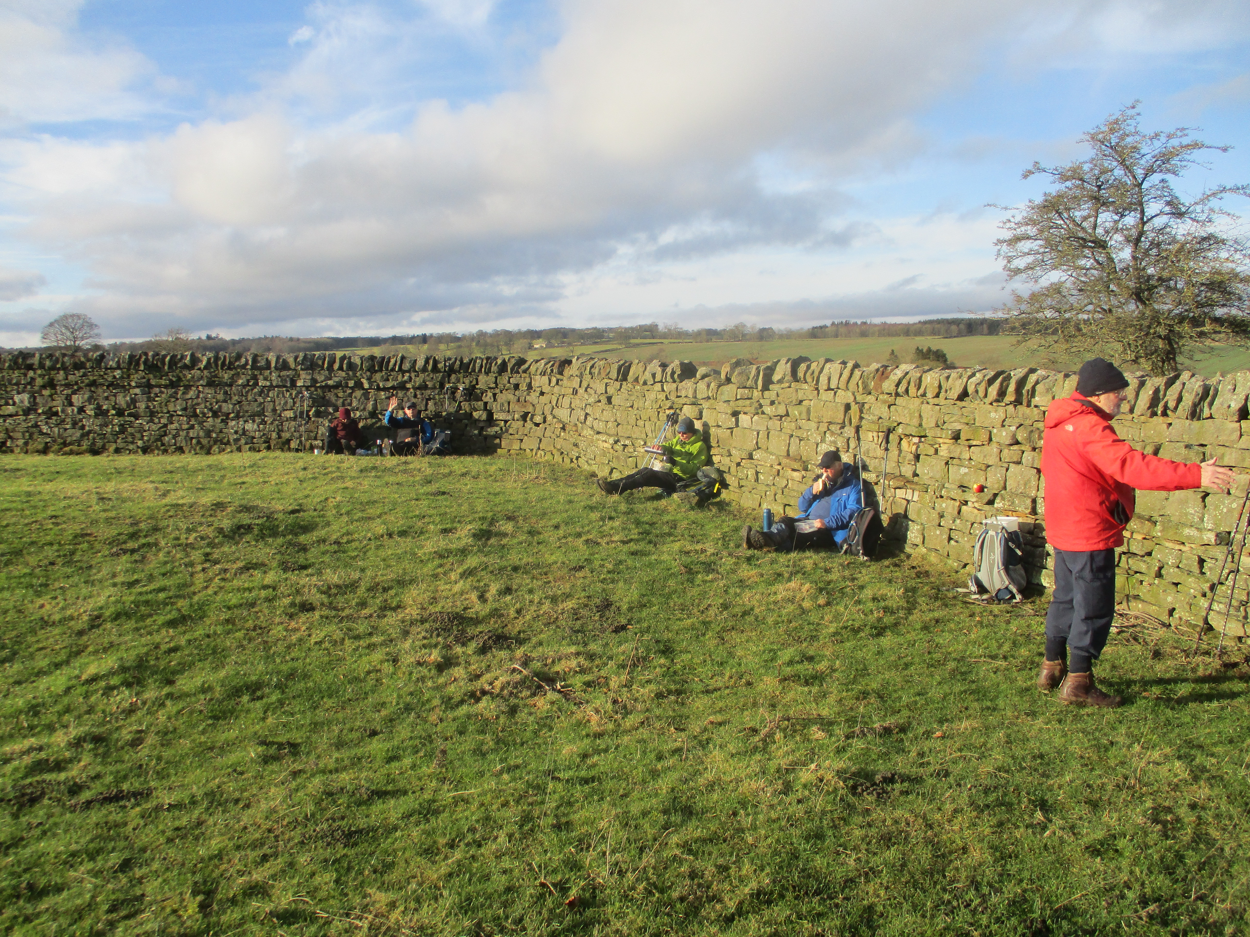
Lunch time: apple pies, chocolate biscuits, cookies, savoury and sweet cakes from Mrs A.
Lunch and politics over we headed off to the farm at Middleton South.

More fields and a standing stone later we came to a stone wall. If you follow this walk there is a stile almost at the west end of the wall, and there is a gate in the middle of a pool of muddy water.
Following the track past Half Moon Plantation we turned right at the second gate, close to the entrance to Salters Nick and walked the muddy trail to Shaftoe Grange.


Moving on we came to East Shaftoe Hall
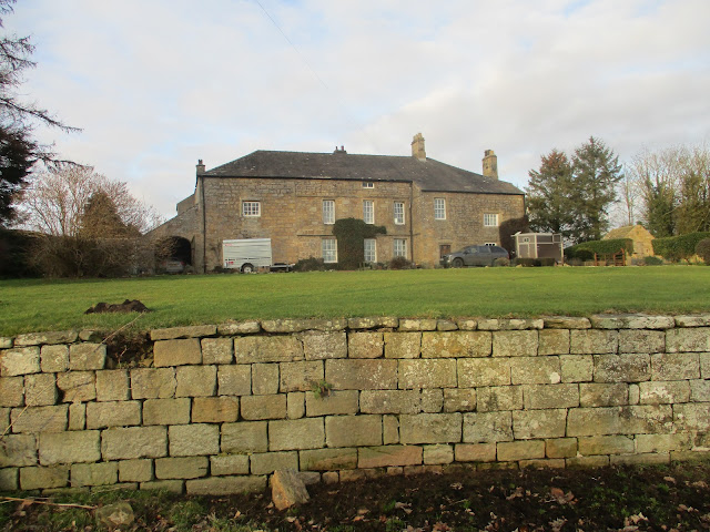 East Shaftoe Hall, the left end is 14th century.

Beyond the hall we followed the farm track initially north then east to Bolam West Houses. TYhe track is partly paved with concrete sleepers from an old railway in Glasgow.
From Bolam West Houses we had to walk along the road before we could join the footpath round Bolam Lake. ( The footpath at the west end of the lake doesn't appear to have recovered from storm Arwen in 2021). A path through the trees at the visitor centre took us to the road and the last threequarter mile walk back to the church.


Visitor centre at Bolam Lake and some comfy furniture.
Once changed we headed for the Blackbird Inn in Ponteland for beer, tea or alcohol free drinks for the drivers. I took a young lady to the Blackbird one day in September 1965. Been together since!

Contains OS data, copyright. Crown copyright and data base right 2023.
The walk is about 10 miles, easy going, little climbing but muddy this time of year.