Catherine of Aragon was here.......(North Yorks Moors)February 26th
After last week's large turn out we are down in numbers today, there are only five of us
The five are John H., John C., Brian, Dave and me and we chosen to repeat a walk from Osmotherley in North Yorkshire, land of the brave, home of the free and Timothy Taylor's Brewery. (On the square at Solomon's Temple, June 13th 2014)
To get to Osmotherley from base take the A19 through the Tyne Tunnel (toll £1.60) and head south beyond Teeside before turning left at the signpost for the village. Alternatively cross the Tyne Bridge, turn left at the first roundabout, head for Sunderland and turn south when you reach Testo's roundabout. Join the A19 and head south as above.
Osmotherley is another pretty village with several pubs and cafes. We were quite early for once and non of the cafes were open so we booted up and set out.
The walk. A map is useful and the whole walk is on OS OL 26 North Yorks Moors, Western Area. It's one of those double sided OS productions, most of the walk is on one side, a short section on the other. A good reason to photocopy and laminate if you can stand your daughters' jeers.

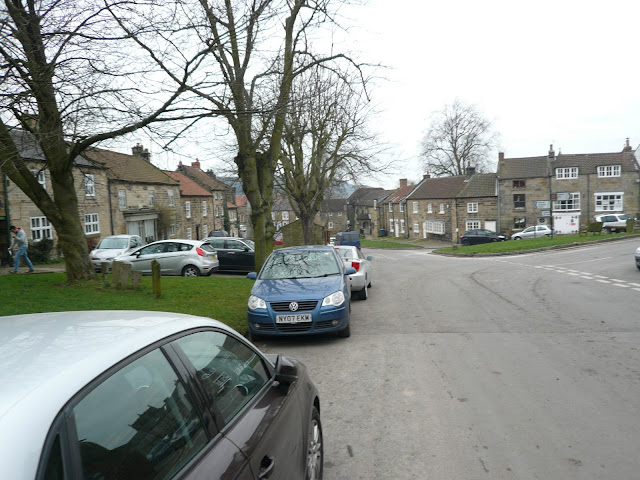 Osmotherley does not appear to have a car park, we left our vehicles on the street, nobody seemed to mind.
We walked up the village street in a northerly direction for about a quarter of a mile until we spotted a finger post on the left hand side that directed us up a lane with a few smart looking houses until we reached the footpath to the Lady Chapel.
 The Lady Chapel officially The Shrine of Our Lady of Mount Grace. Originally built in the 15th century but greatly restored in the 19th. Catherine of Aragon visited on her walks too but didn't write a blog.
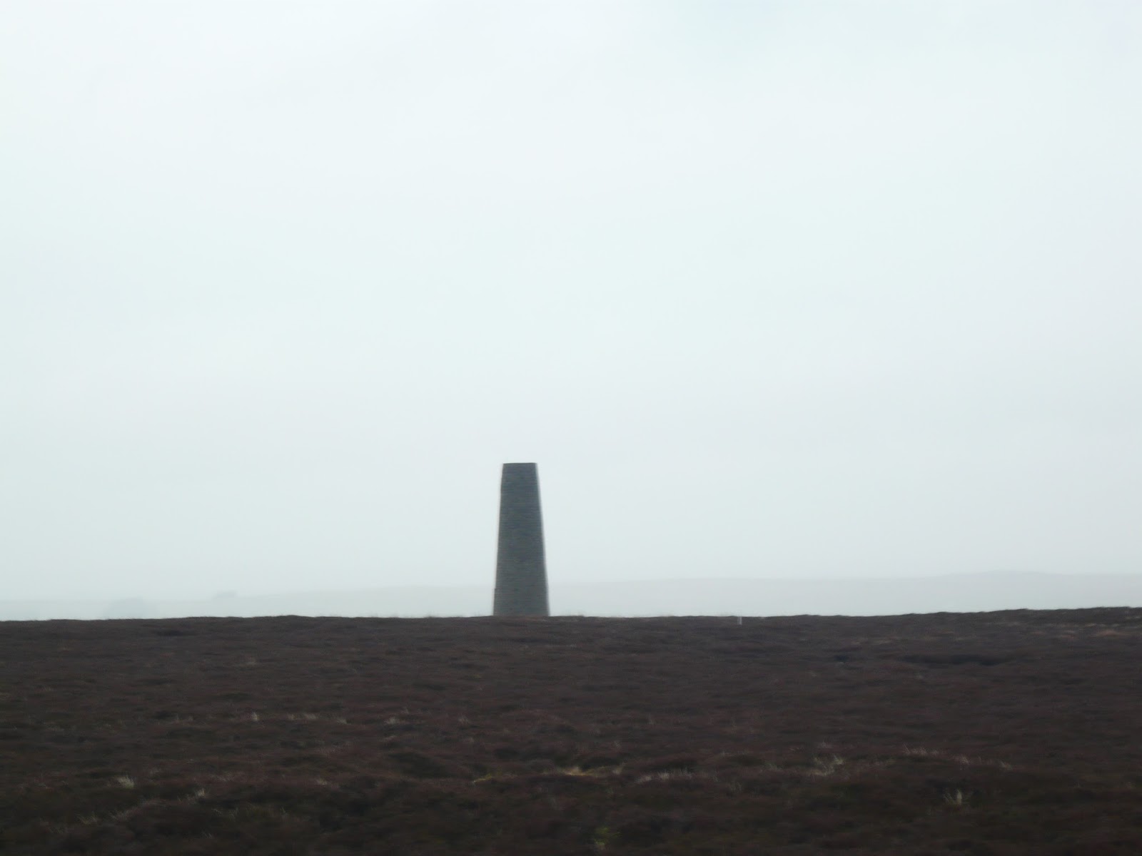
Beyond the chapel the footpath returned us to the Cleveland Way, a long distance path on the North Yorkshire Moors. After crossing a few fields the path entered, just, the South Wood which later becomes Arnecliffe Wood. About half way along the path, which is on the edge of the wood, we passed a TV station as it is described on the OS map.
 Personally I think it is an essential link in national defence, disguised as a TV station.
At the station we crossed a road and continued along a grassy part of the Cleveland Way until we came to a sign post that gave us the choice of leaving the long distance path and heading south across Scarth Wood Moor.
 Go this way

like Brian and John H did
Much of the path has been flagged with stones from closed Yorkshire woollen mills, otherwise it would probably be really boggy. At the edge of the moor we came to a road and headed south west along the narrow road side path towards Cold Beck Reservoir. A popular place for dog walkers and others too, we followed the footpath on the east side and at the dam called a halt for a Herbie Spot. Early but here had been no pre walk cafe stop.
A picnic table made the lunch break almost civilised, today's goodies included carrot cake slices, Hobnob flapjacks, Trackers, Mrs A's coconut and lime cake and for a change something savoury too: PORK PIES, yippee.
 Cold Beck Reservoir, quiet apart from Mallards, coots and a single cormorant.
We did see a dog wearing shoes on his front paws. His owner explained he was arthritic and the shoes made walking on a hard surface more bearable.
 Human disinterest
 Cold Beck from the dam
We headed south from the picnic site, following a deer fence and several markers until we arrived at Rocky Plain, a farm suffering from a surfeit of mole hills. A tarmac drive took us to a road and we turned right, passing Solomon's Temple. There is little evidence of a building that stood here and even Google hasn't been much help but we suspect it has something to do with an old drove road.
Beyond the non visible temple we came to Chequers:
 True Yorkshire wit
 Evidence that we were on a drovers road
 Not to be confused with the Buckinghamshire Chequers.
 Johns Wood near Chequers. Nice idea for a memorial, a whole wood.
Walking on we came to Square Corner, a car park and a turning point. Turning right we headed down a flag stoned path to Oak Dale.
 Information at Square Corner
 Oakdale Mini Reservoir
Beyond the reservoir the road climbed steeply, we followed the markers to Whitehouse Farm, passing a bamboo field and a good looking Nissen Hut.
 Not a panda in sight.
 Whitehouse Nissen Hut. (Left over from WW2 for foreign readers)
 And a rickety rackety bridge before the last steep but short climb.
 Not a stile but it keeps the horses out of the lane.

The end of the walk, back into Osmotherley.
We intended to have a post walk in the Queen Catherine pub but a funeral party arrived as we did so we changed plans.
 Supposedly Catherine of Aragon stayed in the area on her way to a shrine. Would the country have been different if she had produced a son for Henry VIII? Discuss.
Instead we headed back up the A19, through the tunnel (I managed to throw the toll money into the basket this time, saving embarrassment) and stopped at the Cannon in Earsdon which had Doombar, Clockwork Orange, Jack the Devil and Wylam Gold, plus coffee for the driver.
A good walk but we need to look carefully at the map and try and cut out the walking on the road.
The Matrix MMXVI H
steps miles
NAKOSITE 22529 9.42
LIDL3D 20519 8.04
Dave's LIDL3D 19149 8.62
" USB 18368 8.4
" NAK 18134 8.29
Etrex 8.7
OUTDOOR 8.3
John C 8.3
Brian 8.4
Walking time 3 hours. Stopping time 1 hour 13 minutes.

 Contains OS data copyright Crown copyright and database right 2016
After last week's large turn out we are down in numbers today, there are only five of us
The five are John H., John C., Brian, Dave and me and we chosen to repeat a walk from Osmotherley in North Yorkshire, land of the brave, home of the free and Timothy Taylor's Brewery. (On the square at Solomon's Temple, June 13th 2014)
To get to Osmotherley from base take the A19 through the Tyne Tunnel (toll £1.60) and head south beyond Teeside before turning left at the signpost for the village. Alternatively cross the Tyne Bridge, turn left at the first roundabout, head for Sunderland and turn south when you reach Testo's roundabout. Join the A19 and head south as above.
Osmotherley is another pretty village with several pubs and cafes. We were quite early for once and non of the cafes were open so we booted up and set out.
The walk. A map is useful and the whole walk is on OS OL 26 North Yorks Moors, Western Area. It's one of those double sided OS productions, most of the walk is on one side, a short section on the other. A good reason to photocopy and laminate if you can stand your daughters' jeers.


We walked up the village street in a northerly direction for about a quarter of a mile until we spotted a finger post on the left hand side that directed us up a lane with a few smart looking houses until we reached the footpath to the Lady Chapel.

Beyond the chapel the footpath returned us to the Cleveland Way, a long distance path on the North Yorkshire Moors. After crossing a few fields the path entered, just, the South Wood which later becomes Arnecliffe Wood. About half way along the path, which is on the edge of the wood, we passed a TV station as it is described on the OS map.

At the station we crossed a road and continued along a grassy part of the Cleveland Way until we came to a sign post that gave us the choice of leaving the long distance path and heading south across Scarth Wood Moor.


like Brian and John H did
Much of the path has been flagged with stones from closed Yorkshire woollen mills, otherwise it would probably be really boggy. At the edge of the moor we came to a road and headed south west along the narrow road side path towards Cold Beck Reservoir. A popular place for dog walkers and others too, we followed the footpath on the east side and at the dam called a halt for a Herbie Spot. Early but here had been no pre walk cafe stop.
A picnic table made the lunch break almost civilised, today's goodies included carrot cake slices, Hobnob flapjacks, Trackers, Mrs A's coconut and lime cake and for a change something savoury too: PORK PIES, yippee.

We did see a dog wearing shoes on his front paws. His owner explained he was arthritic and the shoes made walking on a hard surface more bearable.


We headed south from the picnic site, following a deer fence and several markers until we arrived at Rocky Plain, a farm suffering from a surfeit of mole hills. A tarmac drive took us to a road and we turned right, passing Solomon's Temple. There is little evidence of a building that stood here and even Google hasn't been much help but we suspect it has something to do with an old drove road.
Beyond the non visible temple we came to Chequers:


Walking on we came to Square Corner, a car park and a turning point. Turning right we headed down a flag stoned path to Oak Dale.


Beyond the reservoir the road climbed steeply, we followed the markers to Whitehouse Farm, passing a bamboo field and a good looking Nissen Hut.


We intended to have a post walk in the Queen Catherine pub but a funeral party arrived as we did so we changed plans.

Instead we headed back up the A19, through the tunnel (I managed to throw the toll money into the basket this time, saving embarrassment) and stopped at the Cannon in Earsdon which had Doombar, Clockwork Orange, Jack the Devil and Wylam Gold, plus coffee for the driver.
A good walk but we need to look carefully at the map and try and cut out the walking on the road.
The Matrix MMXVI H
steps miles
NAKOSITE 22529 9.42
LIDL3D 20519 8.04
Dave's LIDL3D 19149 8.62
" USB 18368 8.4
" NAK 18134 8.29
Etrex 8.7
OUTDOOR 8.3
John C 8.3
Brian 8.4
Walking time 3 hours. Stopping time 1 hour 13 minutes.