Translate

Friday 31 July 2015

We walk the Line................July31st
   The first time I saw and heard Johnny Cash was on a TV programme in about 1959/60. I was hooked, he sang "Stripes" and I rushed off to buy his records. This has nothing to do with today's walk
Holidays and family commitments continue to reduce the squad, injuries are ruling out steep climbs  and the weather has been so wet the hills and hollows would be more like bogs so today is another old favourite usually reserved for winter, the disused railway line from Lanchester to Consett and the other railway line from Consett to Rowlands Gill, the Derwent Way. Five of us are out today, Dave with a broken elbow which is on the mend, Brian with a bad back, John H and me with dodgie knees and super fit Ben.
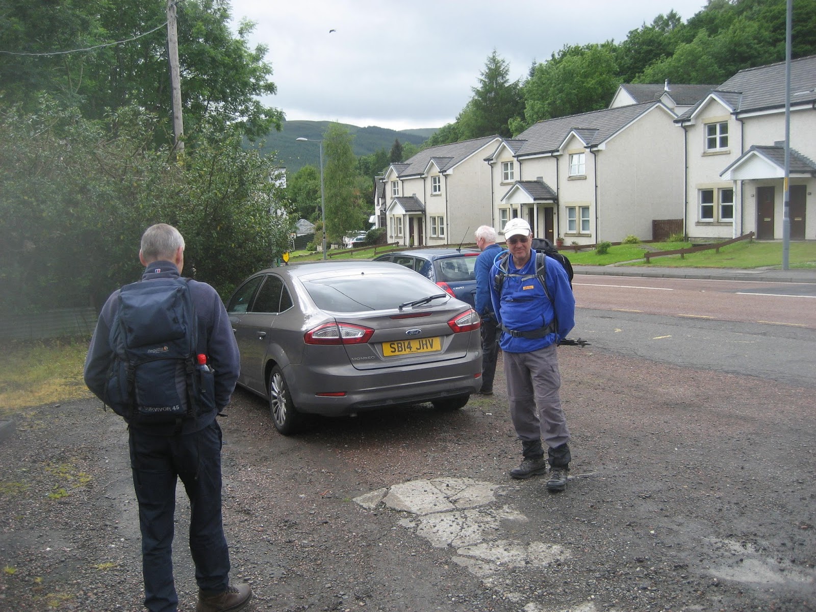
It  is a bus walk too, we caught the X31 from Newcastle's Eldon Square bus station, stand F, 10.15 am and arrived in Lanchester at  11.10  .
                             Eldon Square Bus Station. The circular building is a car park. My daughters, when they were young, loved driving round and round to the roof, and back down again. Toon is the local way of saying town.
Lanchester is a pretty village with its very own playing card shaped Roman Fort, Longovicium  which was on Dere Street, the Roman chariot way from Eboracum (York) to the wall and beyond.
The map for the walk, which is easy to follow, is OS Explorer 307, Consett and Derwent Reservoir.

Newcastle Keep, taken from the bus. All that is left of the "Newcastle", apart from the Black Gate


The Tyne Bridge, taken from the bus

              Lanchester. The church, All Saints, has a Roman Altar built into it, taken from the fort long ago probably.
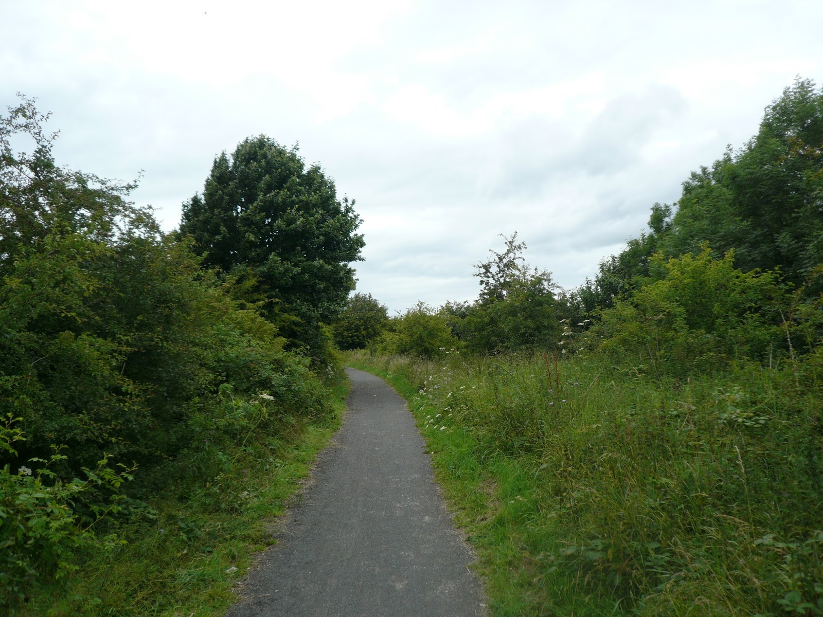
The start of the walk is easy to find, walk down Station Road and look out for the sign saying Consett, 6 miles. The cycle/footpath is on the old railway bed and is quite hard, good for bikes but jarring of the spine for gadgies. The verges have been allowed to go wild and have produced an abundance of flowers, making the walk even more interesting.
                       Level but hard on the feet!
After about four miles we stopped at Knitsley Farm Shop which is in East Knitsley Grange and not where I have written "coffee shop" on the map. Fresh looking produce and lots of sausages. We had tea or coffee, but Brian had an enormous bacon sandwich which came with chips.
                                            After the last few days of rain it's good to be able to eat outside at Knitsley Farm Shop.
Moving on we came to a cross roads of footpaths, on old railway lines too, although not far from the farm shop we called a Herbie Spot and sat on a wall near an old railway truck, a reminder of the days when Consett produced iron and steel. And what a feast we had.  Apart from a sandwich we ate Hobnob Melody, Ben's ginger biscuits, Mrs A's chocolate covered biscuits, Miss E's flapjacks (www.cakepoppins.com) and PORK PIES from Dave.
                                     Built for the Cosett Iron Works which closed in 1980
                                                                                                                                                                        There are clear sign posts, we followed the one to Rowlands Gill.  The first part of this walk crosses the land that was once the steel works. Now a housing estate for workers in local light industries.

 This impressive work of art commemorates the town's industrial past
 A map showing the layout of the iron and steel works. A nearby information board told us the works opened in 1840 and were closed in 1980, although making a profit. The steel for Blackpool Tower and nuclear submarines was made here.
                                                 Housing on the old steel work's site

  The walk is now on the Derwent Way, another cycle/footpath on an old railway. It is quite high up and passes Ebchester which has a Roman Fort, Vindomora, Hamsterley and Linzford. The verges of the path are wide, the trees have grown and made a tunnel for much of the way so at this time of the year there is little to see but trees. We did stop near Linzford to watch for Kites. Red Kites were reintroduced into the area in 2006 and are slowly spreading across the area, as far as Ponteland I am told.
                                              We saw some of these "flying dusters" in the distance
                                                               River Derwent from one of several viaducts
Eventually we reached Rowlands Gill and went to Maguires Fish and Chip shop for a well deserved meal.  Only the British can make proper fish and chips, and tea for that matter. We sat at a table outside the shop to eat and having finished caught a bus back to Newcastle from where we went our separate ways.
                                               Heaven can be a fish and chip shop after about 14 miles walking.

Matrix               MMXV  pp
                                                   steps                            miles
LIDL3D                                     32698                        16.7 ridiculous
Dave's USB                               28472                         13.48 Spot on
Measured on map: 13.5 miles
No GPS today, I kept my phone on for scores from the Test Match. England beat Australia by 8 wickets!!!!!

                             
   All maps;contains OS data copyright. Crown copyright and database right 2015

Friday 24 July 2015

Two Saints and a lost soul..............July  24th
  Back on home territory after the "gentlemen's week" in Scotland but down to a team of four (Harry, Brian, John H and me)  we are off to rewalk an old favourite from Belford in Northumberland. Easy to find this pretty village, head up north on the A1 past Alnwick and turn left at the signpost for Belford. It is about a mile off the A1. On the way we stopped at The Running Fox" in Felton for breakfast. I weakened and enjoyed  a bacon sandwich served in large thick slices of brown bread. A definite five flitches, and Brian agreed.
There is limited parking outside the Community Hall in Belford. The map that covers the whole walk is OS Explorer 340, Holy Island and Bamburgh and the Community Hall is at  GR NU 106338.
                                 Today's parking spot in Belford......free!
On the left hand side of the Community Hall there is a lane, the start of today's walk. The path heads  northwest and crosses some fields alongside the impressive Sunnyside Crags and past a ruined lime kiln until it reaches Swinhoe Farm.
Lime Kiln, once used to make fertiliser.
                                                                                                    Normally we follow the rest of the walk in an anticlockwise fashion but, being rebels we chose to go in the opposite direction and headed  on the path going initial south west. Passing  fields of golden corn Harry stopped to take photographs and was never seen again. We three walked on following the grassy track that circles round the woods called Cockenheugh on the map, past some more impressive rock formations to the path that leads the short distance to St. Cuthbert's Cave. Not surprisingly this part of the walk is on St Cuthbert's Way, a familiar fairly long distance path.
                                                          Impressive outcrops
                              St. Cuthbert's Cave, with visitors.
 We  didn't bother stopping, partly because of the swarms of flies which bothered us and other walkers  but continued past the cave and turned right uphill immediately through the next gate. At the crest of the ridge, Greensheen Hill we turned  northwest and walked the short distance to the trig point where we called a Herbie Spot. Settling on the rocks and safe from the flies because of a strong breeze we ate and watched for Harry, in vain. However Mrs A had sent some chocolate shortcake, novel and nice, we shared chocolate and Golf bars too, We waited for fifty minutes without seeing the errant snapper. Should you come this way pause and enjoy the views, Cheviots in the west, distant Simonside to the south and Holy Island in the east.


                                                              Be warned
                              Look carefully and you can make out Holy Island
Having rested and eaten we continued on our way walking past Holburn Moss and the small lake before entering the plantation  near Rabbit Hill.  Eventually this path joins St. Oswald's Way, partly metalled with what is obviously the burnt off remains of some major road as at one point we found a cats eye. When I remarked it was not usual to find these on country farm tracks Brian pointed out that there was one near Helvellyn in the Lake District, namely Catstye Cam. Work it out. The path goes through woodland and across fields. At the junction which leads to Greymare farm we turned right on a grassy track which crosses Virgin Hill, passes Swinhoe Lake and arrives at Swinhoe Farm.


                                                    Swinhoe Lake
Swinhoe Farm is a riding centre and has a large number of horses, some of which are obviously large work animals. We walked through the farm, past the car park and across field back to Belford. Having changed we waited for the lost boy who appeared after about 10 minutes having taken a slightly different rouite.
                                                  The horse on the hill

Near Belford we past this umnusual looking house. at Westhall. It's a 19th century Gothic farmhouse built on the site of a Norman motte and Bailey
Although slightly out of our way we visited the Anglers Arms at Weldon Bridge. Dawn the manageress asked if we would be having our annual meeting there in January! The pub offered the usual selection of good beers, Camerons Galactico, Youngs Blonde and Black Sheep.
My LIDL3D recorded 24644 steps and 8.9 miles, my GPS claimed 10.3 and Brian's said 10.2 miles. Another good day out, warm, dry with a light breeze.


Sunday 19 July 2015

Killin 
Time............July 11 to 18th
  This years "gentlemen's week" is a return to Killin, same town, different chalets. Unfortunately we are down in numbers because of injuries, family commitments, unable to get away or whatever.
We are, this year, Brian, Norman, John H, John C, Ben and me and in two cars we set off on the morning of Saturday July 11th for Killin, loaded down with 72 pints of Tyneside Blonde, 36 pints of Shuggy Boat Blonde and 36 pints of Shuggy Boat Blonde Special. Plus some food, and walking gear.
No directions for Killin, it's in Scotland at the end of Loch Tay.
A few words about the site though. This year we are staying in the Loch Tay Highland Lodges, about seven miles east of Killin on the north side of the loch. The site offers several types of accommodation.....
                                          Upside down boats: microwave and kettle, sleeps four maybe.
                                                    Big plastic tents, sleeps two, wood burning stove
                                             Wooden yurts. (Oh Mrs. Whitehead); sleeps up to five,
                                               kitchenette, bathroom, TV
                                             Chalets; timber, sleep up to six, bathroom, one room with en suite
                                            dishwasher, micro oven, washing machine, TV, . Norman, 
                                           John C, Ben and I stayed in one called "Crannog"
                                             Stone cottage, "The Ivy Tree" home to Brian and John H

We arrived in the afternoon  set up the beer barrels, complete with proper hand pumps, unpacked, wandered the site and went for dinner in the Capercaillie Restaurant in Killin. A group of young men were celebrating somebody's 21st. They were dressed as gillies and were enjoying themselves and entertaining us. After dinner we returned to our chalets and sampled the beer.

Sunday July 12th
  A walking week needs a gentle start to ease us in to the weeks endeavours so we chose to drive to Lochearnhead and walk back to Killin on the old railway line. A linear walk needing some logistics.
Both cars, 1 and 2, were driven to Lochearnhead and four gadgies were left there. Brian and I drove back to Killin in both cars, left car 1 there and returned to Lochearnhead in car 2. We now had a car at both ends. If you can do this better let me know. There may of course have been buses.
                                   A feast of car parks this week, this one is at Lochearnhead.
We walked south out of town until we spotted the sign saying Railway Walk, Killin, 7 miles, climbed a path up to the old track and headed back to Killin.
It's easy to follow, well signed but if you need a map go for  OS Landranger 51, Loch Tay and Glen Lochart. The views over  Glen Ogle are fine and naturally the walk is fairly level. At one point the path crosses the main road up the glen and almost immediately there is a snack bar caravan selling bacon butties, very popular with a group of motorcyclists, but we walked a little further on to a picnic area which was very popular with Scottish midgies but still we called a Herbie Stop
                                                     Easy walking on day 1
.                                         Viaduct on the old line.


                     There is no exchange of goodies on gentlemen's week walks. Because of the midgies we didn't hang around but hurried on. The footpath joins the Rob Roy Way, a fairly long distance path. At one point the path forks, we took the left hand and walked downhill, rejoined the old railway and headed back to Killin. We stopped to admire The Falls of Dochart, one of the small town's major attractions. In full spate because of recent heavy rain.
                                                 Not exactly Niagara, but impressive.
We then reversed the car manoeuvres described above and returned to the site for tea and cake. Not just any cake but one made especially for the trip. Moist fruit cake, icing, decorations.

   This years gentlemen's fruit  cake, from www.cakepoppins.co.uk .
Having showered and changed, we are all well house trained, it was time for dinner. Tonight's dinner came courtesy of Mrs E. Her special, home made spicy meatballs in sauce. Considering Mrs E is a life long vegetarian she excels at making them especially when she can't taste the sauce as it is being prepared. Eaten with rice and mixed vegetables and followed by cake and custard. (Not the fruit cake) and a few beers as we watche the highlights of Le Tour de France.
A short walk of 8.5 miles by GPS, 7.6 by pedometer (20791 steps)
 Contains OS Data Copyright. Crown copyright and Database right 2015.


Monday July 13th
Another damp day. A woodpecker was attacking the feeder outside our chalet, Greater Spotted and sharing the nuts with finches.
After breakfast we headed for the dam at the end of Loch Daimh. The road to the dam is narrow with passing places and lots of wandering sheep which seem to prefer the road to the grass. For this walk OS Landranger 51 is fine, although a larger scale map would be better. We left cars at GR NN511463 which is an area just off the road with room for 3 or 4 vehicles and a large sign warning hill walkers that stag hunting may be taking place so keep your head down.


                                       Car park for today, dam in the background.
We crossed the road in front of the dam and followed the track for a short way before spotting the cairn at the side of the road  which indicated the footpath that led up to Stuc an Lochain (Peak with little loch) The path was steep and slippy because of the recent rain but after a mile of steady climbing we reached the plateau of the peak and wandered on in the light mist to the summit cairn where we called a Herbie Spot at 960 metres(3149 feet)

                                           
                                                             and misty views.
We returned the same way, going down the steep section proved more difficult than going up.
A short walk, GPS said 5.8 miles, but hard ones, pedometer excelled with 7.8 miles and 22367 steps.
                                                     Lunch on Stuc an Lochain
                                                      The dam on Loch Daimh, in a clear spell
 Back at the ranch we were treated to a magnificent plate pie by Norman with baked vegetables and followed by home made ice cream from Ben, followed by Tyneside Blonde and Le Tour de France.

Tuesday July 14th
 A better day; we decided to tackle Ben Vorlich which is on the south side of Loch Earn. The start of this walk is on OS 51 but most of the walk is on OS Landranger 57 Stirling and the Trossachs which is the name of the map not a punk group.

                                                  Today's car park
                                              Ben Vorlich in the mist
                                                            Trig point on the Ben

Loch Earn


                                                 Herbie Spot on Vorlich
                                                                                           The walk starts near Ardvorlich House, there is enough space on the side of the road for about ten cars at GR NN 632232. The walk is clearly signed just to the east of Ardvorlich House and a good track leads past a farm building housing a hydro electric generator. Initially winding through woodland the stone track head almost due south, becoming a grassed path but leading gently at first to the summit of Ben Vorlich. ( Mount of the Bay) The last stretch is much steeper but zig zags to assist an ageing gadgie. On the small plateau  walkers are greeted by a trig point and the summit is a few yards further on. (984m; 3228 feet)
                                   A better view from Ben Vorlich
Having eaten we headed back towards the trig point but then turned west down a very steep and stony track which led to the massive rocky outcrop on Stuc a Chroin (Dangerous Peak !!!!) Not wishing to climb this we followed a less rocky but almost equally steep footpath which emerged on the flat top of the mountain. The peak was a few hundred yards away and we stopped to admire views and  eat anything that was left before heading north, down a steep path at Bealach an Dubh Chorein. The footpath followed contours but was not easy to follow, it was muddy and slippy but eventually we joined the path we had started on and returned to the cars.
On the way down we chatted to a 77year old gentleman who told us he had only managed the Ben today but for his 80th birthday had promised himself to climb Ben Lui  - again.  Hope we all do as well. Unfortunately Brian had a puncture but mechanic Ben had the wheel changed in no time and we headed home after a walk of 10 miles by GPS but 12.95  by pedometer (36546 steps)

For dinner we were treated to a curry by John H. Not too spicy but a tasty mixture of chicken and vegetables with brown rice. Too full for pudding we watched a couple of episodes of the still hilarious Scottish sitcom Still Game, a bit like The last of the Summer Wine, but dirtier!

 Wednesday July 15th
Another day of doubtful weather. We decided to walk along the side of the loch from the site and make it to Killin. This proved rather difficult. A footpath through the woods to the west of the chalets came to a dead end and we had to walk up to the road. After a while we found a path that appeared to lead down to the water and it did, but no further. Back on the road we continued to the gates of the power station near Finlarig. The sign on the gate said welcome so we went in. A young man operating a grass cutter initially seemed unhelpful but eventually said it was possible to make it to Killin. At this point it dawned that we would be walking a total of seven miles to the town and then another seven back, much of it on a road. I volunteered to walk back and get a car and meet the lads in Shutters Cafe in the town. It was agreed, I returned and reached the cafe minutes before the rest of the crew did.  Pedometer said I walked 6.75 miles, they did 7
We started the evenings feasting with tapanards made by Ben, a paste made of anchovies and spices spread on toast and washed down with sherry. Brian had made a chili and rice, but forgot the vegetables, they are still in the freezer. Tyneside Blonde and cycling, a pleasant evening.

Thursday July 16th
The plan for today was to climb Ben Lawers but doubtful weather and tired limbs helped persuade us that a flattish walk would be a better bet. Norman proposed a walk he knew from Kenmore at the east end of Loch Tay to Aberfeldy, mostly on a path that followed contours.  Cars were organised in the same way as Sunday's expedition  and we started walking from the Crannog  car park in Kenmore.

 Car park in Kenmore. The triangle shape at top left is the roof of the Crannog. A crannog is a type of house built some 2500 years ago, consisting of a round house built on a platform above the water and joined to the shore by a walkway. The one in  Kenmore is a replica, surprisingly! We went round it last year and the centre is well worth a visit. There were at least 18 crannogs on Loch Tay.
 For this walk rely on OS 51  to start but most of the walk is on OS 52 which I haven't got. However the walk is very well signposted, you could do it without a map.
From the centre we headed along the road south west to the hamlet of Acharn. Here a sign post points uphill to the Hermit's Cave and Circular Walk. We followed it up the slope to woodland where we came to the said hermit's cave, more like a tunnel which brought us to a viewing platform overlooking a waterfall.
                                                        The hermit's water supply, beautiful.
                                                  John C, Brian, John H, Norman, Ben
                                                    on the platform near the waterfall.
From the cave we climbed a little more before joining the Rob Roy Way heading north east to Aberfeldy. We crossed fields and walked through woodland until we came to a road near Tombuis Cottage. We sat on the side of the road to eat lunch before continuing on our way. The views over  the valley were spectacular, in the distance we could see Schiehallion, this area is certainly not the Appin of Dull as it is named on the map.

Schiehallion in the distance.
                                                                                                  On the downside one stretch does go through a plantation which was being harvested and looked a mess of tree stumps and log piles. Eventually we came to a signpost that gave us a choice, a footpath to Aberfeldy or a footpath to The Birks of Aberfeldy. We opted, at Norman's insistence on the latter. The path wandered through birch woods until we came to a second waterfall.
        It looks much better in reality


                                                 But it inspired Rabbie Burns to write a poem

                        The braes ascend like lofty wa's
                         The foamy stream deep-roaring fa's
                        O'erhung wi'  fragrant  spreading shaws, 
                        The birks of Aberfeldy.
                                                                              (verse three)
  Actually he was trying to persuade a young lady to go up there to admire the view. And quite right, it is impressive, and from the falls it's a long long way down to the town on a well constructed path with steps on the really steep bits.
                         Rab C Burns, Norman, John C,Brian
 This walk was longer than Norman had thought.  GPS said 12.3 miles, pedometer claimed 11.3 with 32100 steps.

 Back at the chalet we fed on Spaghetti Bolognese made by John C, and we ate every scrap before tapping the barrel of Shuggy Boat Blonde Special, it helps with Le Tour and Still Game.


Friday July 17th.
During the night it rained, heavily and with thunder. Most of the morning it rained heavily too but by lunch time we decided we needed to get out at least and went to look round Killin. The town has one or two points of interest. We visited the long house at Moirlanach, which is owned by the Scottish National Trust and only opens on Wednesday and Saturday but we did get to look through the window. This old building was home for a family for several hundred years up to the 1960s. The family at one time were self supporting, keeping a few cows, chickens and sheep, growing vegetables and a crop. One end of the building housed animals over the winter, the other end was home. Shame it was shut.
We also visited the ruins of the castle, more like a bastle house. The grounds contained the graves of some Campbells, nineteenth century Campbells that is.
                                              The Longhouse, originally thatched


Ruins of the castle.
For dinner that night we had a Moroccan style lamb stew with apricots and couscous. Followed by ice cream and a sweet wine. Didn't we eat well?
                                                   Inside "Crannog" chalet
                               Beer pump just to the right of the window


Saturday July 18th
Up early, fed, watered and packed by 10am and we cleaned up a bit  too before leaving for home after another very successful Gentlemen's Week. Next year; The West Highland Way.