Translate

Saturday 23 February 2013

The Men Who Walk With Goats.....February 22nd
We gadgies have seen the feral goats in three areas of the Cheviots, on the slopes on the east side of College Valley, west of Windy Gyle and on the slopes above Commonburn House. There are also three isolated billy goats on a bluff in the Hen Hole, looking desperately for a bridge to cross or a lonely goatherd liddle liddle liddle lee.  They could of course be one herd who wander around a lot.
There is a good chance we will see goats on today's walk which takes in Humbleton Hill and Yeavering Bell on the north side of the hills.

                                                    A group of the Cheviot goats. They come in several colours and sizes and have roamed the hills for about 150 years.  In  2011 Newcastle University put electronic tags on them. Presumably to track their movements. I have no idea of the results, perhaps it was a wild goat chase.

To get to the start of the walk take the familiar route, A1, A687, turn into Wooler and go up the lane next to the Terrace Cafe that points to Wooler Common. After a mile or so there is a car park on the right, complete with information board. The walk is covered on OL16, The Cheviot Hills, and the car park is at NT976273.
There are five of us out today, km, pm, rm, vm and bm. Naturally we are starting with breakfast at the Terrace Cafe in Wooler. Friendly service, we were offered a choice of bread or buns, white or brown, brown sauce and a very generous quantity of tea. Reasonable price, although in Britain the word reasonable is under discussion at the moment as the result of a famous court case.
The Terrace was awarded five flitches. Awarding GABBAS this year is going to be difficult.

The Walk.
 Next to the information board in the car park is a footbridge across the Humbleton Burn which we crossed. A few yards further on a marker post pointed us through the wood on the first climb of the day. At the edge of the wood we went through the gate and of the three routes offered took the one that led us straight on. At the next junction we followed the right hand path that took us, eventually, down a lane to a marker on the left that directed us up Humbleton Hill.
Humbleton Hill is the site of one of the many Iron Age hill forts in Northumberland and much of the rubble of the walls remains.
                                                    Humbleton Hill Fort walls, left from the Iron Age.
The Battle of Humbleton Hill was fought in 1402 on the lower slopes of the hill. Just another of the many fought between the Scots and English over several centuries, this one was the local Helen of Troy story, a dispute over who daughters should marry. The English, starring Harry Hotspur won on this occasion, although within the year Harry, having fallen out with Henry IV was killed at the battle of Shrewsbury. Humbleton comes from Old English hamel dun, meaning bare hill, and it still is, with an impressive canyon on its South West side.
Down fromthe hill we followed the path in a North East direction, turning west and eventually arriving at the farm called Gleadscleugh.

                                                                 Gleadscleugh \Farm

 To the west of the farm, at a gate we chose the path on the right which led over Akeld  Hill. On the way we passed a cage designed to trap birds of prey which might attack nesting grouse.

                                            These traps are legal but may only be used when the grouse are nesting. Bait is placed inside the trap, the marauding bird of prey enters through a wire funnel on the top and is then trapped. Out of season the door must be kept open and the entrance to the funnel must be blocked.

              There are a number of ancient settlements and enclosures visible along this route which led us to the foot of Yeavering Bell. A sheepfold  was chosen as a Herbie Spot and we feasted on pork pie for a change, sandwiches and a piece of excellent flapjack from Cake Poppins*, a small family firm in Newcastle.
And then upwards again onto the top of Yeavering Bell. On the twin peaks of the Bell are the remains of the largest hill fort in the Cheviots. The outer wall encloses an area of 14 acres, or 5.7 hectares. The boundary consisted of an eight foot wall, a ditch and a rampart. and 130 individual circular platforms have been identified within. Experts think it was constructed about 300BC.


                                                       The ditch on Yeavering Bell

                                               Remains of the outer wall.
                                               And a modern walkers' cairn.PM and rm admire it.
                                               Must have taken a lot of hard work.
On the plain to the north of Yeavering Bell is the site of Gefrin, a Saxon Palace, mentioned by Bede in his History of the Church of England but a myth until it was discovered  by aerial photography in 1949. The word gefrin means goat and Yeavering is a corruption of this, so it is indeed The Hill of the Goats.
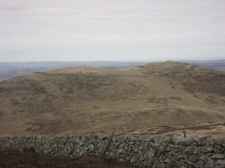
                A view of Yeaverin Bell, the wall in the foreground is a relatively modern field boundary.
We headed south down the hill before going off piste and heading across the heather (very good for cleaning boots but it undoes the laces), climbed a wall and found the path that led to Easter Tor. Having admired the view we turned south east along  a good track that meandered  in a south westerly direction to Wester Tor.
                                                  Wester Tor, overlooking Hethpool in the College Valley.
We retraced our steps from the tor until we spied the gate in the fence that would have taken us to Hare Law but we turned left and followed the fence line downhill towards Common Burn Farm. The goats are often seen on this stretch, but not today.Soon we reached the farm which boasted a John Deere tractor.
                                             Farm yard at Common Burn.
We considered walking over to Broadstruther  but it had been quite a demanding day so we stayed on the metalled road back to the car park. |On the way we disturbed a sandpiper, one of the few birds we had seen that day apart  from the grouse, so it has to be Bird of the Blog.
                                                A sandpiper on holiday by the sea.
 For a change we decided to stop at the Anglers Arms at Weldon Bridge to rehydrate. They had Timothy Taylor's Golden Bitter on offer and two other beers but as a driver I opted for coffee.

The Matrix
MCMLVII

                                                       steps                               miles
MyASDAped                                30366                               14.27
Higear                                            28251                               13.362
Dave's asda curvy                          27120                               12.41
LIDLUSB                                      29297                               13.40
OUTDOORS GPS                                                                  13.29
Brians GPS                                                                             13.1
Measured by Dave                                                                  12.7
Well done Higear, all is forgiven.  and LIDLUSB seems good too.
*www.cakepoppins.co.uk              for cakes to die for.

Photographs:
I apologise for only having small photographs. For some reason I can not enlarge them as on previous blogs. Except for the goats) I have written to Mr. Google but he hasn't replied. Very rude. But if you click on the pictures they enlarge. Amazing
Today I passed 20000 hits on the blog which amazes me.
Most hits from the US for some reason but the UK is catching up. In third place is Canada and then Russia!
                                                                        DDs Me, Brian

Saturday 16 February 2013

Moor of the same; ups and downs on the North Yorkshire Moors....................February 15th

This walk is a repeat of On the Moors again March 2012.
The snow has gone, supposedly, the temperature has risen a few degrees and six gadgies have decided to head for the North Yorkshire Moors and walk from Chop Gate.
Two cars, holding music, vogel, blog, pun, route and halfmarathon driving from Newcastle down the A19, A174, A172 and B1257 to meet in the car park just south of Chop Gate. My guess a year was slightly out, the village name means "Peddlers Path".
Sadly there is not a tea room to dispense  breakfast so we have no alternative but to start the walk as soon as we are booted.
A map is advisable OL 26 covers the whole walk on two sides of the sheet.Careful if it's windy, or you can always laminate.....
The car park is at SE559993

 Useful tables provided in the car park........


                          .............................and pleasant view through the trees.
The walk started at the back of the car park, a sign post directing us towards the south west initially, across fields and with a steep climb until we arrived on moorland.  This area is a grouse moor and there are several rows of butts.
A pretty basic shooting butt, but unlike the rather flash stone built ones in the Cheviots it can be used to defend from attacks on either side.
This area also has many ancient sites, the first we came across being Cock Howe, burial site of a bronze age chief, at least that's what Dave said, donning his archaeologist hat. Not much further along we came across another, Green Howe.

 
Cock Howe Burial Cairn.
 
Now we were on Barker's Ridge, heading north on a track that alternated between heavy mud and snow up to one foot deep. Either surface slowed our progress and conditions did not improve as we passed the remains of the old Gliding Club headquarters, looking abandoned and vandalised.


                                          Run down and neglected if not abandoned, the gliding club buildings.
 
 
Beyond the wreckage of the Gliding Club the track joined the  Cleveland Way, a long distance path and we headed down into Raisdale where we made a welcome Herbie Spot stop. Ben's ginger biscuits were of their usual high quality and the pork pies made up, in some small way,for the lack of bacon.
 
                                           Harry's left foot, Ben and Brian at the Herbie Spot
 
Back on the road we climbed up Cringle Moor, pausing to admire the distant views of industrial Teeside before dipping down again, up again, down again and then on to the Wain Stones,an interesting rocky outcrop providing  a bit of a scramble for a change from the mud.
                                                     Wain Stones, high point of the day.
 
From here the Cleveland Way continued east on the edge of the moors, still offering views of Middlesborough under the smog, until the path descended to cross the B1257 and begin the last ascent onto Urra Moor. Apparently Urra was the Celtic goddess of heather and this place  has many ancient remains, standing stones, menhirs cup markings and the long dyke that follows the western edge of the moor.
                                   Ancient Urra's Dyke shows up well in the afternoon sun.
                Its real purpose is unknown but it is quite long. For defence or a boundary?
 
Leaving the moor by a path that is not too easy to spot he descended to Bilsdale Hall where the path became a track and eventually a metalled road.
The verges of the track were covered in snowdrops with some aconites and daffodils with tight buds.
Spring is here, as Old Blue Eyes sings.
                                              Snowdrops,must return with a spade...................
Soon we were back on the road, turned left and walked through the village, past the Buck Hotel and back to the car park. Changed we returned to the Buck which had Wainstones Ales on offer, sadly I was the designated driver, as was Harry so we had coffee. The others were not over impressed with the beer but the surroundings were reminiscent of the Anglers Arms,  a fire to sit round before we headed home. In my car we had the joy of the latest compilation to listen to. Numbers, with some real gems: The night has a thousand eyes; She was only sixteen: When I'm 64; Eight days a week and so on.
 
The Matrix MMDVII
                                                                           steps                       miles
ASDAPED                                                        21874                      10.28    hopeless
Higear                                                                31394                      14.845*
Daves ASDA                                                     32050                      14.16*
LIDLUSB                                                          30932                      13.66*
OUTDOORS GPS                                                                             12.21
Measured                                                                                           12.5
 
Considering the muddy, snowy conditions and several ups and downs these three readings are quite reasonable.
Having problems with the pictures today, computer flatly refuses to enlarge any after the first two.


Bird of the blog on a day when there was not a lot for ornithologists.
A grouse, waiting for August 12th.  You may eat it, or if you come across a famous one, drink it.
The Dad
                                                                                                             
Drivers. Me and Harry                                        

Sunday 10 February 2013

Старикашки И Kарей Бурн             February 10th.

Burns Day.

Strictly speaking this is not a gadgie walk, although two of us qualify as true gadgies and I suspect one will be a gadgette.
Regardless, on a day when we have been promised snow in the late afternoon an intrepid team of Russian speakers of various degrees from incredibly low to just like a native are going for a walk on the Carey Burn.
The walk starts at the Carey Burn bridge which is reached from Newcastle by means of that now familiar route; A1, A697, turn into Wooler, turn first left up the hill, take the right fork, ignore sign for Wooler Common and Earle, turn right for Langleeford. Go through Skirl Naked, down the hill and pull In on the grass verge on the right.
The map to use is OL16, the Cheviot Hills.
The team of eight consists of: Irina from Siberia and her husband Jeremy, Irina from Ukraine, Liz from America and her English husband John, Susan from Rowlands Gill, daughter Kate and me.
The walk starts on the car park side of the bridge on the right. If you do this walk note that the footpath is not marked on the map but it is such a popular route a sign post points the way.
The path follows the Carey Burn, as did we all, spread out and chattering on a cold cloudy day with a chilly breeze to make some people wear snoods.
At one point  there is a pretty waterfall where we stopped for a photo opportunity.
The mighty Carey Burn pours over the rocks on its way to join the Harthope Burn.
                         Don't go near the waterfall...........
                Jeremy, Irina from Siberia, Irina from Ukraine,John, Liz from America, Susan, me.
(Photo courtesy of Cake Poppins)
Shortly after this halt I pointed out the spot where we had seen a family of adders last spring. This caused people to move a little faster in spite of my protestation that they would all be tucked up in their beds.
Next stop the footbridge across the burn. I told Kate that this is where she and sister Lucy must fling my ashes when I go to that great Youth Hostel in the Sky. She said she might dump me in the wheelie bin .Kids ain't got no respect today and blah blah. (There is a footbridge marked on the map but in the wrong place, the actual structure is nearer the spot marked ford)
                                               A bridge with a view, but not troubled waters.
                             And the view from the bridge.
Having crossed the bridge we continued on the path, slightly uphill and looking down on the Broadstruther Burn which we eventually crossed by footbridge and continued to Broadstruther itself.
When I first walked in the Cheviots Broadstruther was a ruined farm but  a few years ago the building was seiously renovated and is now used as a rest home for grouse shooters in the season.The windows can be barricaded against the marauding birds and there is an endless supply of pioneer women to reload the guns.
                                             Broadstruther.
Having admired the building we turned back down the track for a short way before turning off to the right and crossing yet another footbridge over Hazelly Burn. From here we followed the markers that led   below Steely Crag and Smear Hill until we came down to the sheep pens at Carey Bridge.
                                    On the last leg, almost literally.
                        Kate demonstrates the advantages of a snood on a cold and windy day.

As we arrived back at the cars it started to snow,perfect timing. We drove in convoy to the Anglers Arms at Weldon Bridge and enjoyed an excellent pub lunch. Great pub, good beer, friendly staff, well worth a visit.
As this is not an official gadgie walk, and anyway Dave the pedometer man isn't here, there is no matrix but good old Outdoor GPS gave a distance of 5.19 miles, which was just about right.
 PS. Not a lot of wildlife. We saw a dead badger on the roadside and a live squirrel near Wooler, a distant kestrel and a dipper who is named bird of the blog
                                                      A dipper, lovely little birds that hunt in running water.

Saturday 9 February 2013

Oh! Oh! Coquet........................  February 8th.
                                   
                                               We're back in the hills and it feels so good,
                                               There's patches of snow and plenty of mud,
                                               We're off to a hill called Copper Spout,
                                               And we gadgies are happy just  to be out.
                                               Oh! Oh Coquet, oh! oh! Coquet!

With apologies to the late Roy Orbison, purveyor of hits like Only the Lonely, Pretty Woman,
one of the Memphis Sun Studios stable and member of The Travelling Wilburys.
Today there are six of us setting off for Alwinton in Coquetdale, one of the Cheviot Valleys.
To get there take the A1 north, turn off at the A697. Normally the route turns left for Rothbury at Weldon Bridge but recent heavy rains have caused a landslip at Pauperhaugh so it is necessary to continue north and follow the yellow diversion signs. Through Rothbury and Thropton,take the right fork signed Harbottle and Alwinton, parking on the village green opposite the bus shelter with the rather nice little clock.
But of course we stopped in Rothbury for breakfast, calling at Tomlinsons Bakery and Bunkhouse on Bridge Street.
The bacon sandwiches came in freshly baked buns and were accompanied by a side salad, such sophistication in Rothbury.


                                                Tomlinsons Bacon Butty, top class.
There were some differences on the awarding of flitches because the freshly baked bun was slightly under done. I like bread like this and was happy to award five but Brian does not like it and only gave four. We compromised at 4.5.  Harry had a toasted teacake.
 The walk; Six gadgies out today; music, pun, vogel,route, halfmarathon and blog. All pleased to be off the railways for a day.

A map is more than useful for this walk, OL 16 The Cheviot Hills covers it and the green where we parked (It,s free, there is a charge at the National Park car park in Alwinton and we are all pensioners) is at GR NT922063.
Free parking, a useful picnic table. The footbridge is on the right, just out of picture.
Booted up we crossed the footbridge over the  Hoseden Burn, turned left and followed Clennell Street for the next few miles! Clennell Street is a medieval drove road that stretched from Kelso to Morpeth
It was originally called Ermspath, meaning Eagles Path, probably as well the name was changed, there are not any of these magnificent birds around now.
There were some snowdrops out near the footbridge, a sure sign that spring is not too far away, and we saw a family of long tailed tits in the trees heading up the lane from Alwinton.There were also a number of chaffinches, but little else. The path (Street is a bit of a misnomer) now heads generally  north and uphill, the first time we have had to fight gravity for a few weeks.  On the left as the path turns from north to north west there are the remains of an ancient hill fort, Castle Hills and on the right is another, Camp Knowe. In fact the area is rich in cairns and settlements and a "cross dyke", whose true purpose seems to be unknown. We followed the street for several miles, mostly in a north west direction, on the edge of Kidland Forest, a conifer plantation much of which has been cut down. In places there are signs that it is being replaced with deciduous trees. Should be nice forfuture gadgies At one point we came to the site of a long defunct Youth Hostel which had been a shepherd's bothy, similar to the famous Black Sail Hut in the Lake District, but without the curry.
         No, the hut is not the old YHA, the site is. Cropped woodland in the background.*
We turned  south west off Clennell Street at a marker post  (NT897106 if you have a map or GPS) and after  a half mile the path turned south, heading for a hill with the interesting name of Copper Snout. I can't find an explanation, but once there were some illicit whiskey stills in the area although Copper Snout is fairly open territory!
The walk here is high above the Usway Burn, a beautiful valley carrying a stream of that name to join the River Coquet.

                              The lower Usway Valley and Burn. A poular gadgie walk.
Once over Saugh Rigg the path headed downhill to Shillmoor, a farm and a couple of cottages. The farm seems to be used at times by the army who have a huge exercise range to the west. We could hear the big guns firing most of the day but they missed us.
                                                 The farm at Shilmoor.
Shillmoor is on the Coquet** but we did not cross the river, instead took a sharp left of almost 180 degrees taking a the Pass Path back to Alwinton. Finding a sheltered spot above a minor burn we called a Herbie Spot, sitting out of the wind and into the sun, quite warm for February. We had the usual, sandwiches, pork pie and ginger biscuits but for a change we had chocolate too.  The table talk was the normal manly mix of smut and innuendo, although the punmeister dragged up an oldie and goldie as we talked about films.
"George Segal, Peter Finch and Sean Canary  have made a film with Alfred Hitchcock{ The Birds"
Lunch over we continued on the last uphill climb of the day, a relatively short stretch as we were getting a little gadgile.***
Below, built on a haugh by the river, the outlines of a medieval settlement were clearly visible.     


        Outlines of buildings and enclosures, clearly visible on this Medieval Village site.
                                    
The Pass Path eventually joins the road for the last mile back to Alwinton.
                        The Coquet Valley near Alwinton.
                                 Alwinton parish church, dating back to the 12th century although most of it is now 19th.        Dedicated to St. Michael.
 Changed we headed for the village pub, the Rose and Thistle but the large room was being used for a wake and the bar was crowded so we headed for the five barrell Anglers Arms at Weldon Bridge which had Speckled Hen, Directors and Theakstons Black Bull on offer.
The Matrix      MCMVII
                                                                steps                  miles
Daves ASDAPED                                  18959                  8.53
Daves LIDLUSB                                    18640                  8.53
My ASDAPED                                       18787                  8.82
Higear                                                     19070                  9.02
OUTDOOR GPS                                                                8.21
Measured by Dave                                                              8.0
Measured by me                                                                  8.1
Another grand gadgie day out.

Bird of the blog, one of the few seen.

              Long tailed tit, common throughout Europe and Asia.


*If you like cats and tales set in Northumberland Paw Tracks in the Moonlight is a good little read.
The story of a man and his cat, which at one point he takes camping in this area - on horseback.
The book is written by Denis O'Connor, lecturer in Education at teacher training colleges and Durham University. He may have tried to educate me. This is not a reflection on his abilities but mine.
**Coquet has the same origins as the Welsh word cochwedd and means red. Not exactly the Red River although as it runs through sandstone it could be slightly cloured.
*** Gadgile is an Old English word meaning tiredness in older men, originally gagil. The female equivalent is fragile.

Saturday 2 February 2013

The Deerness Valley Railway Path.  February 1st.

  Thanks to a rapid rise in temperature and some heavy rain last week's snow has vanished but we gadgies considered that the hills would still be very soggy underfoot so opted for another railway walk in County Durham.
 Four of us, vogel, pun, music and blog met on the now familiar Eldon Square Bus Station and caught the first bus that went to Durham. At Durham we decided to catch the first bus that left for either Crook or Bishop Auckland. The first was for Crook.
Crook is a small town in Durham, the name means "land in a secluded area" and the settlement was first recorded as "Cruketan" in 1267.( For Anonymous; cf Crook with the Crook of Lune near Lancaster). The town is in a valley, a tributary  to the river Wear and the walk is on the old railway down the Deerness Valley.
It is possible to do this walk without a map but if you insist it crosses three OS Explorer Maps; 305 Bishop Auckland; 307 Consett and 308 Durham. Not because it is long, it cuts the map corners.
But first we needed a late breakfast. In the town centre there is a square and on the north side we spotted Cafe J's, a small but popular tea room.  We were asked if we wanted the bacon butty in bread or bun, white or brown and opted for buns. They were like mini plaits, full of bacon, HP sauce was offered and the tea was fine. Five flitches and a recommendation for friendly staff and a very reasonable price.

The gentleman in the picture is admiring the menu in the window of Cafe J's.
                                               Downtown Crook in County Durham.
Leaving the cafe, rather late too, it was 12.50 we turned right and turned right again into Hope Street which is very interesting being like the town streets of 30 years ago, small individual businesses including one shop dealing in material and associated items with the title Sew Impressed.
At the top of Hope Street we turned right onto the B6298 and followed it for a short way until we came to the start of the Railway Path.
 The first part of the walk climbs steadily out of Crook. It is too steep to have been an ordinary railway line, perhaps it was a rope railway, using gravity to come down and an engine and rope to pull up.
At the start of the track is a piece of art made from old railway sleepers,
                            An interesting use for old sleepers.  (cross ties)
The walk passes Temperance Terrace and Billy Row before it  crosses a road at Stanley Crook and joins the Deerness Valley Railway Path proper.
  A memorial to a local footballer at  Stanley Crook.
From this point the walking is easy, gradually going downhill all the way to Durham.
Almost entirely in open countryside the path is lined with birches. the surface seems fairly new and it is firm,making it a cycle track too, listen out for the bells.
We  made a Herbie Stop at Waterhouses, even though breakfast had been late, at a small playground with a picnic table . No mince pies but some homemade chocolate covered peanut brittle to round off the usual pies and sandwiches.
             One of a series erected for the Queen's 50th year on the throne.
On the road again we passed Esh Winning although the birch lining made it difficult to even realise we were walking through a small town.
The usual high level of conversation eventually turned, as it always does to music. Some highbrow mentioned Tchaikovsky's famous overture with the guns.
"What do you call a person eating eggs at 6.12 pm/" asked the punmeister.
Answer; An 1812 ova chewer!
A wasted talent teaching IT

                                                On the Deerness Valley Railway Path.

                         A grey day, but isn't it good to be a gadgie and out on a Friday near the Deerness River.
 We walked near Ushaw Moor. Close to this small town there was once a Catholic Seminary, now closed.  More important to us was a sign saying the walk was closed because the way was blocked by trees blown over by the recent winds. A few horizontal trees are not an obstacle for a determined gadgie.

                  A small step for a determined gadgie.
And in this area we saw one of the few small birds of the day so he wins the Bird of the Blog Award for this week.

                                       Bullfinch  (Pyrrhula pyrrhula) Resident to UK and widespread.
Shortly we came to a junction. Turning right would have led us onto the Brandon Bishop Auckland Railway Path.Turning left the footpath led  alongside the East Coast main line for a while before leading through  Quarry House Farm, turning right onto a footpath next to a stream and emerging at the footbridge close to the site of the Battle of Nevilles Cross.  (1346)
   The Battle of Nevilles Cross explained in one easy lesson. England 1 Scotland 0

Once over the road we followed a footpath through several streets before  reaching Durham Bus Station.


                                            An interior view of the Cathedral for a change, looking towards the altar.
Aren't those columns beautiful? And yes, on one there is a mistake, but not in this picture!
We caught the first bus to Newcastle and headed for The Five Swans Wetherspoons but it was packed with young  men in suits and black ties so we crossed the road to the Hotspur Hotel, a real pub with real ale for real people. A friendly welcome and a couple of pints of Wylam Brewer Red Kite Ale ended another good walk.

The MATRIX  MMDCVI
                                                                     steps                          miles
Daves ASDA                                              22540                         11.03
Daves LIDLUSB                                         22633                         11.08
My ASDAPED                                           23488                          11.03
Higear                                                          23350                          10.834

OUTDOORGPS                                                                              11.15

Pretty good